Here’s part 2 of our journey (Part 1 is here) to meet family in New Orleans. Now we’re taking the long way home…
We left New Orleans and drove north across Lake Pontchartrain – mostly because I had never crossed the Causeway before, but also because it was the fastest way to get to Covington, Louisiana.

When we arrived in Covington, they were beginning an Octoberfest celebration down at the Covington Trailhead, but that’s not why I wanted to visit. I just wanted to see the World’s Largest Statue of Ronald Reagan. Of course it’s in a small town in Louisiana! And there it was 10 feet tall and looking trim:

By the way, the “Trailhead” is a former railhead, a 31-mile stretch of track converted to a trail called the Tammany Trace. Check out the Rails-To-Trails Conservancy for more info on that and many other trails all over the country.
As the sun was going down, we set our sights on Natchitoches for our nights sleep, it was a pleasant few hours on the smaller roads in Louisiana. Natchitoches, pronounced “nack-a-tish” according to the locals, is the oldest town in Louisiana, beginning as a French frontier fort bordering on Spanish territory.
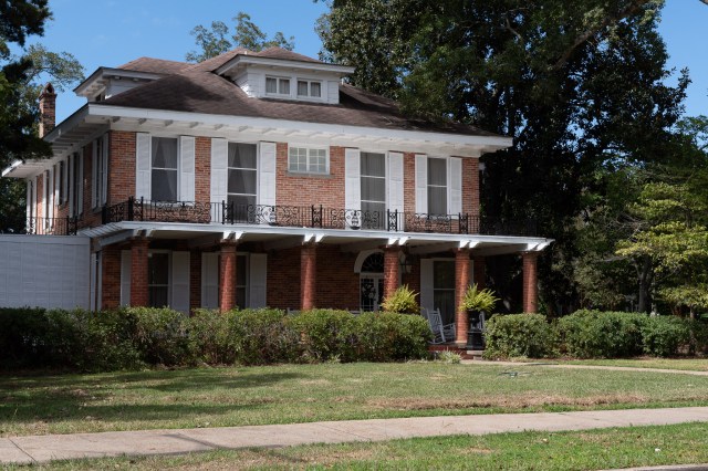
It has a couple of attractions worth seeing. The first one we headed for was the “Steel Magnolias House.” IF you’re not familiar with the movie, check it out, it’s worth seeing. And it appears to be a nice house, it’s a Bed and Breakfast now. We didn’t ask for a tour… 🙂
The other place we stopped was Fort St. Jean Baptiste Historic Site. That’s a reconstruction of the original 1716 fort, based on original drawings. I found it interesting in part because the frontier forts in Texas are from the mid-to-late 19th century, 150 or so years after this one. Surprisingly little change in 150 years, except in the medical arena – the hospitals in the 19th-century forts are slightly less frightening… or more frightening, depending how you look at it!

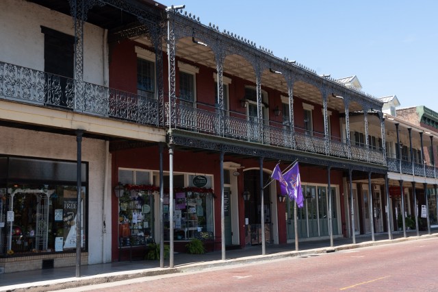
From there we visited Natchitoches’ historic Front Street, along the bank of the Red River. Yes, the Red River that forms that squiggly border between Texas and Oklahoma! It winds a ways through Louisiana and runs into the Atchafalaya. At any rate, they have some nice old buildings, as you see here. I believe the purple flags are for the Northwestern State University Demons!
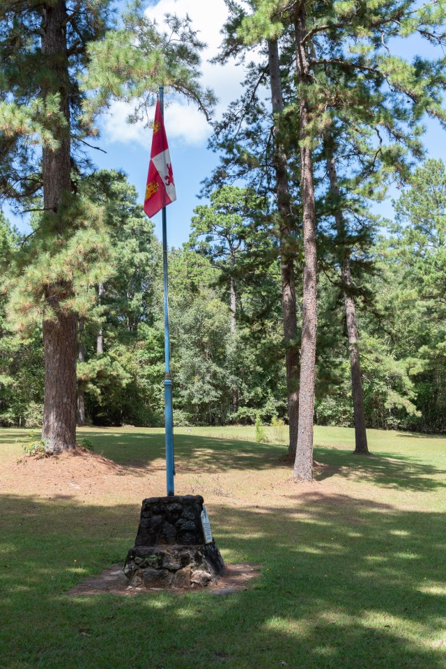
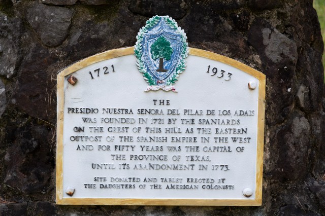
When we left Natchitoches, we headed for the first capitol of Texas: Robeline, La.! Yes, that was while it was a Spanish province: 1721 until 1772. Then they moved it to San Antonio for a while. Robeline is about 30 miles east of the Sabine River which forms much of the border between Texas and Louisiana.
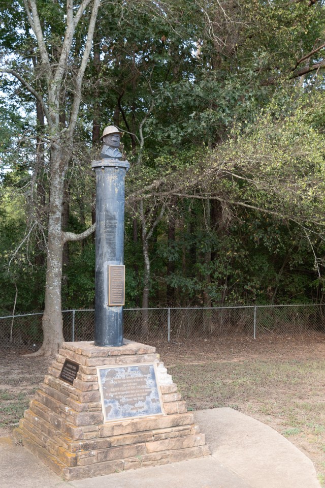
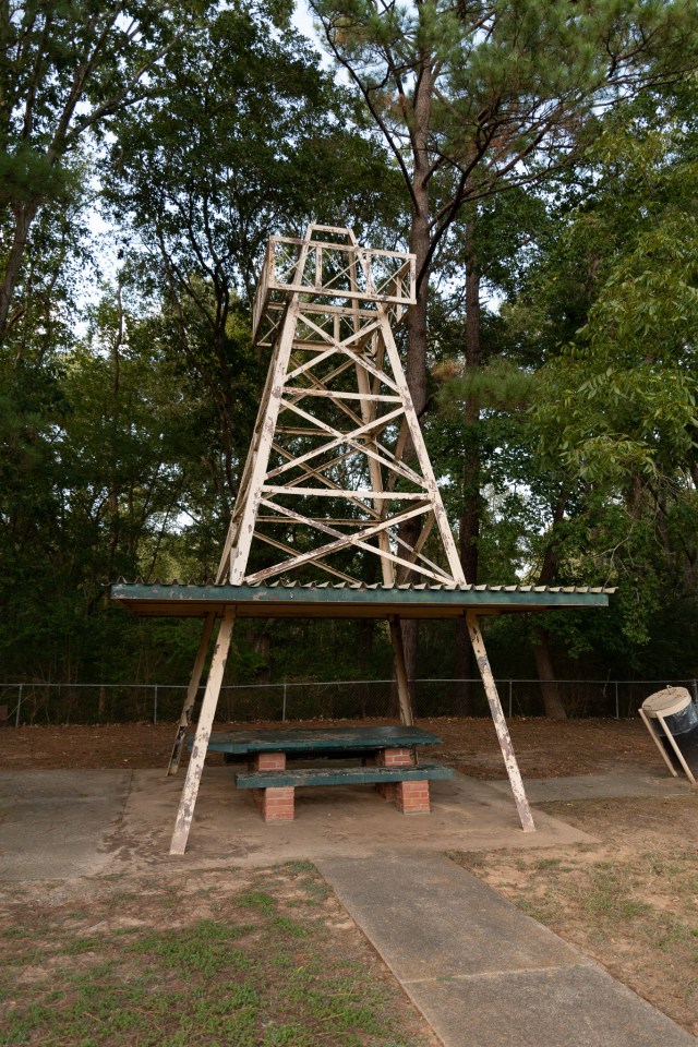
From there we crossed the aforementioned Sabine into Texas and passed through the Sabine National Forest. Then we headed up past Henderson to Joinerville, TX, where we found Joe Roughneck waiting for us! Well, a monument to that oilfield mascot, anyway. The pipe that Joe’s head is mounted on, so to speak, is a time capsule dedicated in 1957. Provided by Lone Star Steel, a company that made (and I think still makes) a lot of the pipe used in the industry. I’m not sure if they made the pipes used in the drilling rig covers over the nearby picnic tables…
This oil-themed rest stop is only a few miles from the location of the”Daisy Bradford #3″, the first producing well in the huge East Texas Oil Field, completed in 1930. That field still produces today.
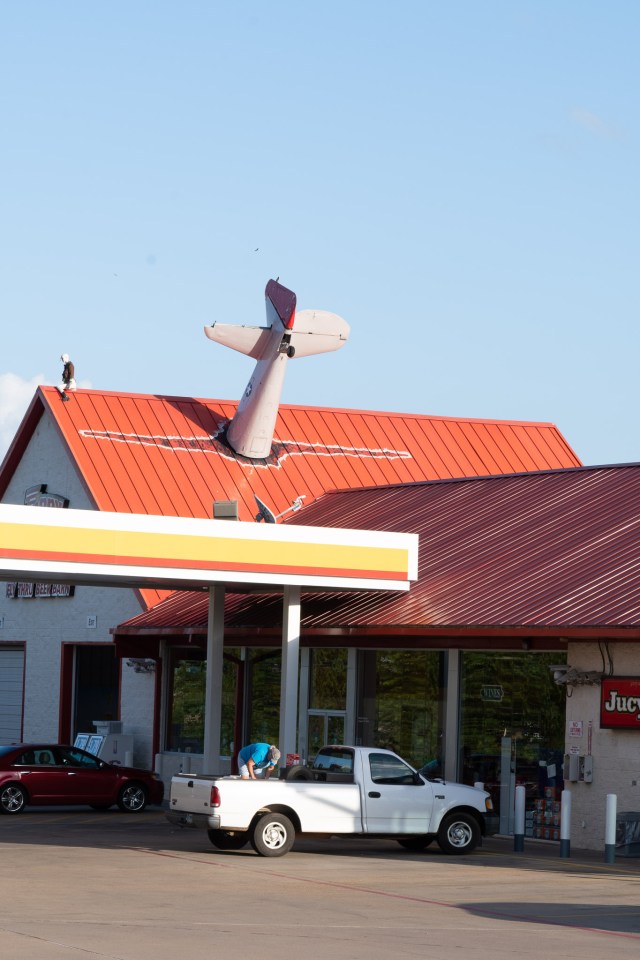
Our last stop was a somewhat less historic site – The “fly-through” Beer Barn in Longview! Most people just drive through…
After that it was getting late so we headed for home!
