
A trip to West Texas is always a joy for me and I was really looking forward to hiking in Big Bend National Park. We hadn’t been there for over a decade and that trip had included a recalcitrant youngster so we didn’t do as much hiking as we might have liked. We were excited!
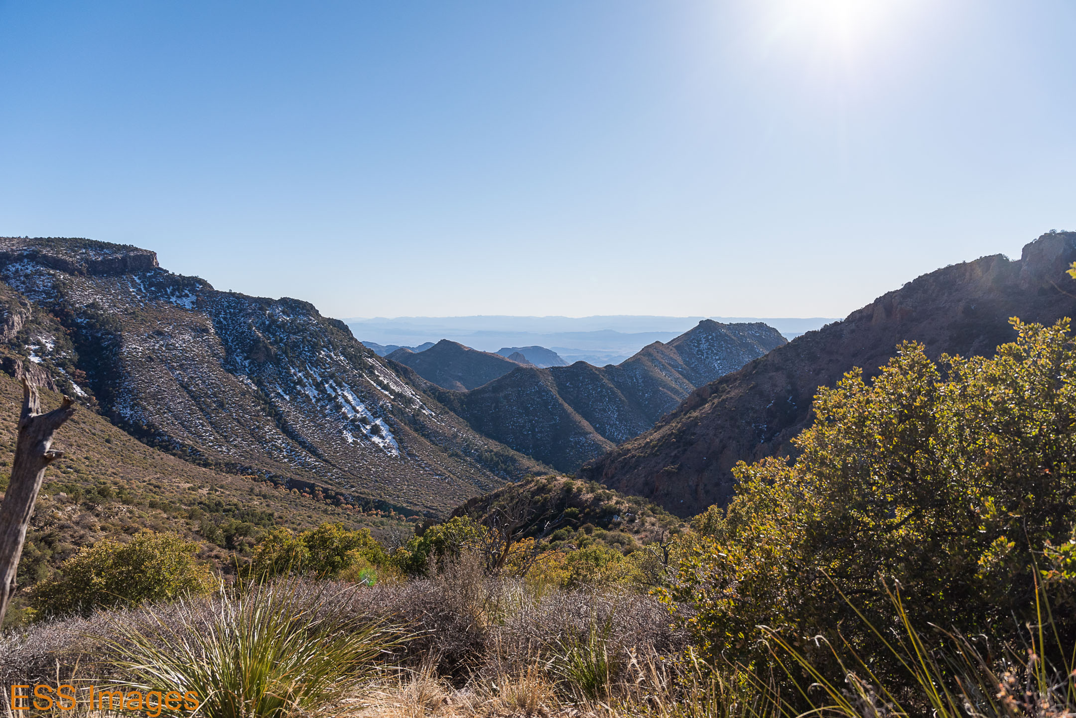
On the way down (it’s a long way from Dallas!) we spent the night in Sanderson at my favorite classic motel -the Desert Air Motel! We got up early the next day and drove down U.S. highway 385 to the park. It’s a fairly large park (800,000 acres), so when we passed the sign, we could only see the mountains off in the distance. But as we got closer, we saw this:
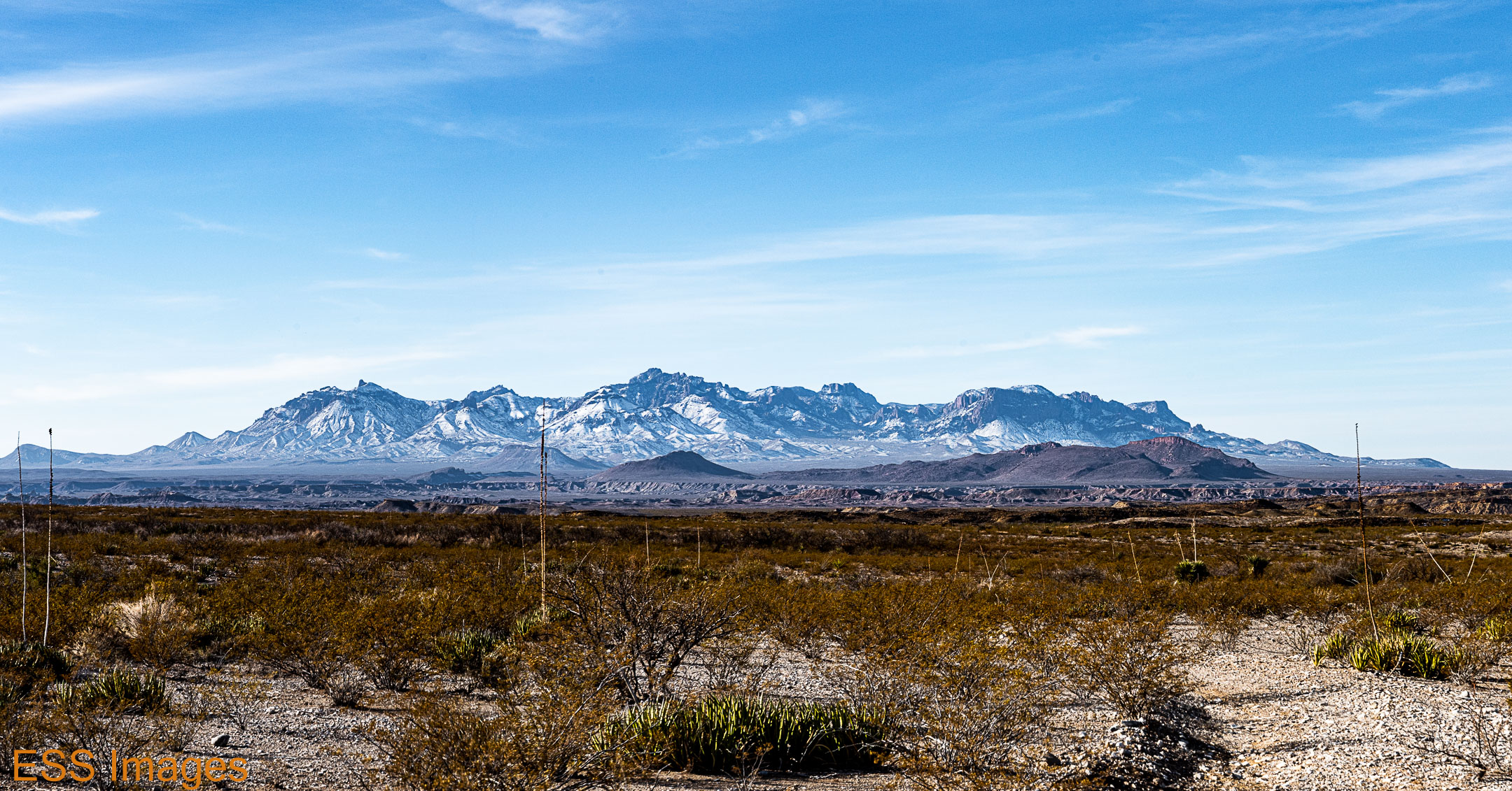
A snow-covered mountain range in the middle of the desert! Cool, eh?
We took a quick swing by the Panther Junction Visitor’s Center. They weren’t letting people inside, but they had brought a selection of souvenirs & such outside, including the all-important stamp for our passport! Well, pre-stamped pieces of paper without a date on them. You take what you can get in these hard times…
Then we drove on up to the Chisos Basin, where the main lodge is, along with another visitor’s center and a general store. It’s also the starting point for a dozen or more trails that are listed on Alltrails. We strolled around a little bit, chatted with the Park Rangers about trail conditions (answer: icy). But the Window Trail was in pretty good shape, ice & snow on the early part, then clear. So we went thataway!
The Window Trail is unusual for a mountain trail – you go downhill on the way out and uphill on the way back! Most trails it’s the other way around.


The beginning of the trail is a long staircase, covered with snow and ice but the individual steps were flat enough that it wasn’t too difficult. There was a lot of snow still on the trail early on, then we got to a stretch where it looked like we were walking between winter and spring, with snow only on one side! After a while we found ourselves walking along what seemed to be a dry streambed (not for the last time). It was a fairly easy trail most of the way, but toward the end we found ourselves scrambling around boulders. There were also Mexican Jays here and there in the trees. Rather noisy creatures. When you get to the end, there’s a…well, a window. Surprise! In the gallery above, you see a shot of my wife sitting on the slippery rock right at the end of the chute where the water runs out in the rainy season. The panorama in the gallery is the view out the window from slightly higher up.
Instead of hiking straight back to the trailhead, we took a turn up the trail toward Cattail Falls. We went far enough to look down on the Window, see the great view that was behind us, and find a nice precipice for Leigh…

So we retraced our steps back (up!) to the Chisos Basin. Going back up the steps did remind us that we were more than a mile high in the Basin, but we stay in pretty good shape…mostly.
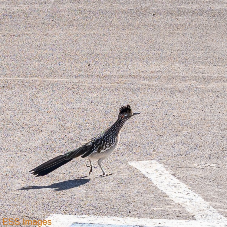
We did have a little visitor outside the Visitor’s Center (of course!). I’m not sure what he was looking for and he would have needed a mask to get into the General Store…
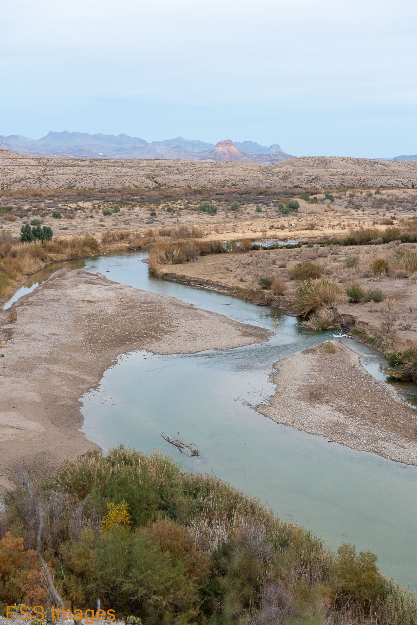
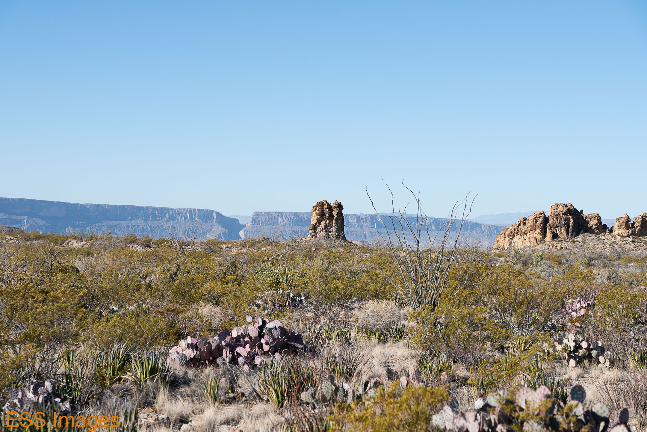
From there we went in the general direction of Terlingua. On the way, we took a left turn onto the Ross Maxwell Scenic Drive. This is a beautiful drive through the (western) desert part of the park. There are great views of the mountains, like this:

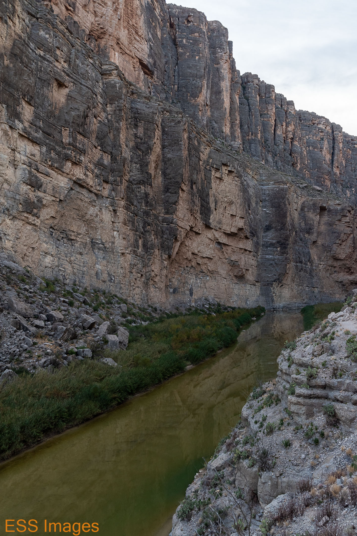
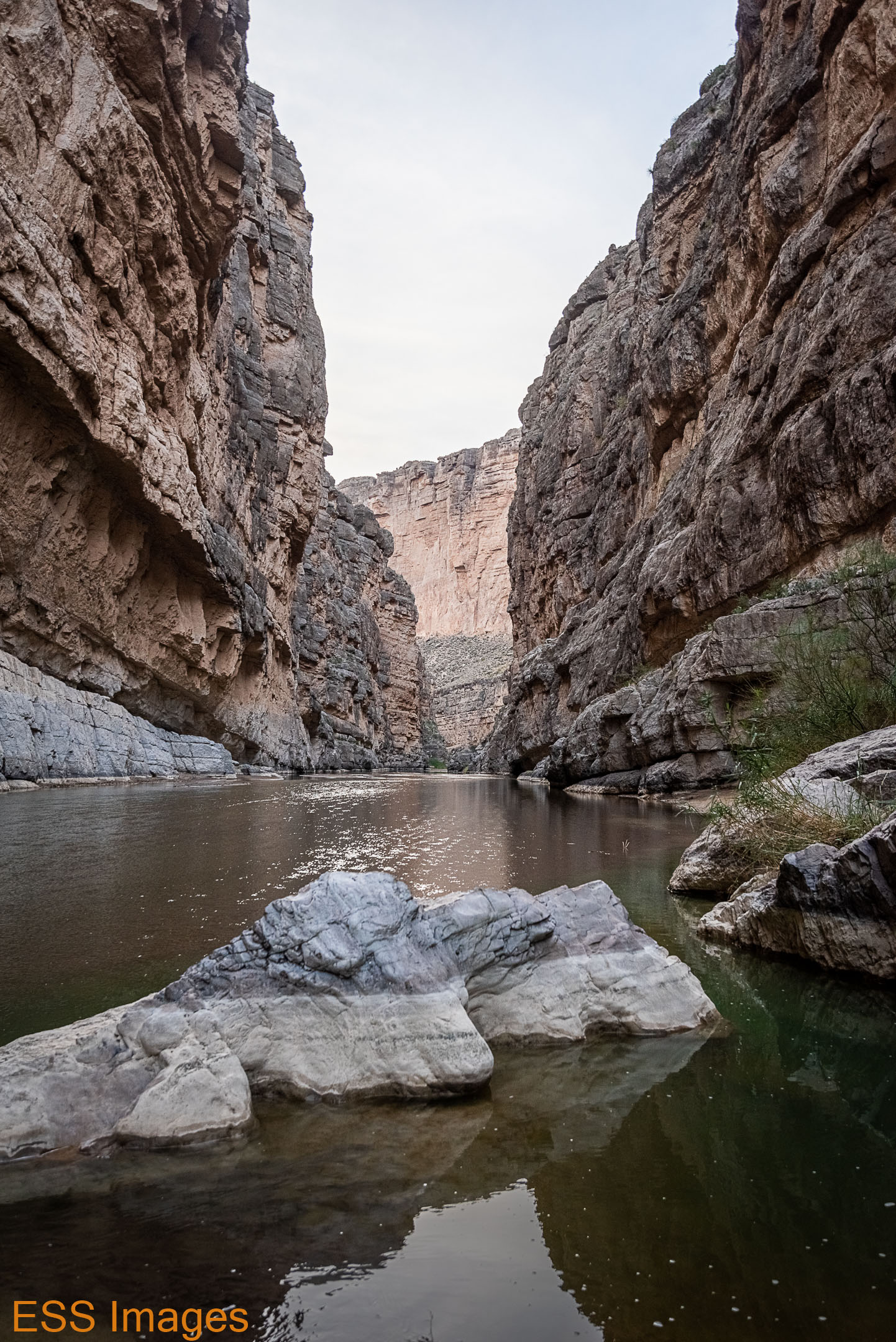
The drive takes you past Burro Mesa (more on that later) and a number of other interesting peaks and sights as you slowly descend down to the Rio Grande. We stopped at Castolon, but both the Visitor’s Center and the store were closed by then. It was getting a bit late, but we went on up to Santa Elena Canyon.
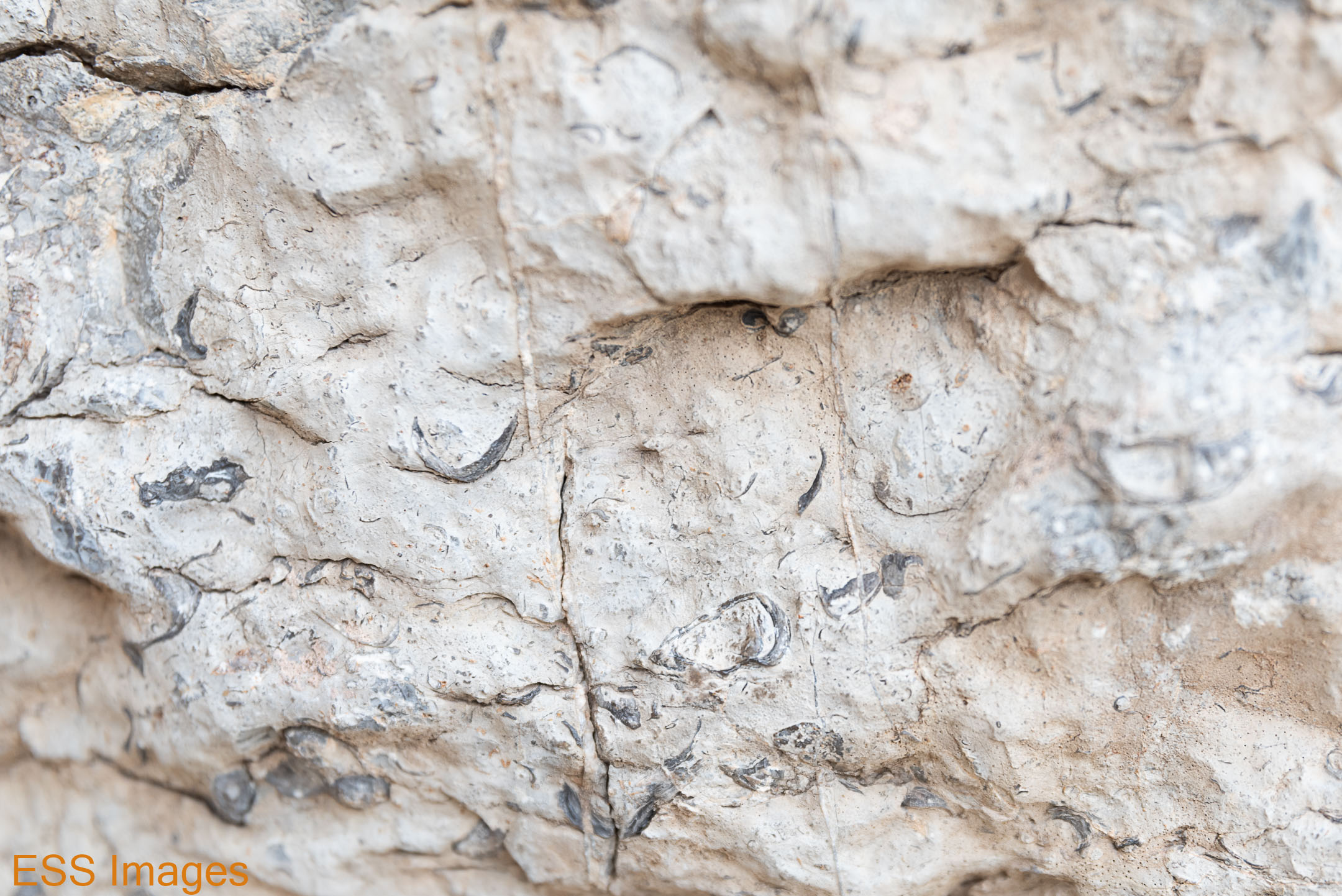
At this point along the river, there’s about a 1000 -1500 foot cliff that runs southeast from around Lajitas in the U.S., across the river, and down into Mexico. Right in the middle of this, the Rio Grande has carved a narrow canyon with walls as high as 1500 feet. The trail starts out at a parking area and is flat until you cross Terlingua Creek (sometimes a muddy crossing, I’m told – not this time). A series of switchbacks take you up maybe a hundred feet, giving you a nice view downriver (as you can see in the gallery). They also give you a glimpse of the geologic history of the region (note the seashells embedded in the cliff face!).


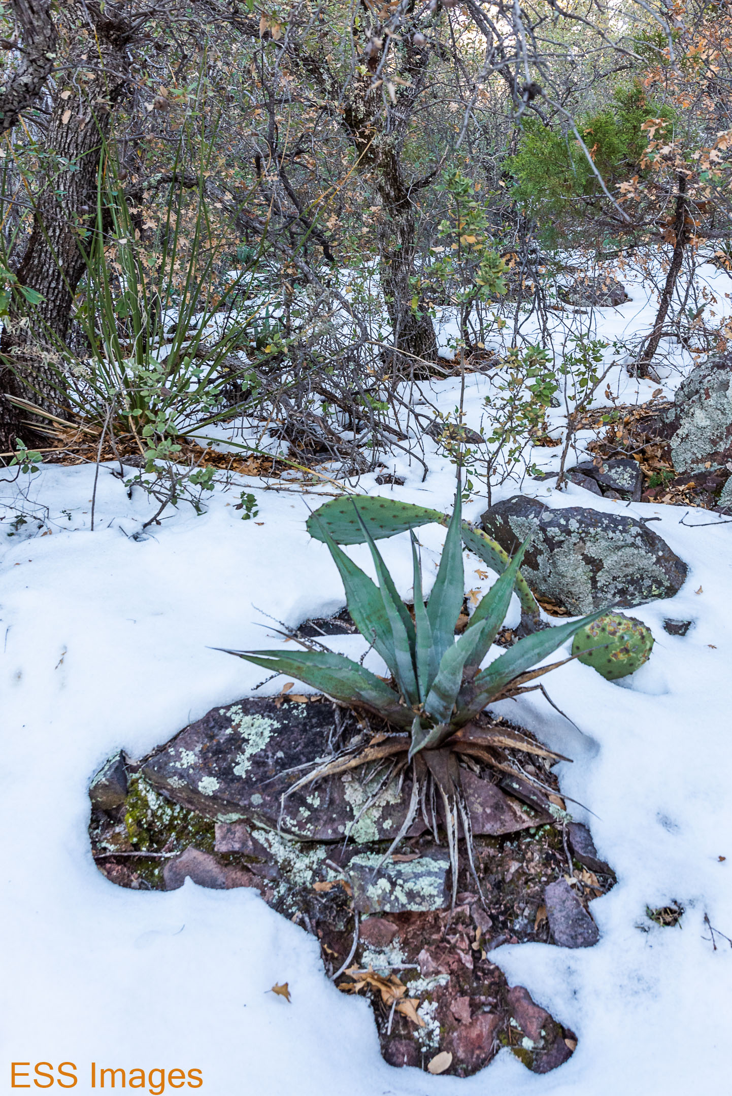
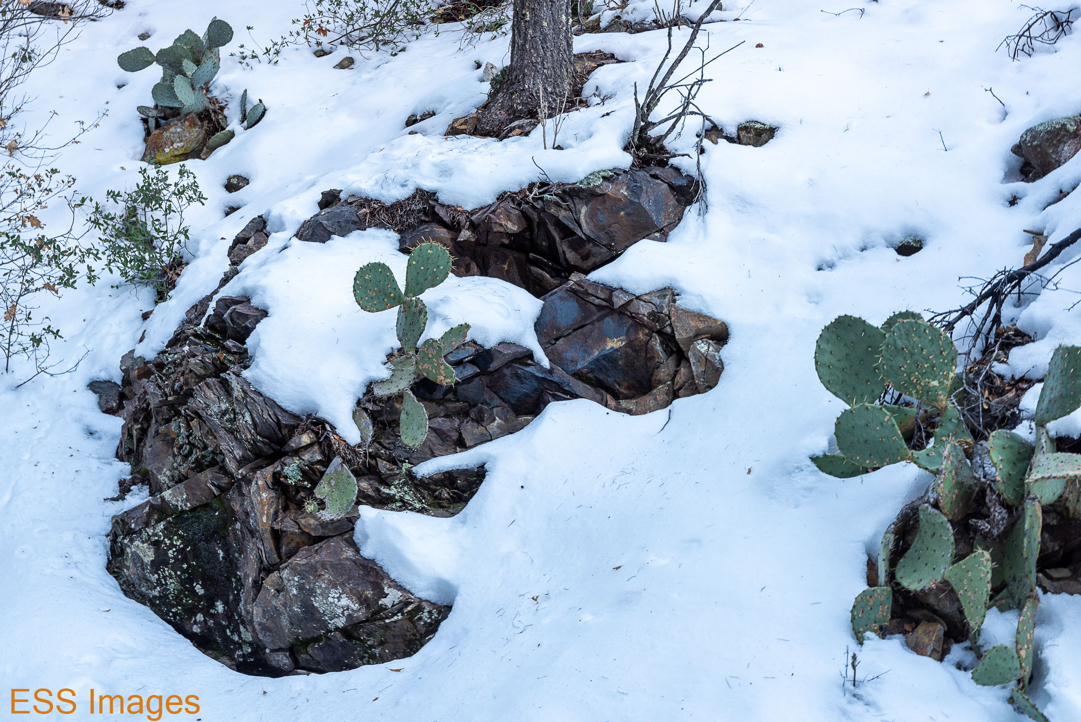
After that, the trail and the river come together and you pass by a variety of cacti and river plants, including what looked to me like bamboo. There’s also a plant that shows up around Big Bend called a “resurrection plant” or “flower of stone” (see the photo above). In hot, dry weather it curls up tightly into a ball, looking brown, leathery, and dead. Then when it gets exposed to moisture, it opens back up! There were many along this trail, and we saw them elsewhere in the park as well.
After we got back from this trail, we drove on to the Paisano Village RV Park & Inn in Terlingua. Or is it Study Butte? And why is Study pronounced “stoody?” I am uncertain of the geography down there. The route we took was the Old Maverick Road, unpaved but in pretty good shape. Alas, it was dark so we really couldn’t enjoy much scenery!
So, the next morning we were planning to hike Emory Peak, the highest point in the Chisos Mountains. We drove in to the park, and turned up the road to the Basin… and stopped! Due to road construction, the road is closed from 8-11 (and 1-3pm). It was about 8:10. Oops! Check that before you go in the next few months!
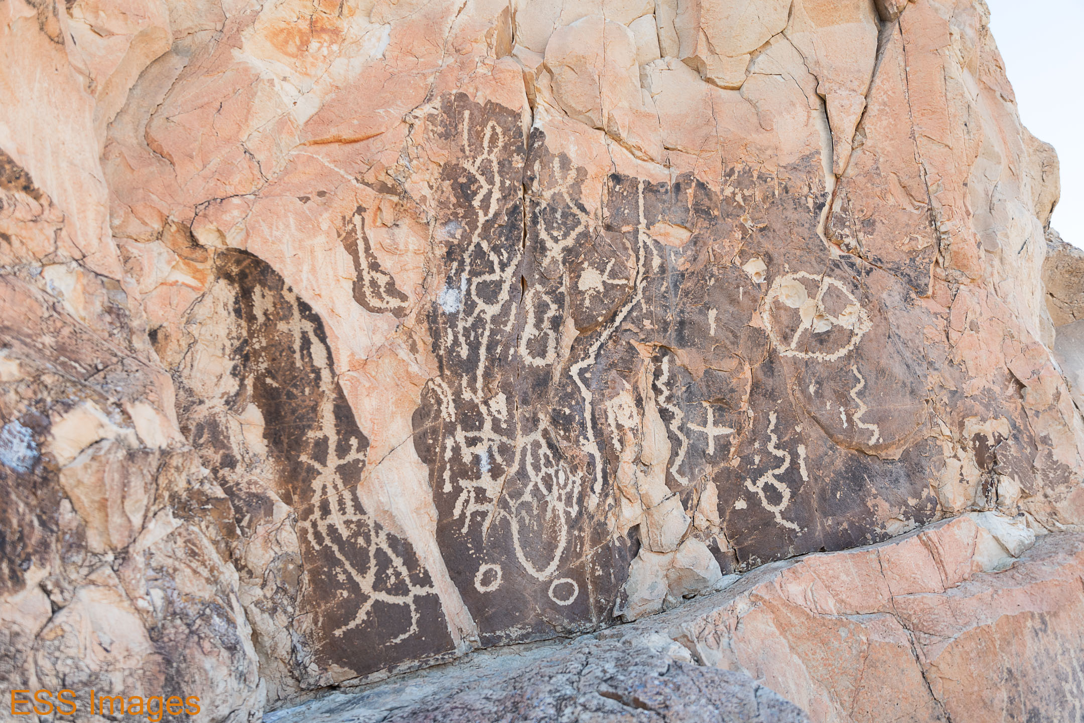
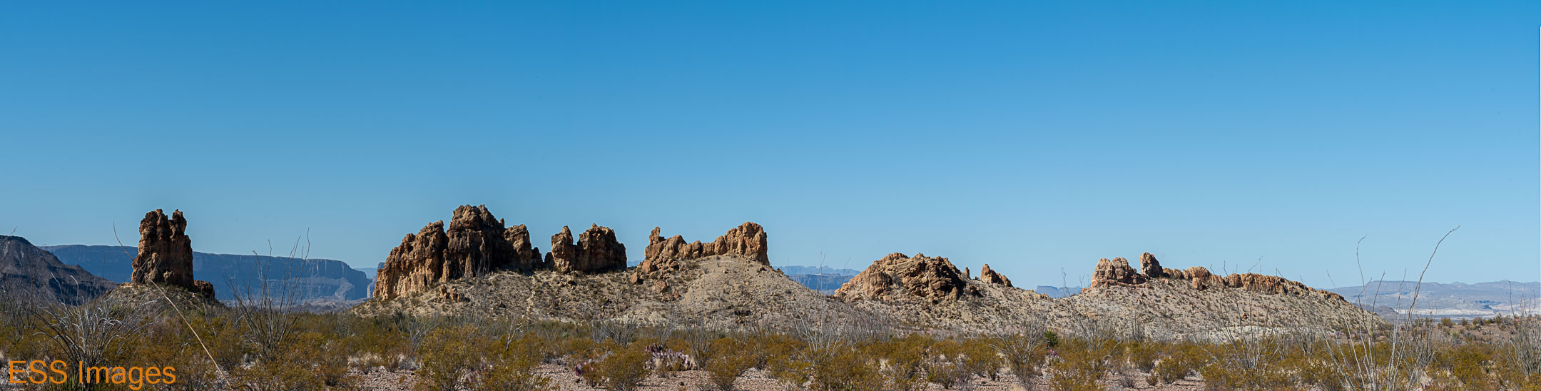
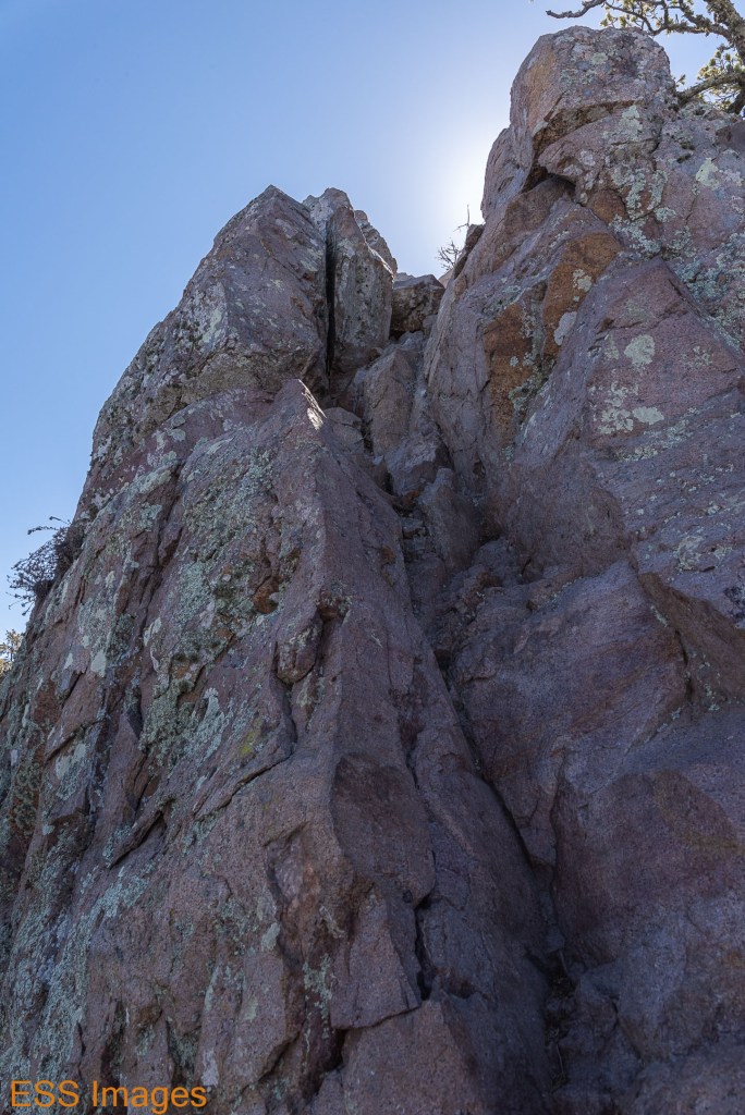
So we went back down to the Scenic Drive. Checking Alltrails (of course!) for the best trails off the Scenic Drive, we decided to start with The Chimneys Trail. It’s only (only!) rated 4 stars on Alltrails, but it has petroglyphs!
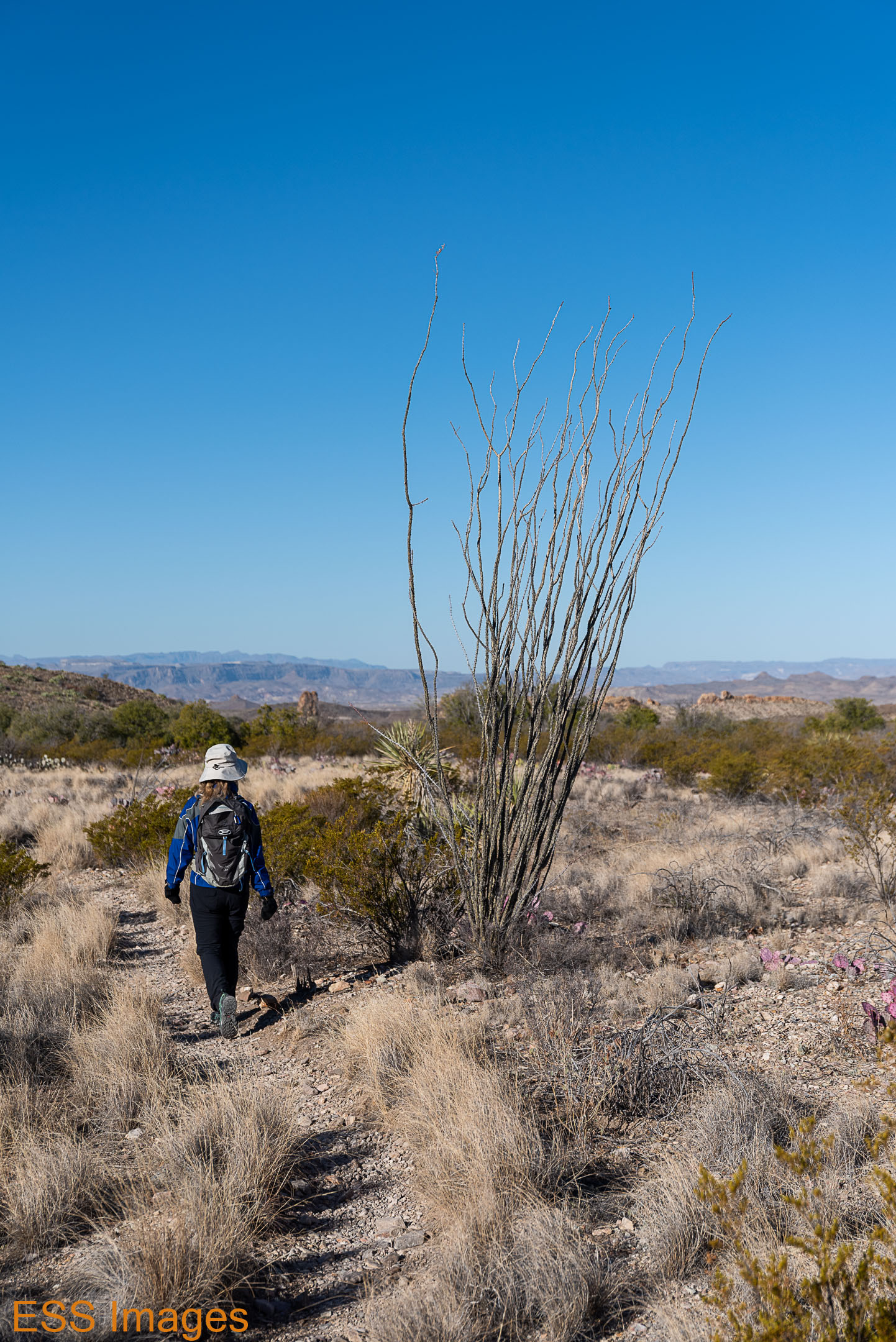

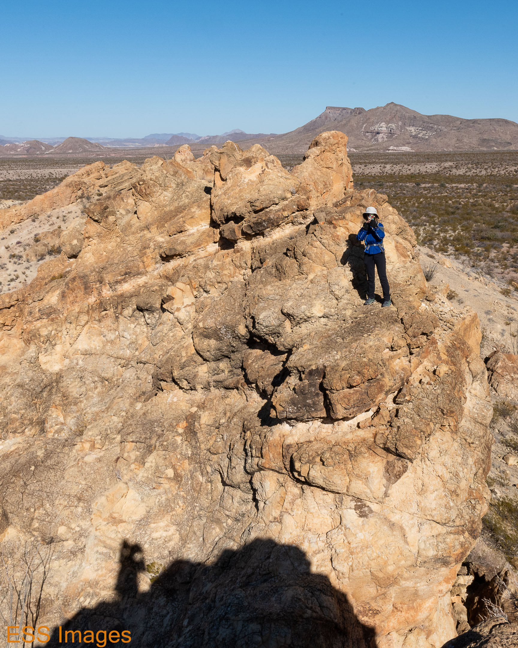
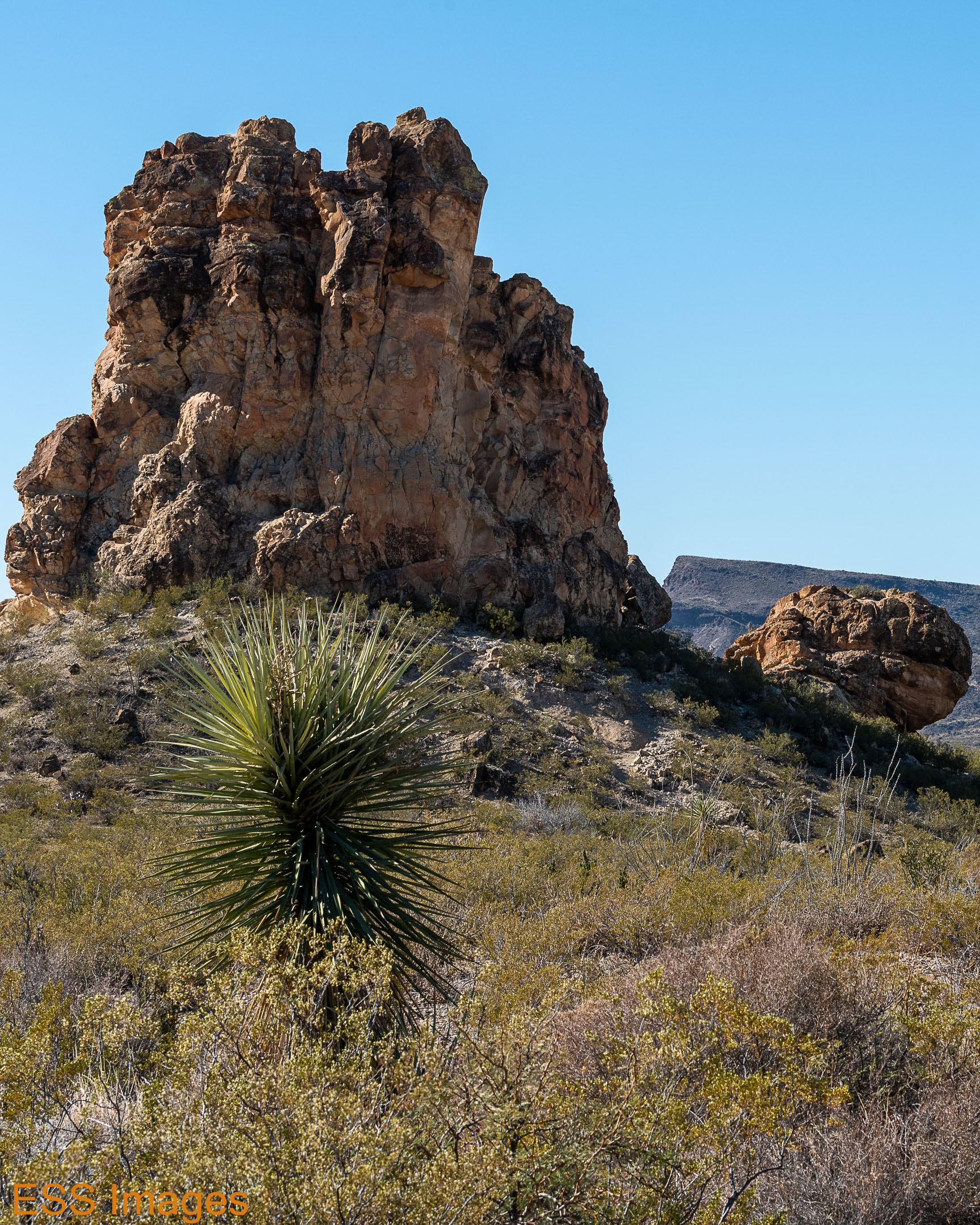
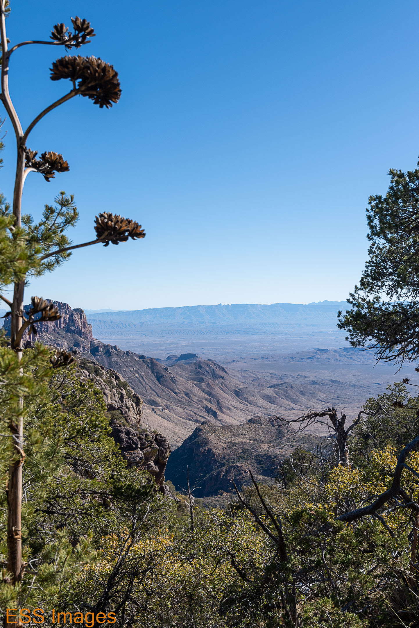
The walk out to the Chimneys is not all that exciting, unless you trip on the rocky trail. Watch your step! You walk past a lot of desert plants, like my favorite Ocotillo (see the one in the gallery that towers over Leigh) and the Purple Prickly Pear. We heard occasional birds, but only saw a few. And there’s no shade, which is less of a problem in January than at other times of the year.
The Chimneys themselves were pretty cool. We clambered around the base of the lonely one, where the petroglyphs are, and then climbed up on top of some others (see the picture of Leigh taking a picture of me!). It wasn’t crowded (on a weekday in January) but we did pass a few hikers on the way back to the road.
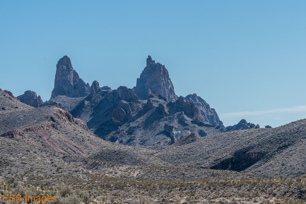
A little farther down the road is (are?) The Mule’s Ears. We only stopped at the overlook, though there is a trail going out to a spring near the base of the formation.
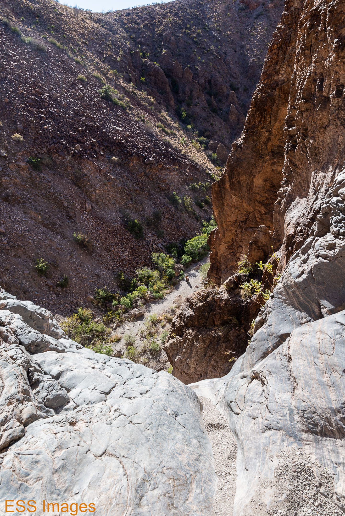
Leaving the Mule’s Ears, we went back north a ways, up to the Upper Burro Mesa Pouroff trail. Burro Mesa is a large formation west of the Scenic Drive and this trail leads from the road down a dry (when we did it) streambed and finally…well, as the guy we passed who was coming back said, “When you get to the 100-foot dropoff, stop!”

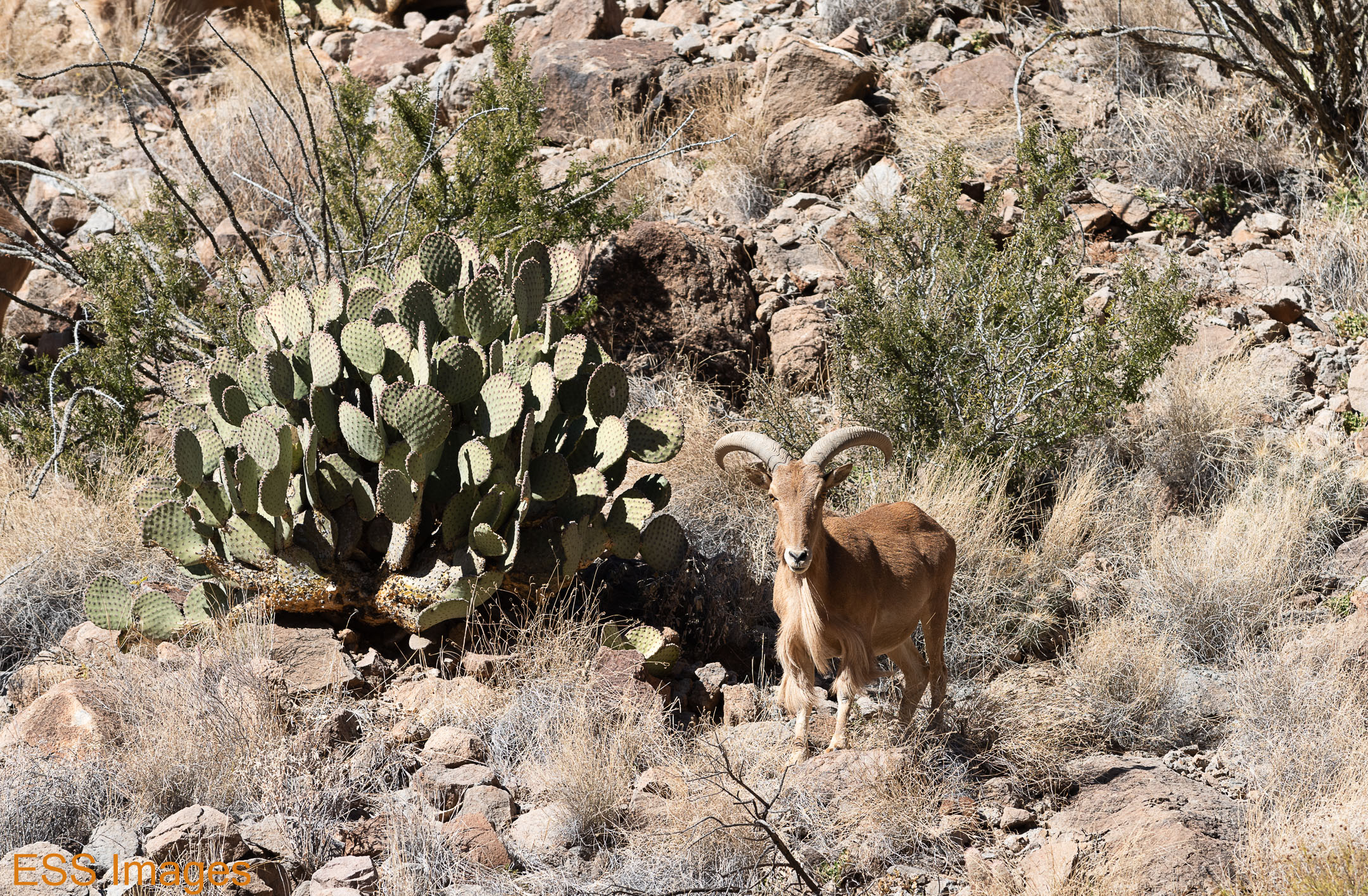
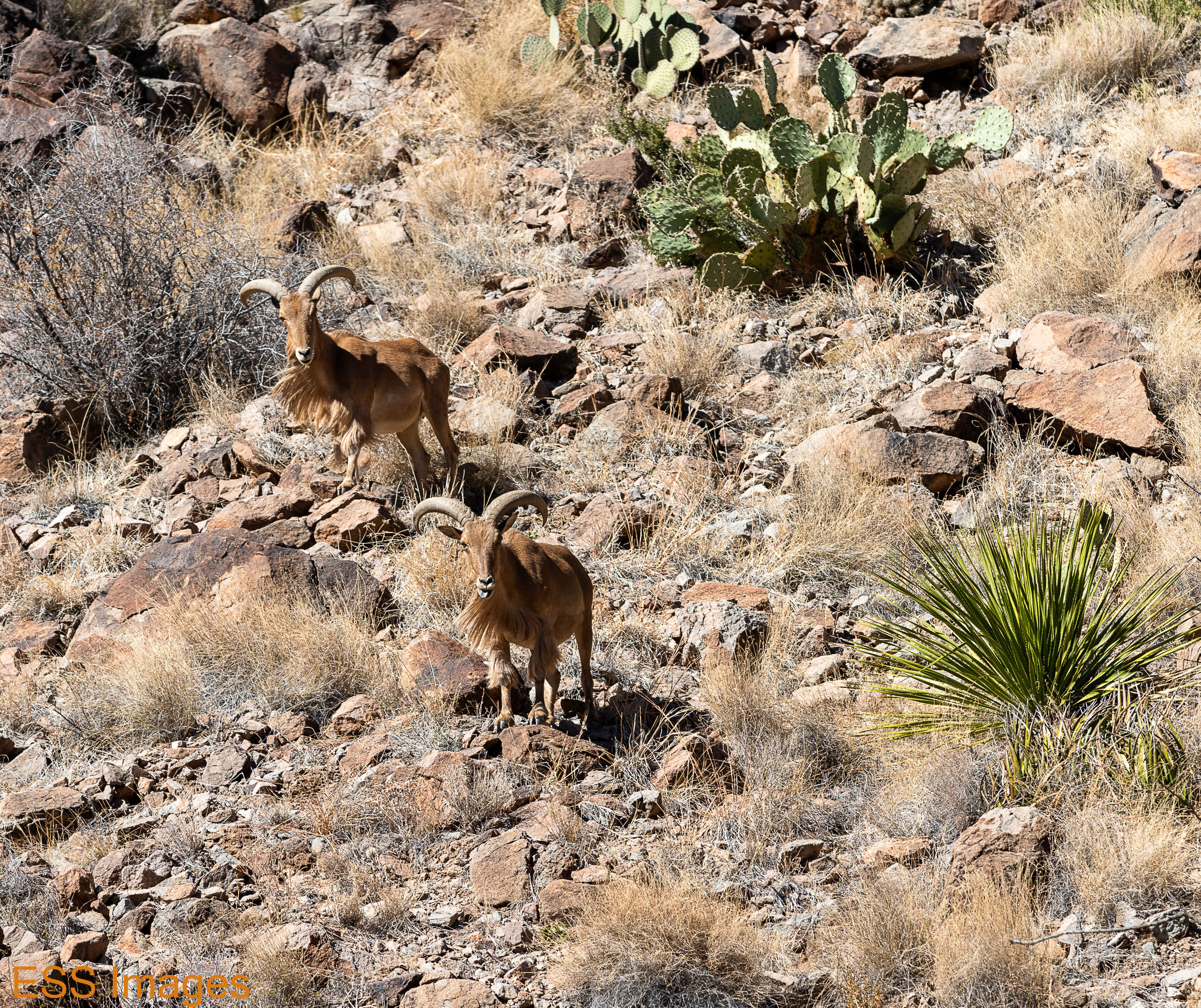

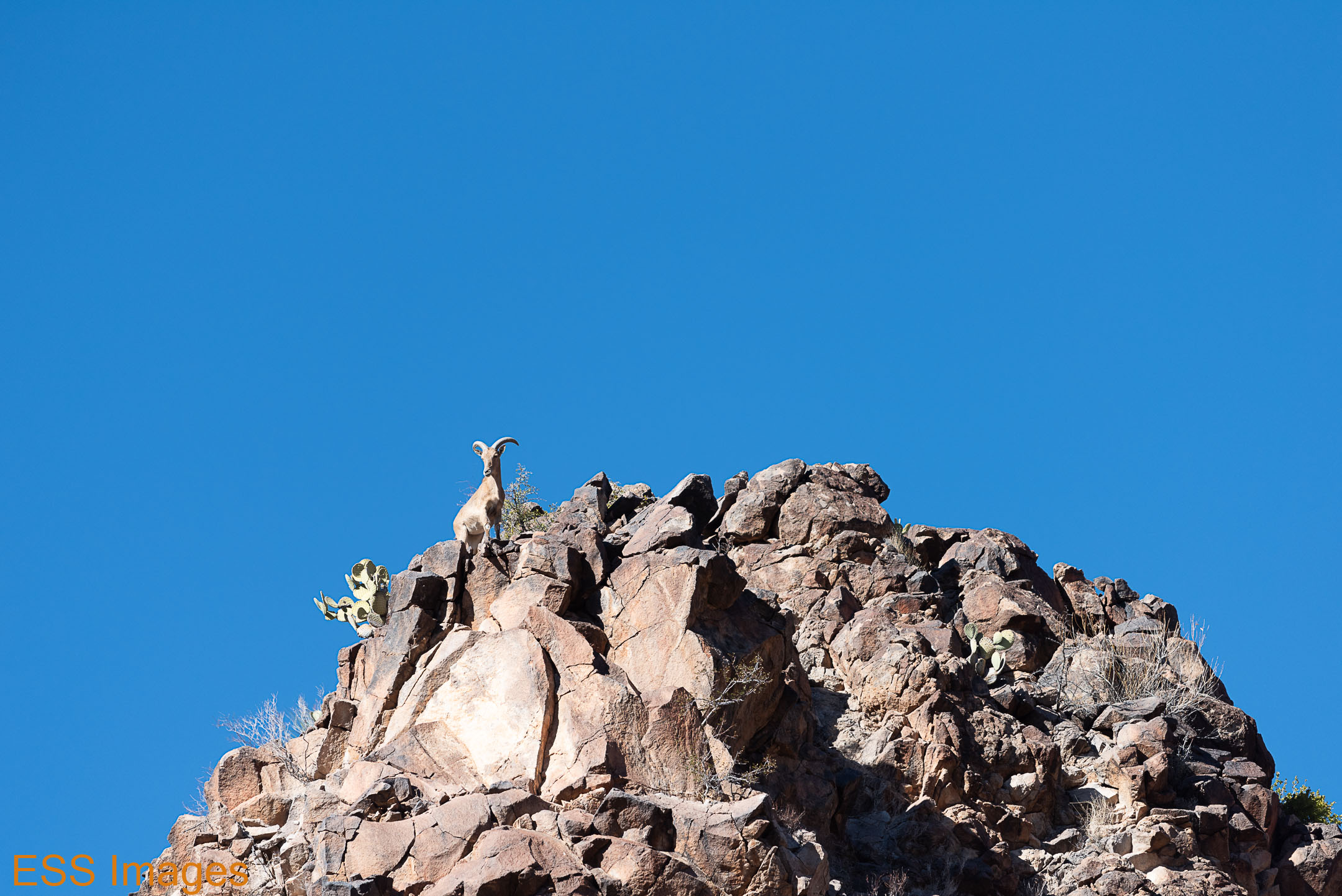
As we were walking down the streambed from the road, the walls got higher and higher. Then we started hearing rocks fall down, so we looked up! And there were a bunch of Bighorn Sheep roaming around the sides of the canyon. And knocking down rocks. I asked them to be more careful but they just kind of looked at me, then went back to eating the grasses or the prickly pear cactus they had been chomping. We watched for a while and saw that there were a couple of dozen wandering around up there.
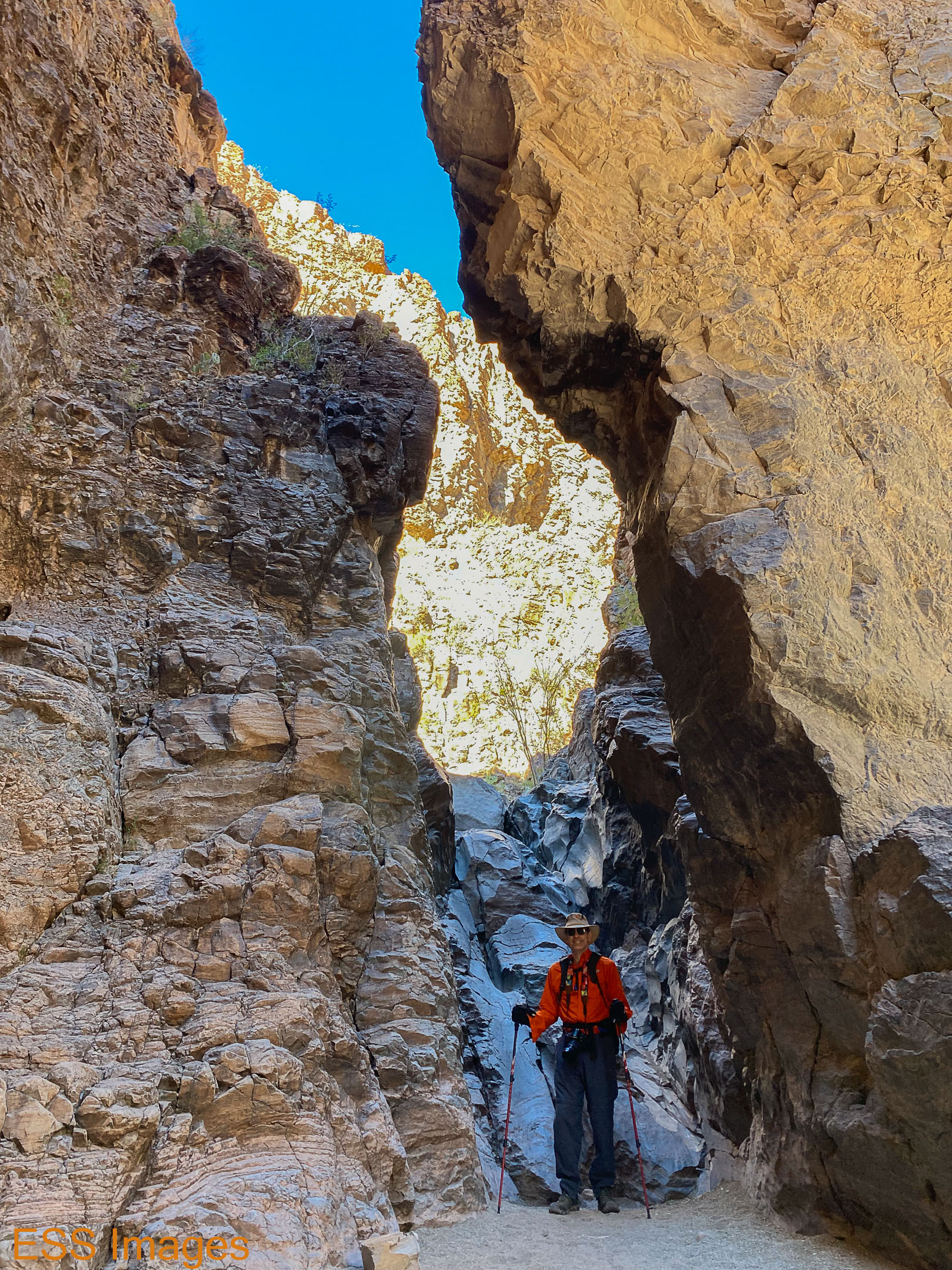
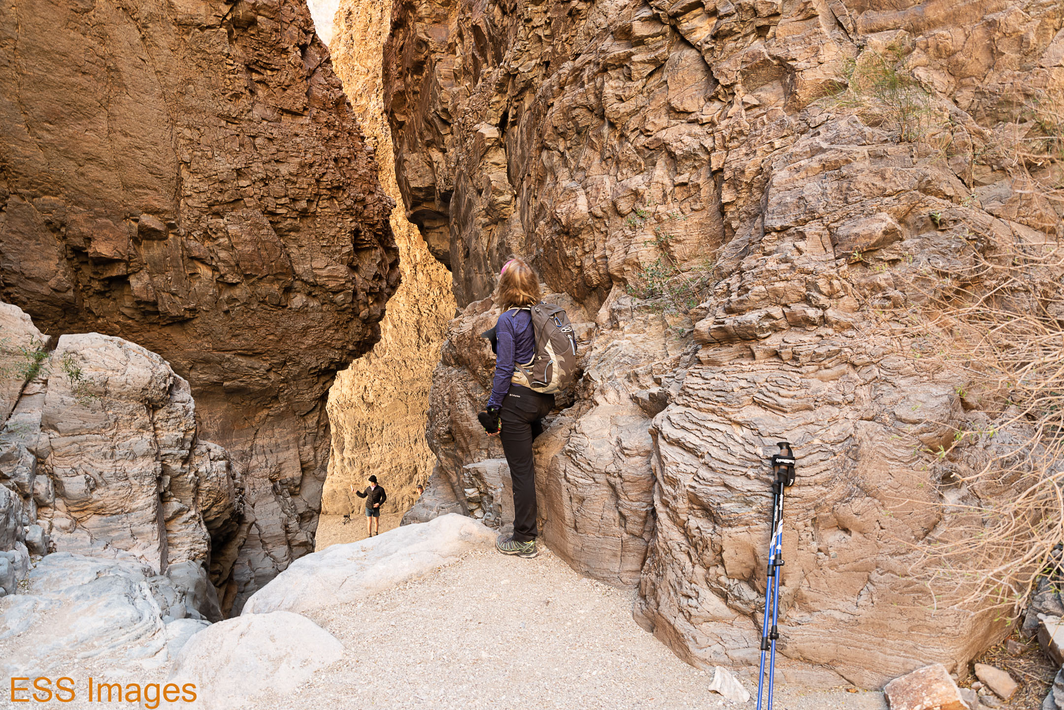
Eventually we started moving again, finally coming to a narrow crack through the mesa with a slick rock ramp going down into a chamber (you can see Leigh at the top or me at the bottom of it in the gallery). It was a bit slippery, but not too hard to get down safely. A little more difficult to get back up, but everybody we saw made it pretty well. At the other end of the chamber was the aforementioned 100-foot (or more!) drop. If you look closely at the picture that looks down over a rock ledge, you can see two people standing at the bottom.
And on the walk back, I finally got one of the Bighorns to pose where I wanted them – profiled against the beautiful blue sky!
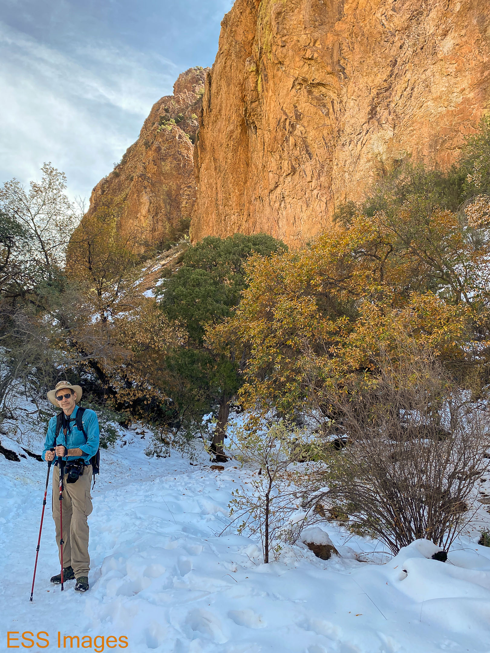
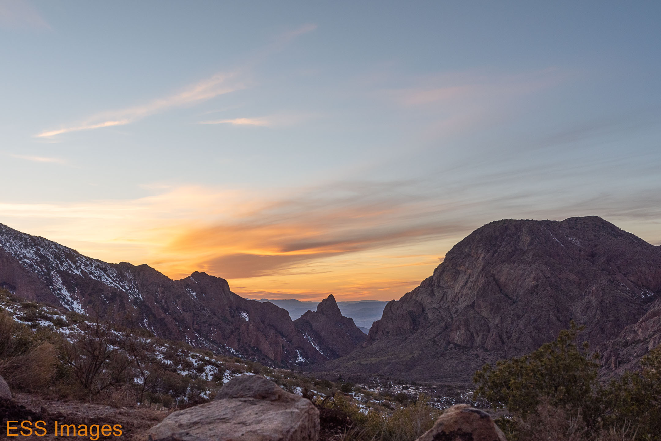
The next day we got up a little bit earlier. This time we made it to the road in time to get up into the mountains! As we parked in Chisos Basin the sun was making a silhouette of Casa Grande on a nearby mountain. You can see them both here – Casa Grande and its shadow:


As the day before, our plan was to hike Emory Peak. It’s about 5 miles from the trailhead up to the peak – and 2500 feet of uphill! You start above a mile in elevation and climb up to 7825 feet, according to the US Geological Survey. Our friends at Alltrails rate the trail as “Hard,” and they’re not entirely wrong! It’s pretty much 5 miles of uphill and if you’re not in good shape you might find it tough going – especially in all the ice and snow!
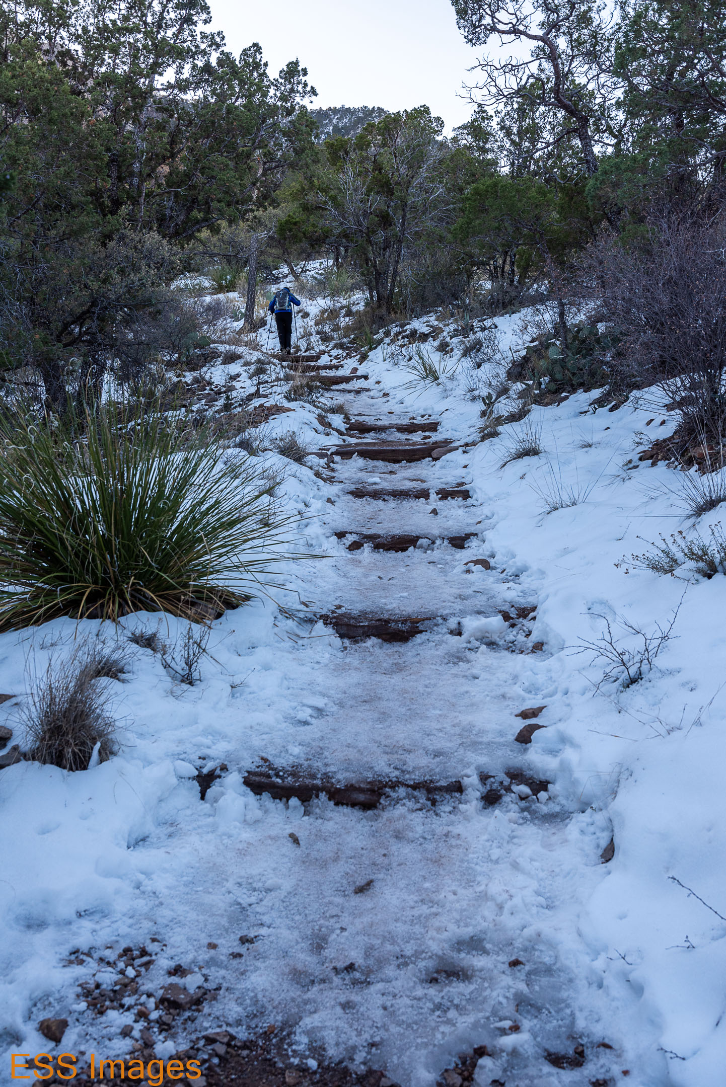

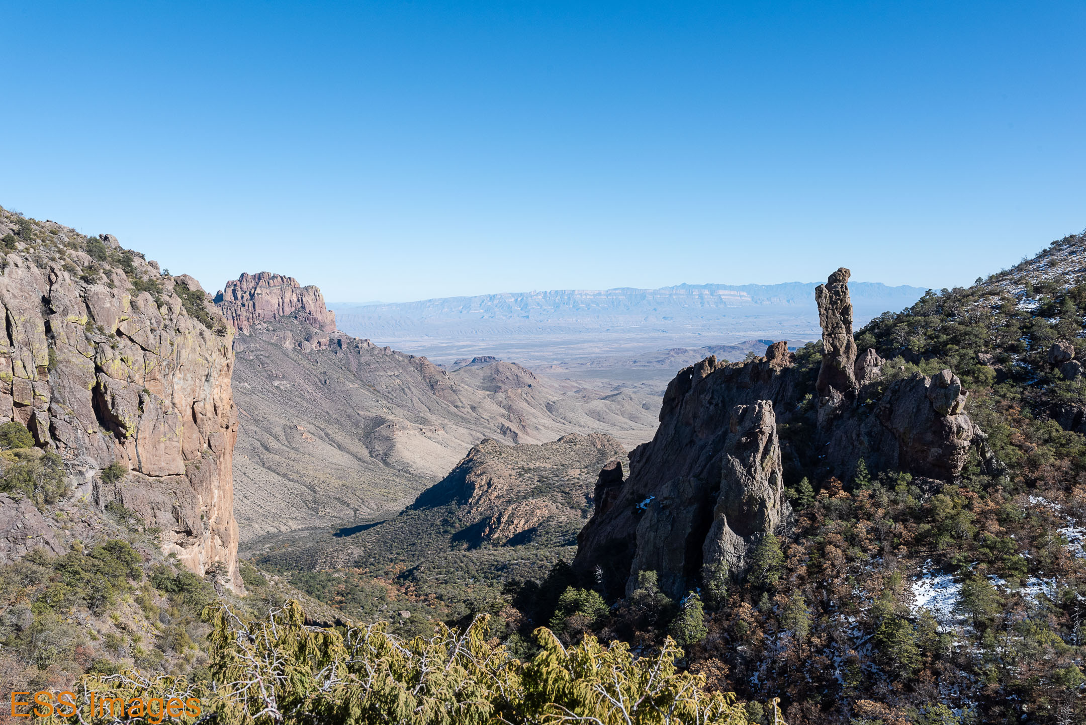
The trail started pretty icy and snowy (and it was pretty chilly that morning!), and it continued that way off & on all the way up. Much of the time we were either walking on ice or on frozen mud. Fortunately we had our trusty trekking poles. If we hadn’t I’d have ended up on my backside a lot more than I did! Periodically we’d break out into an area that got a little more sun and the trail would be mud or packed dirt. Sometimes we got a nice view out toward the next mountains over, as you can see.
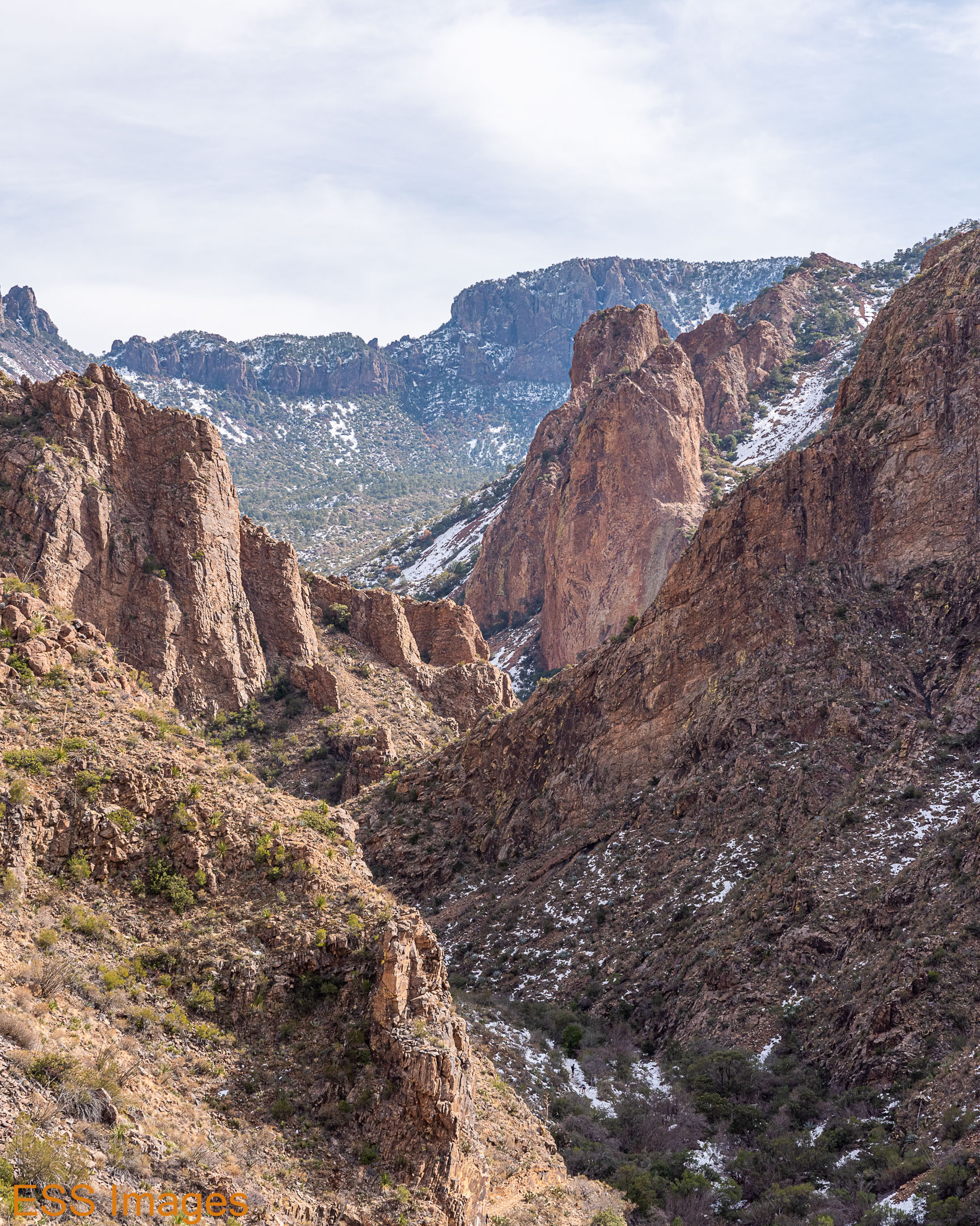
Finally we got to the place where you turn off of the main loop trail to head up to the peak. The relatively dense woods we’d been traversing gave way to rocky ground, more succulents, and fewer trees. Then we came around a corner and finally saw our destination – with the moon guiding our way!
The last bit of climb to get atop Emory Peak is described in many reviews as “scary” or “vertigo-inducing” so I was a little nervous. Until we got there – this picture makes it look steeper than it really is, and the rocks were quite solid so I never felt at risk. Of course, some people might not like to turn around and see a long drop from the 3-foot-wide ledge they’re standing on…
So we scrambled up to the top, and there was only one other person there when we arrived – a young lady who was taking lots of selfies! I took a picture of her (with her phone) after she had walked out to a particularly scary-looking spot. Then Leigh went out there! Of course she did… 🙂 It’s not the one where you can see the solar panels, it’s the other one – the one showing how windy it was. And she forced me (against my will!) to pose for her…


Getting back down off the peak was a little bit more of an adventure than going up, but we made it. On the way back down to the main trail we ran across some white-tailed deer. Alas, they were less cooperative than the bighorns & wouldn’t come out to pose!


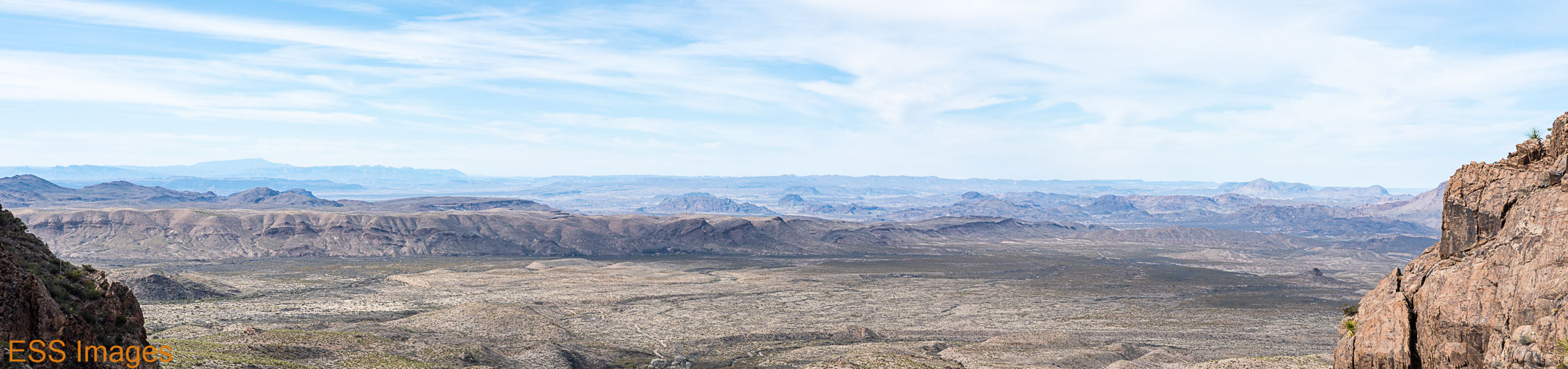
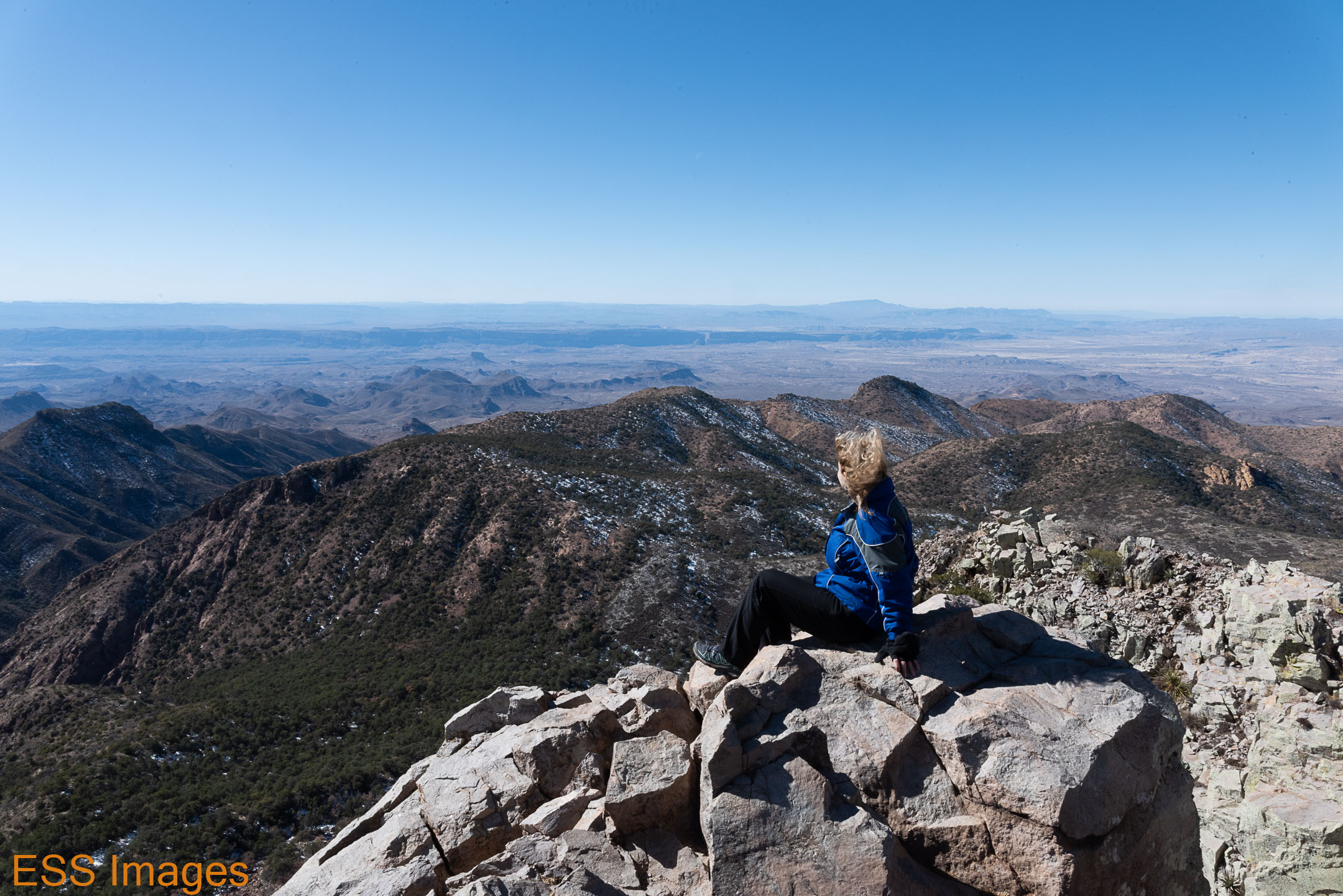
When we got back to the main trail we decided not to take the short route retracing our steps to the trailhead. We knew how much ice was waiting there for us! Instead, we turned south toward the South Rim. We took a shortcut across the loop, though, instead of doing the full South Rim trail. It had taken a surprisingly long time to get up top and I did not relish the thought of finishing an icy trail in the dark.
It turned out there was a fair amount of ice on the southern route as well! But once we got to the south side of the mountain we had a long stretch that was actually on a packed dirt trail! It made for a nice change. The views south & southwest, down into Mexico, were fabulous! Then we went around to the north side of the mountain again and found ourselves back in snow and ice.
When we got back to the car, the sun was almost gone!
I thought this post was getting a bit long, so I’ll pick it up in Part 2 in a few days.
Catch you later
– ESS

Enjoyed the hike with you two! Beautiful country which I have never seen in all of my years growing up in Texas!
Sometime take a look at my latest book on Amazon “Divinely Different” with photography by our talented friend, Richard Bettinger. See you soon!
LikeLiked by 2 people
Thanks, I’m glad you enjoyed it! I try to bring a little of the Texas flavor to the blog when I can. I’ll definitely check out the book, Santa Fe is beautiful and combined with your poetry it must be a treat!
LikeLiked by 1 person
Enjoyed the pictures and the tour. I was surprised how how pretty it is.
LikeLike