Part 3 of our adventure begins in a lovely Airbnb in Soledad, California. For part 1 go here, for part 2 go here. The location was great, just 15 minutes or so from the western entrance to Pinnacles National Park.
Of course, our first day hiking in Pinnacles, we decided to go in the eastern entrance, which is a bit farther, an hour or so. We did that because we wanted to do the highly-rated Condor Gulch Trail to High Peaks Trail, and that starts at Bear Gulch over on the east side. It was top-ranked on Alltrails and it is rated “hard,” and it deserves both.

We pulled in to the Visitor’s Center on the east side and I was looking for condors!
I never saw this guy spread his wings, but I’m pretty sure this isn’t a condor… 🙂
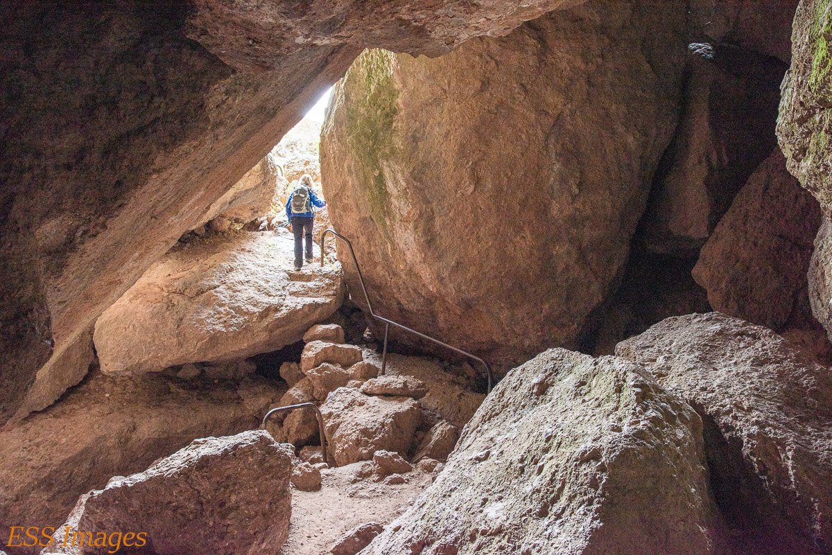
We stopped in at the Center, looked around in the store, got a stamp for our National Park Passport, and then went back to the Bear Gulch Day Use Area to park. From there up to the Bear Caves Trail. These caves aren’t quite like Carlsbad (or Sonora). Pinnacles is a 20+ million-years-old volcanic formation that has taken a bumpy ride up the San Andreas Fault for almost 200 miles since it was born. Between earthquakes and erosion, boulders and pillars collapsed and formed interesting cave formations. Like these:

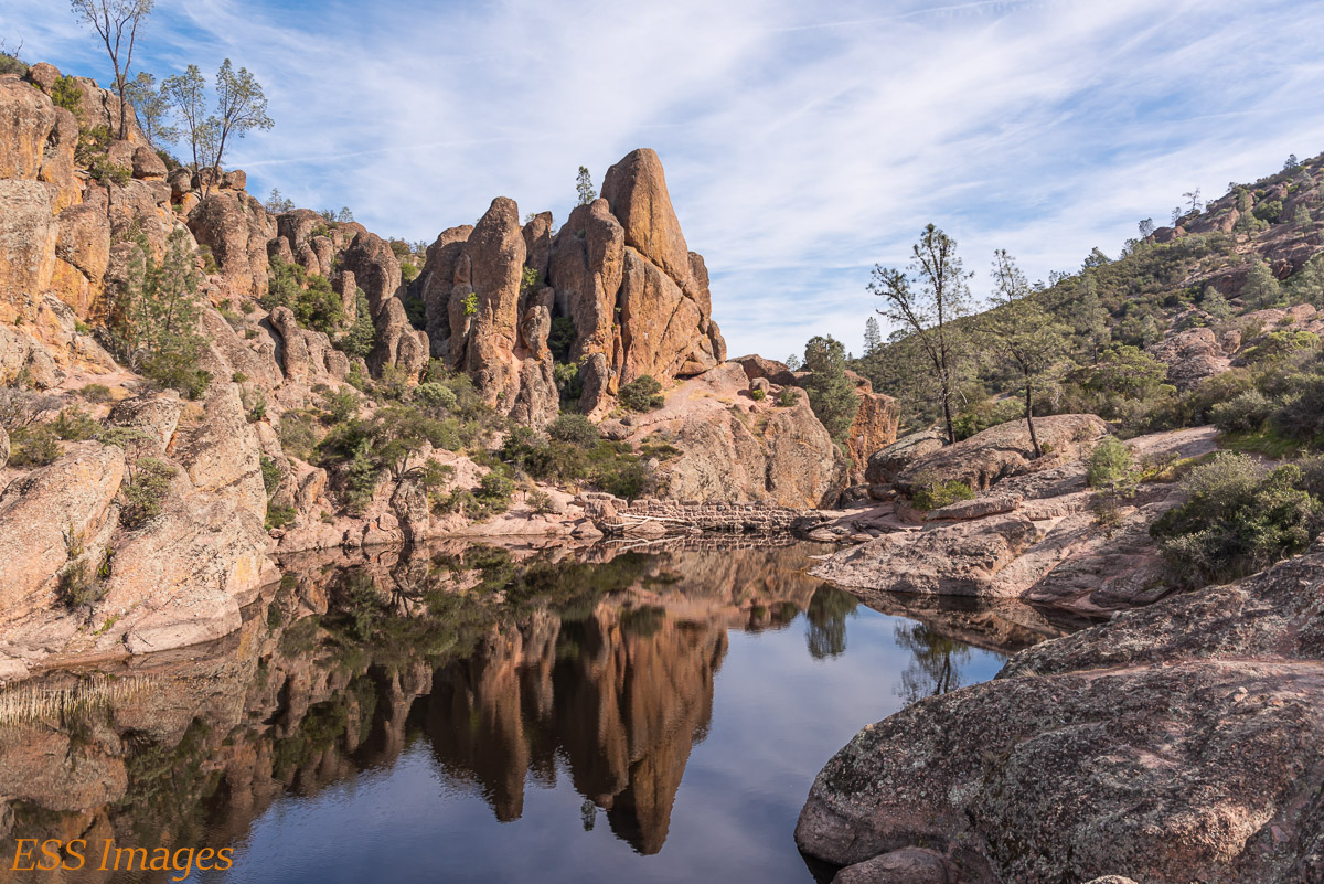
It was fun going through the caves, and there was only one place where I had to go on hands-and-knees. Once you get out of the caves, a little farther down the trail you come to a lovely reservoir.
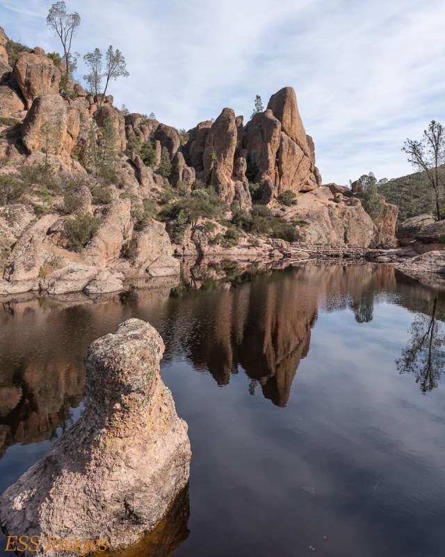
I like the reflection . Also the little rubber duckie on the lower left…
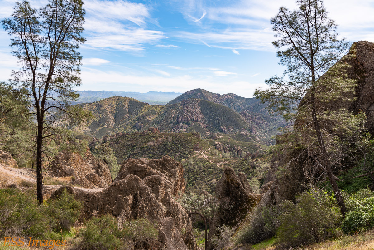
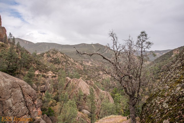
From there the trail gets a little steeper as you head up toward the High Peaks. There were a lot of switchbacks and a little scrambling, but it was a great trail. Here are a few shots from along the way.
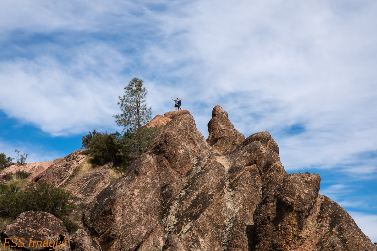
Once we got up to the first peak (where, if you look really closely, you can see Paul and his sister Dana, who we met earlier on the trail), we looked over at the other peak and saw condors! We realized that the other peak was where all the action was so we hightailed it down from that peak and sped toward the peak where the condors were. And…
They left before we got there!
Admittedly, there was a little operator error involved, so we took a non-optimum path. We chatted with a couple of other people who were there and I got a snack and drank some water and we relaxed for a few minutes. And then…

Whoosh! Around the peak and past me before I could aim a camera! Of course, having a protein bar in my hand didn’t help… Anyway, several condors came and tooled around the peaks for a few minutes. Did you get the license number on that beast?
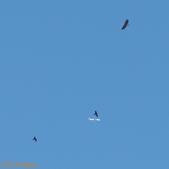
Some of them even went to gang up on this poor airplane…
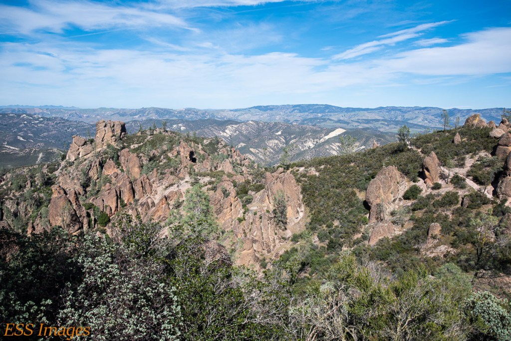
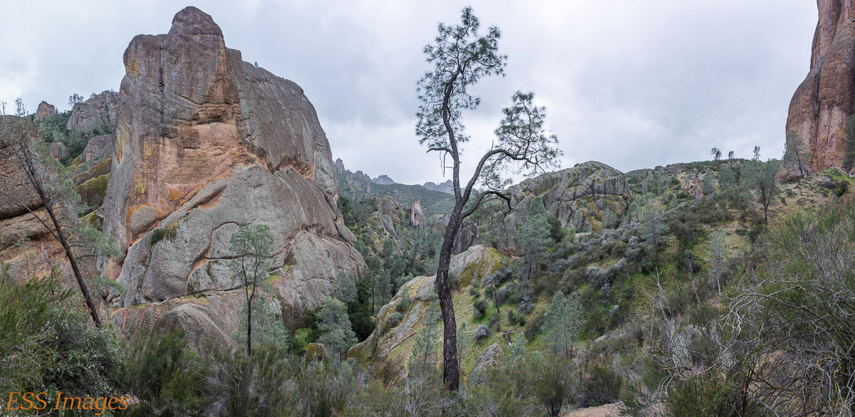
That was the literal and figurative high point of that hike. We completed the loop, past the Condor Gulch Overlook, where we saw no condors (maybe one or two in the far distance) but impressive and ancient rock formations.
We finished the trail and got back to the car. Since we had taken the southern route to get to the entrance, we took the northern route home,only partly because that was the closest gas station! Fair warning, there’s no gas within about 25 miles of the park entrance, so maybe fill up on the way in! We had plenty – the car said we had another 15 miles worth or so when we got to the gas station! A forgettable fish dinner in Salinas and back to the room.
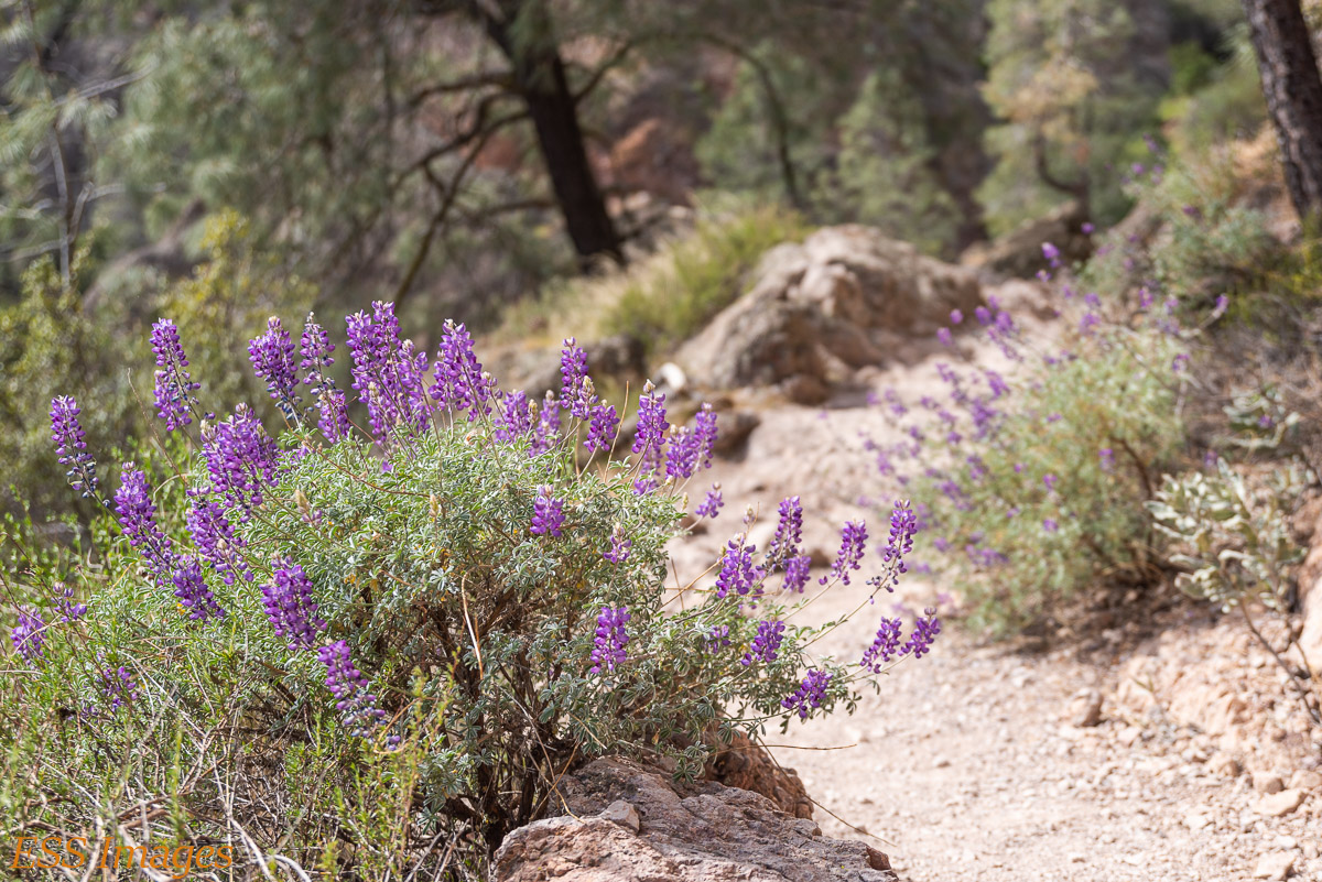
Saturday we took the short way into the park, just up the road from where we were staying. We went past the ” West Pinnacles Visitor Contact Station” and parked at the Chaparral Picnic Area. The plan was to hike the Juniper Canyon Trail up to the High Peaks and the Balconies Trail, and maybe a couple of side trips. Have I mentioned our hikes always seem longer than the trails? 🙂
It was a a rather grey morning, and the flat light did not show off the terrain to its best advantage, but it was a nice trail, relatively easy until you approach the High Peaks Trail. There you get back to the steep part, switchbacks, a little scrambling, and so on. We went back up to the plateau where we had seen the condors on Friday. And there they were!

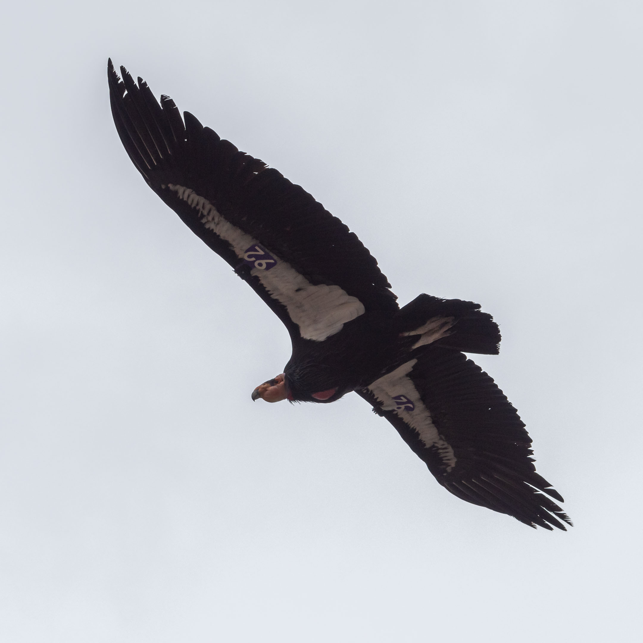

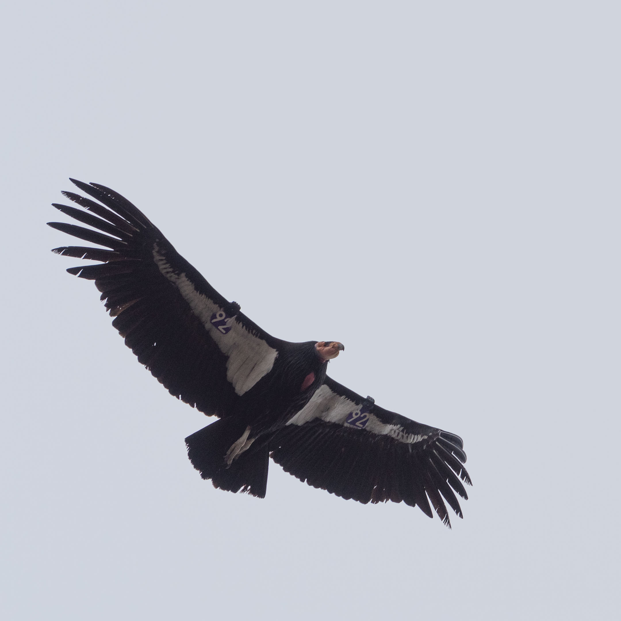


I like the one where you can see the antenna on the radio tracking device, a fashion accessory worn by all the chic condors (for the Condor Recovery Program). If you’re on your phone, you may have to use the “view full size” option after you click on the gallery! There, I added a crop so everyone can see it. These shots are all of our friend 692, he was out showing off for me!
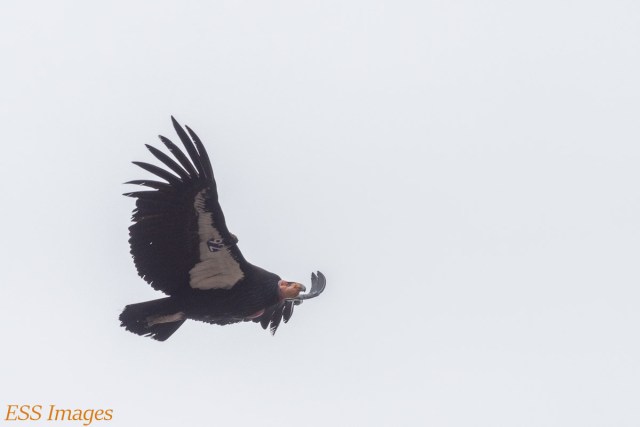
Photographing the Condors (I almost said “shooting the condors…) was certainly a lesson in contrast, with dark birds against a bright sky! Not to mention that I’m more accustomed to shooting landscapes and buildings – which tend to sit still (we hope!).
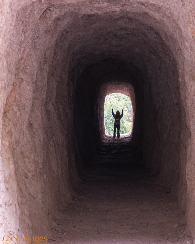
When we left the condors, we made a side trip down the Tunnel Trail, which would have been the other way up to the High Peaks from the west side. It’s called the Tunnel Trail because…well, you know. Had I realized at the time that to see the tunnel we’d be going almost all the way down the mountain, I might have requested a different itinerary.
We went down the mountain, went through the tunnel, came back through the tunnel, and walked back up the side of the mountain. I hope you like the picture! 🙂
I should put in a plug for those Trailbuddy trekking poles Leigh is carrying, but they’re not paying me so I won’t mention them. Oh, wait…
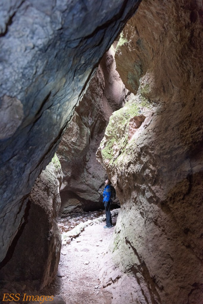
After re-climbing the peak, we followed the High Peak Trail down to the Bench Trail and up to the Old Pinnacles Trail, and finally to the Balconies Trail. The Balconies Trail offers two possibilities: you can go through the caves or you can bypass the caves. Us being us, we did both…
First we bypassed the caves. From the above-ground trail (well, really above-rock) you look down into the valley into which the Balconies hillside collapsed, creating the caves.
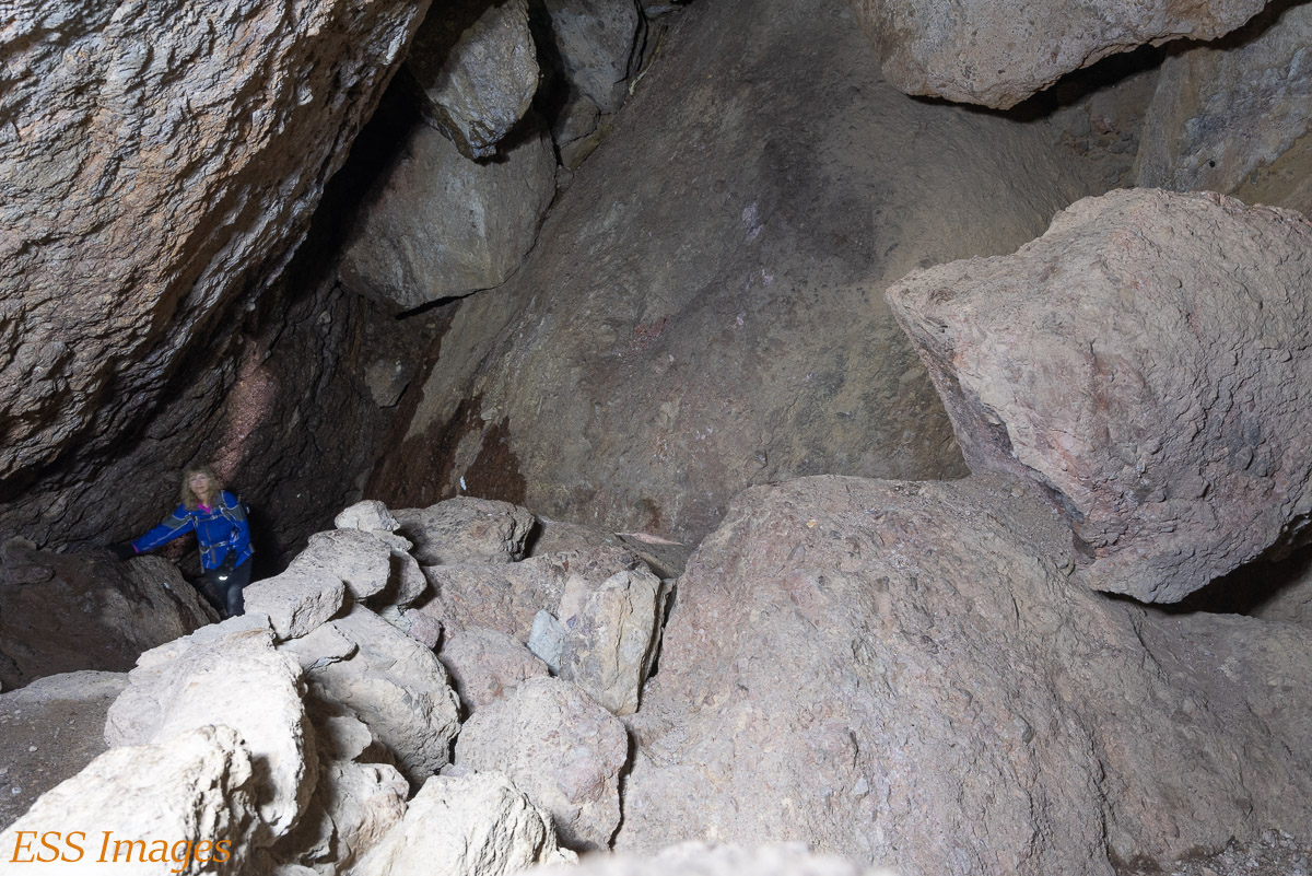
We reached the point where the Bypass Trail meets the cave trail, so we turned back for the caves. Like the Bear Gulch caves, these caves are really a path through a very large boulder pile. It’s bigger than the Bear Gulch caves, and in some places much darker. It was fun going through the caves, I had my headlamp and flashlights, so we were well illuminated when we needed it. Two of these pictures are long exposures lit by our lights. It’s good that we enjoyed it, since, of course we had to go back through it (or the long way up the hill) to get to the end of the trail!

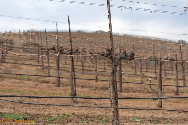
After the caves, it was an easy walk back to the picnic area. On the way out we passed some interesting sights. The repeating pattern of the out-of-season winery caught my eye.
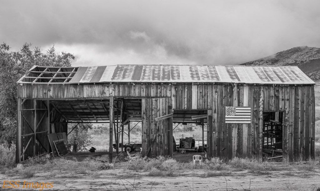
And this rather dilapidated structure earned me Honorable Mention in a competition at the New York Center for the Photographic Arts.
Well, we’re back in Texas, safe and sound, all things considered. I guess we won’t be flying anywhere for a little while. But West Texas is driving distance. Maybe Langtry, to visit Judge Roy Bean! My feet are getting itchy…

Good you saw those big birds – never seen condors myself.
LikeLike
Yes, we had a couple of good days with the condors at Pinnacles! I hope we get to see more at other locations on the West Coast and, I believe in Arizona.
LikeLike
They do have some in grand canyon area but I never saw any.
LikeLike
We’ll be there in the nice, cool weather of…August! Perhaps they’ll be out to keep an eye on us…
LikeLike
Maybe I went in the really cold month of december ☺
LikeLike