“…a burning, seething cauldron, filled with dramatic light and color.”
-Georgia O’Keeffe.
In our last days of freedom, before the Enclosed Times, we took a trip up to Palo Duro Canyon, up Amarillo way. Unfortunately, we came back… But it was a great trip while it lasted! I hadn’t been there for more than 30 years and now I have no idea why, what a marvelous place!
Palo Duro Canyon is, as I said, up in the Panhandle, close to Amarillo, about 6 hours of driving from home. It’s not a bad drive, past Wichita Falls and then the smaller towns along highway 287, Chillicothe, Quanah, Childress, Memphis…Memphis? Are we lost again? 🙂 And on to Canyon, TX, where we were staying. We arrived late in the afternoon and we didn’t have a day pass but we couldn’t resist driving over to the park and checking things out.
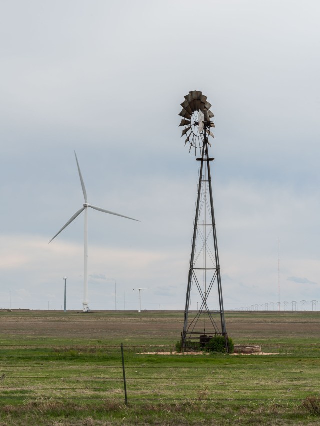
On the road to the park we saw this sign of the changing times in Texas. If you follow me on Instagram or Facebook you’ve seen plenty of both kinds of windmills, but rarely this close together. Equally rare is that this wind turbine was all by itself, most of the time it’s a whole farm!
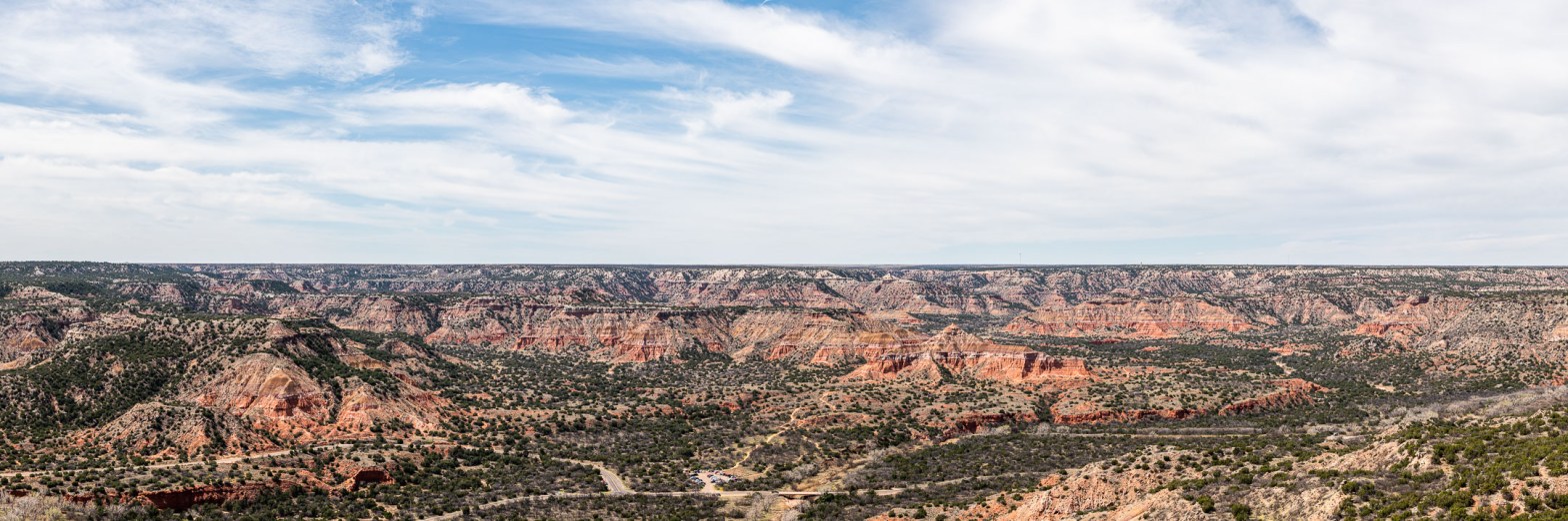
At 120 miles long and up to 20 miles wide, Palo Duro is the second largest canyon in the US, behind that other Grand Canyon! 🙂 It was formed by the Prairie Dog Town branch of the Red River as it flows off the Caprock of the Llano Estacado. The base rock was laid down by a Permian Ocean 250 million years ago, covered by a Triassic Swamp about 225 Million years ago, and then capped off by Rocky Mountain sediment around 10 million years ago. For some reason there’s a 200-million year “discontinuity” in the rocks.
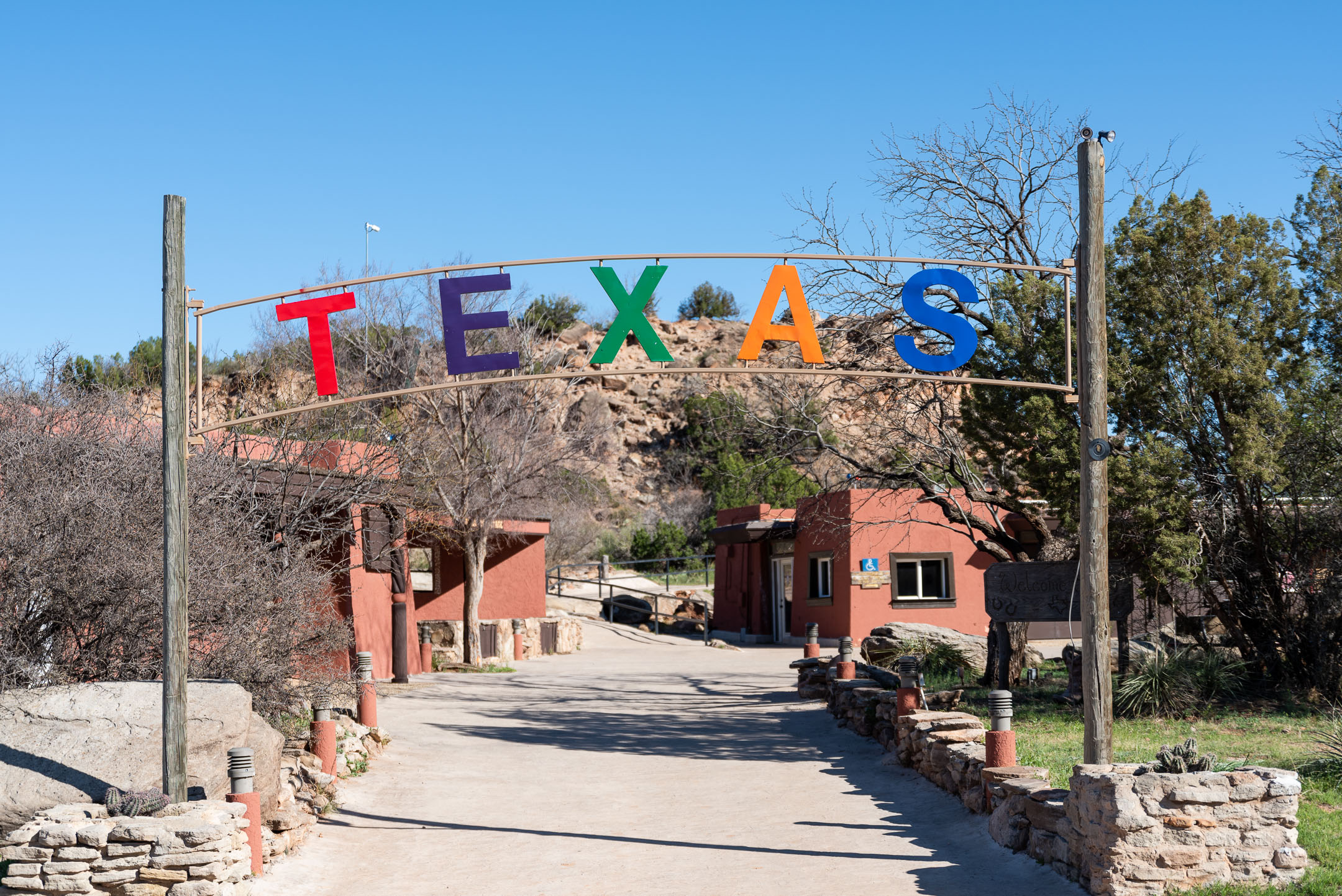
Saturday morning we heard The Lighthouse calling our name. The Lighthouse is perhaps the most recognizable feature in Palo Duro (except maybe the arena where they perform “Texas !”) and it’s a popular hike. Being us, did we head right for the Lighthouse Trail? Don’t be silly! We decided on the Givens, Spicer, Lowry Trail which meets the Lighthouse Trail part way, and up to the Lighthouse. On the way back we’d follow the Lighthouse Trail back to its trailhead and then the Paseo del Rio Trail back to where we parked, to minimize retracing of steps. Simple! 🙂

The parking lot for the GSL Trail is watched over by a defunct windmill and an empty water tank. Only a few vehicles preceded us (the park was already restricting entry) and the trail was also sparsely populated, at least until we reached the Lighthouse Trail.
The trail is a pretty flat but rather fun trail, through and around much beautiful geology.
These red rocks at the bottom of the canyon are part of the Quartermaster formation, laid down in the Permian period (fitting for a canyon this close to the Permian Basin I guess). Those white stripes are gypsum layers in the sandstone.
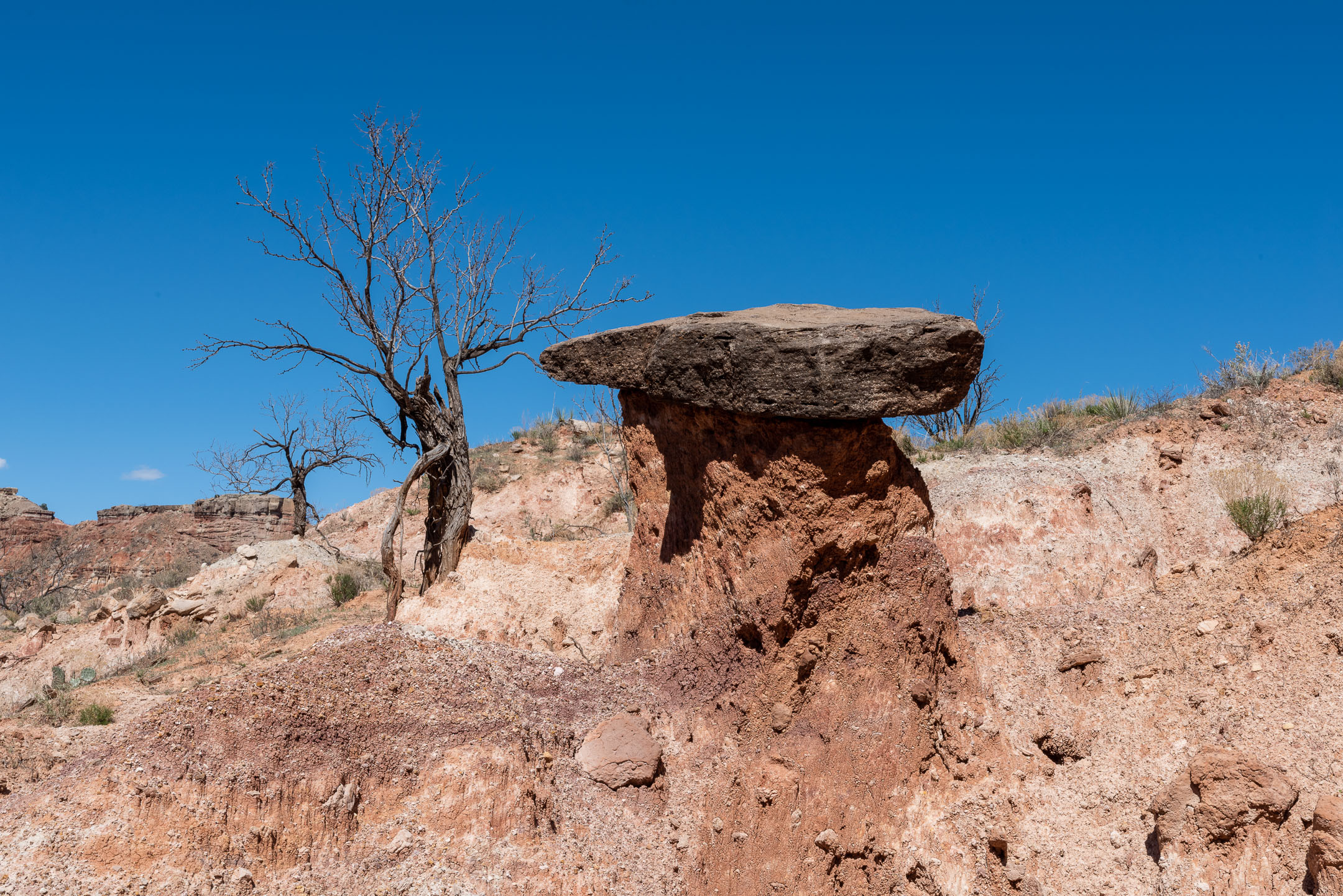
There’s a type of formation known as a “hoodoo” around here (also as a “pedestal rock,” but that’s awfully boring, don’t you think?) , I think they called them “fairy chimneys” in Cappadocia. We only saw a few of them in Palo Duro, but one of the biggies is the aforementioned Lighthouse. The hard cap cracks and the softer material below erodes away.
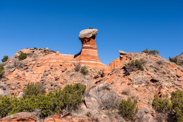
This isn’t the Lighthouse, but it is a hoodoo along the GSL trail.
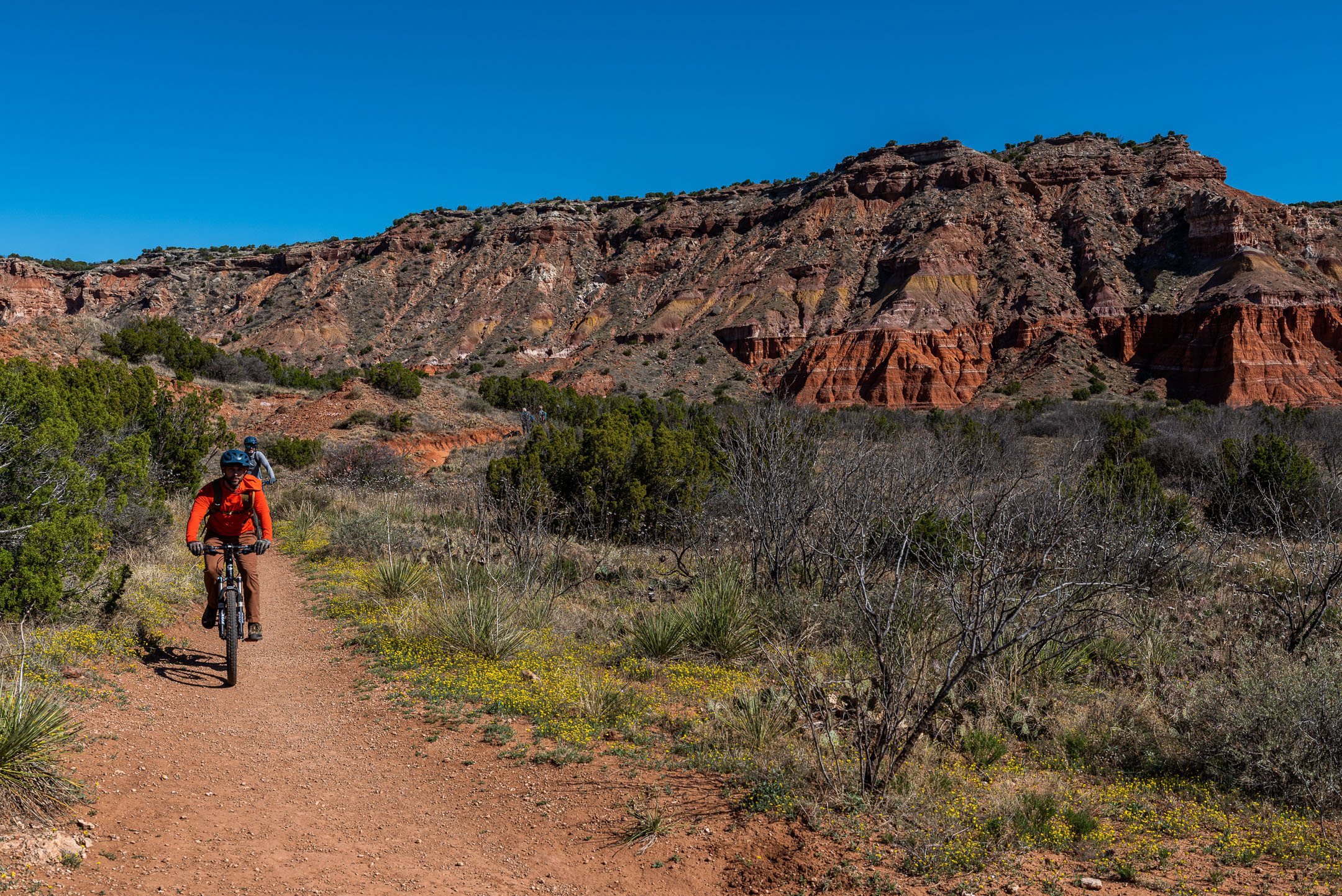
The GSL trail runs into the Lighthouse trail about a mile from the Lighthouse itself. Along the way we were passed by several cyclists. Many of the trails are bike-friendly and there are some trails that are just for bicycles. Why didn’t we bring the bikes? Next time… Oh, and in the picture with the cyclist you can really see the distinct layers of the rock formations on the right!
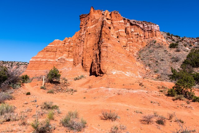
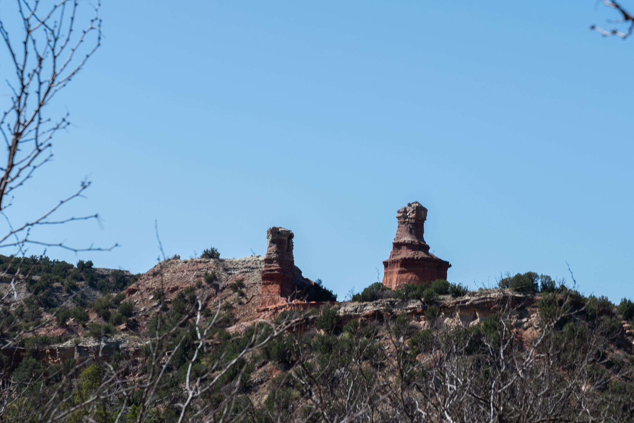
It was just after that junction that we got our first glimpse of the Lighthouse in the distance…

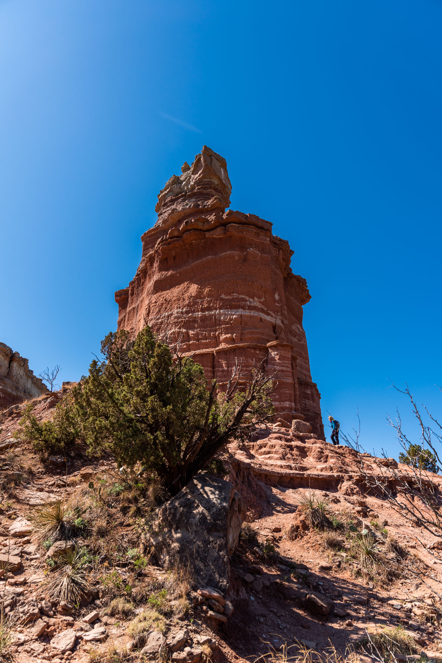
When we got to the base of the formation, we took a non-standard route up to it. It was perhaps a bit steeper than the recommended route, but it was fun and it got us where we wanted to be. A little more scrambling up the red rocks and we were standing next to the Lighthouse!
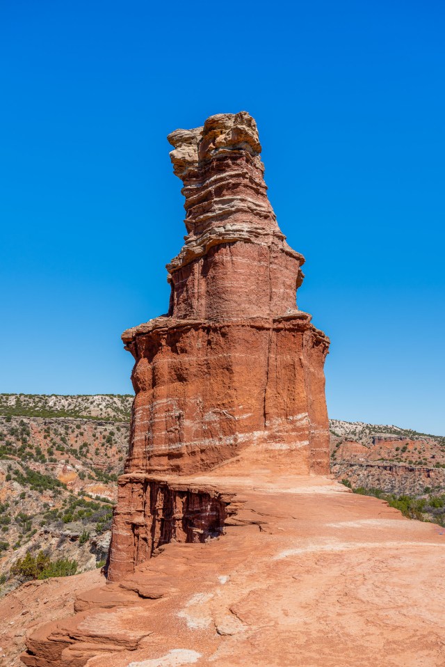
The Lighthouse is a good example of much of the geology in Palo Duro. Over 300 feet high, it contains the older geology of the park, with the Triassic sandstone on top!

And the views are spectacular!
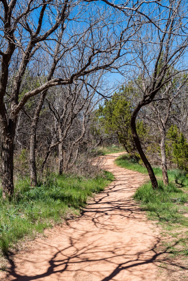
We left the Lighthouse by way of the Lighthouse Trail and followed it back to the trailhead. From there we went up the Paseo del Rio Trail, a flat, rather pleasant walk, mostly through woods. In about a mile we were passed by at least a half-dozen cyclists, definitely need to take the bikes next time!
There was still plenty of daylight, so we went to the short-but-interesting Caves Trail.
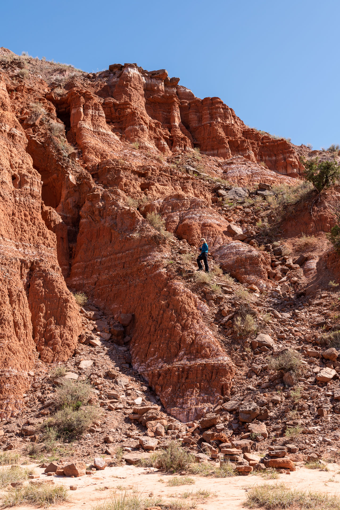
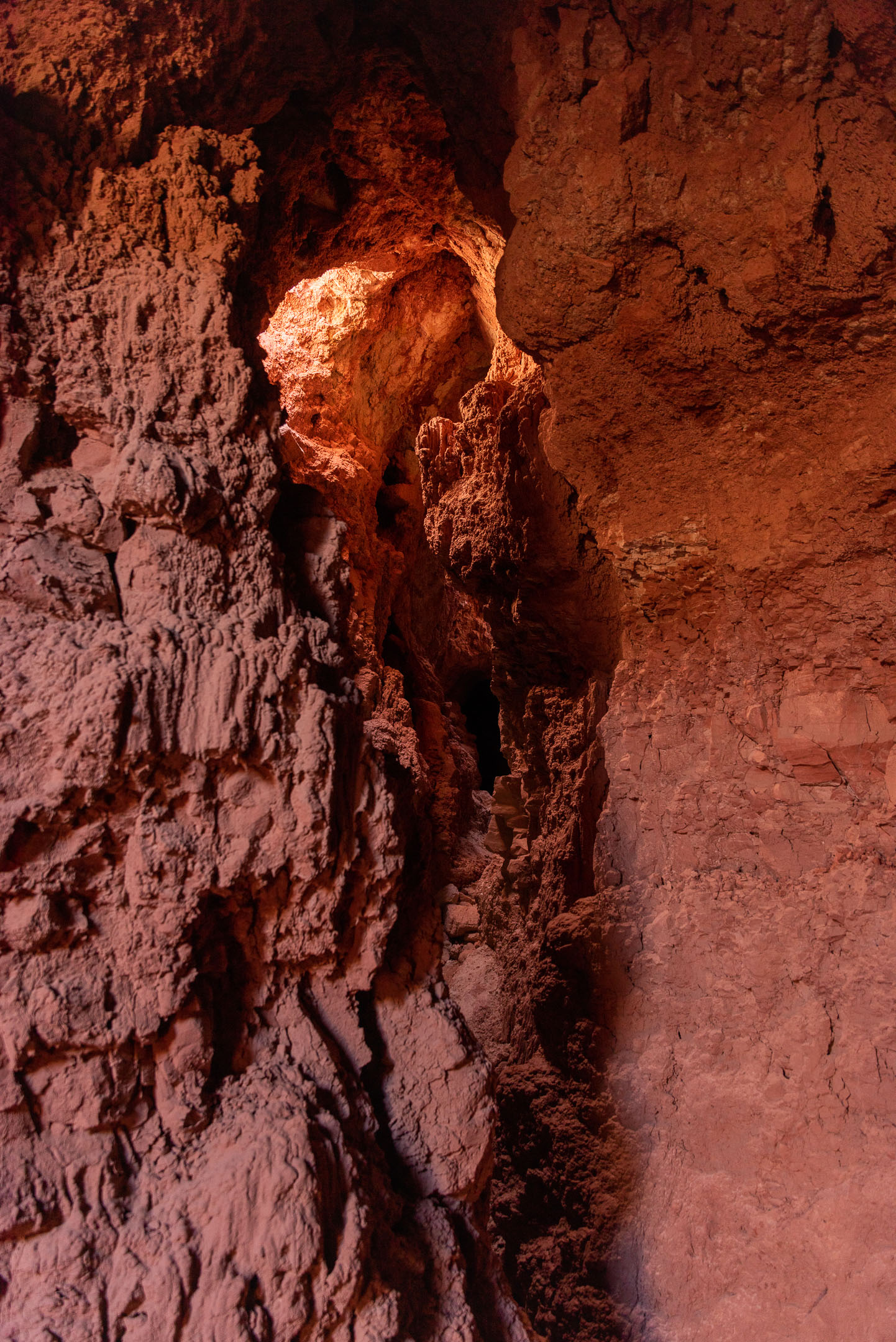
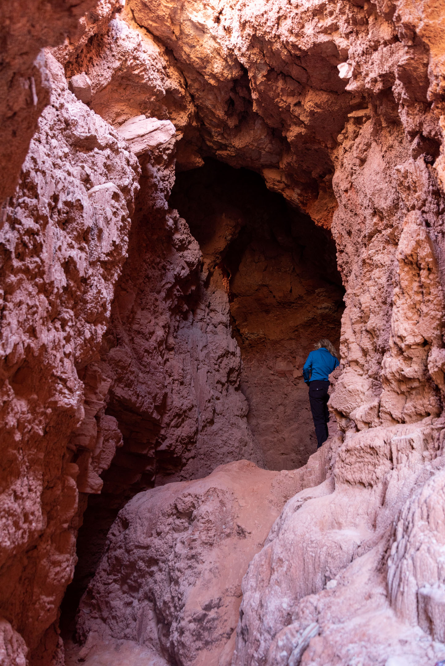
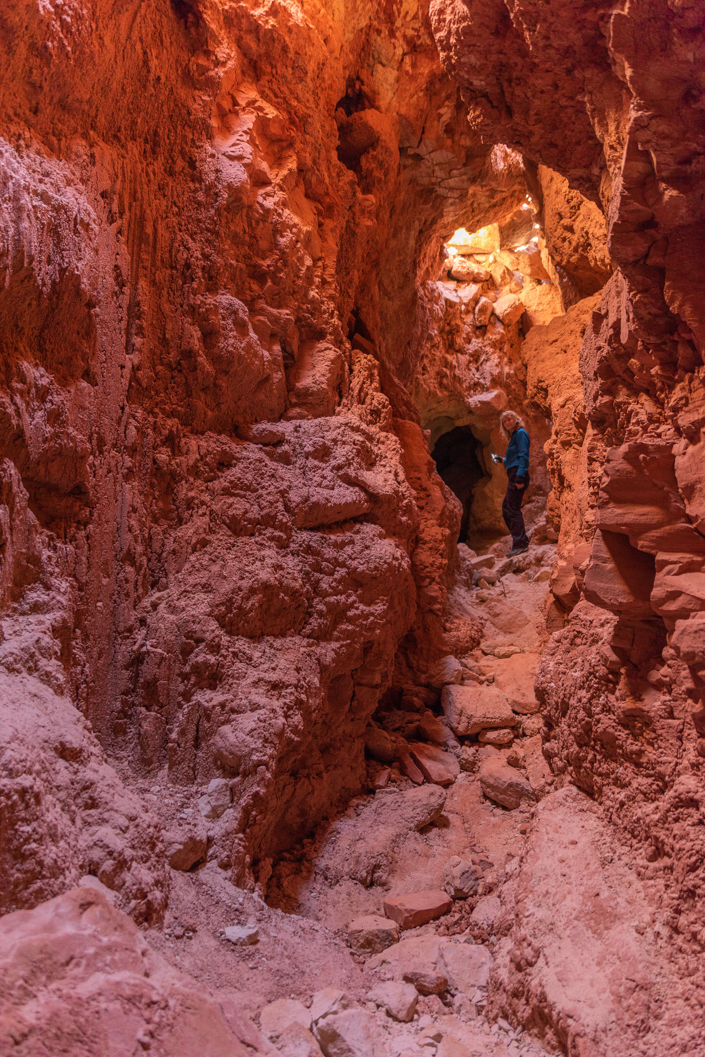
We explored a couple of caves, and Leigh went up the side of a cliff and a good time was had by all!
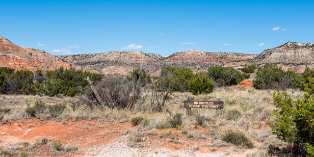
On the way back we passed this “No bicycles beyond this point” sign. Since I don’t see a trail back there, I think I can live with that – although my brother-in-law might be tempted!
After the Caves we went on to the CCC Trail that starts near the Visitors Center (which was built by the Civilian Conservation Corps in 1934). In the early 1930’s, this trail was the only way that the CCC workers could get from the rim of the canyon to the bottom. I don’t envy them the commute, especially during the summer! And the winter up in the Panhandle is no picnic either! They built the road, bridges, and trails as well as the “El Coronado Lodge,” which is now the visitors center.
The trail is only about 1.5 miles, going from the Visitors Center to the Pioneer Amphitheater, with about 500 feet of elevation. You go down a little from the Visitor’s Center, then along a ridge for a while. Then you pop over the ridge and head down into the central valley and the Pioneer Amphitheater
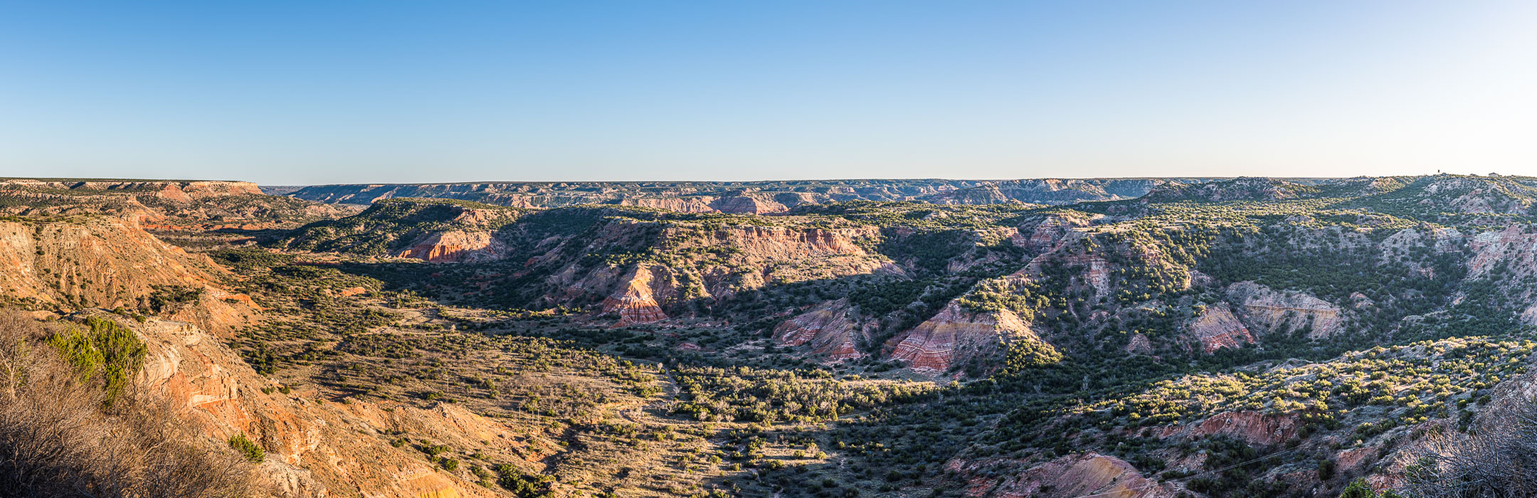
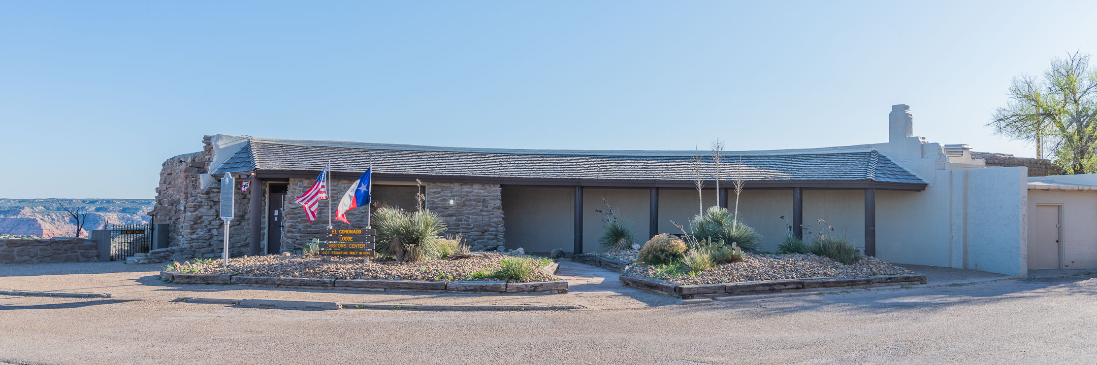
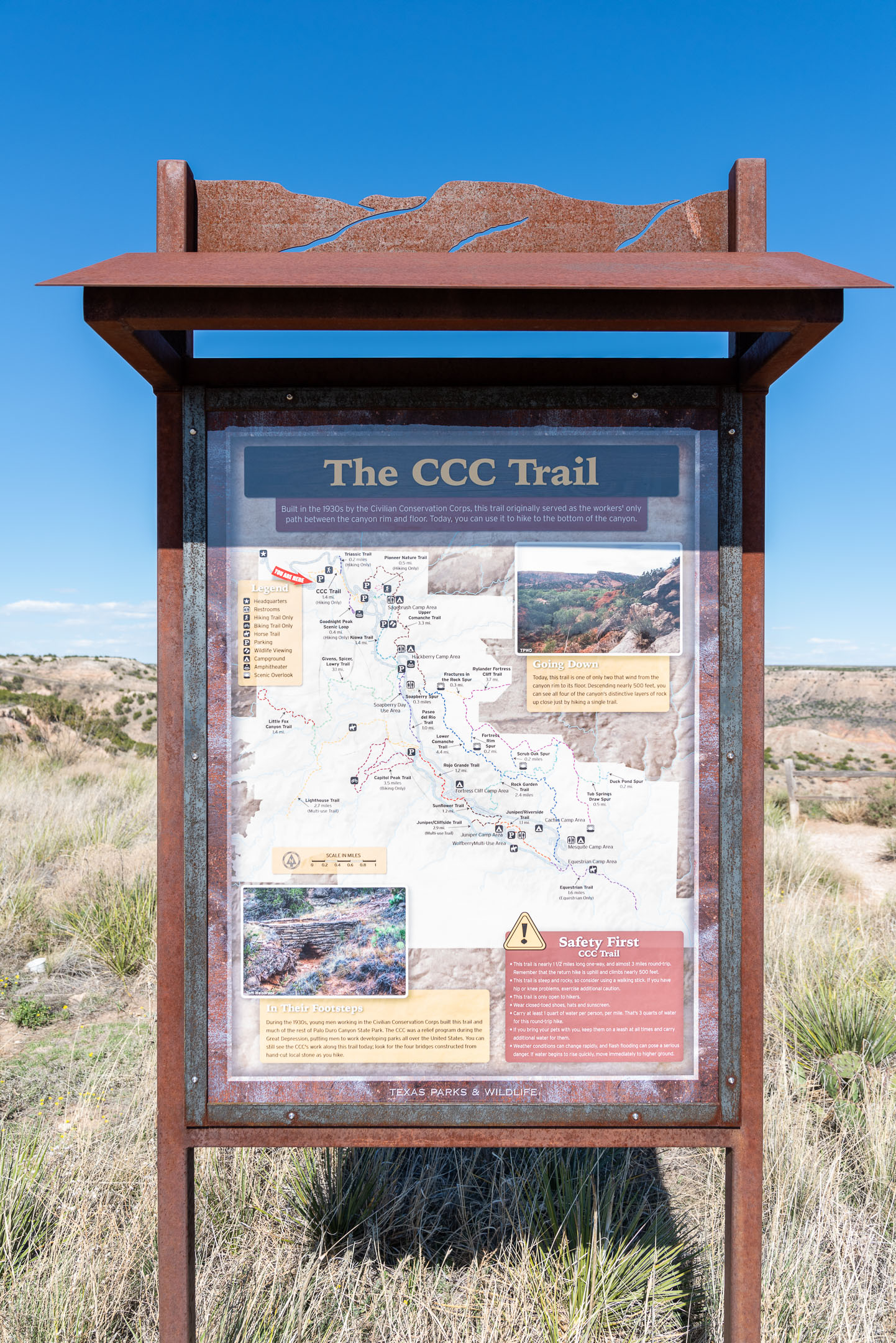
Of course, the downside to this trail is that once you get to the end, you turn around and go back. The descent to ( and ascent from) the amphitheater is fairly steep, so it was a good workout getting back up top! We weren’t passed by any bikes on that trail. When we got back to the Visitors Center, the sun was getting low, so I took one last panorama that you can see above.
And so we returned to the hotel for a good nights rest and concocting plans for our next day’s adventure!

Great post 😁
LikeLike
Ahhh, our very own Grand Canyon! Great trip, awesome photos!
LikeLike