When we started planning this trip, we looked at the average conditions for Bryce Canyon in September. Average high around 70 (about 21 for you metric types) sounds great! Lows around 40-42? (yes, 5-ish in metric) Not a problem, layer up a little and take it off as the temperature climbs. Easy, yes? Then, as the time approached, we could look at the 10-day forecast. And that showed a cold front moving in. So we packed a little bit differently than we originally thought. And it was a good thing!
When we flew into Vegas and drove up to Tropic (Utah), it was a lovely day. We stopped along the way and did a bit of hiking (in the Dixie National Forest) as the sun was going down. The sky was showing some haze, perhaps from the California fires. But it was starting to cool down.
We checked in at the Bryce Country Cabins, at the north end of Tropic (cute little cabins, clean & comfy!). Next morning off on our first adventure. We had (as usual) scouted out the area on Alltrails and picked out a few. Our first morning hike was Mossy Cave, conveniently located between the Cabins and the main entrance to the park. It’s a short hike with only a bit of elevation gain so it seemed like a good warmup!
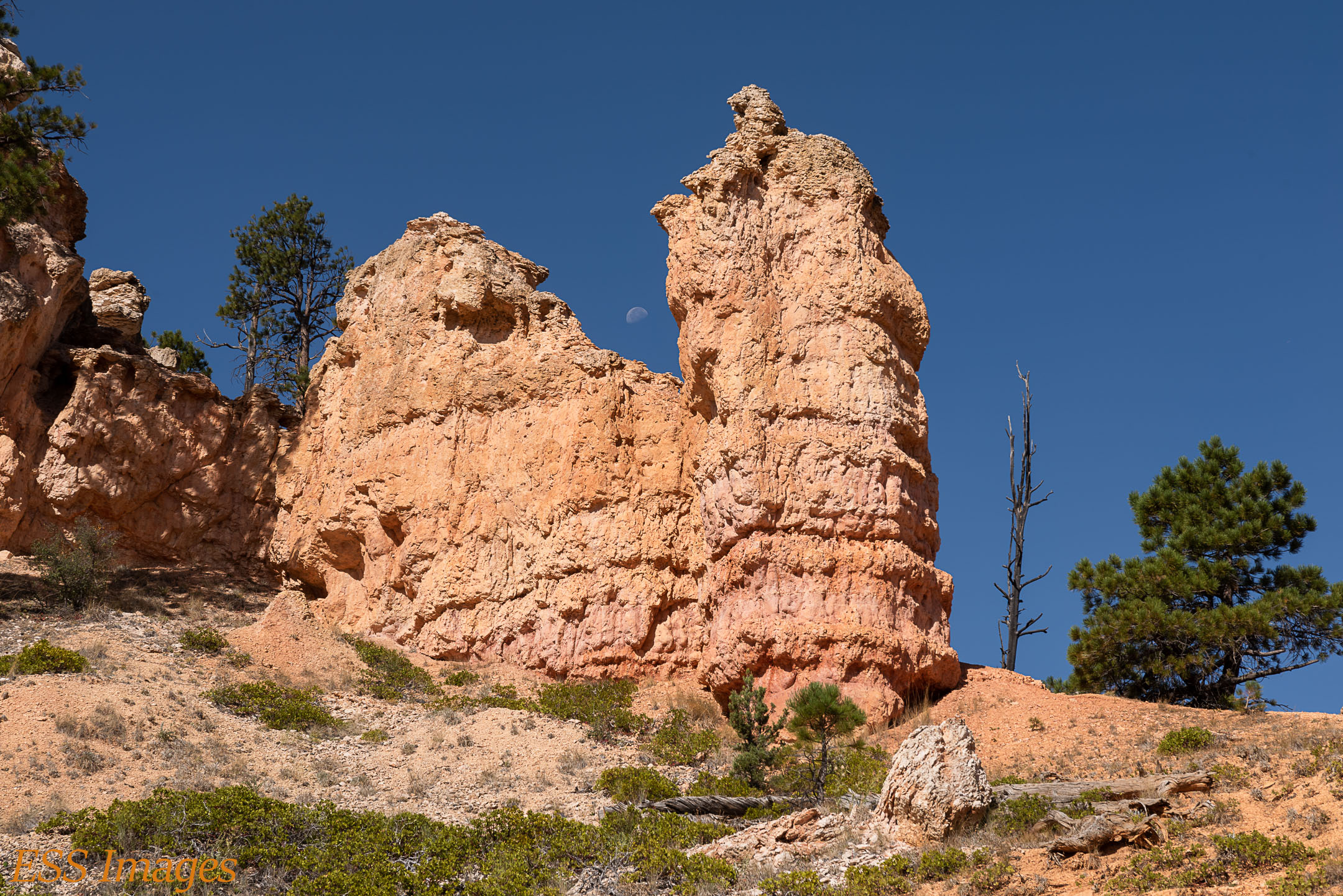
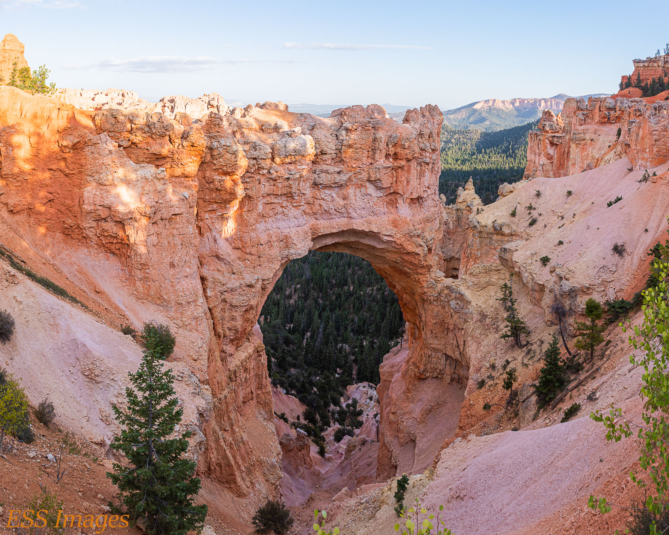
The hike is pretty flat going along the stream in the “Tropic Ditch,” essentially a canal dug over 100 years ago. They tell me it’s only run dry once since then. Well, it has a lovely waterfall, behind which my wife can hide! If you look closely, you can see her. There are a lot of cool rock formations, one of which framed the moon at just the right time! You can see the wind whipping at my jacket, making it hard to hold still. Oh, there’s also a cave with moss growing…
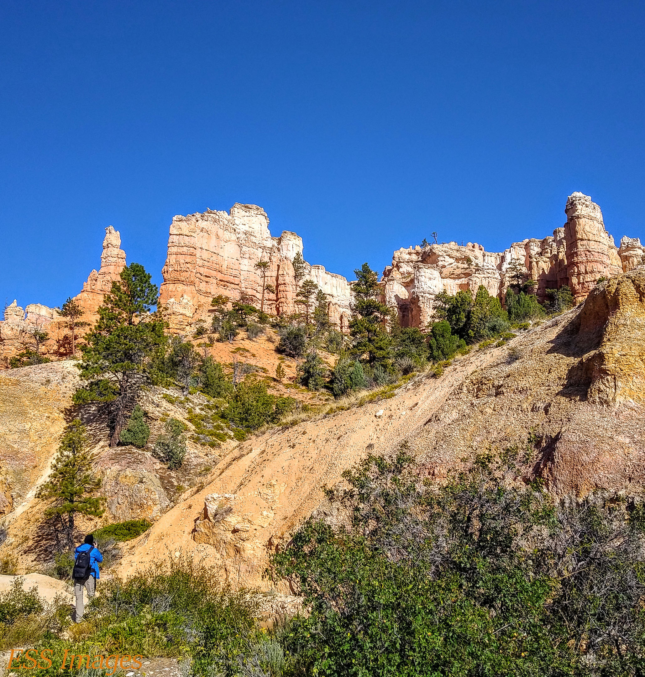

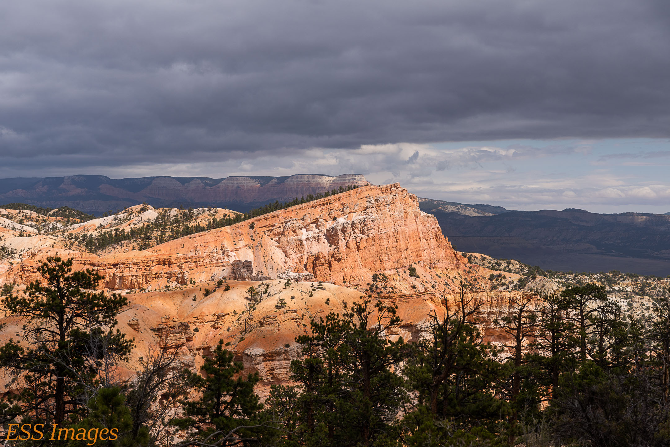
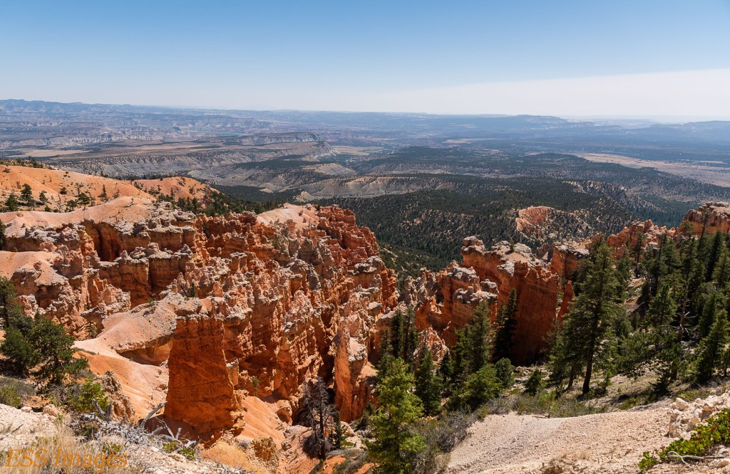
After our visit to the cave and waterfall, we headed for the park. We stopped at the Visitor’s Center to get our park passport stamps and then headed for the Fairyland Loop trail. We started where it goes down into the canyon close to Sunrise Point and this is where we got our first view of the strange beauty of Bryce Canyon!

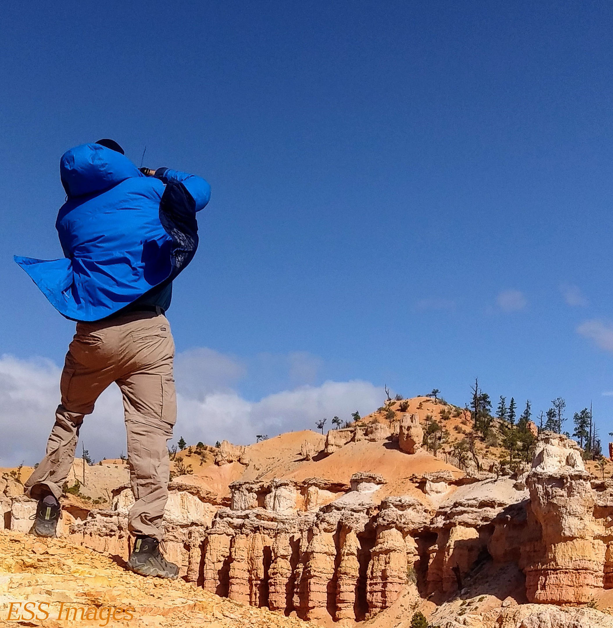
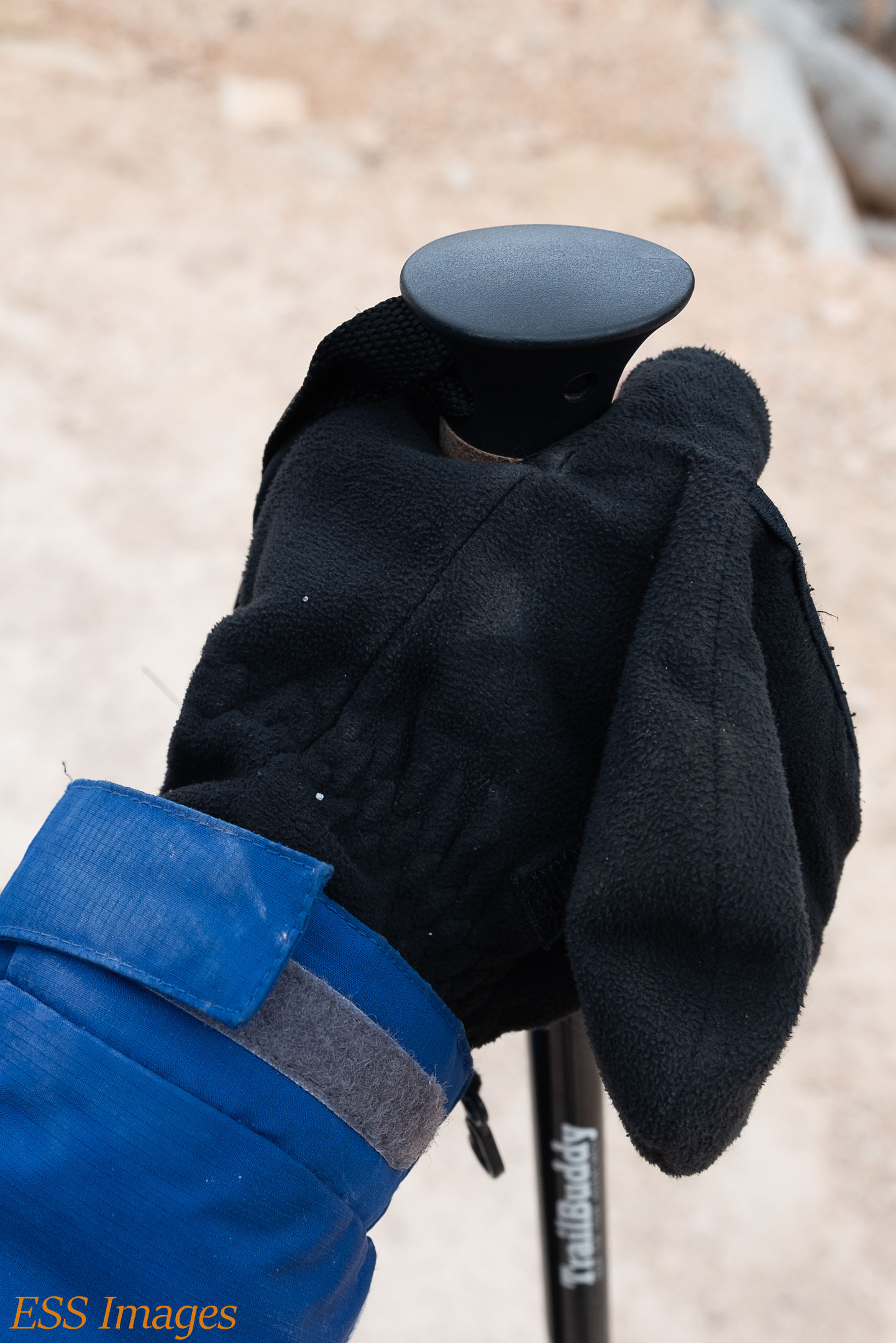
Did I mention a cold front? As we were going to the trail, the temperature was dropping and the wind was rising! Here we see what the well-equipped hiker was wearing. We saw a lot of people who hadn’t read the forecast apparently – many Bryce Canyon sweatshirts were being sold to many cold-looking people!
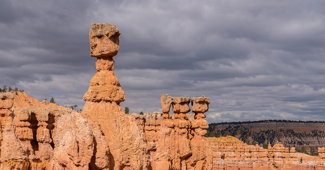
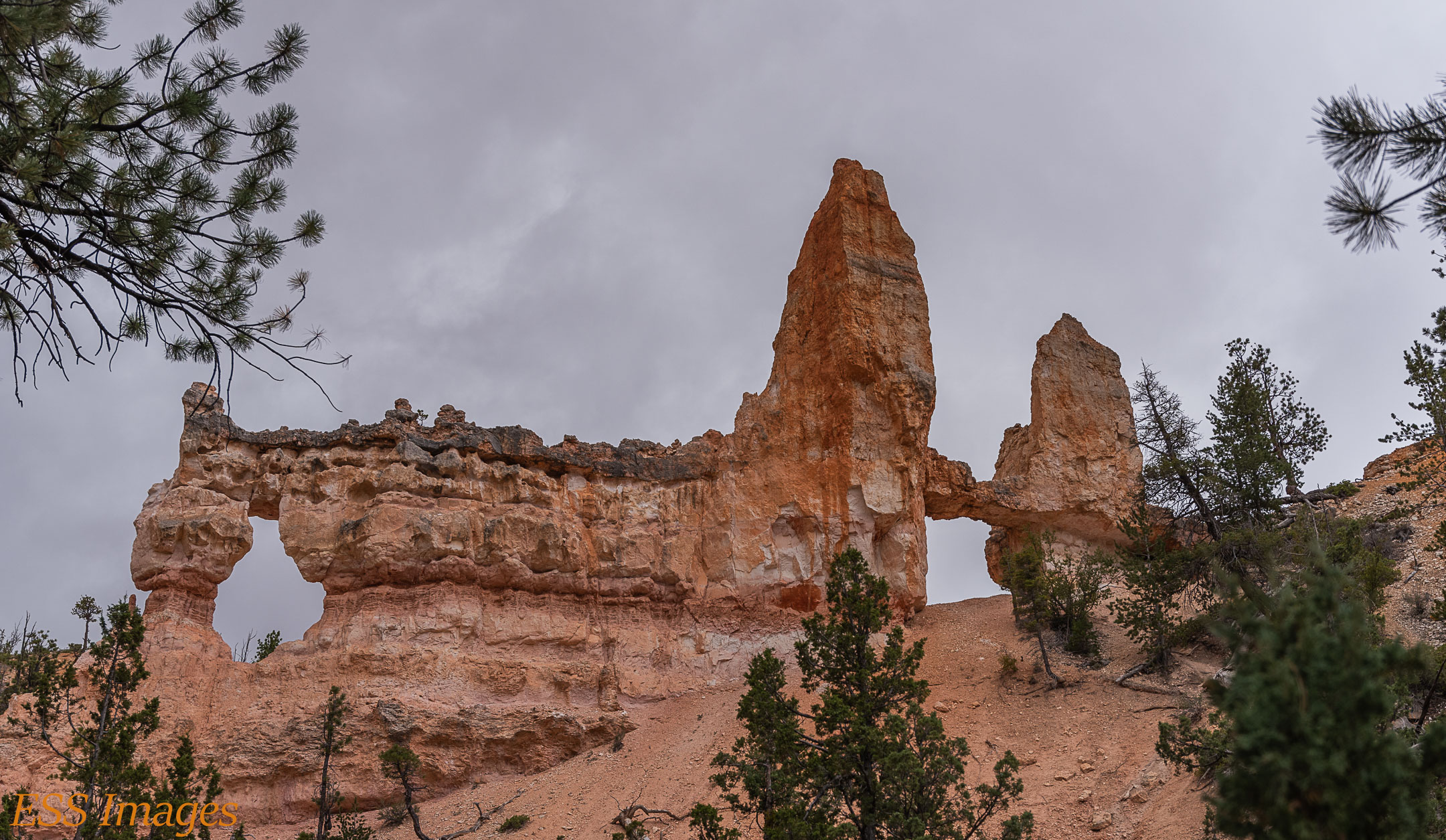
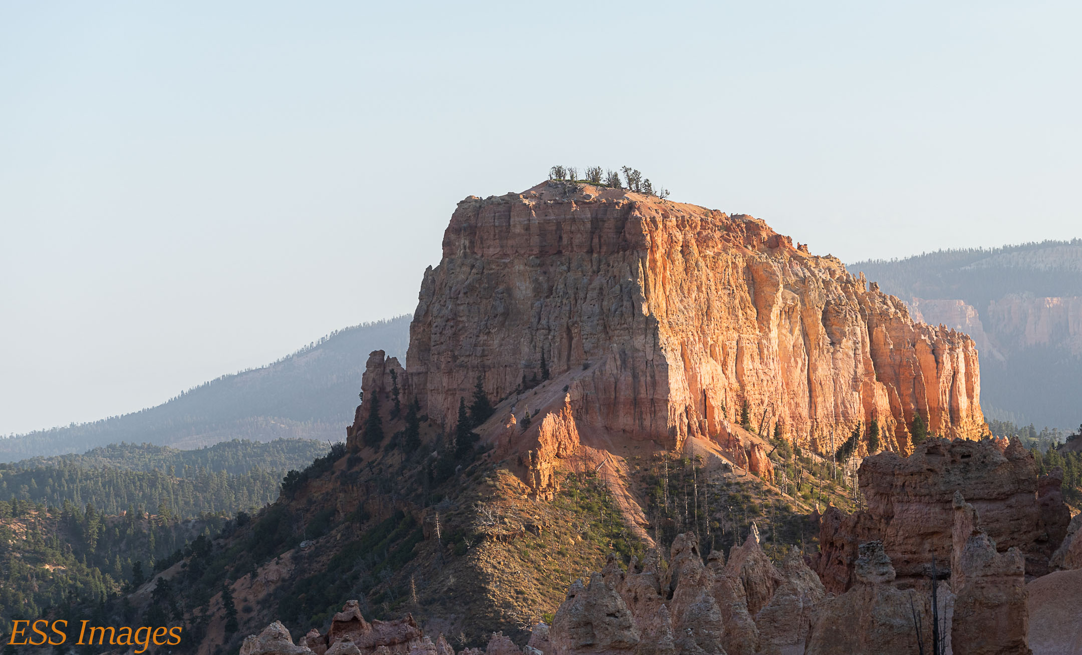
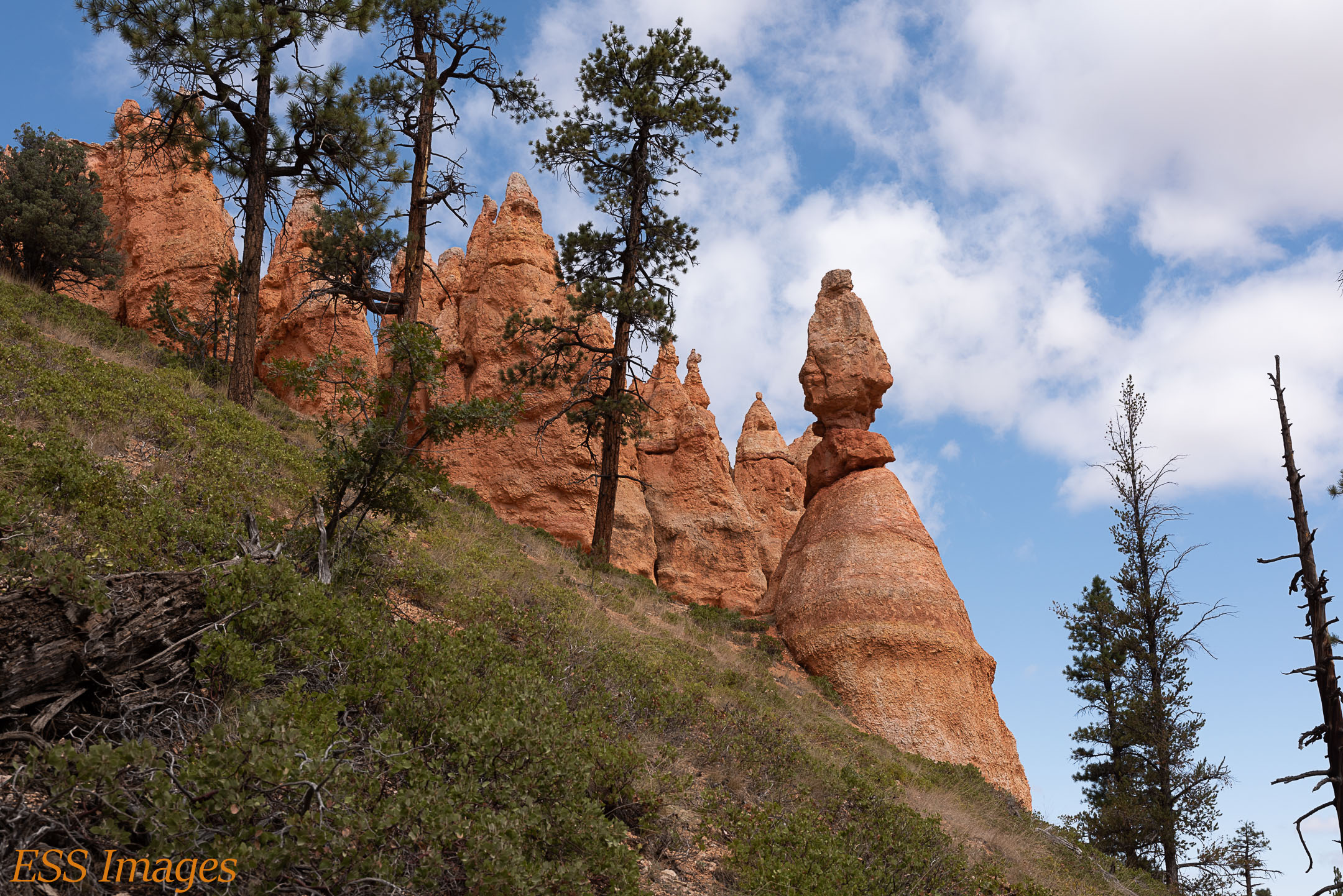
But the trail was marvelous. Once we got down in the canyon we were (slightly) shielded from the wind, which was good, since it was about 40 degrees! As we went along the trail, at first we saw more large formations, walls and proto-hoodoos. We went on a bit of a side trip to see the Tower Bridge (as you see in the adjacent gallery). We got a great view of the Sinking Ship (also in the gallery), though we saw it several other times from different trails while we were there.
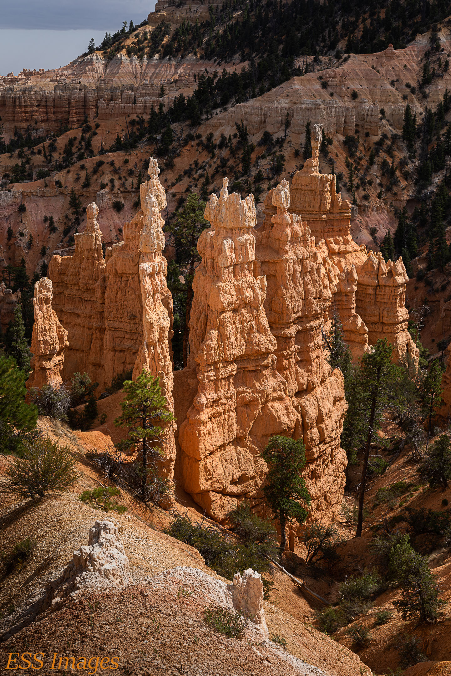
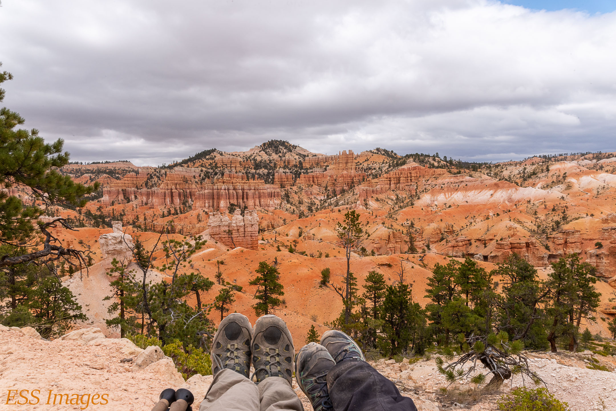
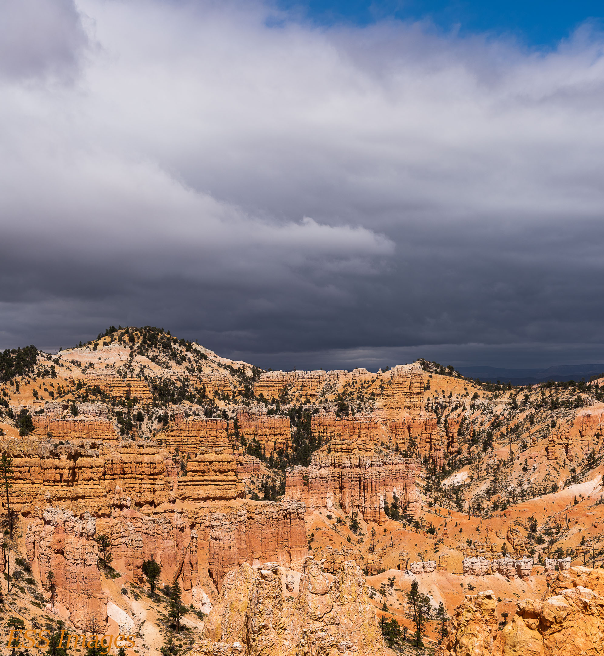
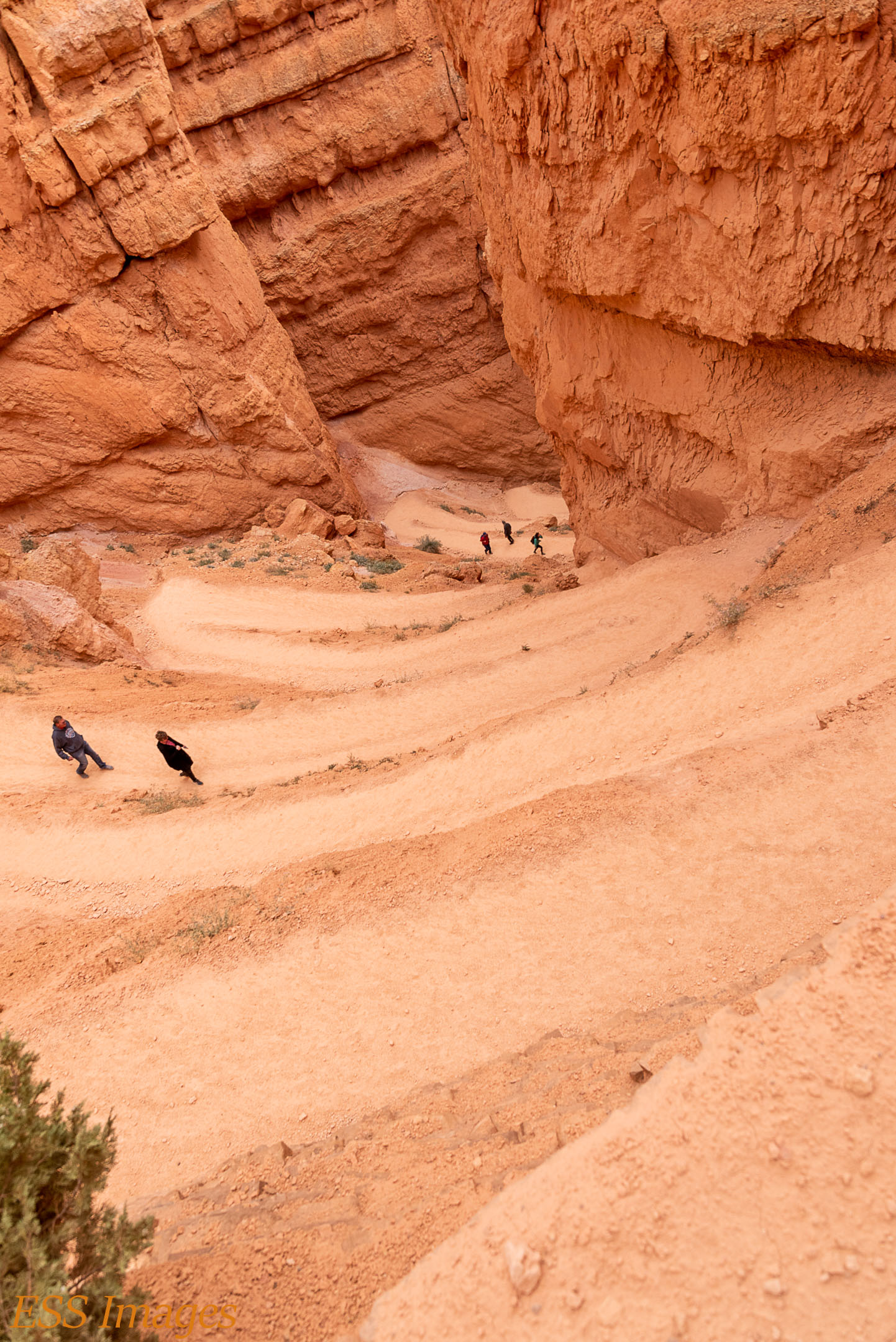
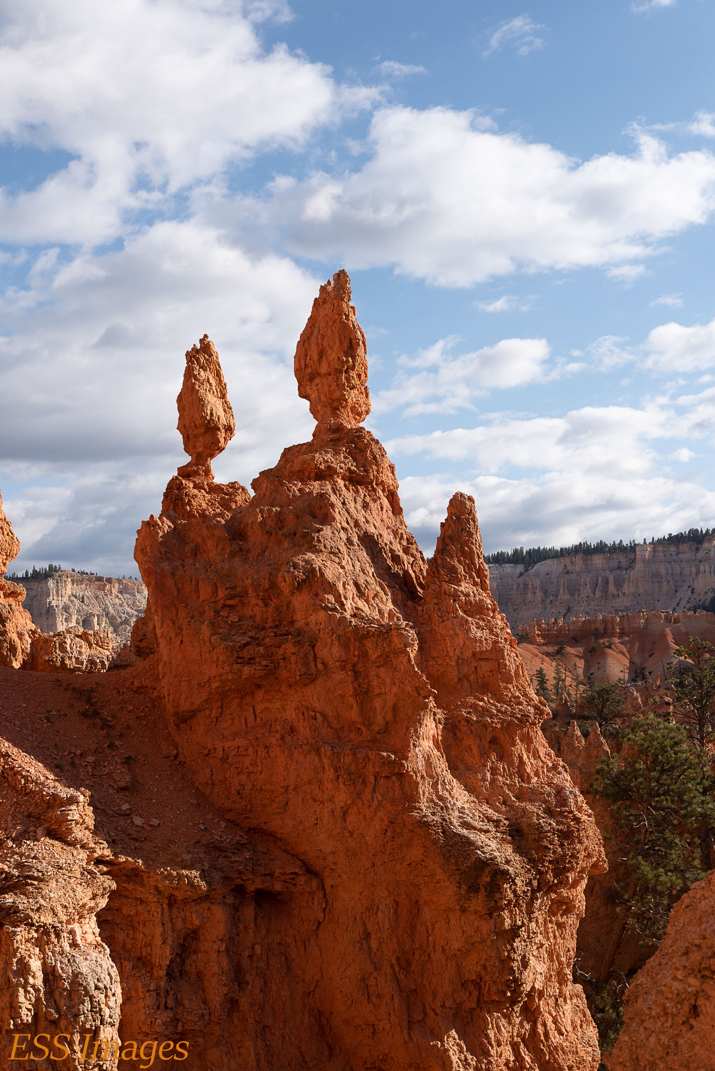
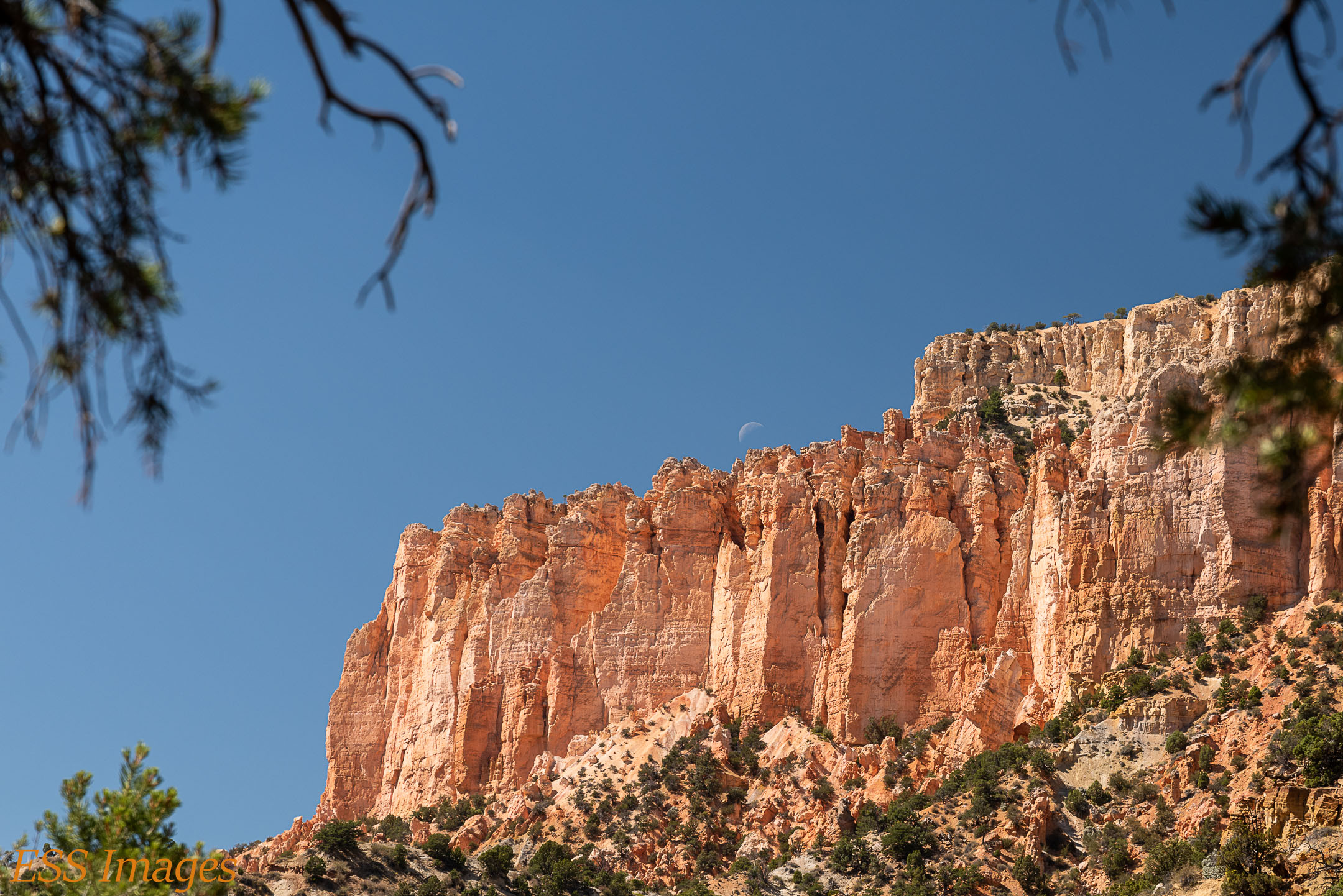
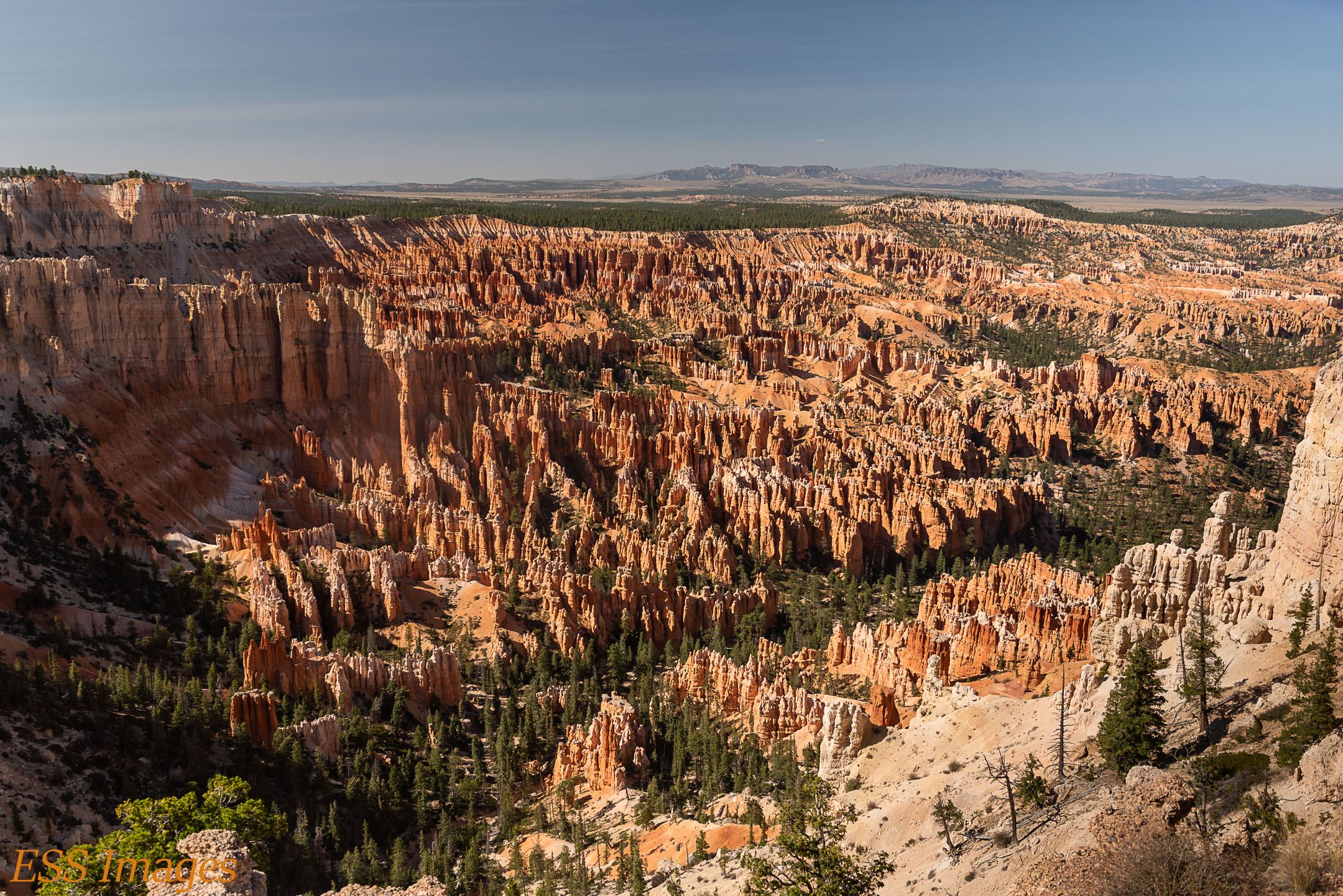
At some point you come around a curve (or over a ridge, I really can’t remember!) and you begin to see more and more hoodoos. We stopped and took a “boot” picture with some of them. And then more in the next picture. It’s just amazing and unearthly! Finally, you get to Fairyland Point, back up on the rim. You look down on what looks like a grand gathering of hoodoos and you can see why they called it “Fairyland!”
As we strolled along the Rim Trail back to our starting point, we got snowed on! See we have evidence – not one, but TWO snowflakes on my wife’s glove! 🙂 We strolled back to the car and went to check out a few of the overlooks in the park, the Natural Bridge for example. Beautiful views as the sun went down!
We’d trained up for this trip so we were ready for the ups and downs but it was still pretty tiring. So we went back to the cabin and got a good night’s sleep! Tomorrow is going to be even more up & down – we planned to do the Navajo Loop and the Peekaboo Loop. And so we did!
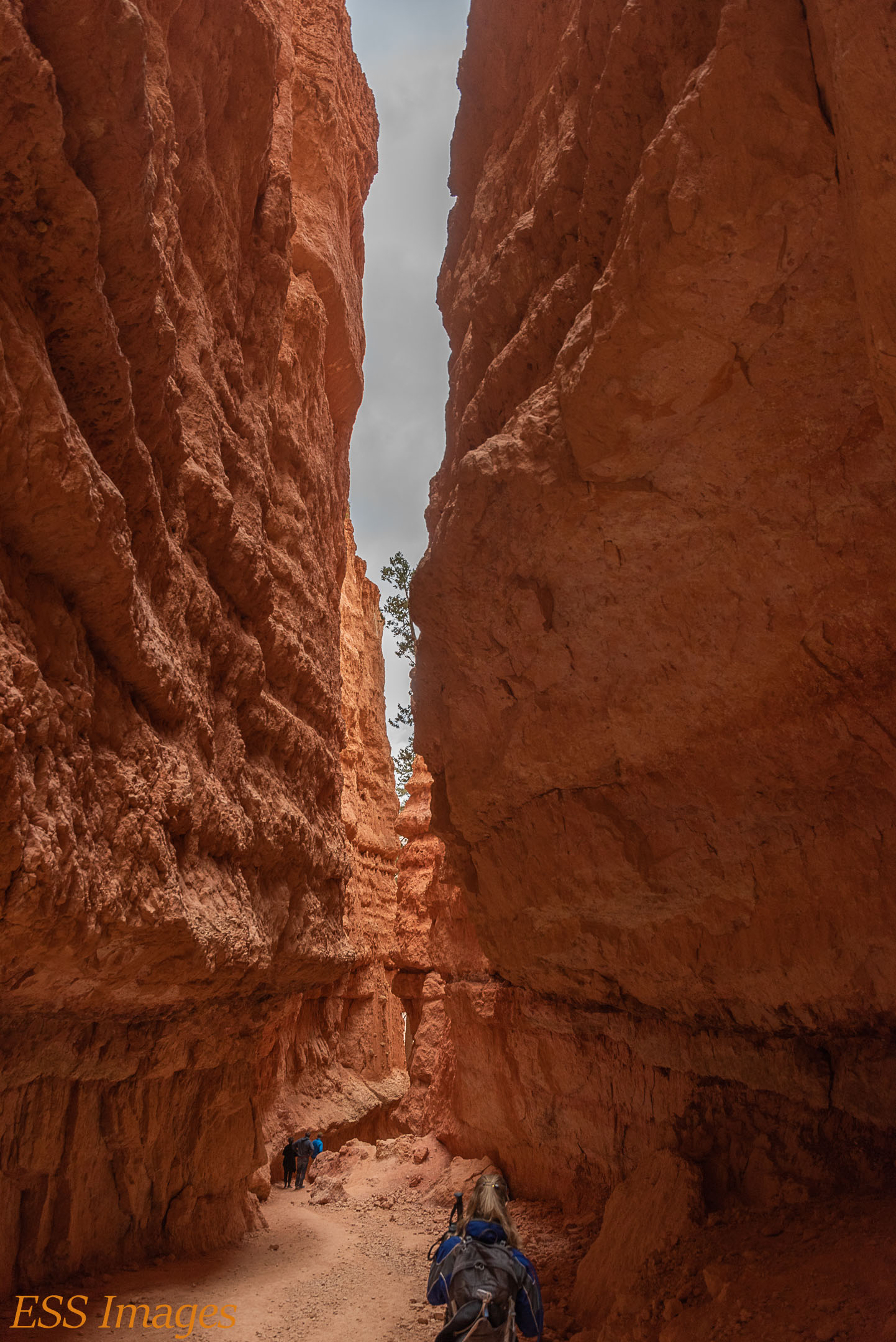
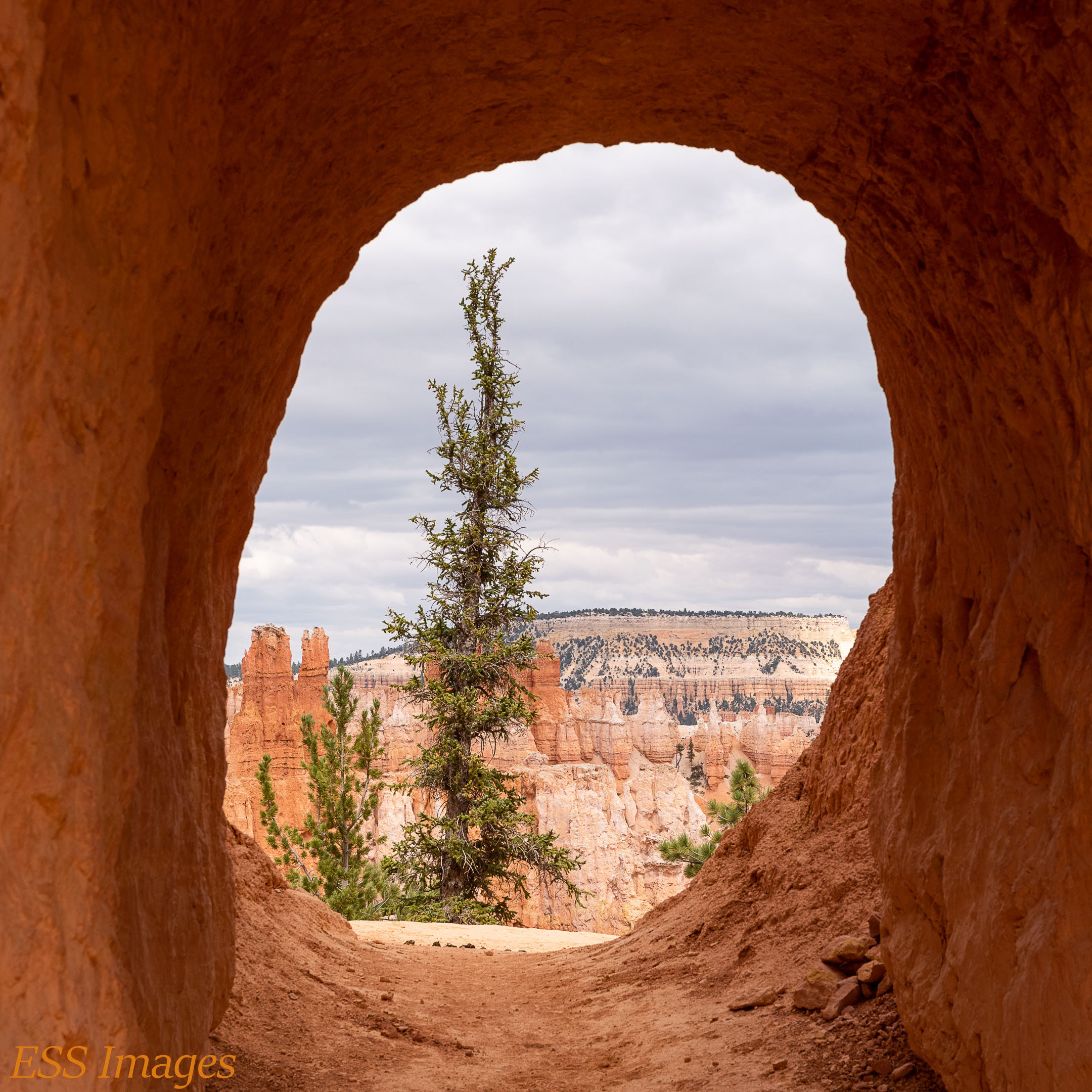
In the morning we headed to Sunset Point, where the Navajo Loop starts with a descent to Wall Street. If it looks like a long way down, that’s because it is! But it’s a good trail and it takes you down to the high walls of, well, Wall Street! It’s a neat little, very tall, slot canyon.

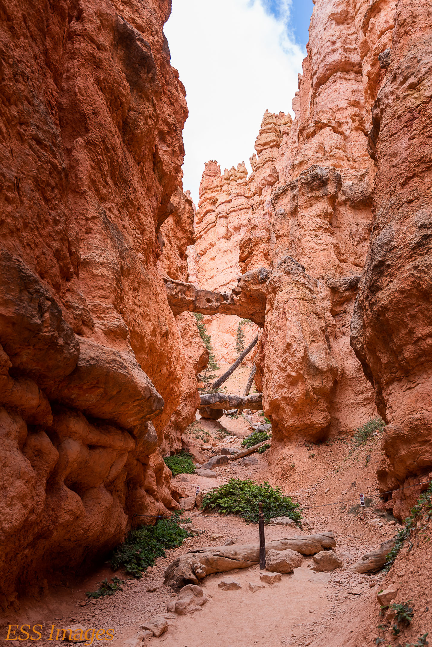
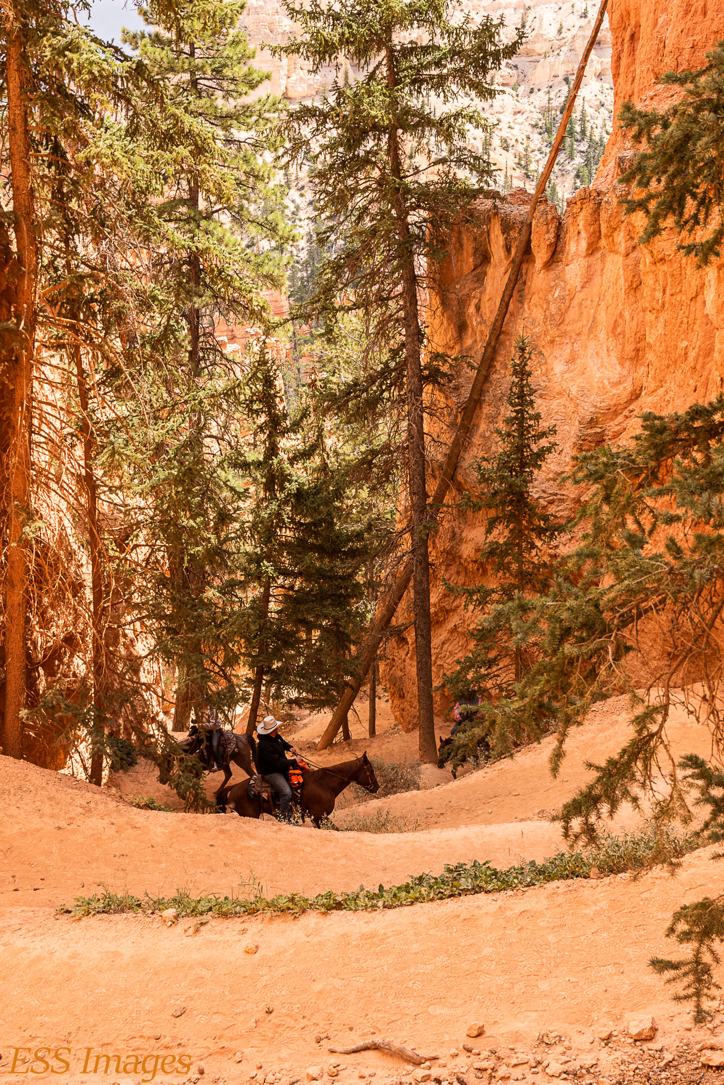
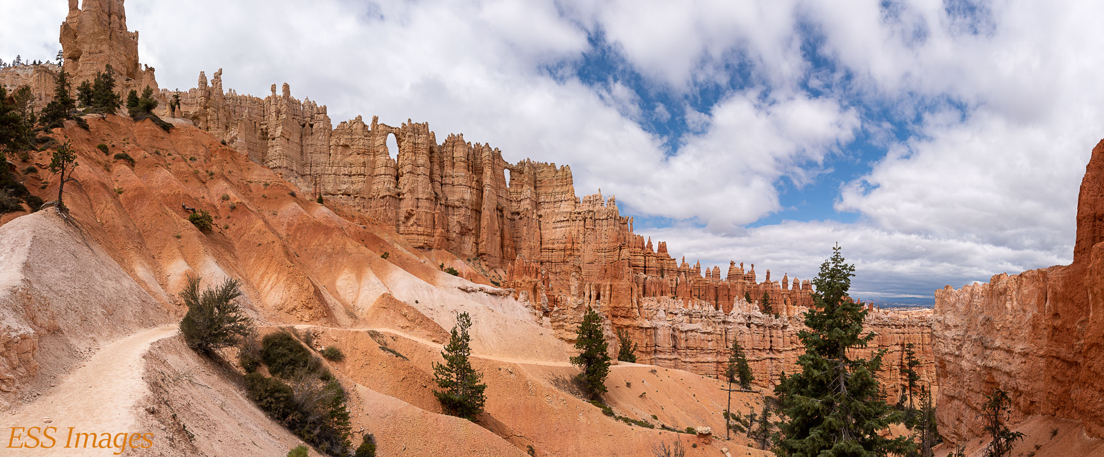
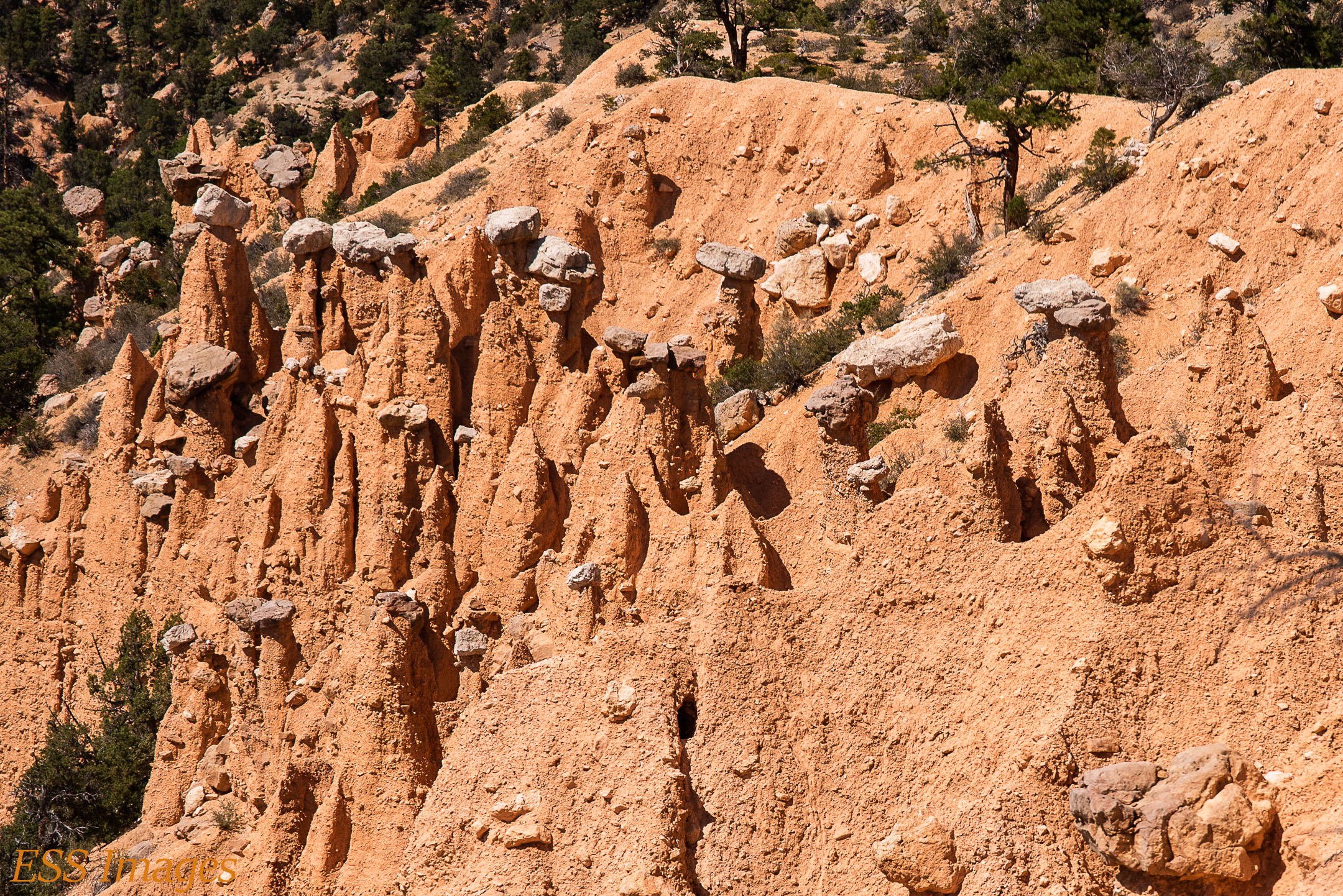
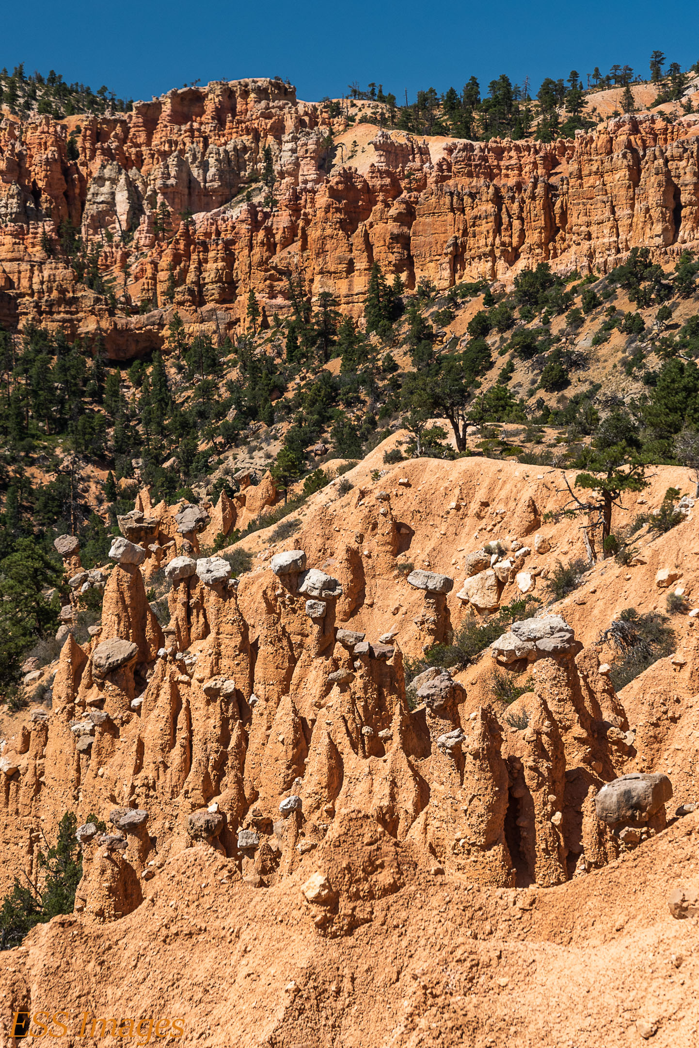
After Wall Street, you hit a level part of the loop until you branch off for the Peekaboo Loop, then you start going up and down. This loop takes you through some of the most fabulous stretches of rock-based scenery I’ve ever seen! In the gallery below, you can see the Two Bridges, the Wall of Windows, some very cool hoodoos and more. Even the horses that passed us by after dropping off a gift…


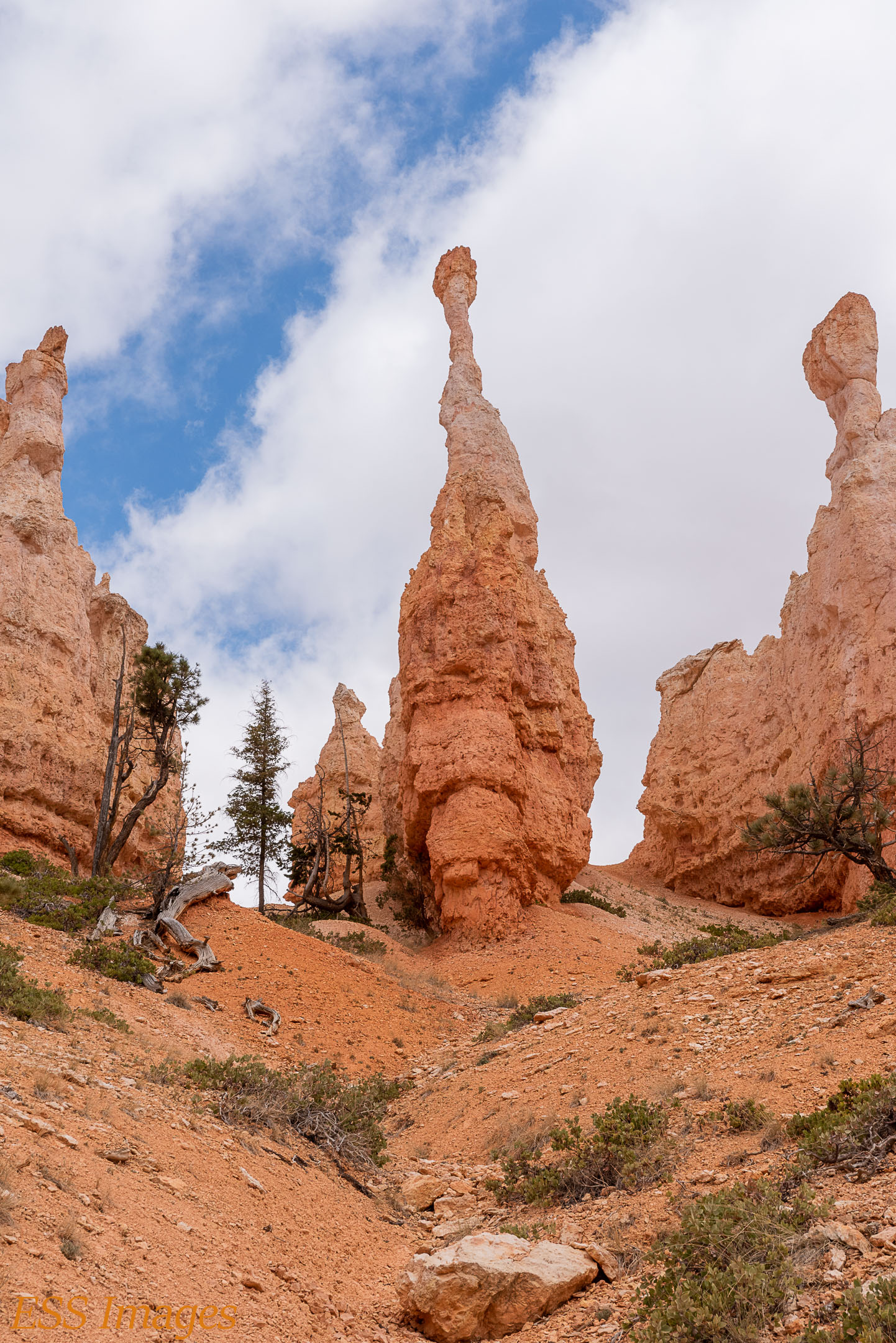
After we had finished the loops and gotten back up to the rim, I wanted to go back down through Wall Street again because I had discovered that my camera had underexposed several shots I had taken there. Silly camera! 🙂 We decided to do the Navajo Loop – Queen’s Garden trail, staring back down through Wall Street. After I had retaken a few pix we turned left toward Queen’s Garden instead of going straight toward the Peekaboo Loop. This trail took us by the Queen Victoria Hoodoo and some other nice formations, as seen in this gallery:

That was sufficient hiking for us for the day. After all, in two days hiking in Bryce Canyon we had hiked about 27 miles – and climbed the equivalent of about 500 flights of stairs! So we took the next day off from Bryce and went to Kodachrome Basin State Park – but that’s for another blog post! We came back to Bryce that night, though…
We went back to Sunset Point just to see what we could see. This is what we could see!
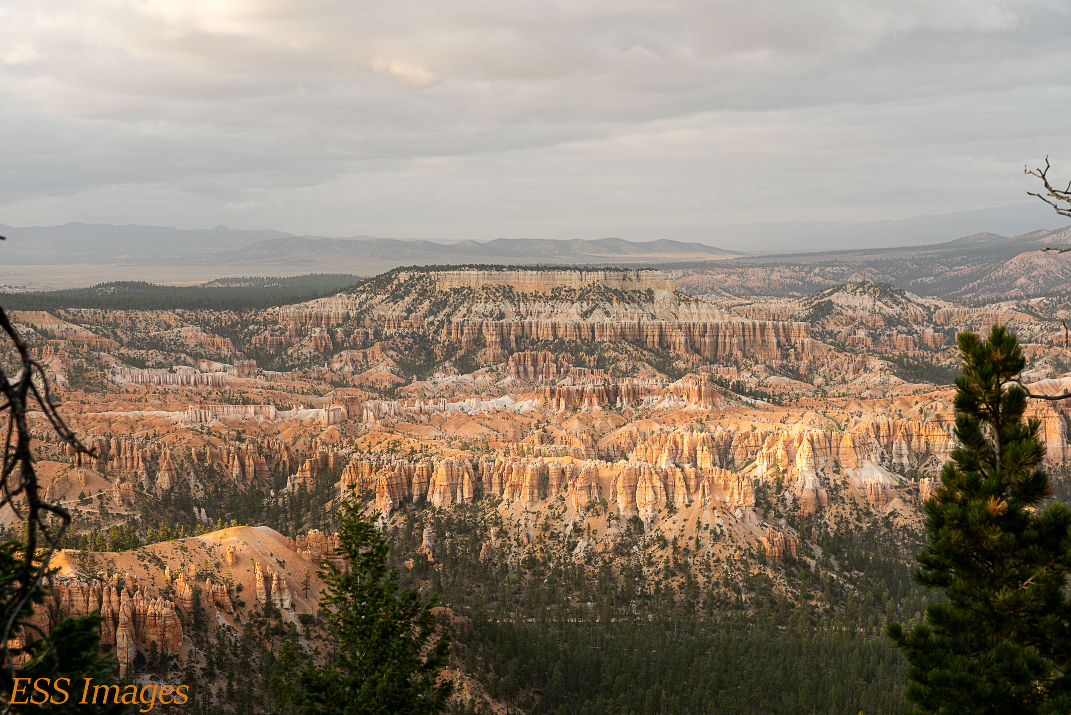
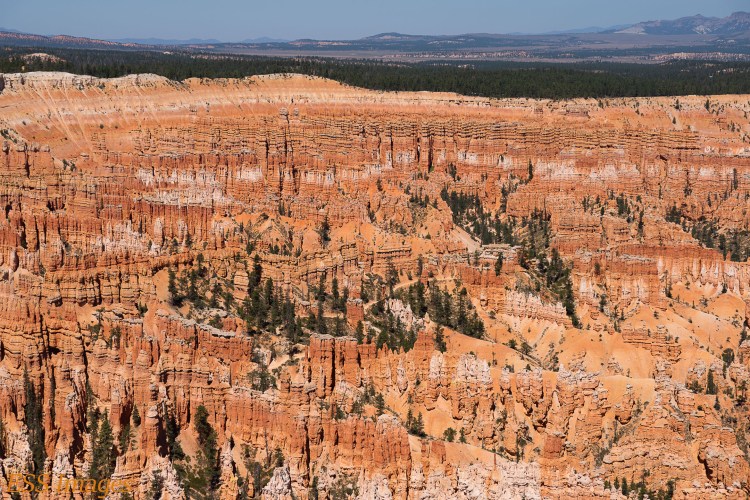
The next morning we wanted to do the Hat Shop via the Rim Trail. This is a fun out & back trail that leaves from Bryce Point. There’s a fabulous view from Bryce Point, it’s like you’re looking out on a vast sea of hoodoos! And you can see Earth, off in the distance…
So we gaped at it for a little while and then we headed down the trail. You start out walking along the side of the canyon through the trees. After a little while you come to a point where you have a view looking out east. A bunch of hoodoos and one little spot in the distance…
I looked out and said “Hey, look at that little bunch of hoodoos way out over there! ” That spot there on the right, in the hills. Eventually I figured it out. That’s where we were going!
It looks pretty far away. And pretty far down. It’s really only two miles of hiking, And about a thousand feet down. It’s easy going down, a nice walk and cool scenery. The problem with that is that there’s no shuttle going back up! But the Hat Shop was pretty neat, there are a fair number of hats to be seen! As you can see in the gallery…
We went a ways past the Hat Shop, down into the woods, for no really good reason except maybe momentum. Then we walked all the way back up. Adding an extra 200 feet of climbing for walking through the woods! It took a little while, but we got back to Bryce Point.
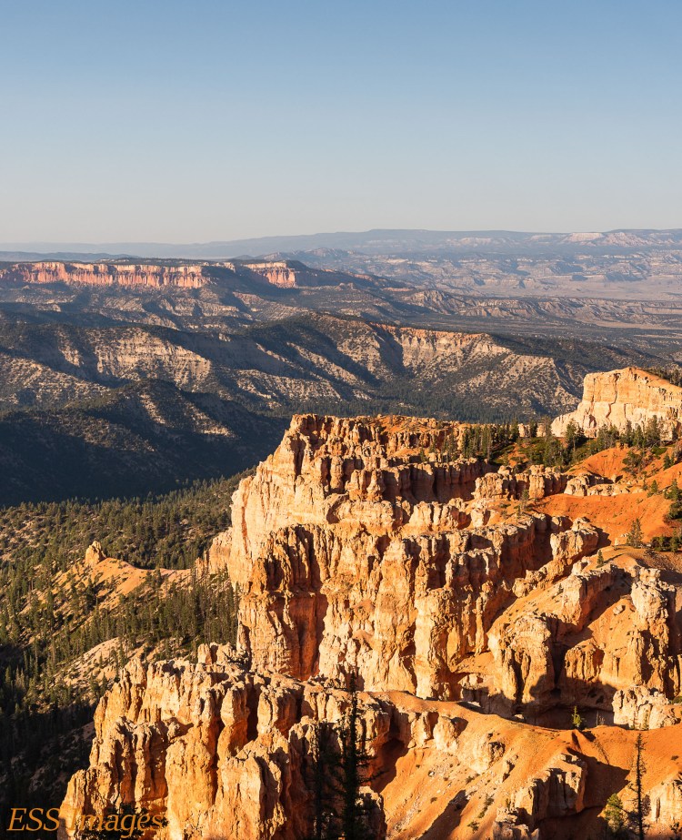
After we finished the Hat Shop we went down to Rainbow Point to do the Bristlecone Loop Trail. That’s a nice easy 1-mile loop through the woods. But the best views were at Rainbow Point, as you see here!
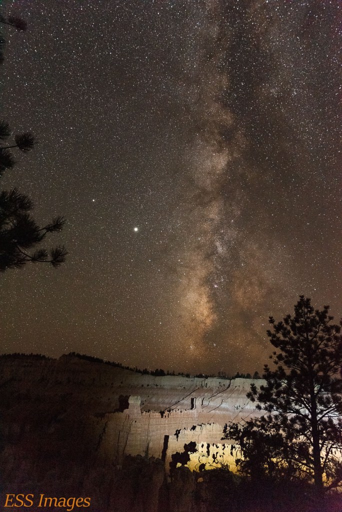
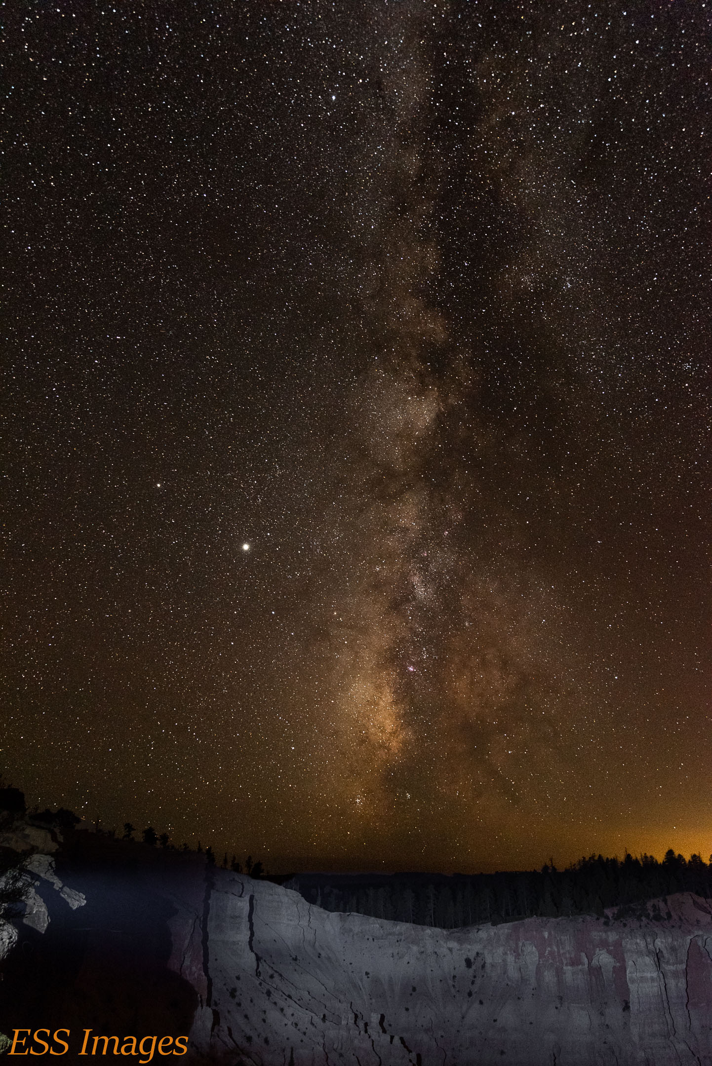
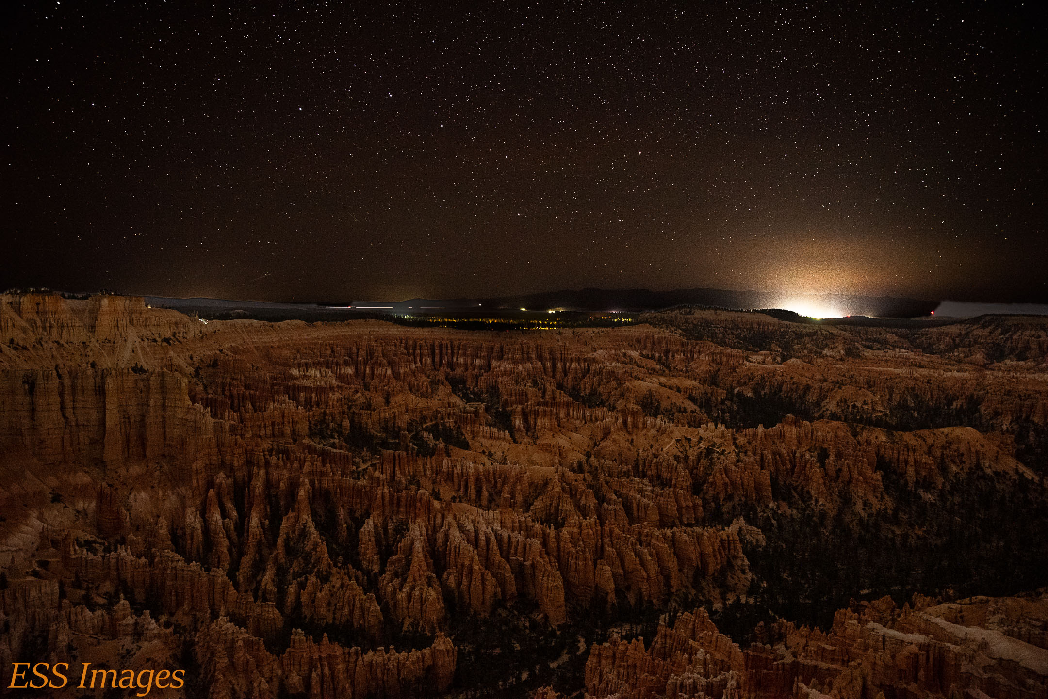
After we went back to the cabin and had a cup of tea and some dinner, we went back to Bryce Point for some evening photography. The sky is a little darker there than at Sunset Point. But if you’re looking north, you see the lights of Bryce Canyon City. As you can see in the photo below, looking over the hoodoos at the Big Dipper!
So we spent three wonderful (albeit a tad windy and chilly!) days hiking in Bryce Canyon National Park. About 40 miles of hiking, along with almost 700 floor-equivalents of climbing, through some of the weirdest rocks I’ve ever seen. We had a blast, and I would recommend it to anyone!
Stay tuned for Zion and more!
-Eric

2 thoughts on “Bryce Canyon National Park”