Saguaro National Park. Just saying it brings to mind that majestic cactus, standing tall and proud, branches reaching to the sky! And rightly so, everywhere you look, even places where you’d think nothing could grow, there they are. Such a ubiquitous symbol of the west, you see their profile everywhere, even here in Texas. Unfortunately, you won’t see any real Saguaros in Texas! They’re strictly in the Sonoran Desert: Arizona, California, and down into Mexico.
Rather on the spur of the moment, we decided to go hiking in Saguaro! With just a few days planning, we flew into Tucson, picked up the rental car (it was supposed to be an SUV, but you know those rentacar companies), and checked into our AirBNB. After a little grocery shopping, we settled in to make the important decision for tomorrow – West or East!
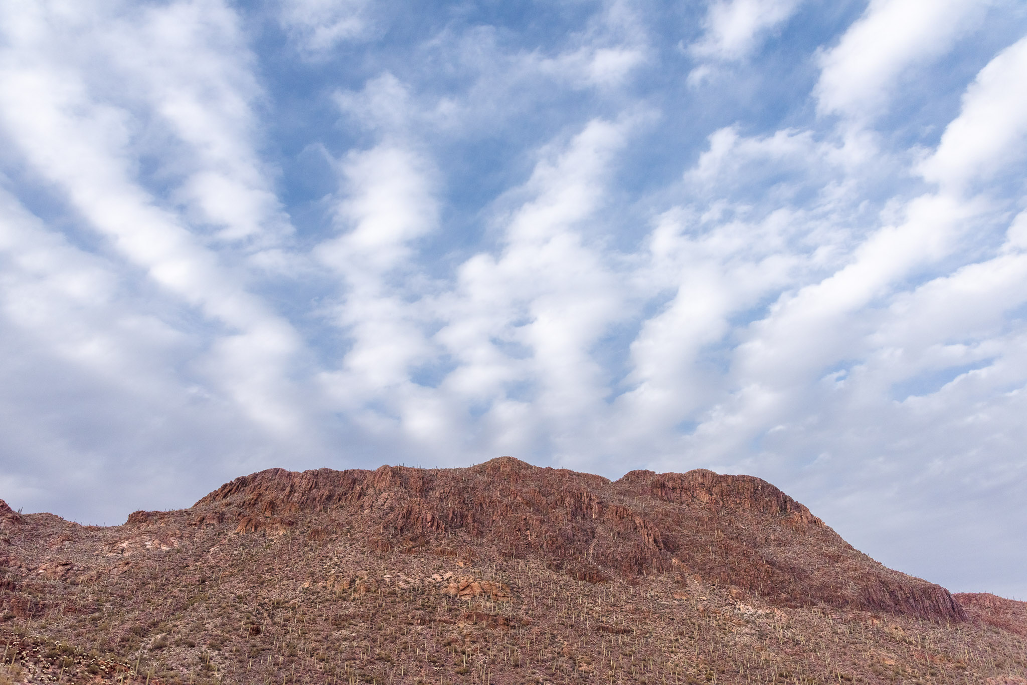
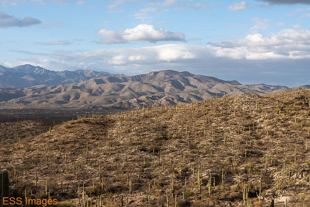
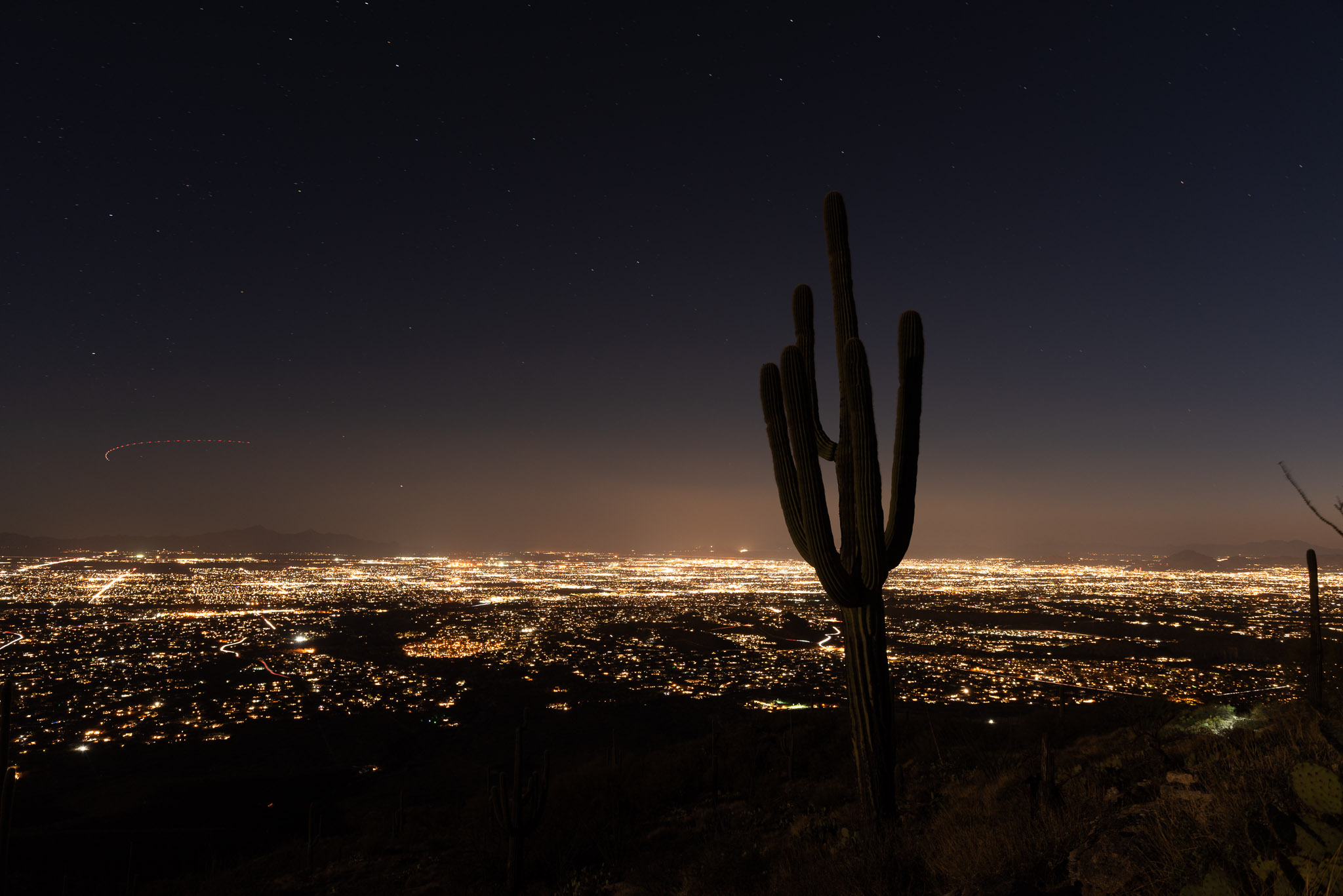
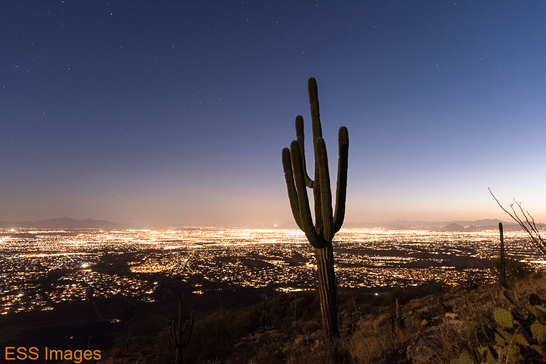
Saguaro has two sections (and two Visitor Centers), one on each side of Tucson, with slightly different personalities. The West side has lower mountains, scrub and grasslands, and more and younger Saguaros. The East is higher, the Saguaros are older, and the altitude allows some woodland along with the desert scrub. We decided to go west, in part to be closer to Gates Pass – a good place to be for sunset.
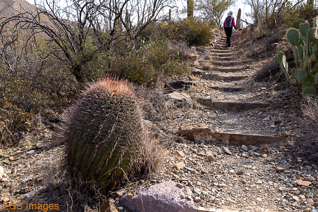
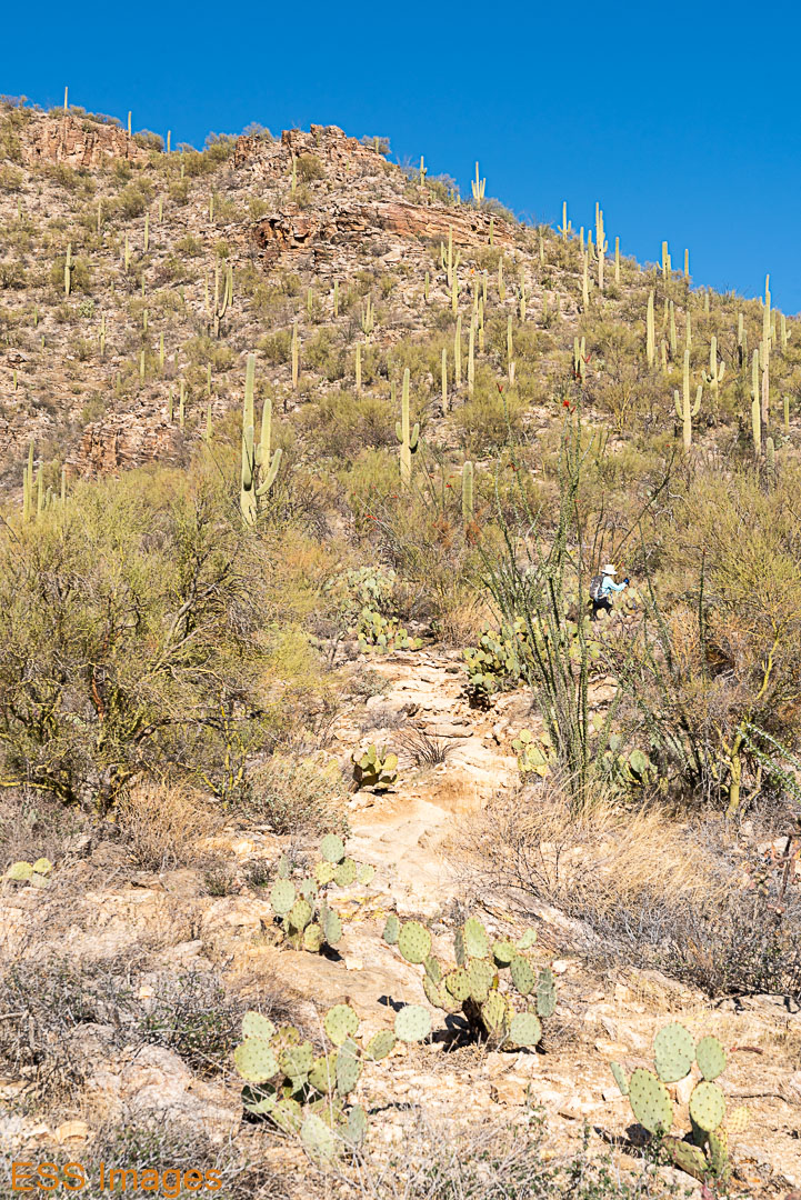
We got up bright and early for our first day of hiking… well, early enough for a cup of tea and a protein bar for breakfast! We had decided to go to Wasson Peak via King Canyon and Hugh Norris trail (again, from our friends at Alltrails!). Wasson peak is the highest point in the West section of the park, at 4687 feet. The trail has a mere 1863 feet of elevation change so we figured we could handle it even though we hadn’t trained.
The trail head is actually in the next park over, Tucson Mountain State Park, but you cross into the national park almost immediately. We began our hike on a parallel path, walking though a dry streambed while the trail was on the ridge above us. This had the advantage of taking us directly to some of the petroglyphs!
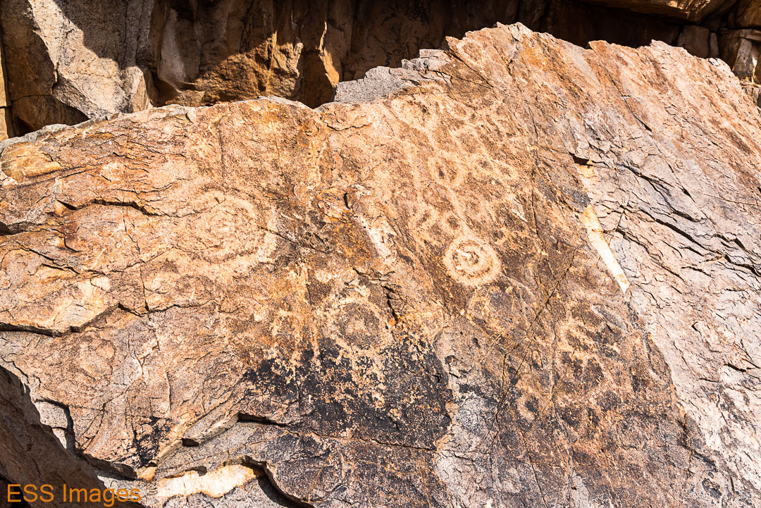
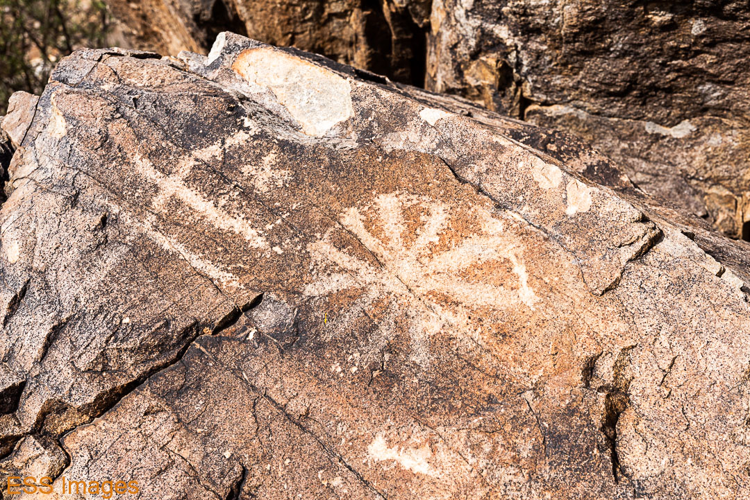
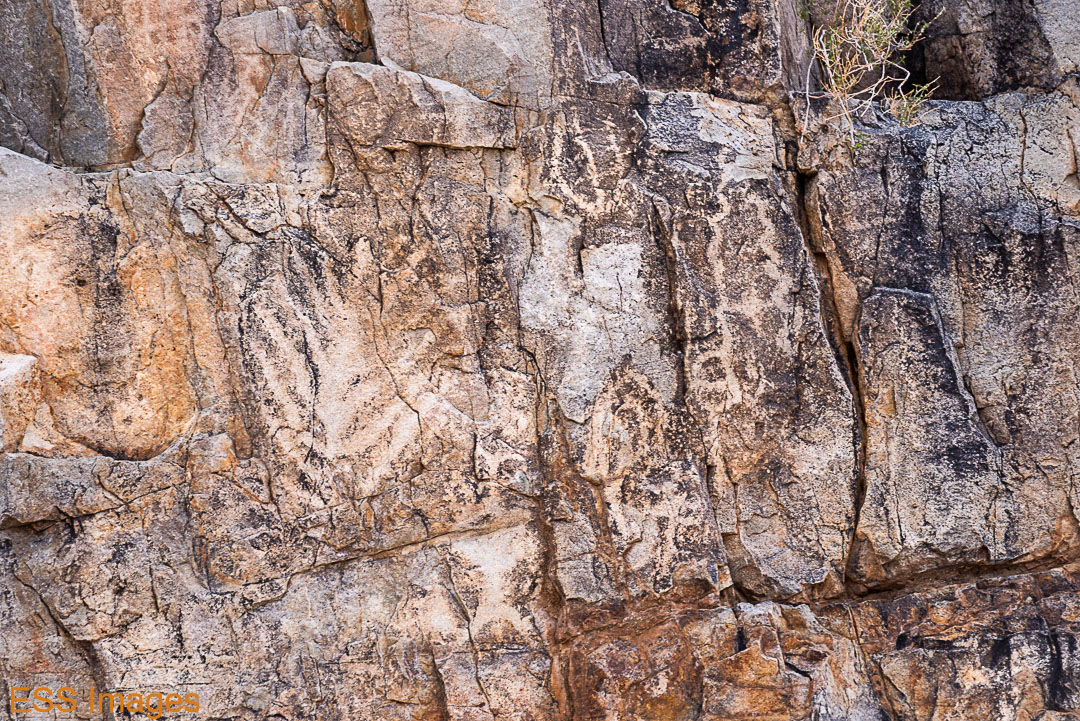
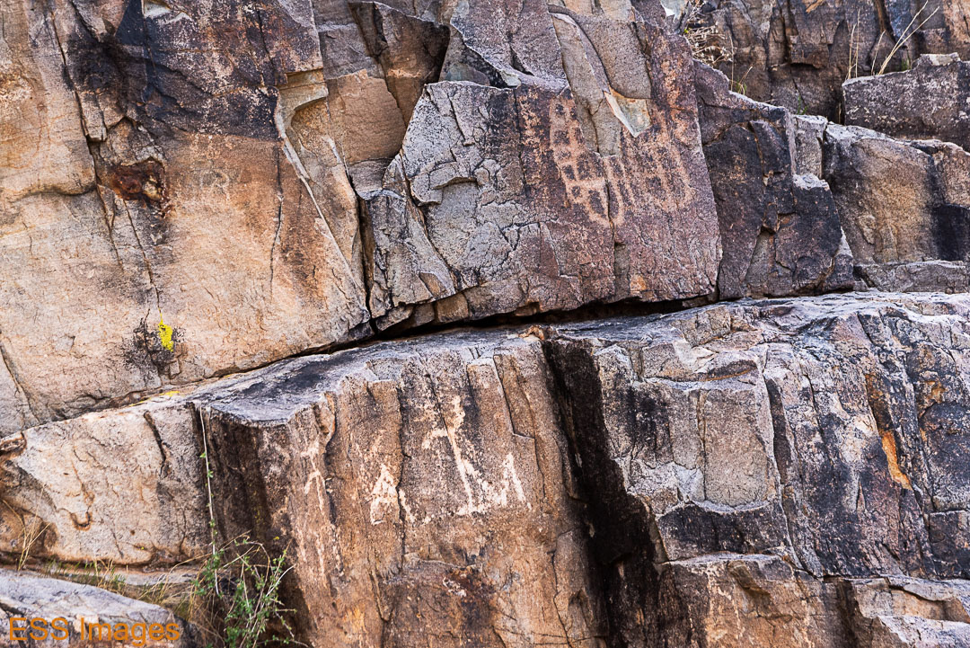
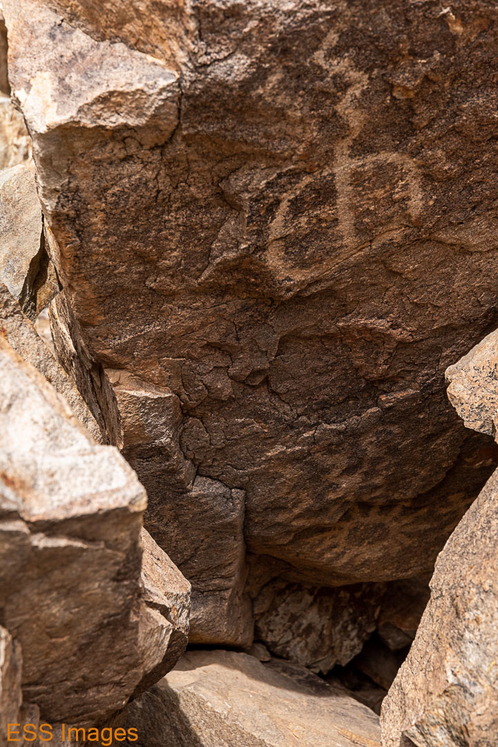
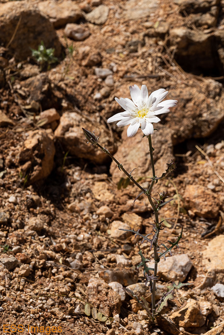
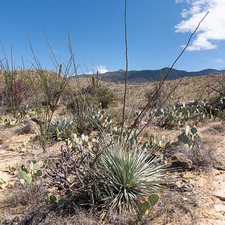
Cool petroglyphs, indeed, about 800 years old by the Hohokam, they say. Though one of them does look like an early Texas A&M! We climbed around on the rocks for a while and then went on our way. From there all the way up to the peak it was a delightful hike among a variety of cacti and other desert flora. Not so much of the fauna – I think we caught a glimpse of a lizard, the occasional bird. Lots of Saguaros, lots of (very happy looking) Ocotillos. A fair amount of Prickly Pear of different varieties.


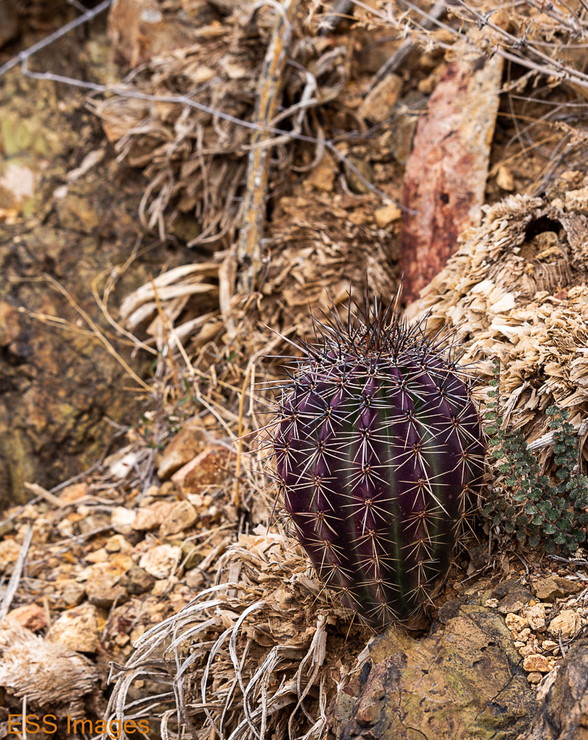
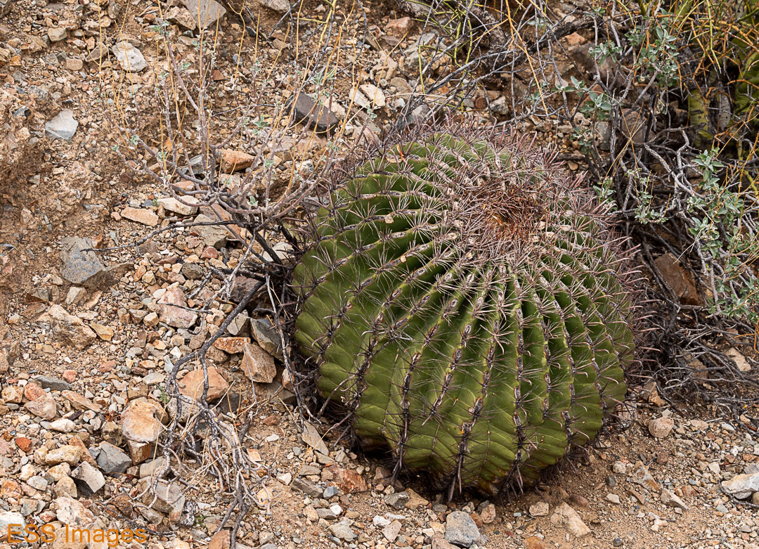
The above cacti include Saguaro (naturally), a staghorn cholla, a silken pincushion. And some others… 🙂 I haven’t even learned my Chihuahuan Desert cacti yet, I should add the Sonoran Desert? I think the purplish one may be a young Saguaro.
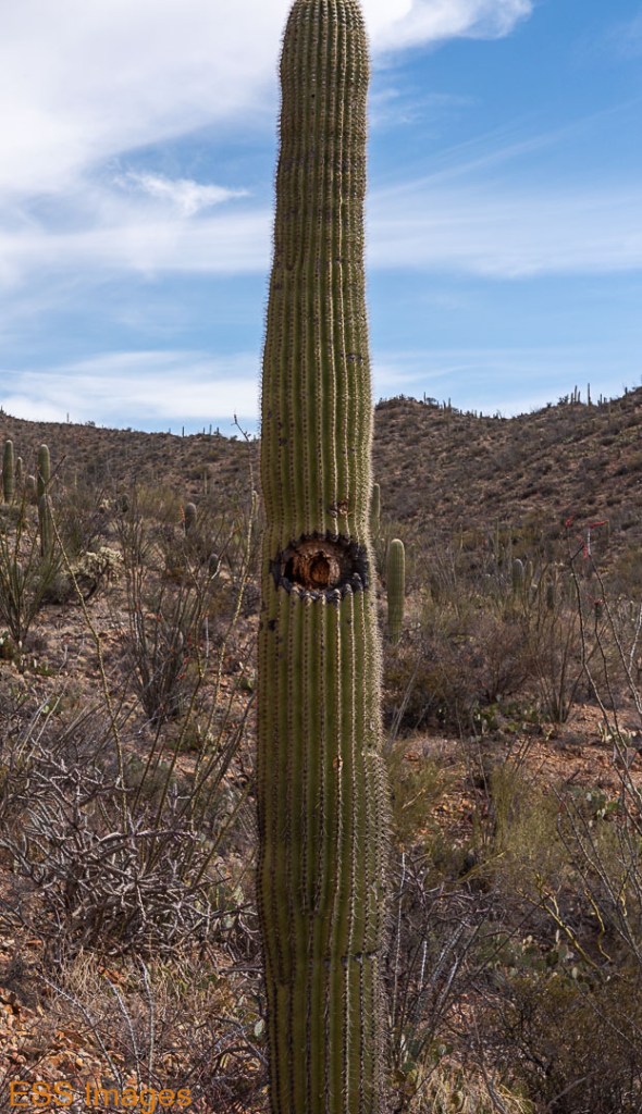
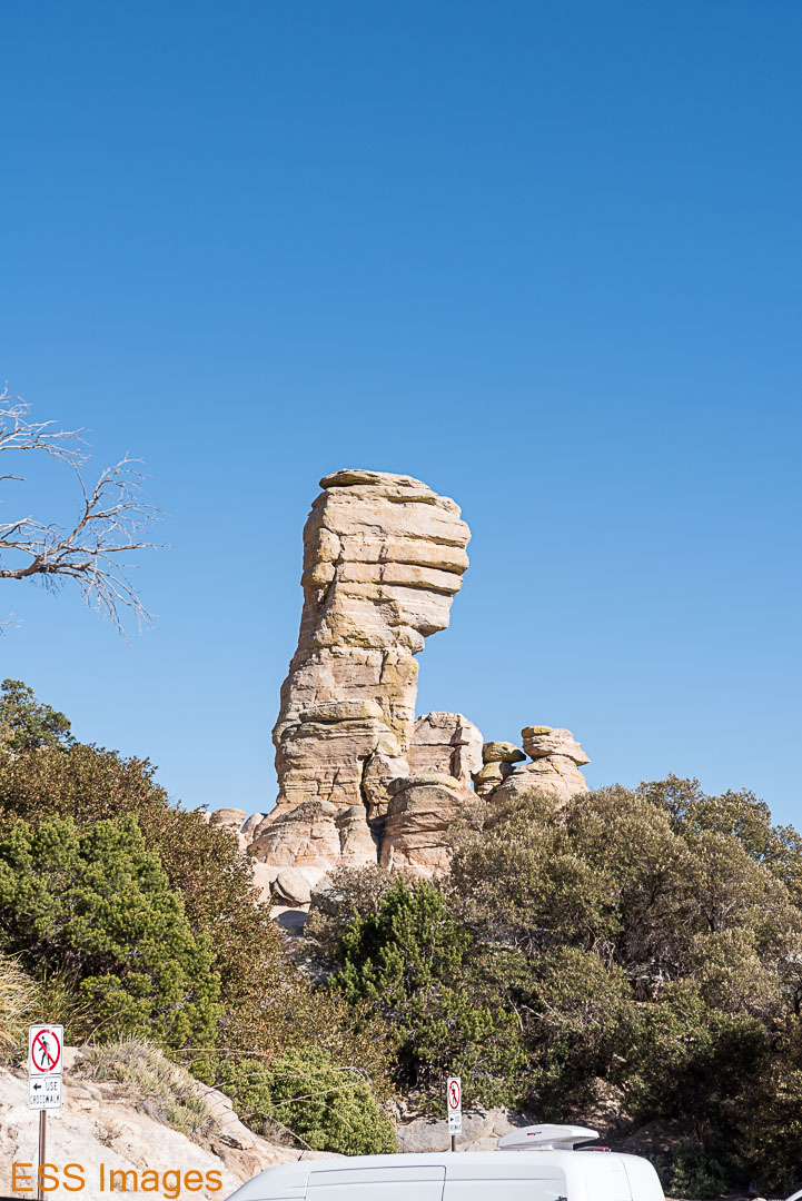
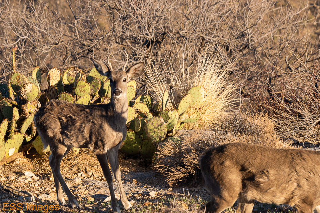
Do you ever get the feeling you’re being watched?
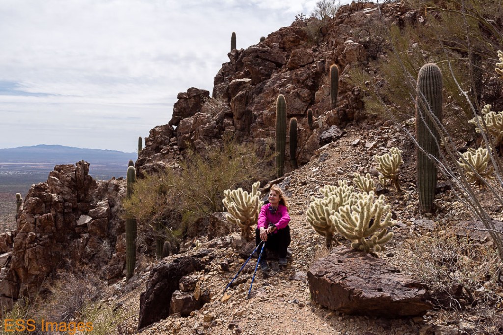
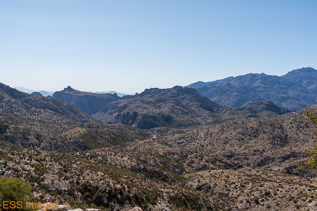
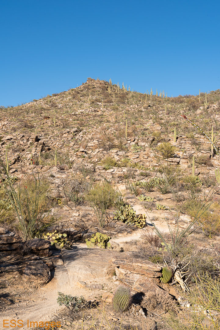
You have to cross a little saddle to get to the peak, you can see the trail running around the side on the picture below. Lovely view of the Santa Clarita Mountains and Mt. Lemmon with its snow. We went to visit that later in our visit!


We took a different route down. The scenery was beautiful, and there were a multitude of cacti and other desert plants around.
On the way back down, Leigh stopped to cuddle with some Teddy Bear Cholla!
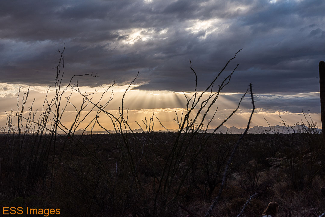
When we got back to the bottom it wasn’t long before sunset, so we headed over Gates Pass (back in the state park).


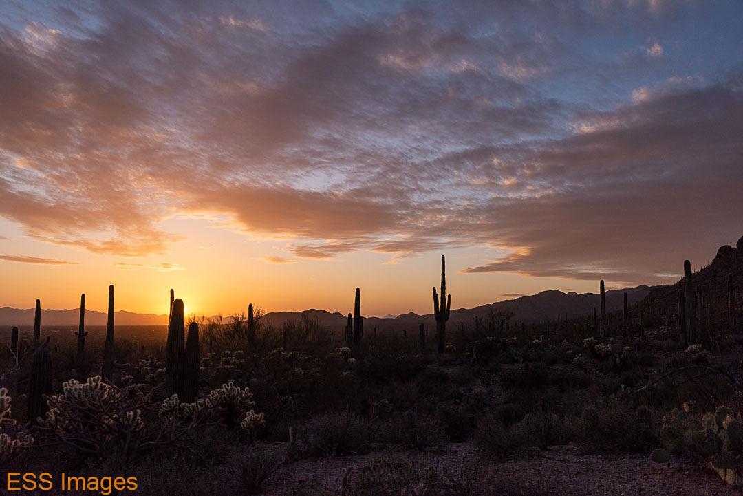
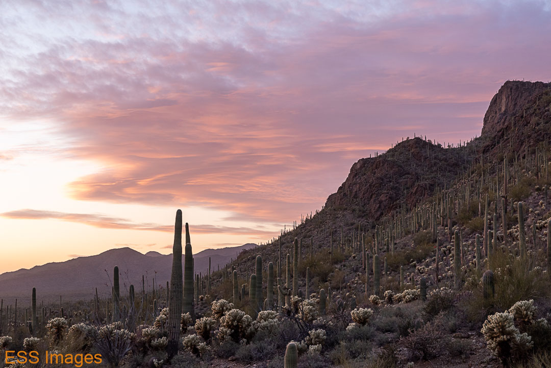

And thus ended our first day hiking in Saguaro.
The next day, we decided to head east! We had chosen the “Douglas Spring, Bridal Wreath Falls, Three Tank, Garwood Loop.” It sounds like a lot of trails, but it’s only a 7.1 mile loop. Less elevation than the previous day as well.
The trailhead is right at the end of Speedway Boulevard. There’s a small parking lot and some parking on the road. We got there just as someone was pulling out of the parking lot, which probably indicates that we didn’t get there very early! The weather was cool, though, as we started out.
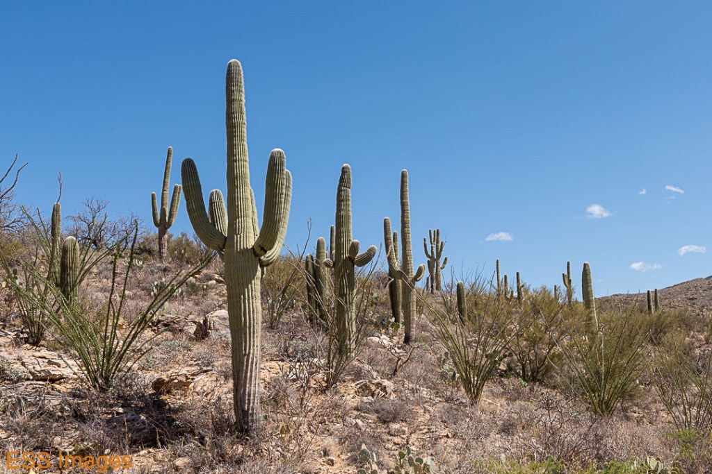
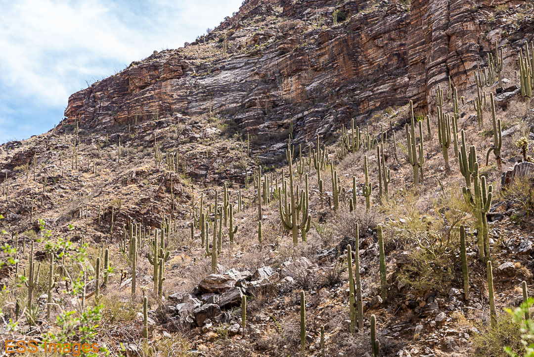
The trail begins fairly flat, winding through the Saguaro Forest with a lot of ocotillo and other cacti mixed in, not to mention creosote and other scrub plants.
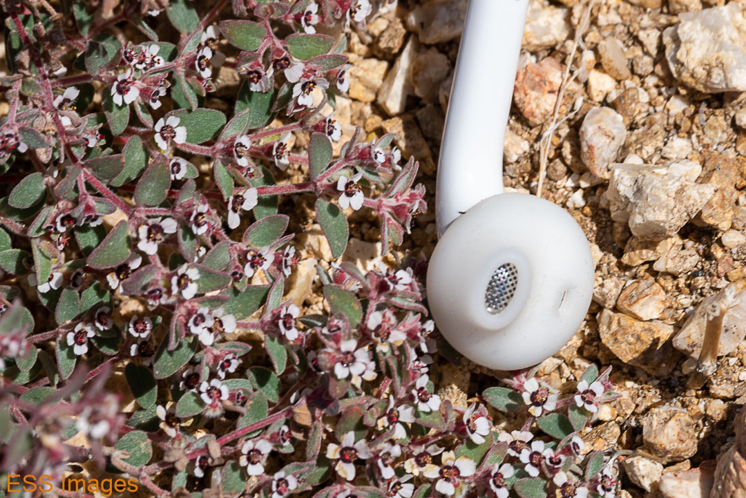
After a little while, you begin climbing uphill – generally at a moderate rate but it occasionally gets steep. We saw some delightful flowers, including some of the tiniest I’ve seen (earbud included for scale…). And while we heard some birds, the only flying thing I got close to was that butterfly!

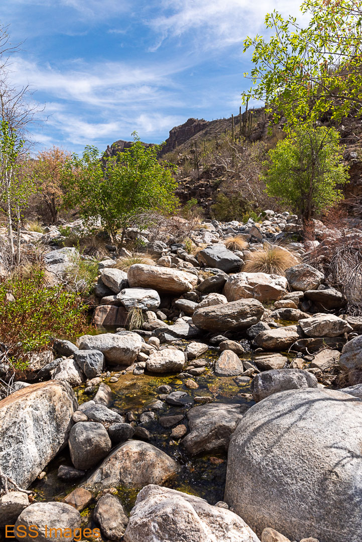
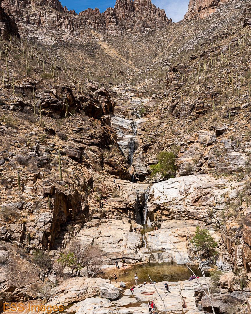
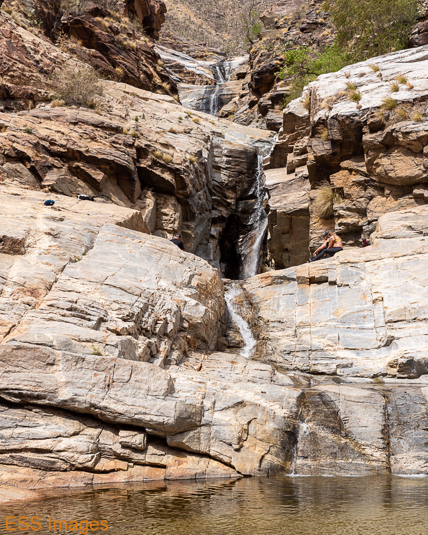
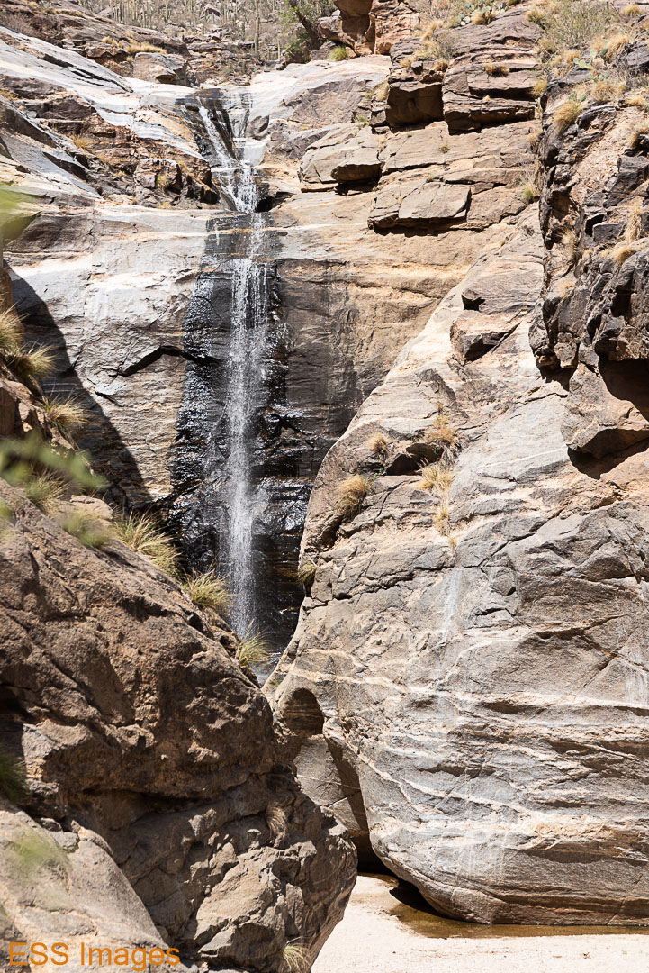
At the top of the loop, you take a turn up to Bridal Wreath Falls. You cross (at this time of year, anyway!) a dry streambed a couple of times, then you head up a rock-strewn path into a small canyon where the full majesty of the waterfall awaits you:
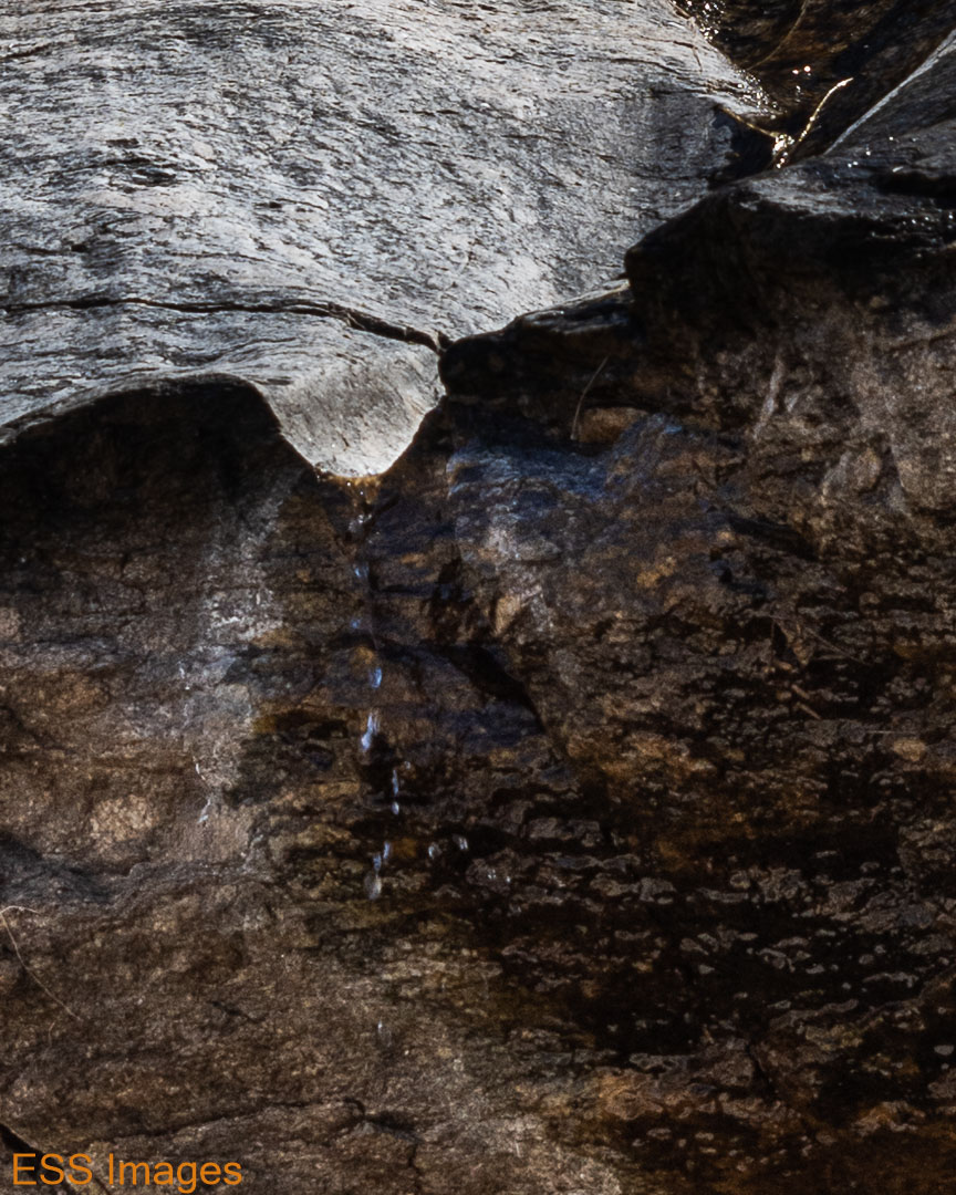


If you look closely, you can see several drops of water falling off of the rocks! And you can see that the water flows a full three or four feet after it lands on the rock below! Okay, I suspect it’s more impressive during one of those summer storms that would wash you away if you stood where I was.
From there, we went back to the loop and continued (counter-clockwise) toward the trailhead. As we went up and down the trail, we did notice some changes in the frequency of the different plants. At one point there were very few Saguaro in view, and on one stretch of trail there were a bunch of agave.
I like this picture because it seems like most of the non-saguaro desert plants all growing on top of one another! We have an Ocotillo, a sotol, a prickly pear, a staghorn cholla, and the bones of at least two bushes that will no doubt come back with the next rain:
It was a really nice hike that I quite enjoyed, and would be tempted to do again at a different time of year just to see the seasonal changes.
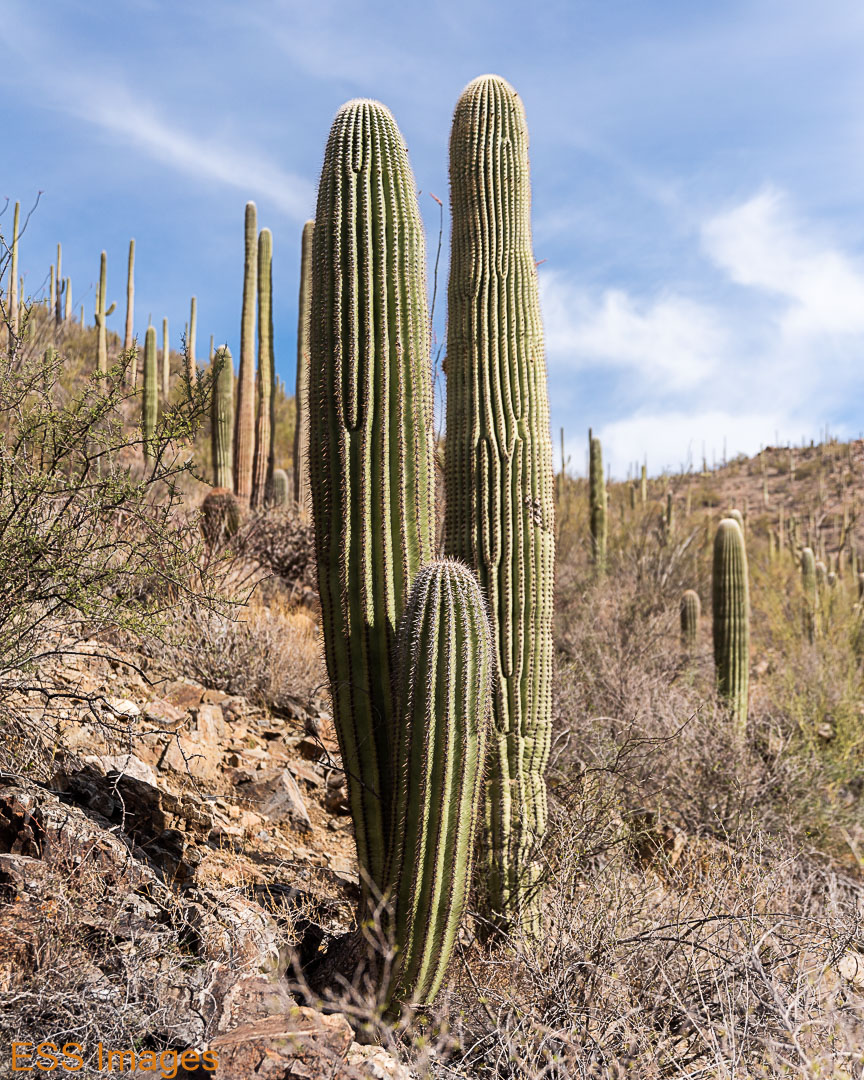
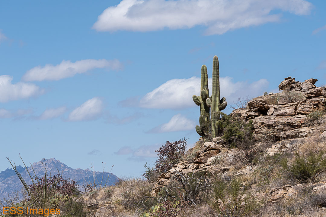
After we finished the loop, we went over to the Rincon Mountain Visitor Center for a passport stamp and to look around. That’s also where the Cactus Forest Loop Drive starts and ends, a scenic loop through the terrain where we’d been hiking. Well, the flat part – you don’t go up in the mountains! We did the scenic drive and stopped a few times to check things out. This was where we found my personal favorite Saguaro:


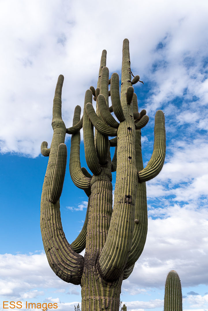
As you can see, it’s about 5 or 6 times taller than Leigh. It’s probably not the tallest Saguaro we saw, but I think it was the coolest… 🙂
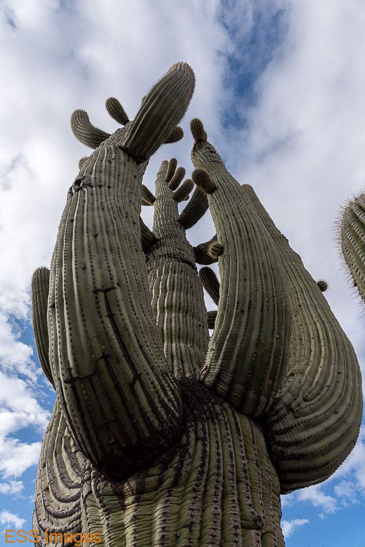
Here are a few more shots from along the drive:


The bird appears to be a Phainopepla nitens. I’m told… 🙂 A member of the silky flycatchers family, we saw a couple of them around Saguaro.
Towards the end of the drive you come to the Javelina Rocks and the Javelina Picnic Area. This was a spot recommended to me for a sunset, so we stopped and scrambled around on the rocks and strolled into the desert until the sun went down. Also I took a photo or two:


And home to a big salad and a good night’s sleep!
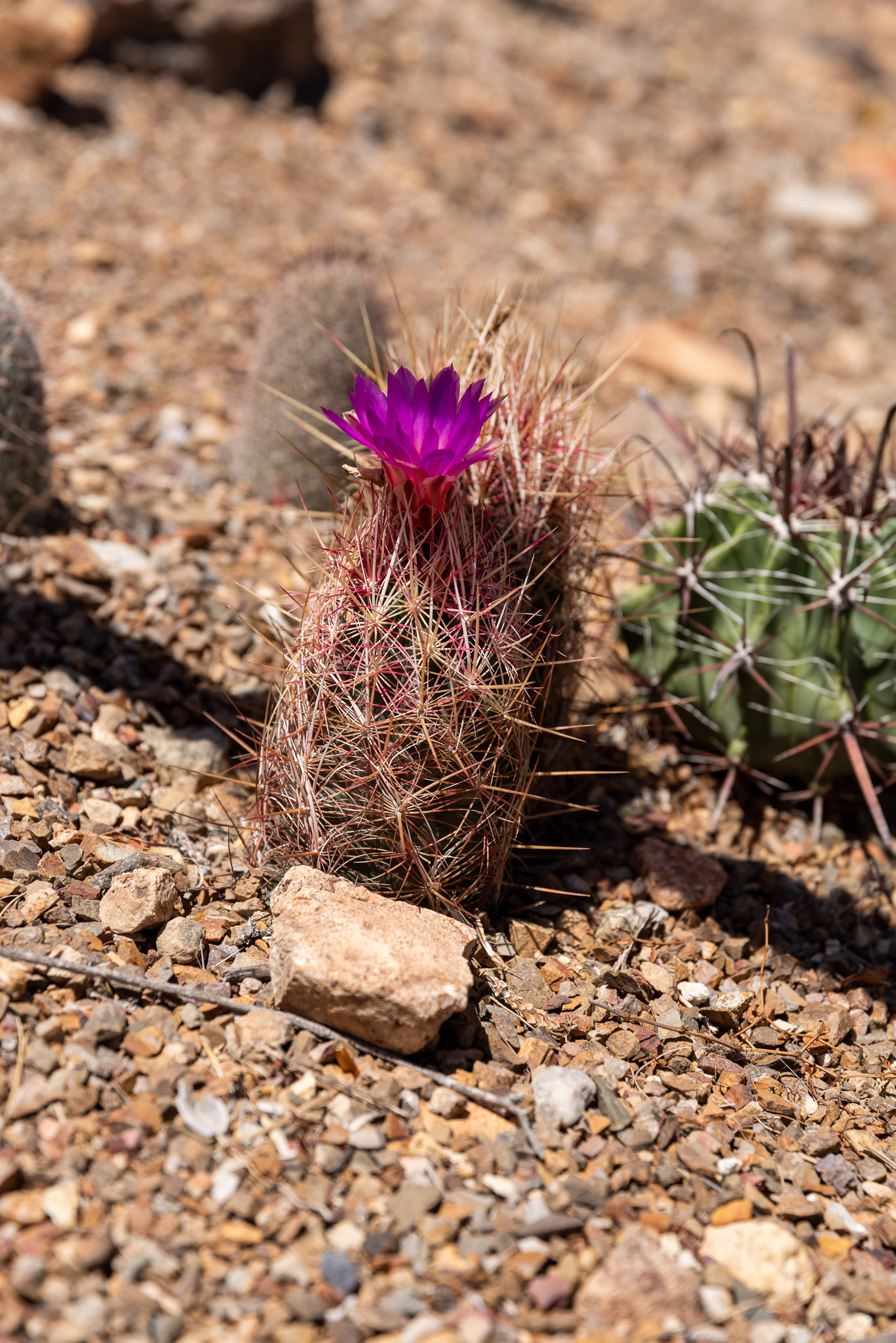
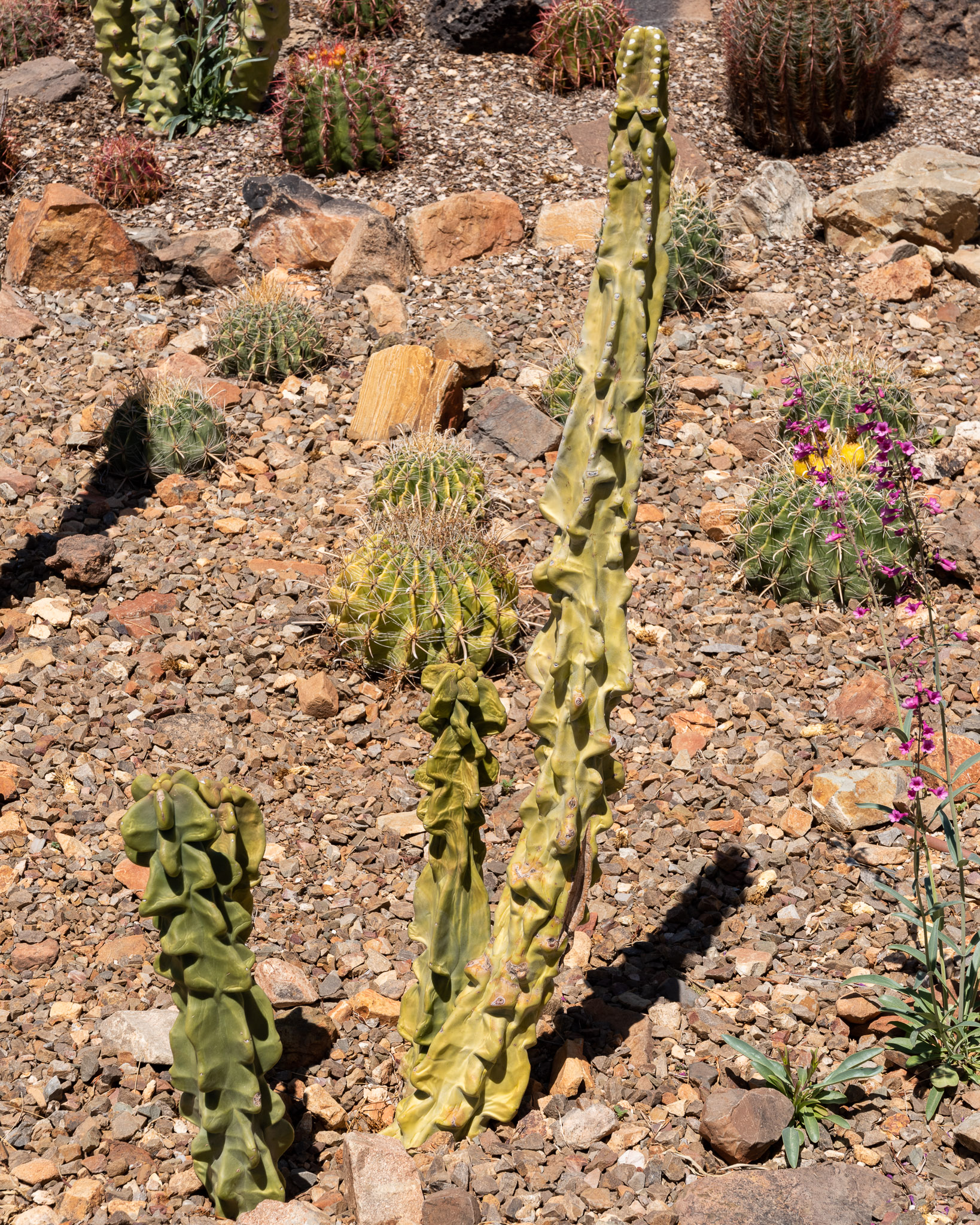
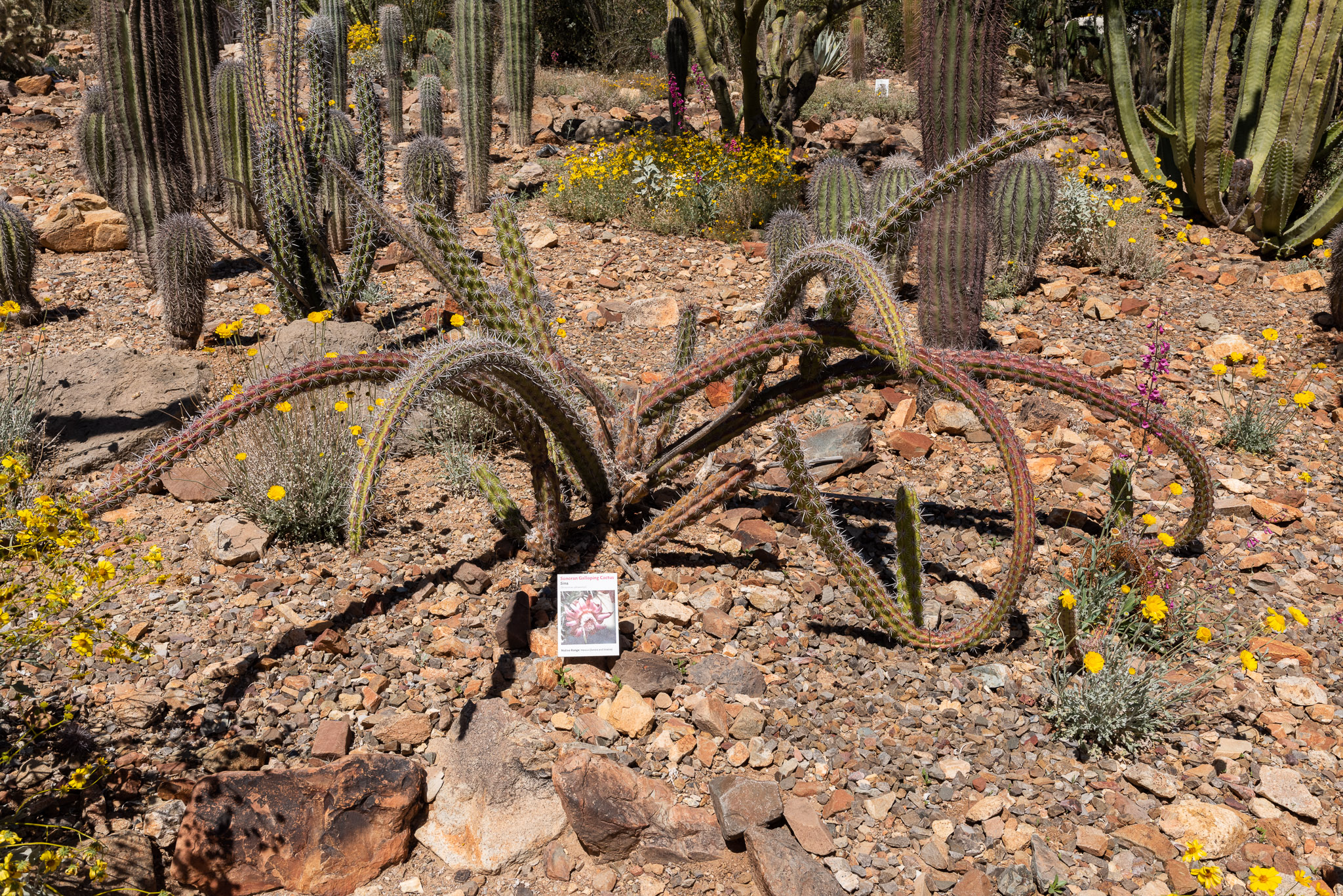
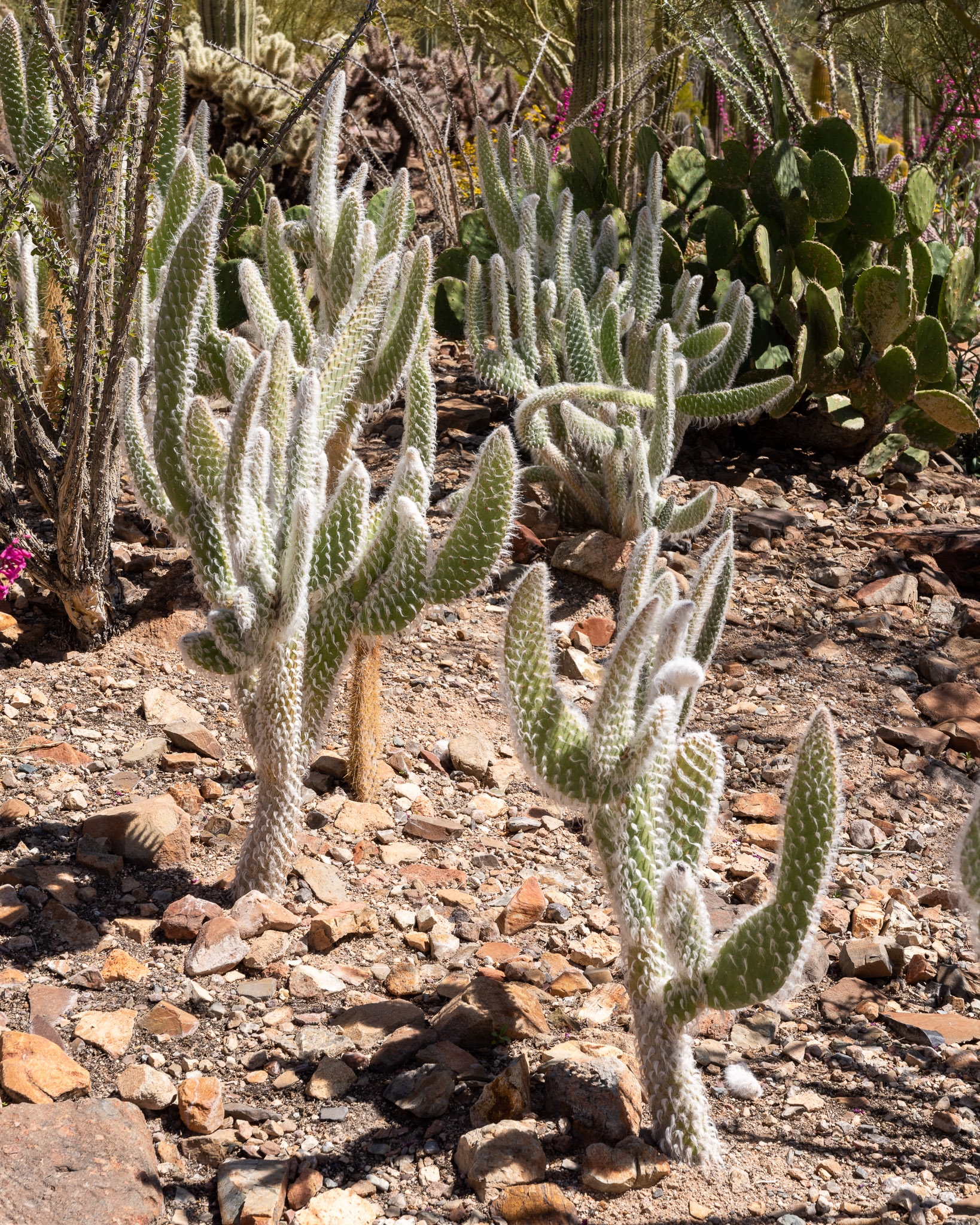
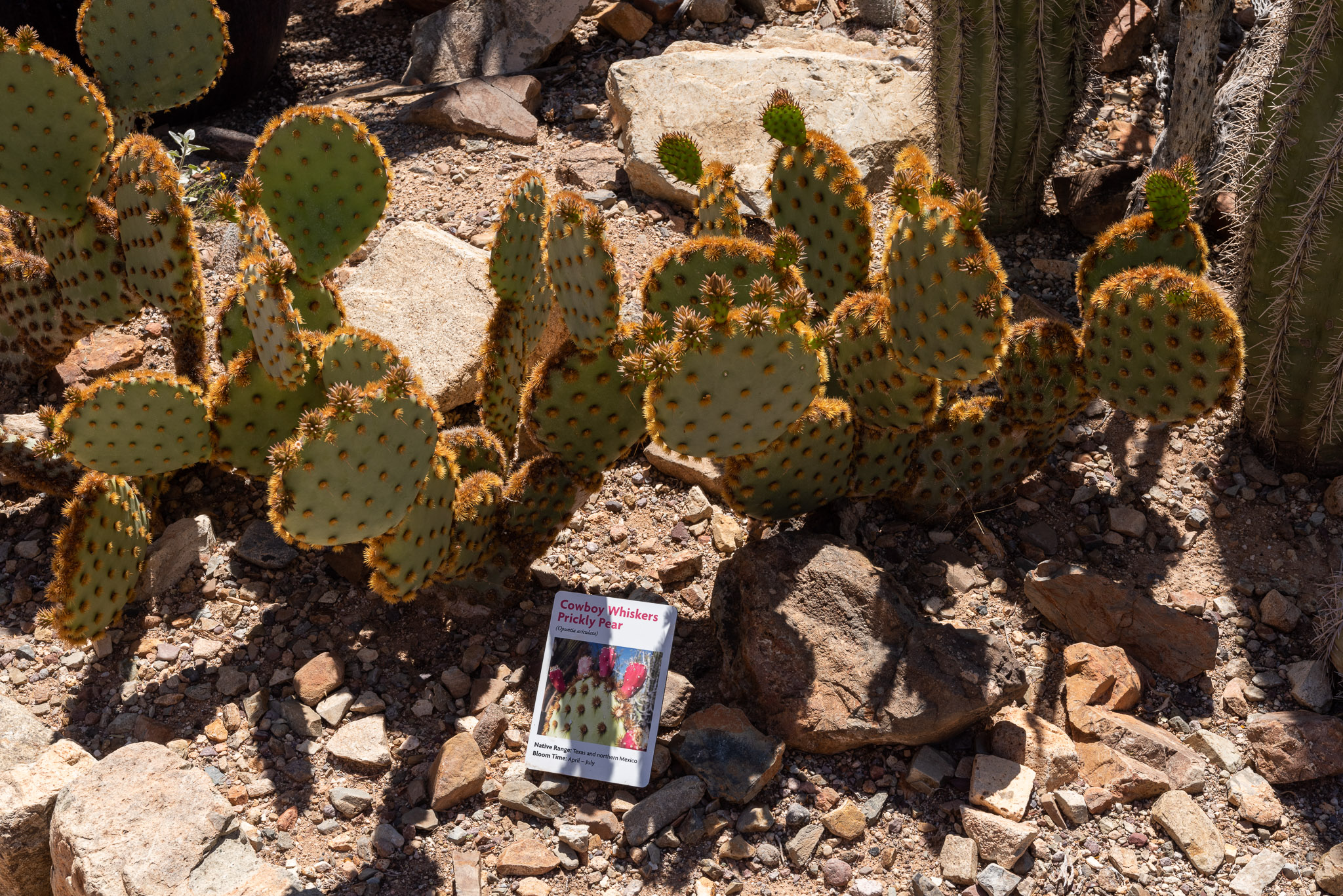
Saturday we had decided to check out the Arizona-Sonora Desert Museum, West of Tucson in the state park. This turned out to be a fine idea! They have an aquarium, a “zoo,” a natural history museum, and more. The part we liked best (and spent the most time wandering) was the Botanical Garden. They have an endlessly amazing, frequently amusing collection of desert plants that I just loved. I had never seen a “woolly jacket” prickly pear or a “cowboy whiskers” prickly pear before, and so many other things.


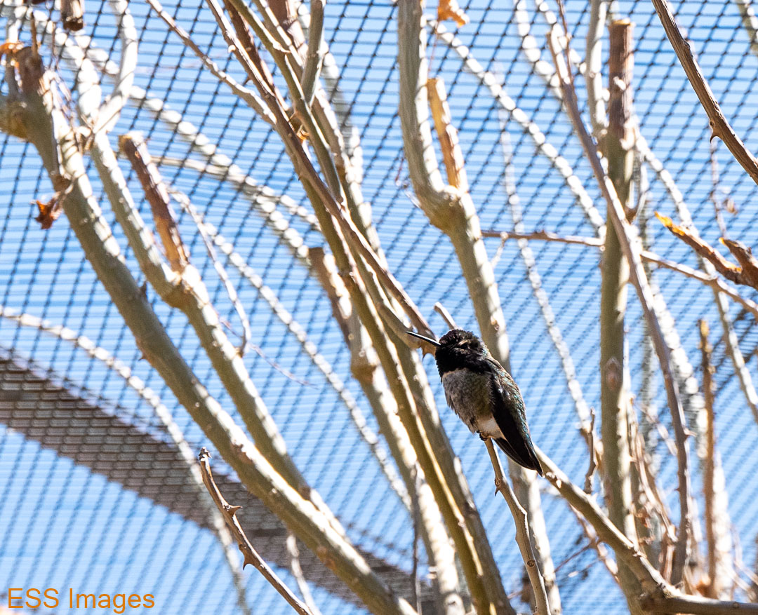
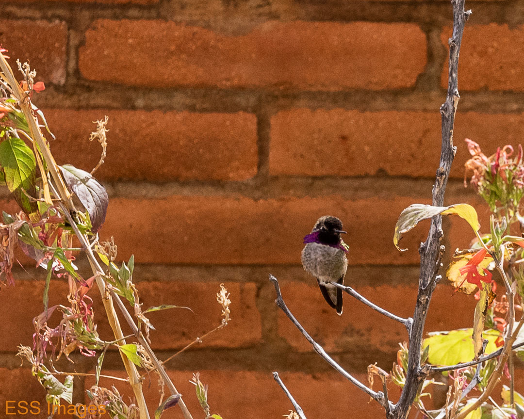
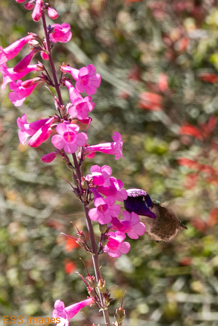
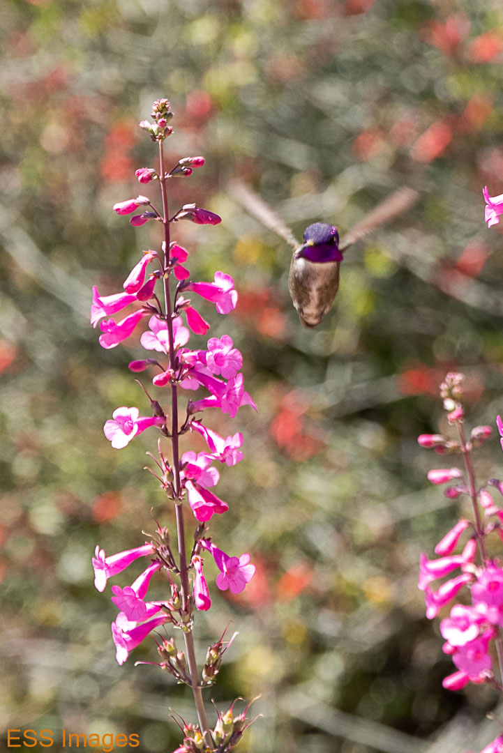
They also have hummingbirds, some in an aviary and some just wandering free. Have you ever tried to take a picture of a hummingbird? They are most uncooperative models! And my reflexes were a little slow…
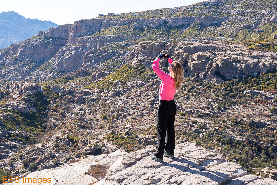
After the museum, we were looking around and we saw Mount Lemmon! It’s the tallest peak in the Santa Clarita Mountains north of Tucson and there’s a lovely scenic drive up to (almost) the top. With many scenic pullouts! And Hoodoos! And a fun precipice for Leigh to approach…

We stopped a few times on the way to the top, then we got up to the village with the ski lifts and the hotel and restaurants and such. And we got there…right after everything closed down! Fortunately, we were (as usual) carrying protein bars and sparkling water so we were okay with that. And worse than that, the road to the very top was blocked! We saw this sign:
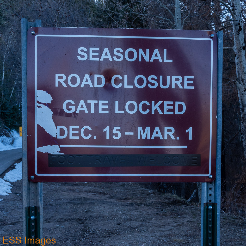
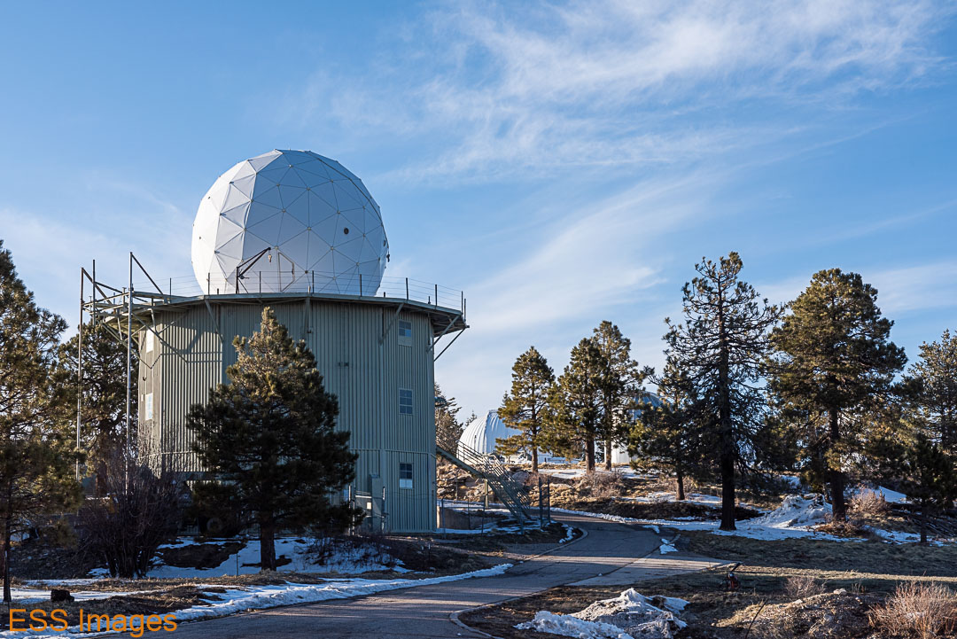
It was March 27th. So I was bitter and resentful. And we decided to walk the rest of the way! It’s about a mile and a half up the road to the observatory and other stuff on the top. The sun was getting a bit low on the horizon and the temperature up at 9000 feet was around 40 degrees. But we had our jackets and walking shoes on, so up we went. Past several areas that were burned in the fire last year 😦 .


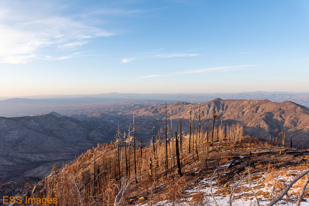
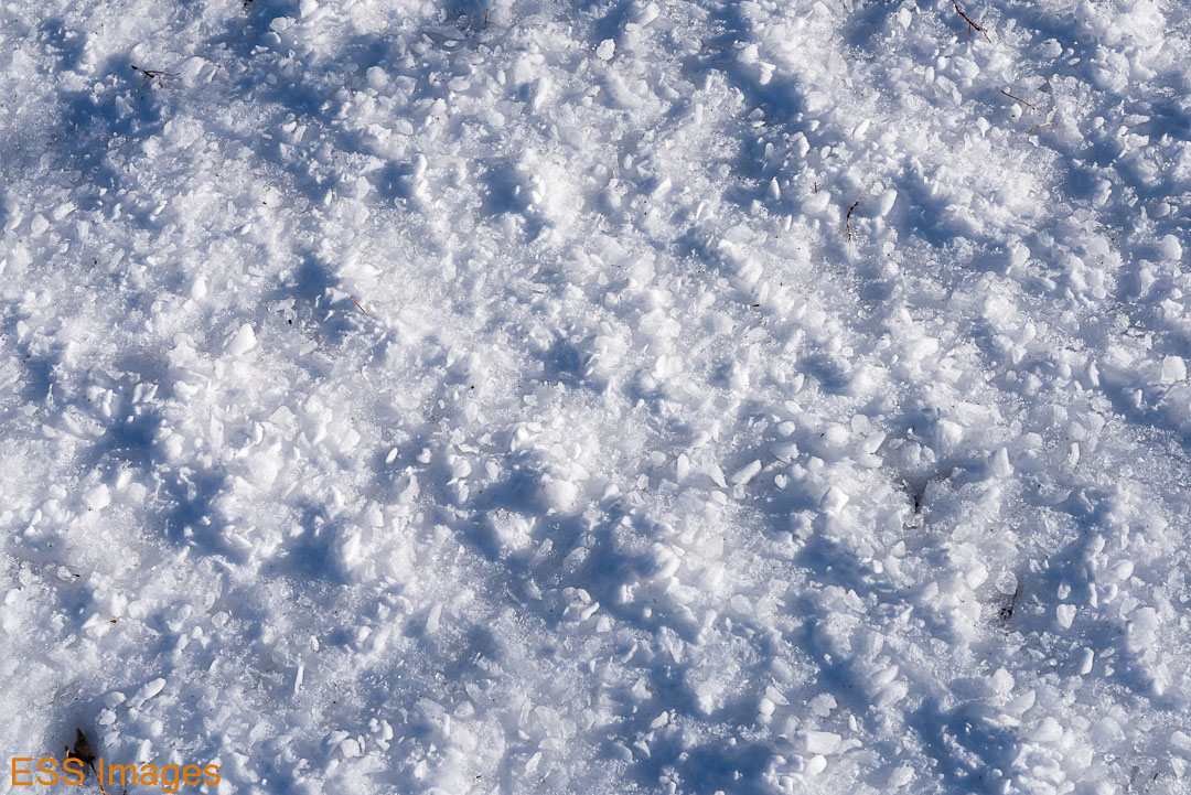
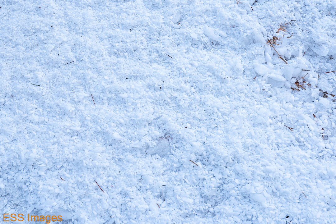
At the top we found snow, an observatory behind a locked gate (and barbed wire!), a heavily locked gate standing wide open, and more snow! The snow was of a texture I had not seen before. And I loved the way the evening sun glistened on the radome… 🙂


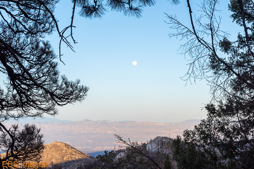
And then on the way back down, we watched the sun set and the moon rise…

And back to the old homestead.
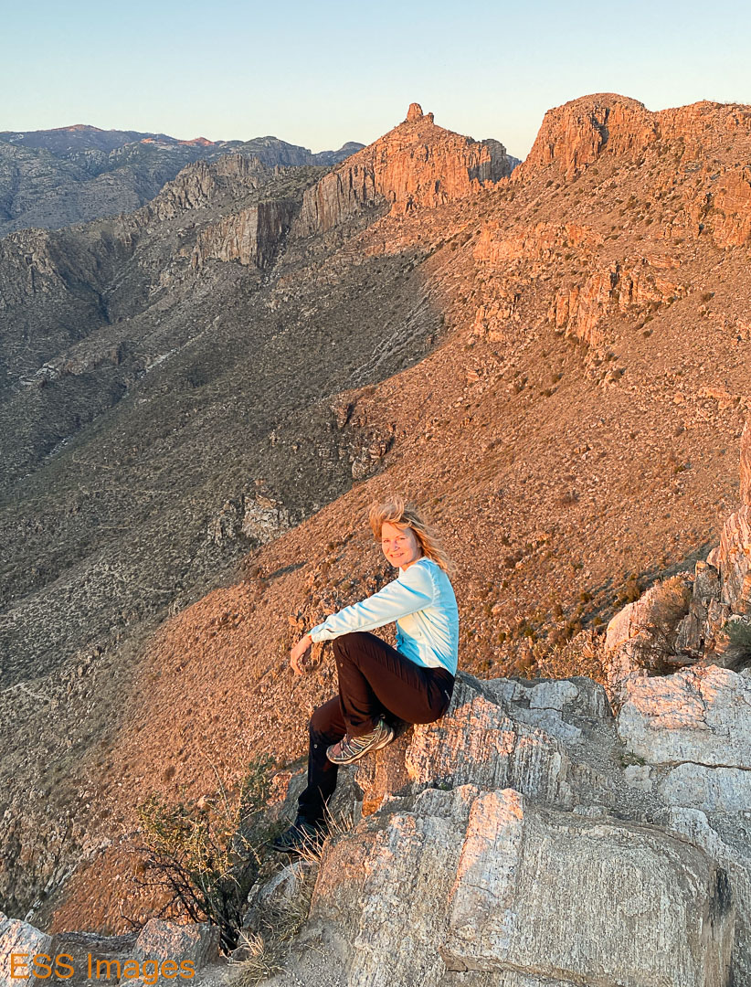
Sunday was the most difficult hike we had planned: Blackett’s Ridge up in the Sabino Canyon Recreation Area in the foothills of the Santa Catalina Mountains. AllTrails rates it “hard,” though it’s a mere 6 miles. It’s about 1765 feet of elevation in a relatively short hike. We parked at the Sabino Canyon Visitor Center and headed out on the trail!
It starts flat, as most of the trails going into the mountains do. About a mile in you start uphill, than at about 1.5 it gets pretty steep. In the next 1.2 miles or so, you go up 1200-1300 feet! Much of it is up rocky trails or just a slope made of rock, as you can see here:
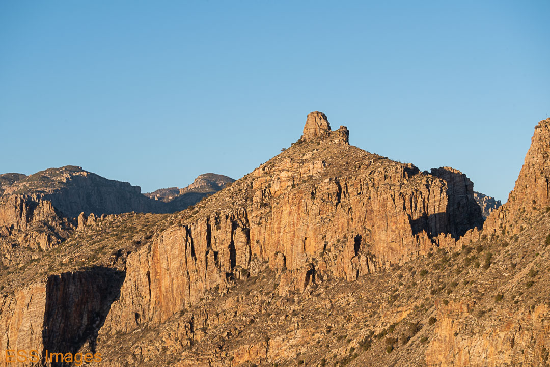
It was a bit challenging, but we’re in pretty good shape so it wasn’t too bad. We probably stopped to catch a breath more often than we had on other hikes! Since we hadn’t started until well past noon, we didn’t get to the top until after 6pm and the light was becoming wonderfully warm and reddish-gold…

We relaxed at the top for a while, helping out the people around us by taking their pictures with their phones. Then we headed back down the hill, so we’d at least be part way down before the it was completely dark! We passed some of our furry friends on the way down.

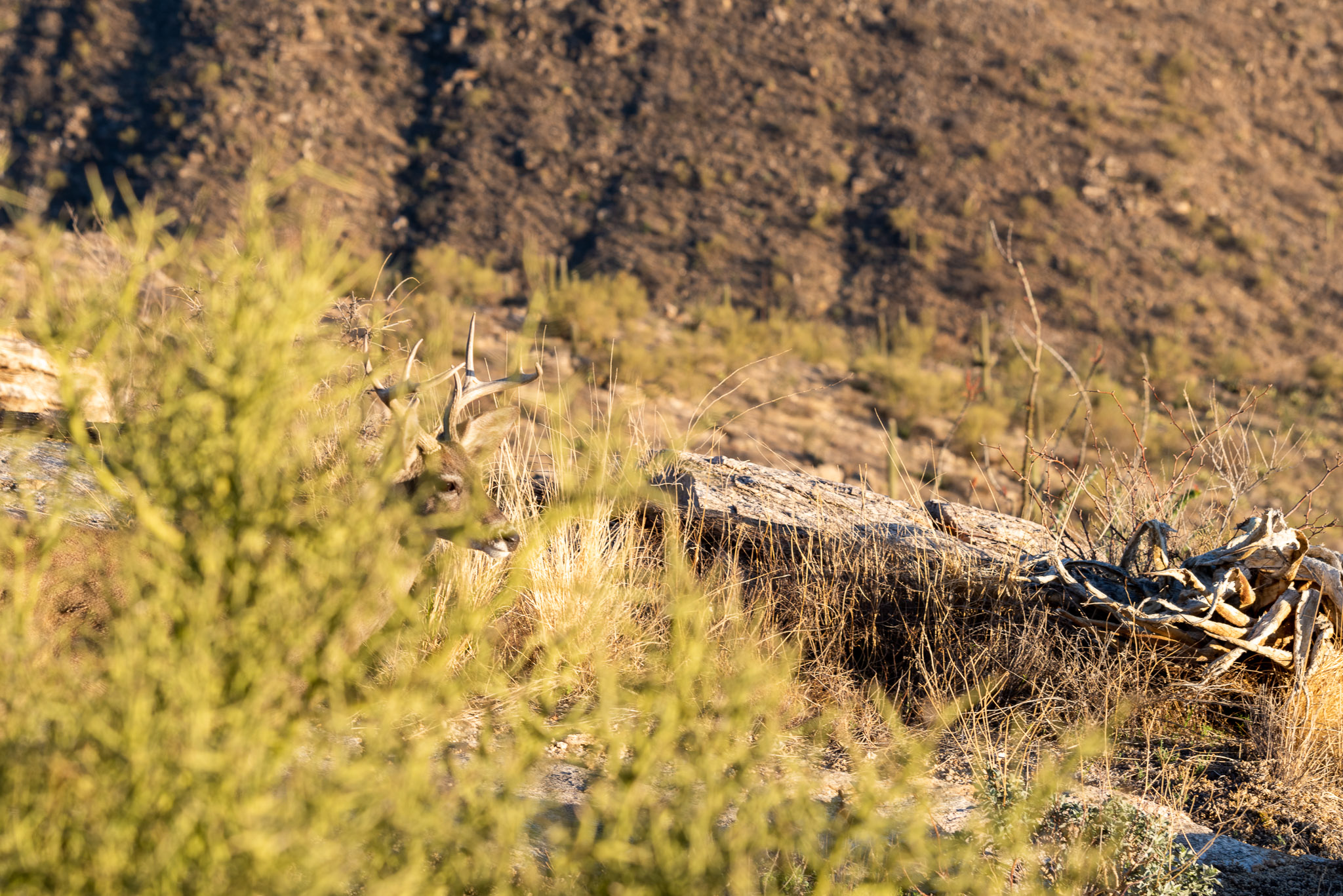
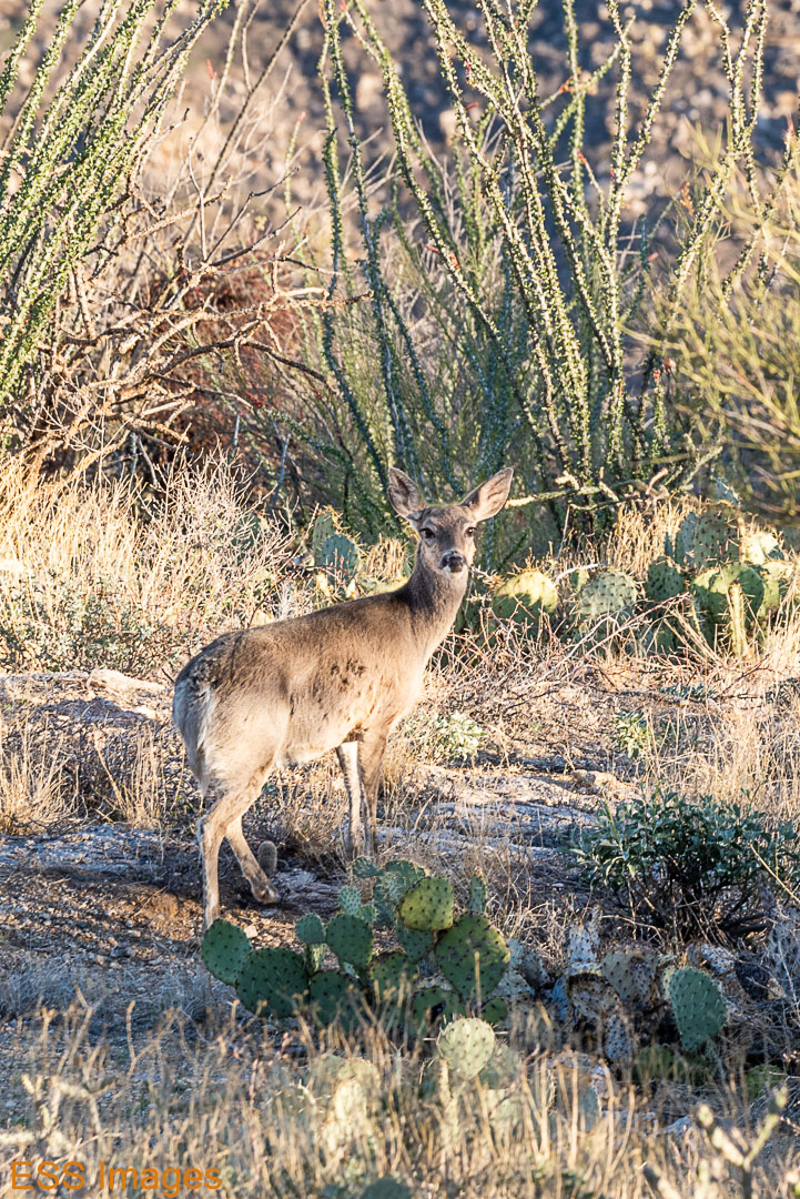
So you can see once more that I’m not a wildlife photographer! But I have fun…
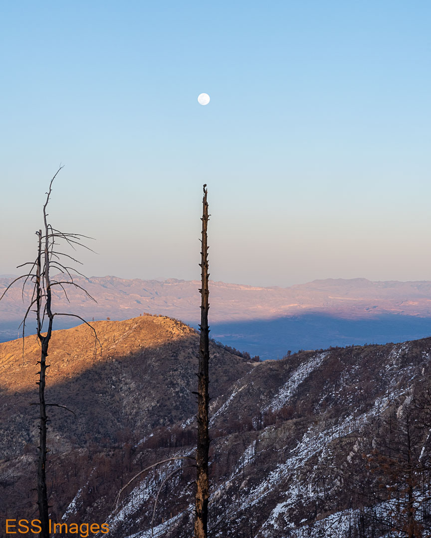
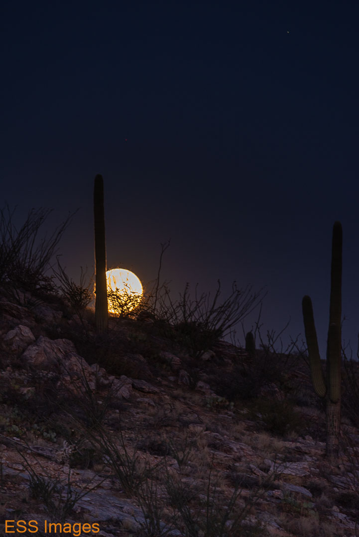
There was a full moon that night, with the moonrise a few minutes after sunset. Once it got up, the moonlight was almost bright enough to walk down the trail without a flashlight. Almost. Not on this trail! I tried to get a good moonrise shot as we were heading down the mountain, but it didn’t work out. I blame the equipment! 🙂
But here’s what I did get:
For our last hike, we went back to a place we’d been a couple of times before: Seven Falls, also in the Sabino Canyon Recreation Area. We parked over off Bear Canyon Road so we wouldn’t start out over the same trail as yesterday. Of course, the scenery was pretty much the same:

Let’s see, we’ve got Saguaro, we’ve got cholla, we’ve got prickly pear…
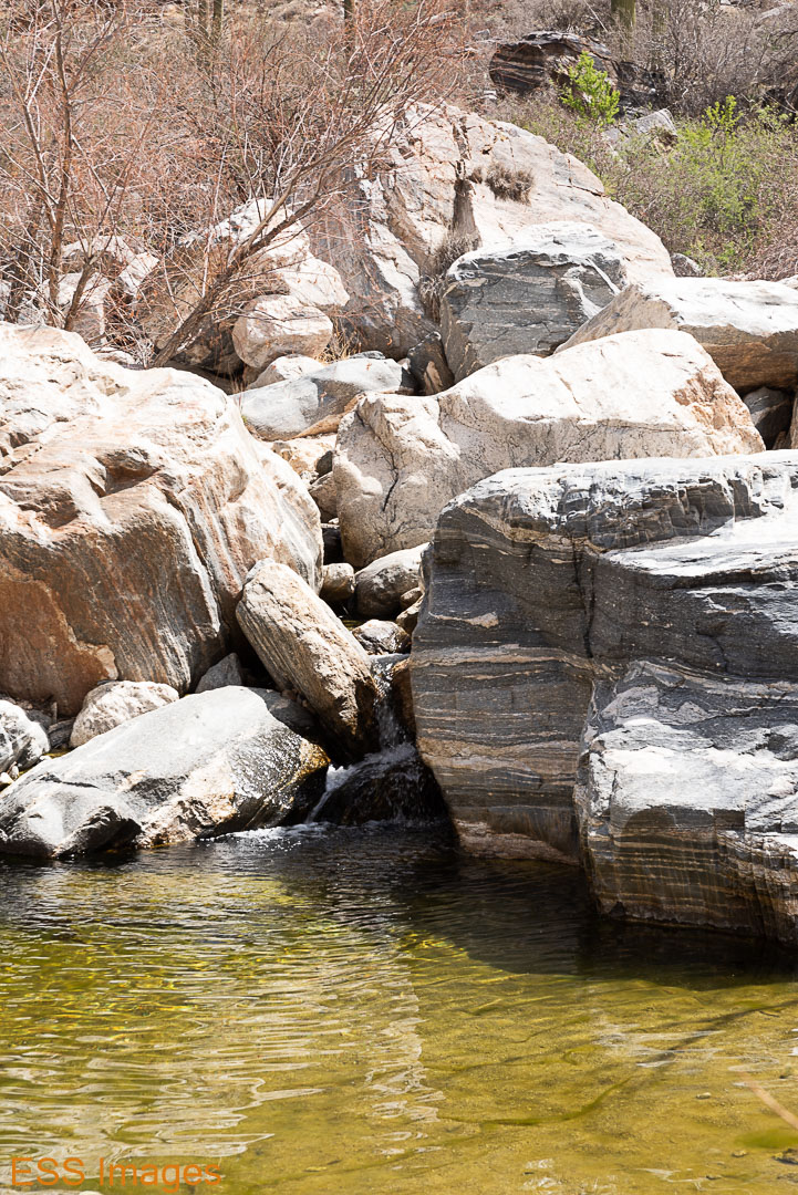
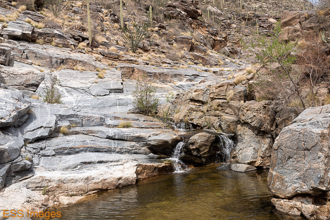
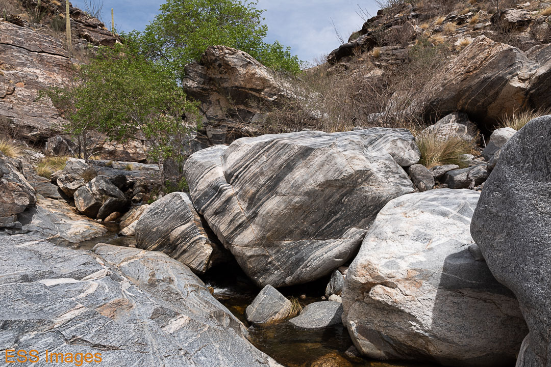
You go back and forth across the stream a few times, slowly going upstream and uphill. Until you finally come to Seven Falls:
As we climbed up to the top, we tried to count the falls and there seemed to be more than seven. We kept passing more. It’s a fun and occasionally challenging climb, certain sections were not for the faint of heart. There’s probably an easier way up, sometimes we take the most direct route rather than scouting around!

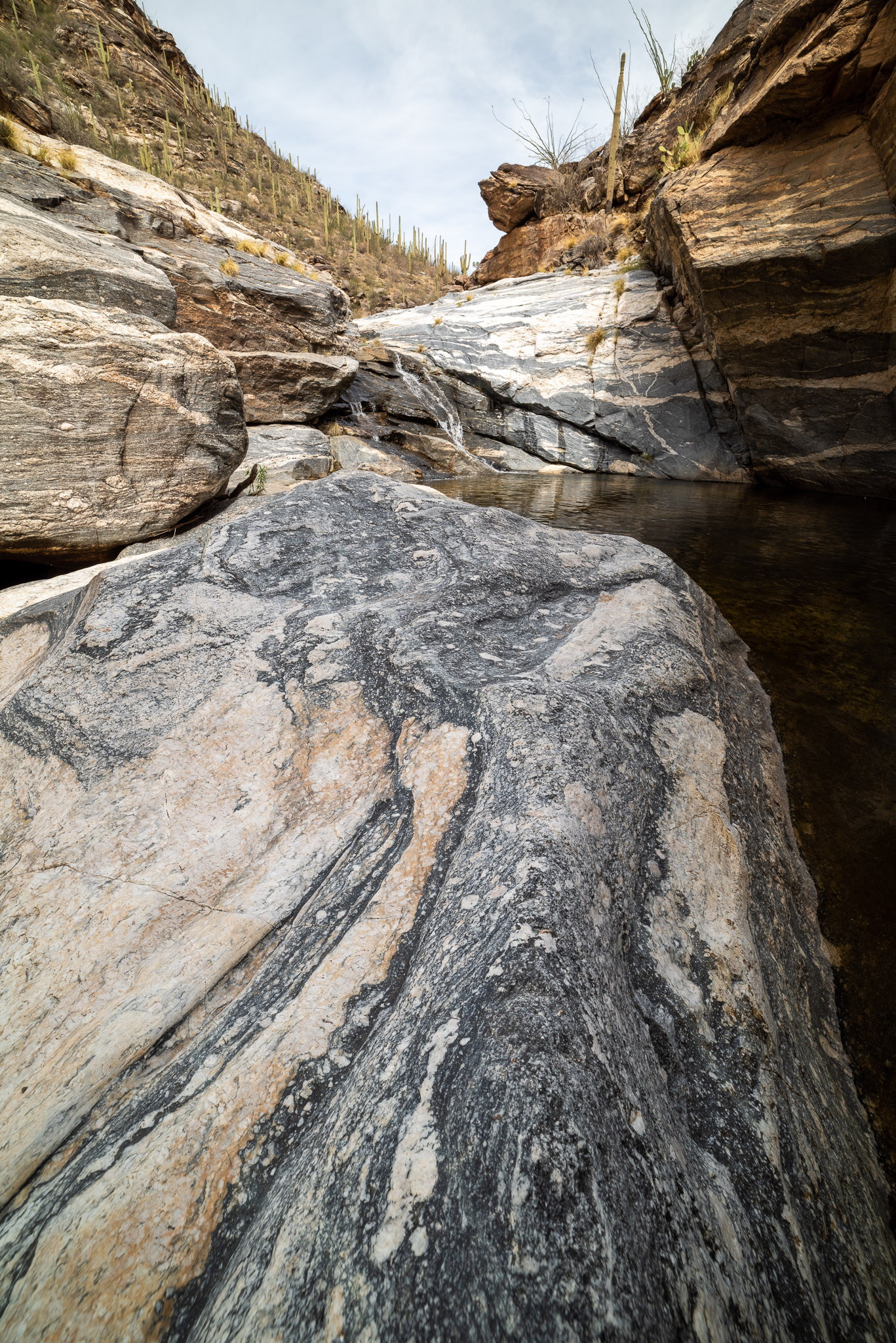

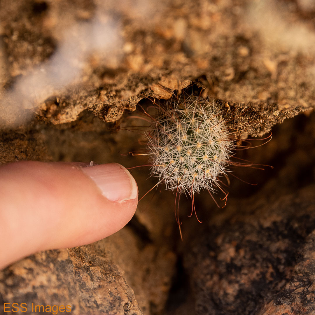
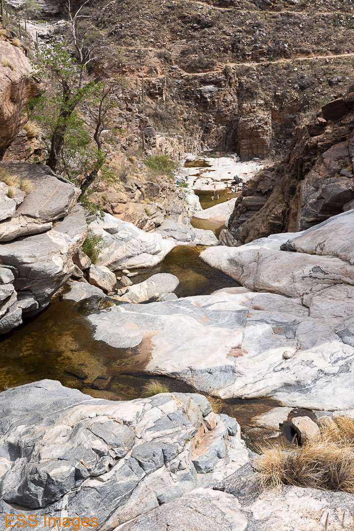
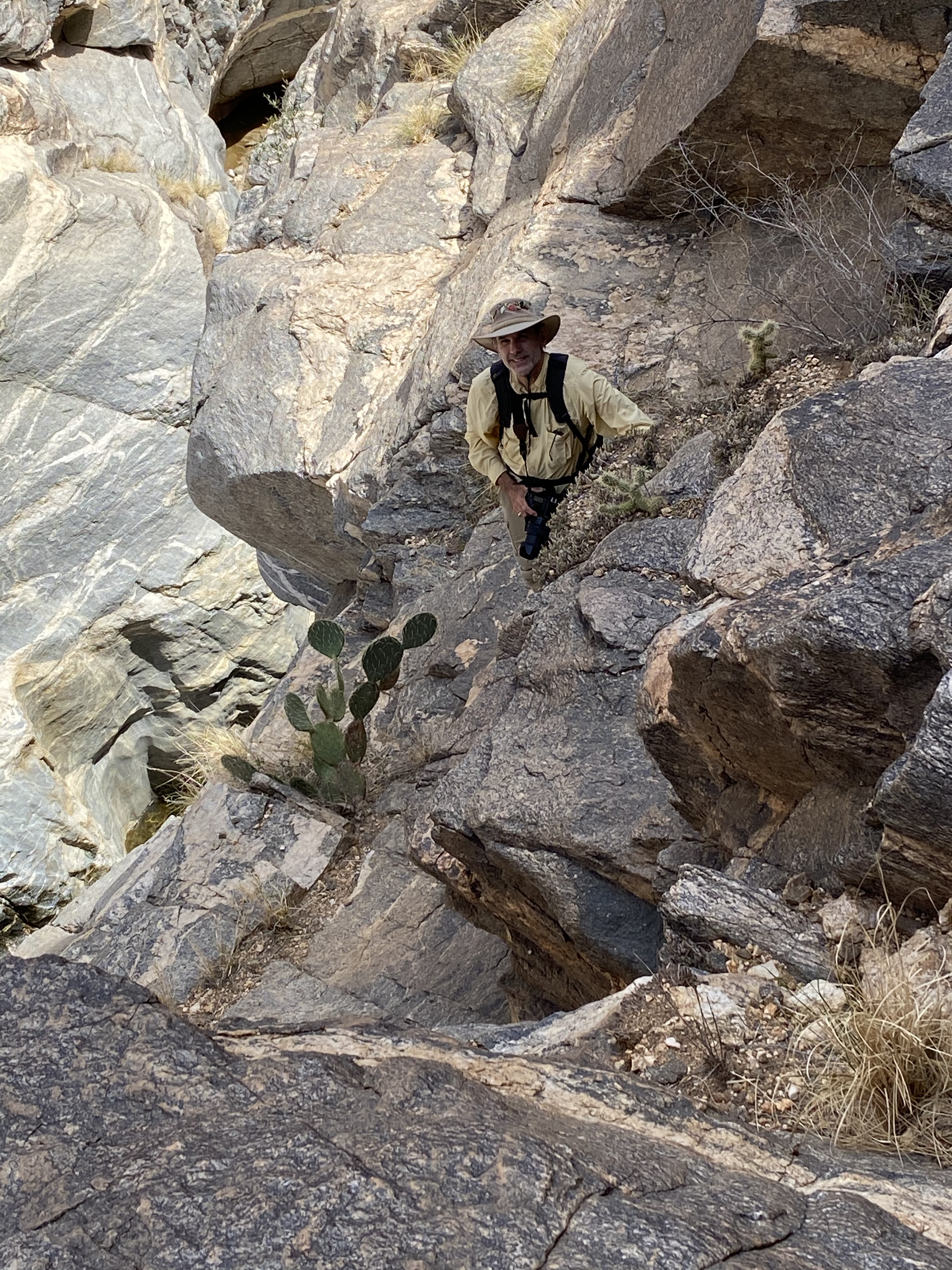
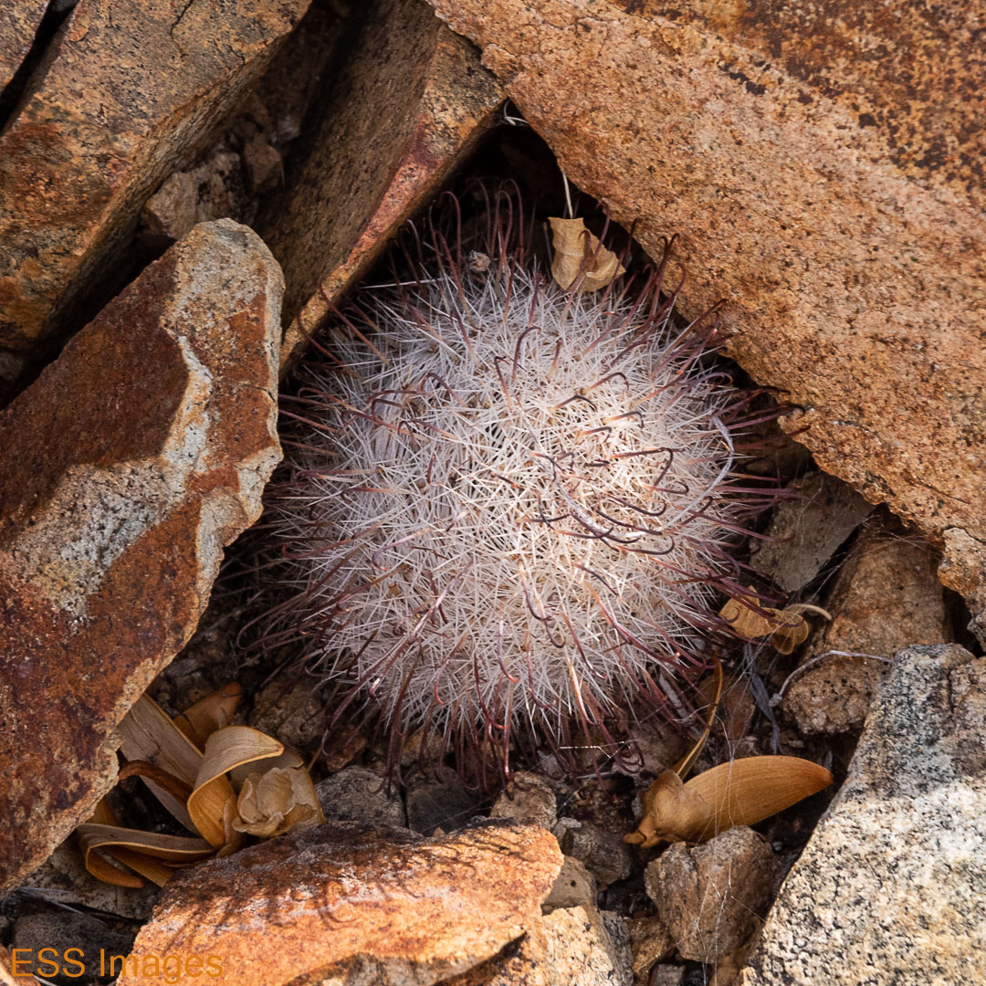
On the way up, you pass through layers of geology and it’s fascinating to see. Not to mention the tiniest little cactus I’ve ever seen! That’s my little pinkie finger in the picture with that little sphere of thorns. It may be a silken pincushion cactus, but don’t quote me on that…
On the way back to the car, we passed the second of two of our reptilian friends, the only non-avian creatures we saw that day. Unless you count people, I guess we saw a few of those. Here are the two:
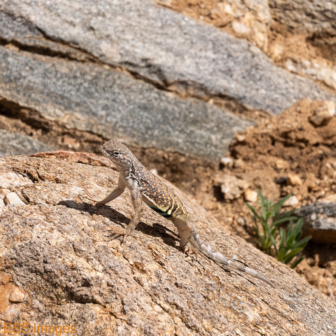

I’m not even going to hazard a guess as to varieties! Okay, maybe I will. The lighter one seems like a greater earless lizard and the dark one appears to be a desert spiny lizard. Again, don’t quote me!
So, that was our last day hiking in the Tucson area. The next morning we stopped at the Pima Air and Space Museum on the way to the airport. It’s a great place if you like airplanes, but I won’t overload you with pictures since it doesn’t relate to hiking! I will put one picture here:

That’s a B-36J “Peacemaker.” Early models only had the 6 turboprop engines, then they added on the 4 jet engines!
After that visit we went on to the airport, and, with a special assist from American Airlines, we got home a mere 28 hours later! Life is good.

Since our travel/hiking days are past, I really enjoyed reading this. Bill and I would spend days like you and Leigh, and I treasure those memories.
LikeLike
I’m so glad you enjoyed it, we hope to keep them coming for a long while!
LikeLike
I LOVED Saguaro! Once again we didn’t have nearly enough time to explore all that we wanted to. The petroglyphs look incredible. I can’t wait to get back!
LikeLiked by 1 person