Late August is not a highly recommended time for visiting the Grand Canyon, especially if you’re going to walk down to Phantom Ranch. But that’s when we had a cabin at Phantom Ranch, and we weren’t going to miss it! After all, I’d never been there before. And we’re from Texas, we can deal with heat.
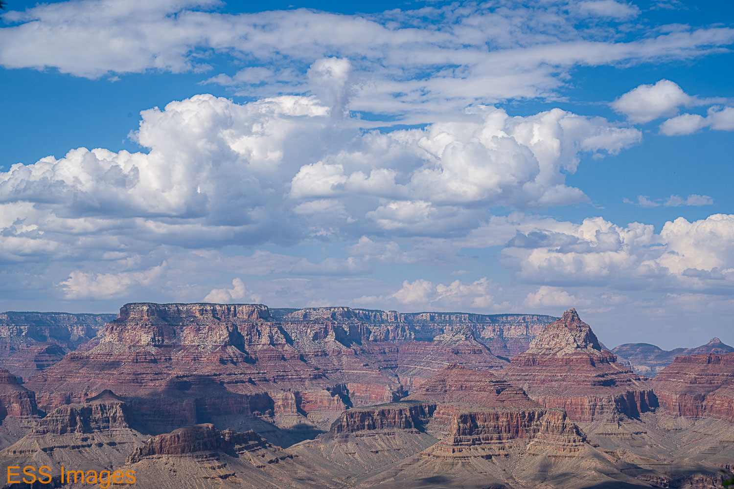
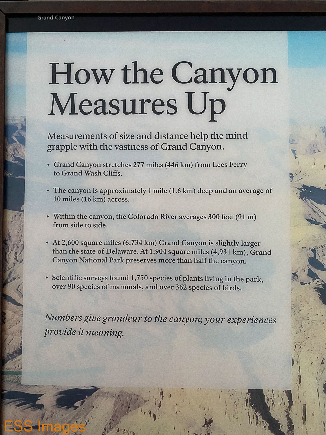
So we flew up to Flagstaff, rented a chariot, checked into a hotel a bit south of the National Park, and drove on up for my first view of this fabled hole in the ground. How many times have you heard this: the pictures just don’t do it justice! But then, they really couldn’t. 277 miles long, an average of 10 miles wide and a mile deep, I would have needed a really wide lens to capture it all. Or a seat on the International Space Station!
Before I get too deep into this, here’s the National Park Services map page for the Grand Canyon, in case you want to see a high-level view. I have also included links to Alltrails trail maps for the trails we did.
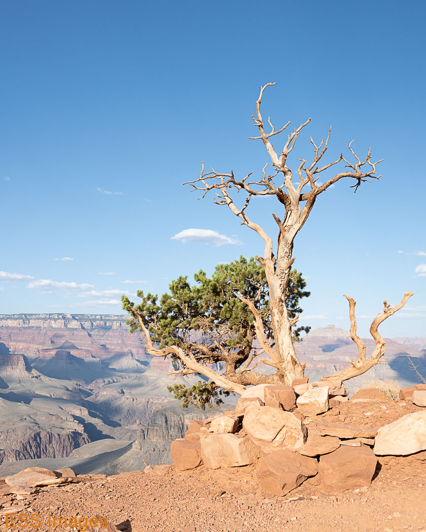
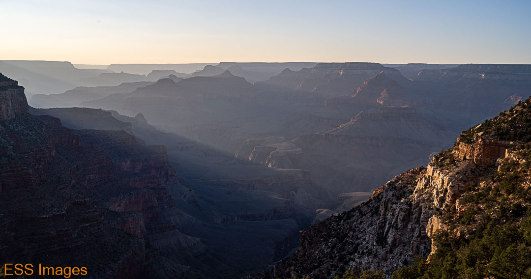
Here’s our first view, near the Visitor’s Center (And just for reference, here are a few facts about the Grand Canyon courtesy of the NPS):
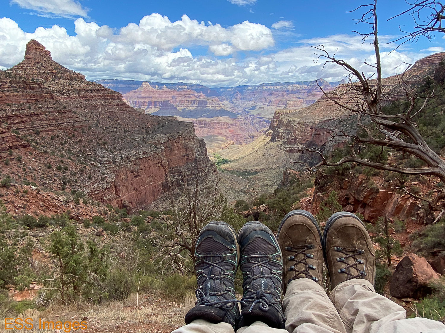
We got there fairly early in the day, so we thought we’d try a little hiking just to start getting accustomed to the altitude, so we headed over to the South Kaibab trailhead with the intention of hiking down past Ooh-Ahh Point to Cedar Ridge (following our friends at Alltrails!). But first, a precipice to sit upon! It’s only about a mile and a half down there, around 1100 feet of elevation. It seemed longer coming back up.
But the views along the way, magnificent! There’s a reason they call it Ooh-Aah Point.


We hiked on down to Cedar Ridge, took a bit of a rest, and started back up. Did I mention that it seemed (a lot!) longer going up? It was, after all, our first day at altitude. It’s difficult to train for that when you live in Dallas – altitude about 600 feet above sea level (at least where I am right now). We could get up over 700 feet in a tall building. The lowest point on this hike is just over 6000 ft! Someone should import some oxygen up there. But with regular rest stops (oh, I just wanted to take one more picture…) and plenty of water, we made it back to the top. I was glad that wasn’t the trail we were planning to use coming up from Phantom Ranch…
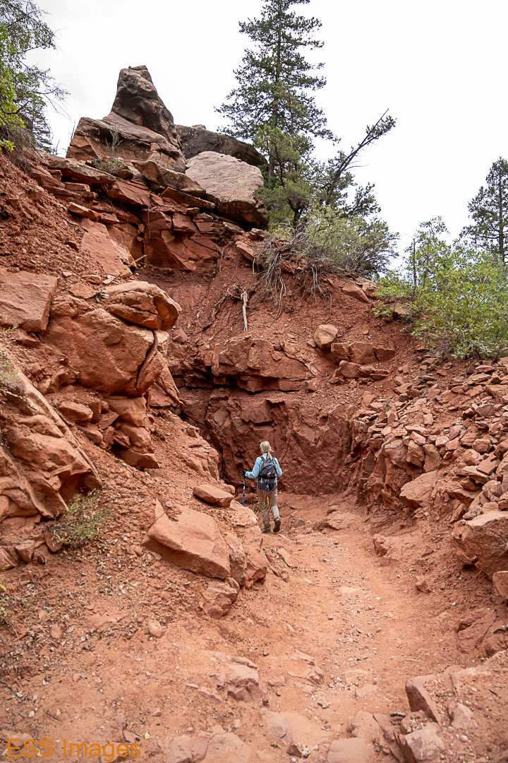
As an aside, I should mention the great mistake we made that day – we did not have our trekking poles with us for the hike. That was the last time we made that mistake! Both of us are in the habit of using two and we were glad to have them for the rest of our trip.
Someone we bumped into recommended going over to Yaki Point for the sunset, so we did. It was a quiet sunset, sky-color-wise, but the red/golden light on the canyon’s rock formations was beautiful.

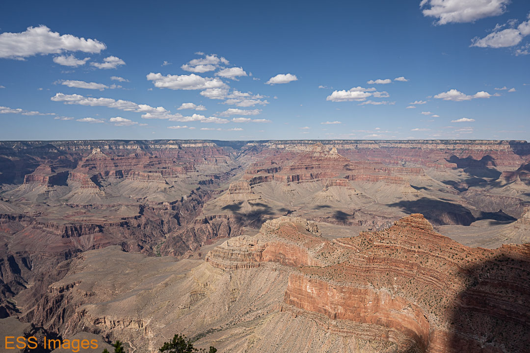
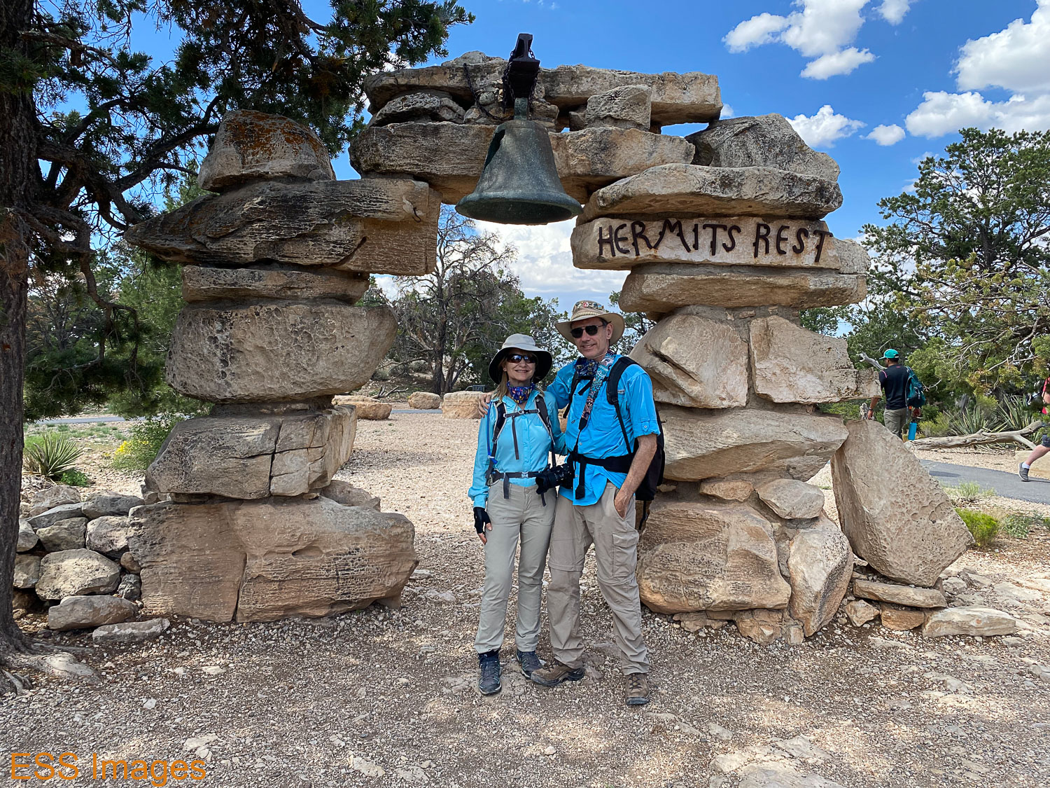
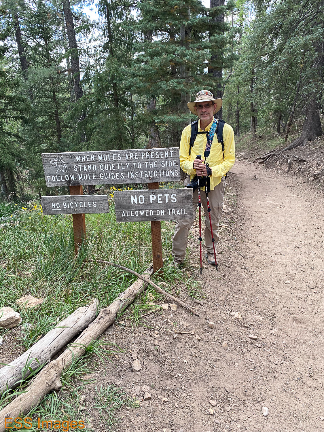
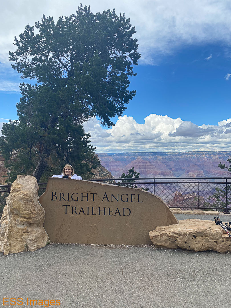
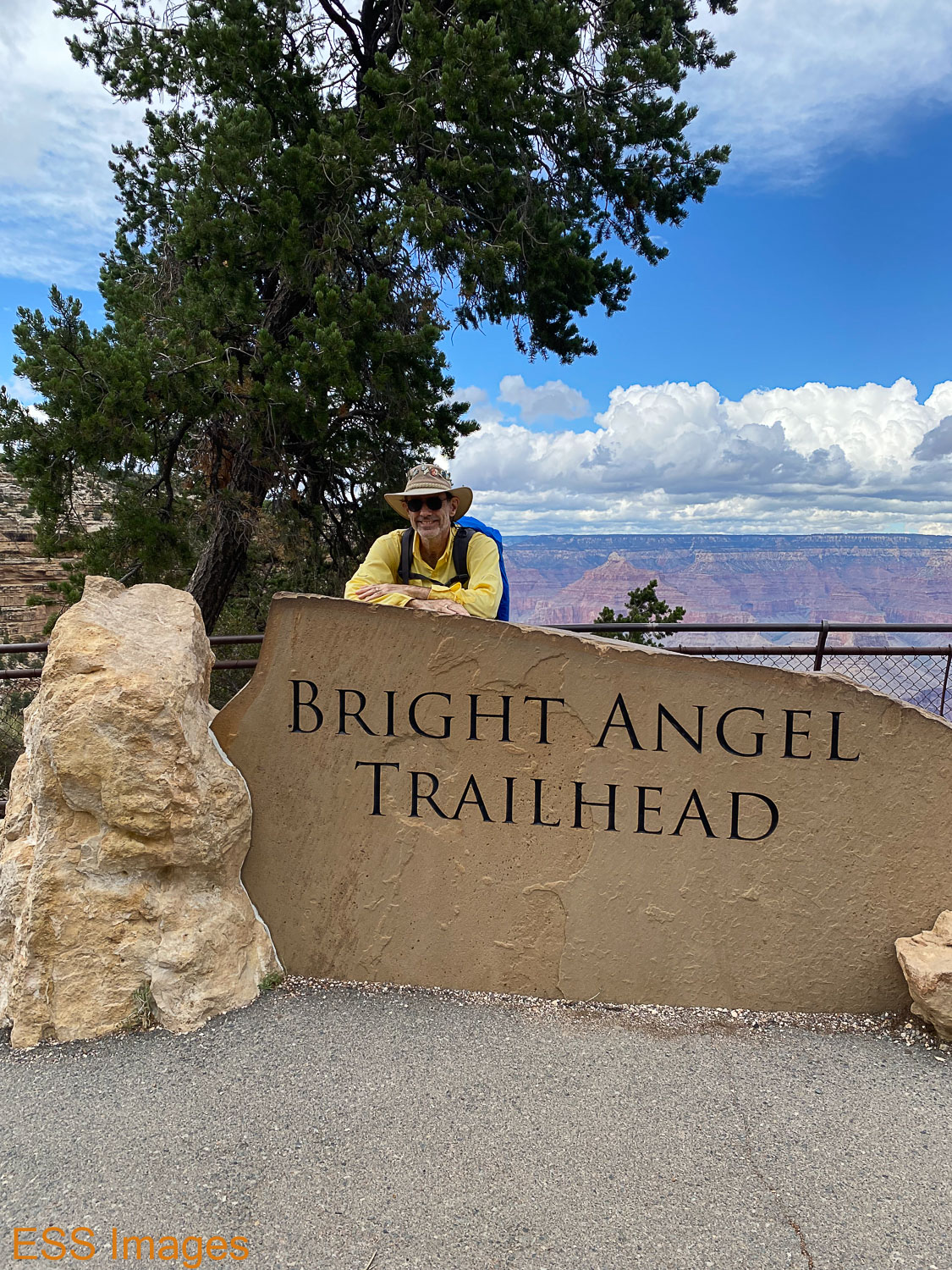
The next morning we went to the Bright Angel Lodge and dropped of a duffel bag with some things we wanted to be waiting for us when we came up out of the canyon on Wednesday. Clean clothes to wear to dinner, for example! Then we paid a visit to the Bright Angel Trailhead where we would be arriving in a few days, and walked over and hopped on the Red Shuttle out towards Hermit’s Rest. We hopped off at a couple of stops to check out the view, did a (very) little hiking on the Rim Trail. After a brief visit to Hermit’s Rest, we went back to the village. There we hopped into our chariot for the quick, 11-mile journey to the North Rim Lodge!
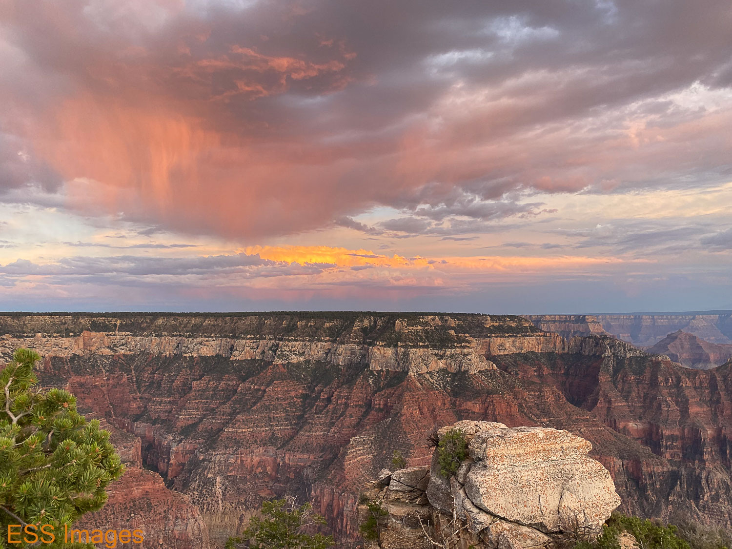
Ha Ha. As you may know, in order to travel the 11 miles to the NR Lodge, you have to drive over 200 miles around the canyon, crossing it near the head (Marble Canyon, more later) where it’s only about 200 yards across. You drive past the Vermilion Cliffs, turn south into the Kaibab National Forest, and eventually reach the end of the road, where the Lodge is conveniently located. We checked in, dropped our gear in the cabin and went off to Bright Angel Point (see Alltrails!) – just a short walk from the lodge, but a marvelous view! We stayed there for sunset, then went to get a good night’s sleep.
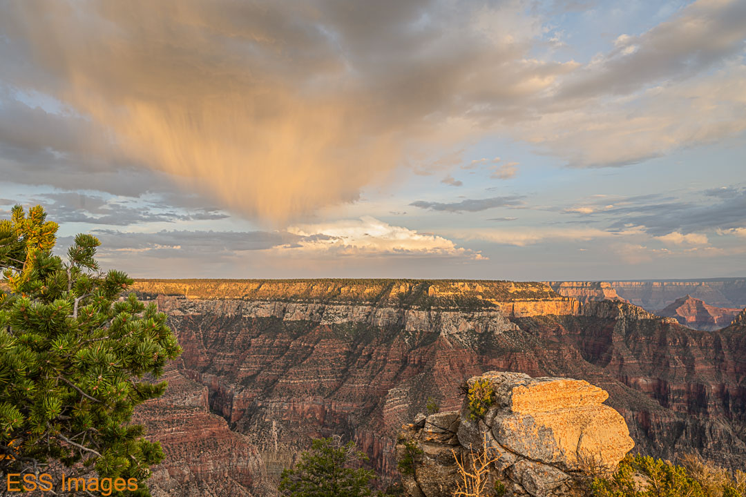
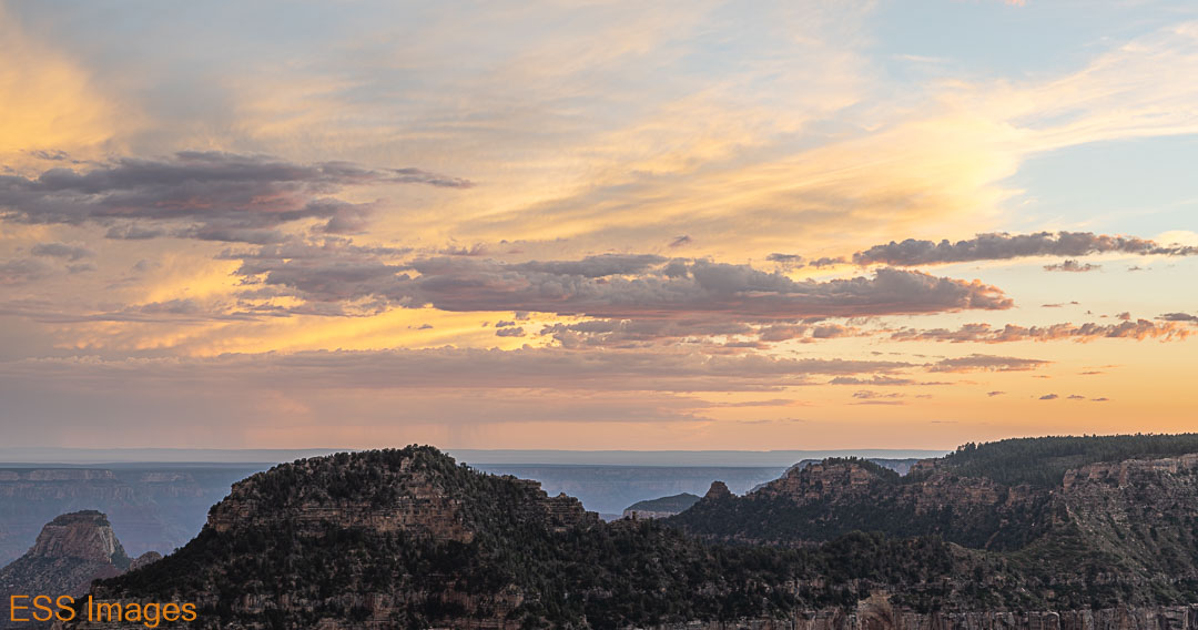

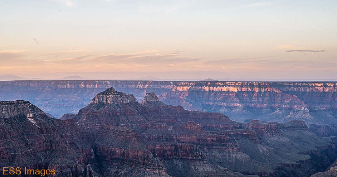
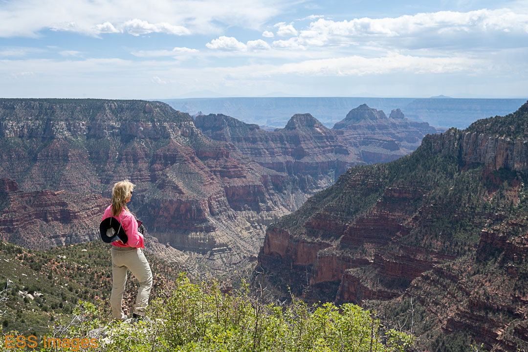
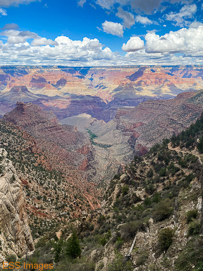
The following morning we went back to Bright Angel Point for the sunrise. Again, the light was nice and the clouds were mostly absent. But it was that morning that I realized that the narrow canyon we could see below us was Bright Angel Canyon, the route we would be taking to get to Phantom Ranch! You can see it running lower right to upper left.


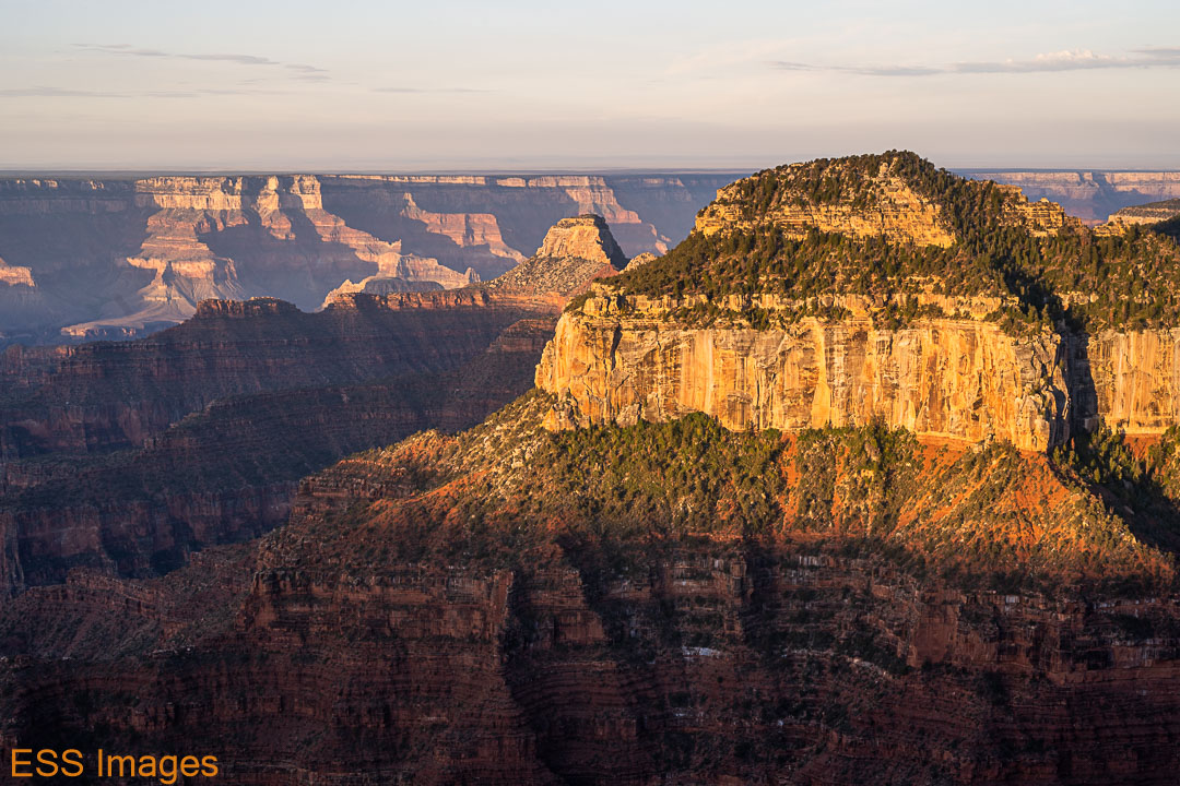
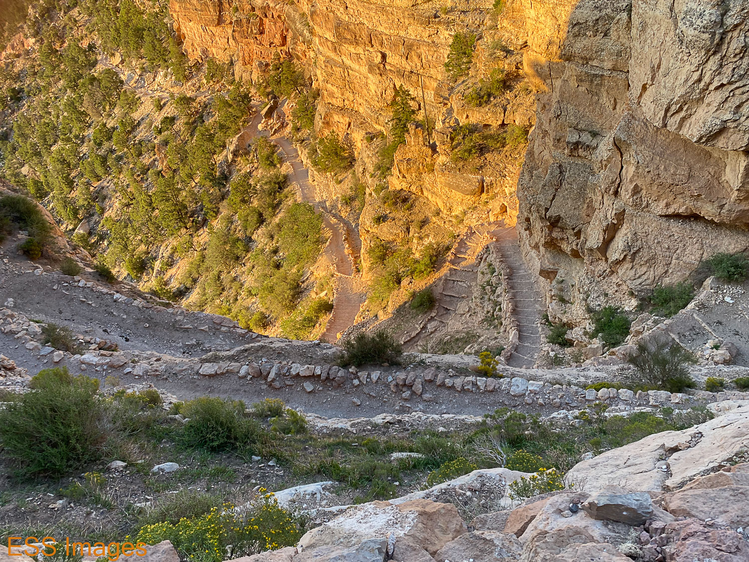
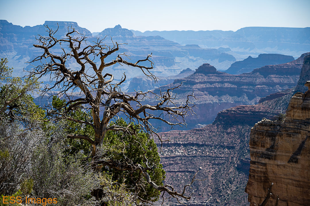
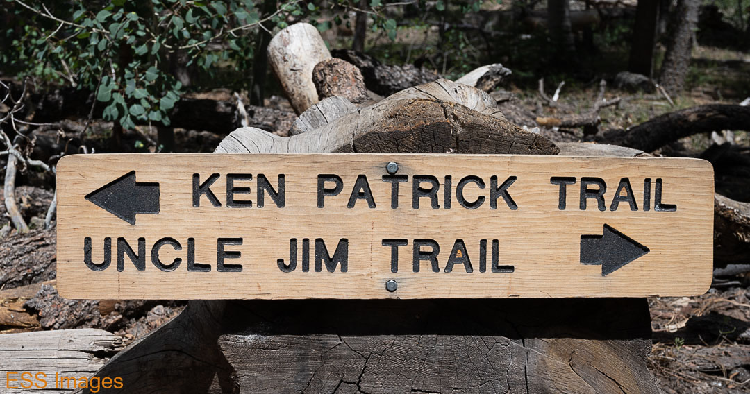
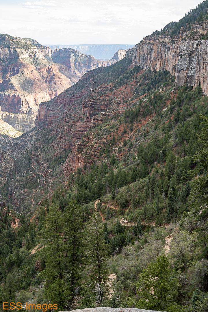
After a little breakfast (had to have my tea!) we decided to go hike the Uncle Jim Trail (on Alltrails), one that starts near the North Kaibab trailhead. The trailhead is a couple of miles up the road from the lodge, so we tossed our trekking poles into the chariot and cruised up there. Uncle Jim is about 5 miles long, you hike out to a loop, around, and back along the trail. Most of the trail is through the woods, but at the end of the loop there’s an overlook with an amazing view! Especially the view overlooking the North Kaibab Trail, which you can see zig-zagging down the side of the canyon!
It was a pleasant hike, in spite of the…high mule traffic on the trail. Not while we were hiking, they’d just left a considerable amount of evidence, especially on the early part of the trail. Once you get on the loop, it’s much better.


After Uncle Jim, we decided to hike down the North Kaibab Trail as far as Coconino Overlook (Alltrails). We thought it might be nice to go down this part of the trail while we could enjoy the view, as it would probably be dark when we next hiked that stretch! I tried to spot the Uncle Jim Overlook, but I couldn’t be sure…

After the much-longer climb back up to the trailhead we went back to the lodge and wandered around a bit, stopped in at the gift shop where we fell under the spell of the cashier talking us into joining the Grand Canyon Conservancy!
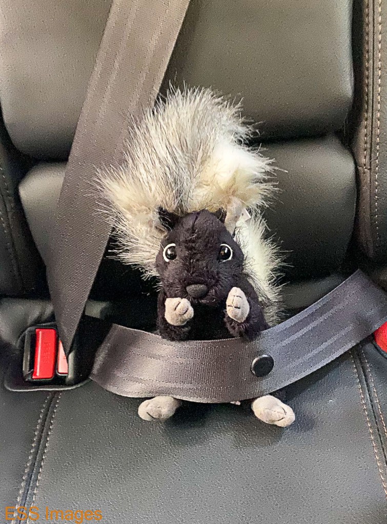
As a reward for joining the conservancy, they gave us Kai! In spite of appearances, he is not a skunk – he is a rare Kaibab Squirrel. So rare that he’s the only one we saw. In order to prevent him from becoming endangered we had to fasten his seatbelt. He was kind enough to guard our chariot while were were crossing the canyon.
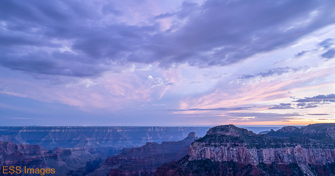
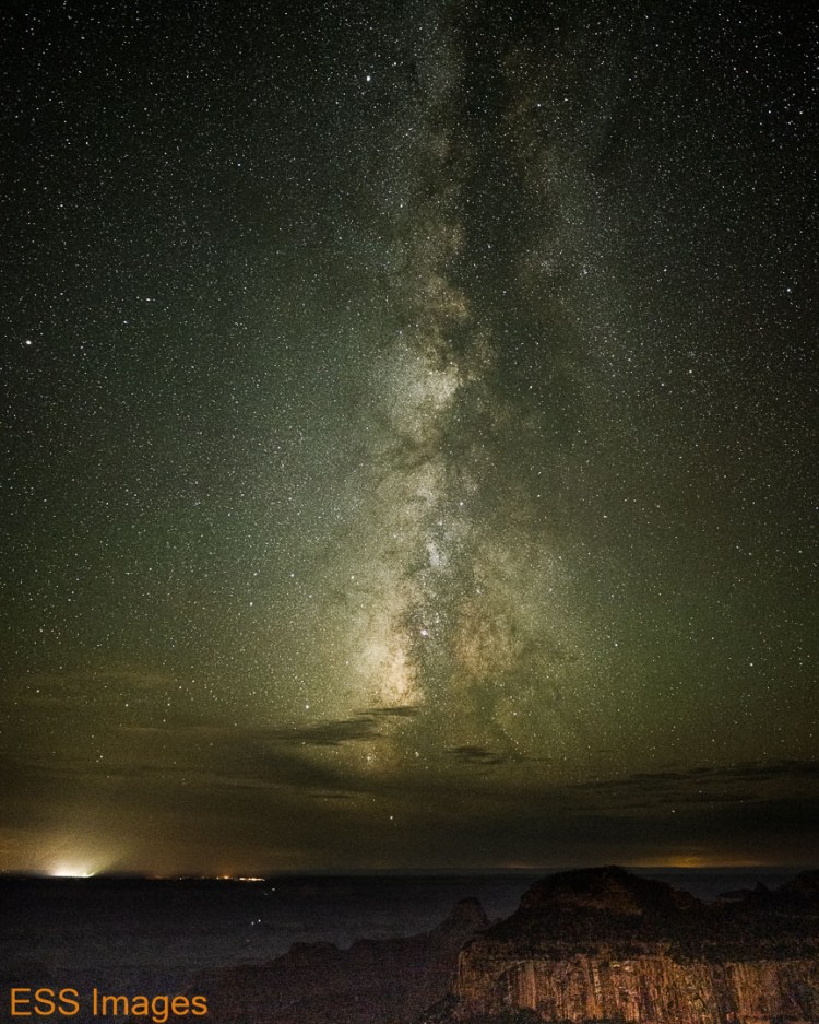
Then we had a bite and waited for dark. And after dark, just for variety, we went to…Bright Angel Point! Looking south from there, we could see the lights on the South Rim – and the Milky Way. Even then the clouds wouldn’t quite leave us alone…
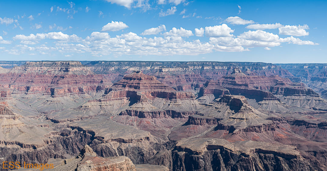
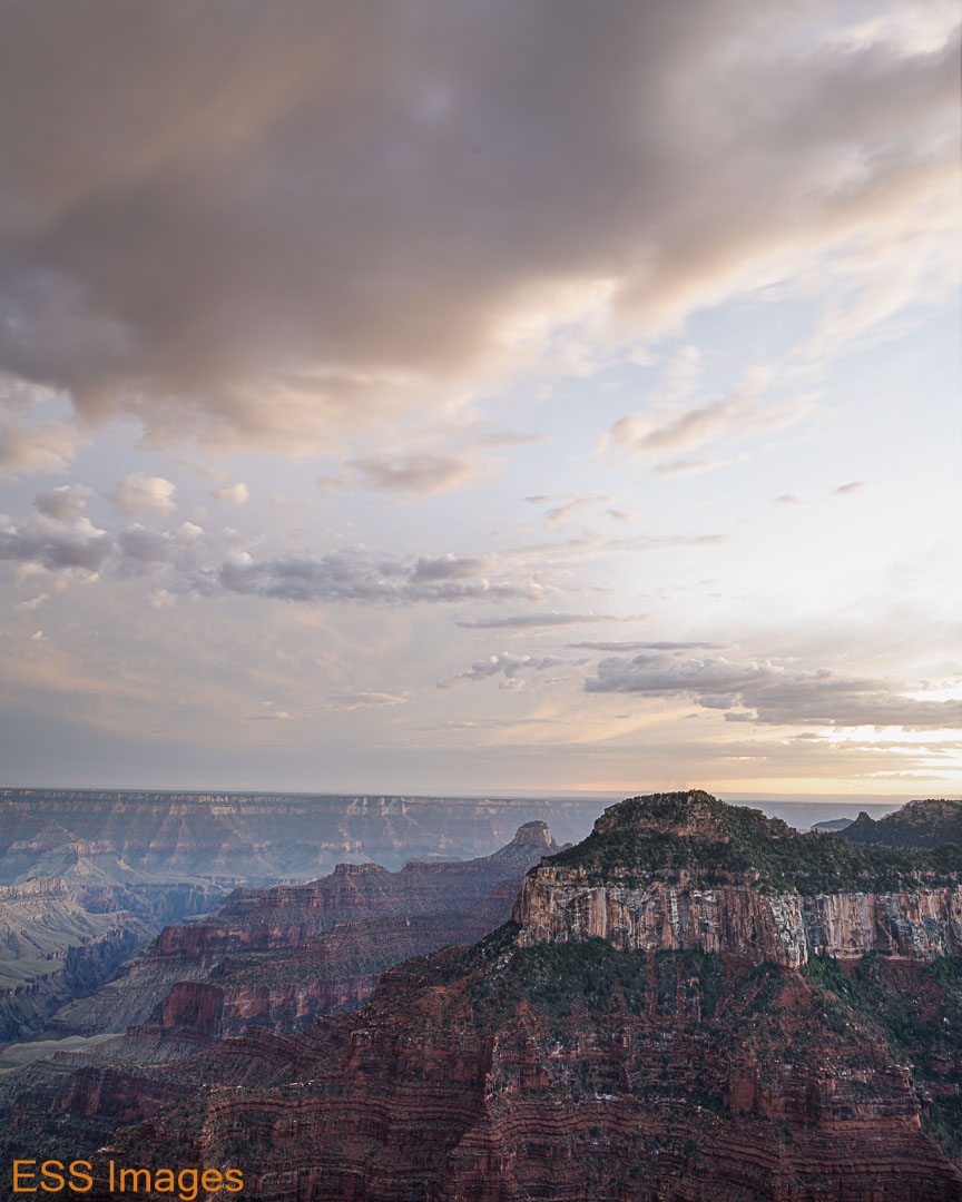
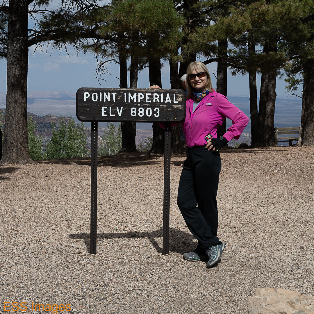
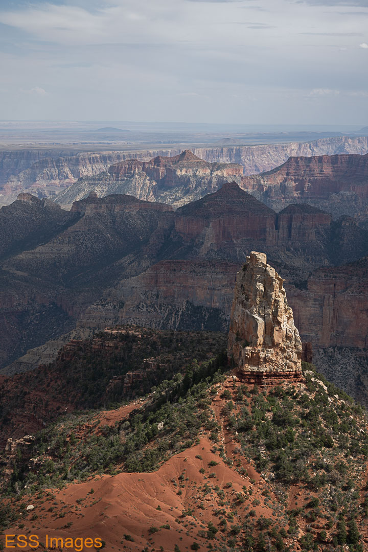
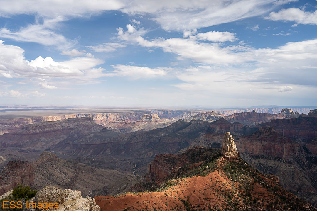
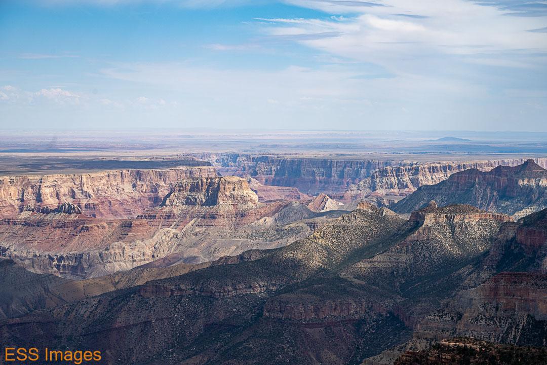
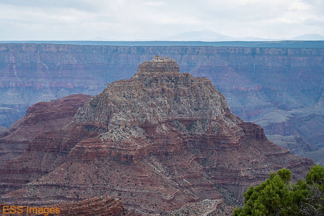
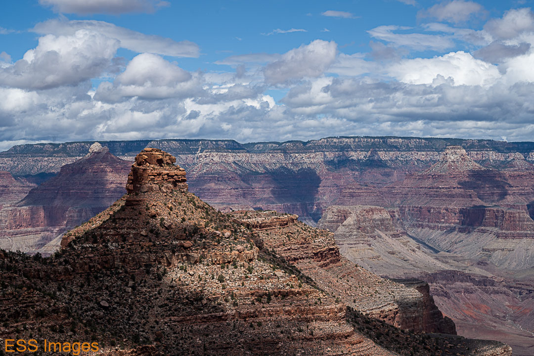
After sleeping in the next morning (you can only do so many sunrises) we took a fairly easy day, to rest up for the big event. We drove up to Point Imperial (Alltrails – it’s not much of a trail, but if you zoom out it gives you a nice topographic map of what we were looking at!), the highest point in the park (8803 feet, according to the sign). From there you can see where the canyon really widens out. It goes from 100 or 200 yards wide around Lee’s Ferry and Marble Canyon to about 2 miles across at a gap in the wall you can see from Point Imperial and then 5 miles and wider almost immediately. The prominent rock formation in the foreground is Mt. Hayden, according to the sign at the overlook.
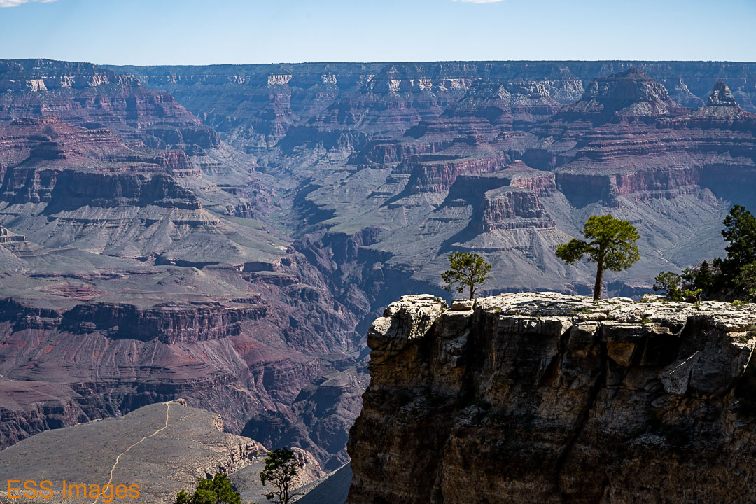
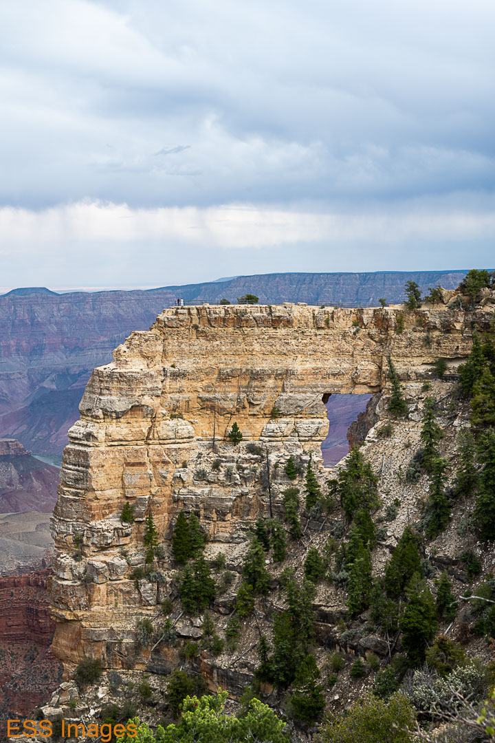
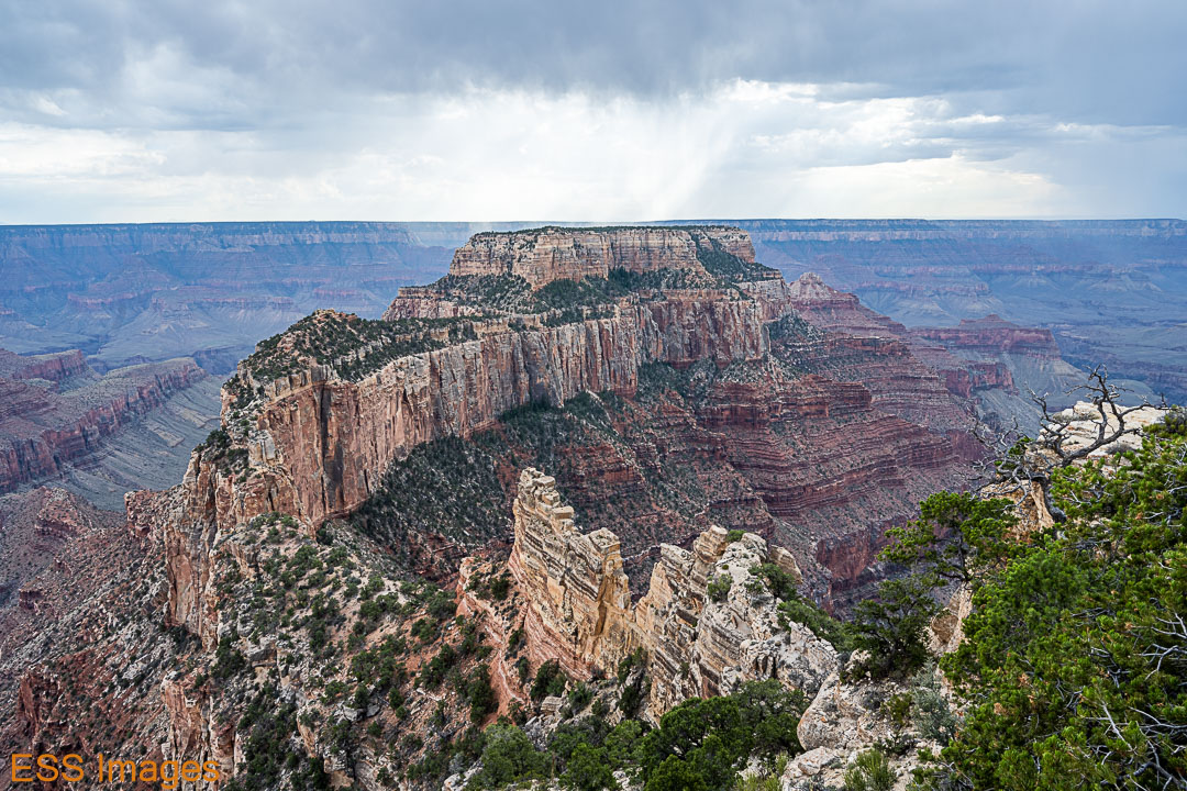
After enjoying that view for a while, we moved on down to Cape Royal and Angel’s Window(Alltrails). On the drive down, there’s a spot with a great view of Angel’s Window, so we stopped there briefly. The tiny people walking on top of it should give some idea of the scale of the rock formation. From the Cape Royal parking area, you walk down the trial toward the point and take a left to go out onto it. It’s fairly wide and you’re fenced in, but if you don’t like heights, maybe not…
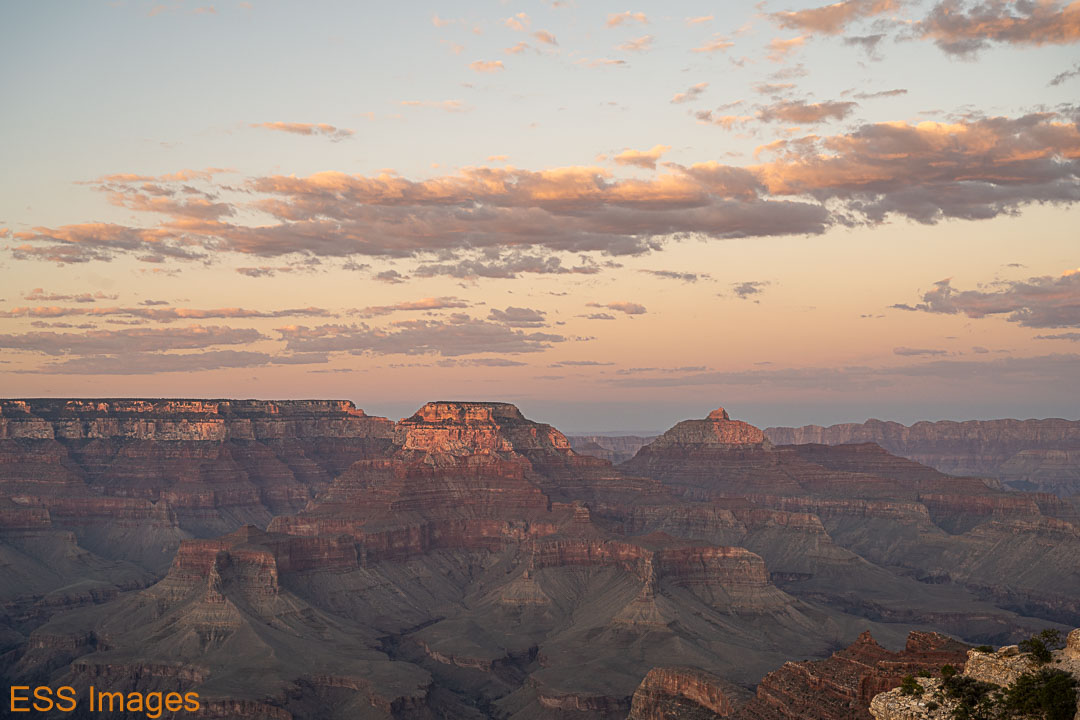
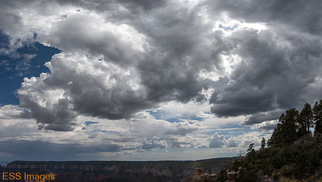
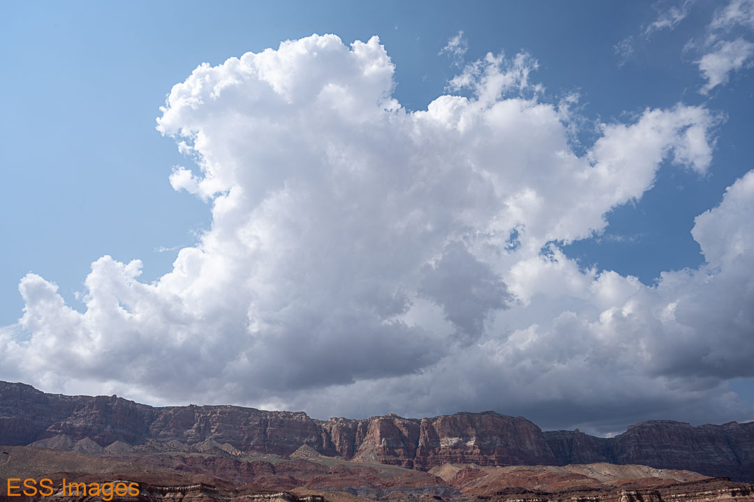
Then we walked on out to the Royal Overlook. From the Overlook you can see Wotan’s Throne and the Vishnu Temple. Some weather was making an appearance on the South Rim, so we watched it for a while. Looking at the map, it may have been near Grand Canyon Village. I was beginning to think that the amount of cloud cover did not bode well for my night-sky-photo hopes!


We went back to the lodge for a dinner in the main dining room (the buffalo tenderloin was only fair, my wife enjoyed the trout) and an early bedtime. Our plan was to be hiking down the North Kaibab Trail by 5:00 in the morning! We packed up our luggage and our backpacks and hit the sack.
Up early Tuesday morning, I had to have my tea and a protein bar for breakfast! Took everything we had left out to the chariot and drove the two miles up to the trailhead. We could have hiked it, but why? It’s far enough to Phantom Ranch without adding miles… (Here’s the trail map)
But we did indeed start hiking about 5! Okay, maybe closer to 5:15… We had our headlamps and more flashlights than we needed, especially since we could pretty much see without them by about 5:30. Here are a few shots from the early journey down:
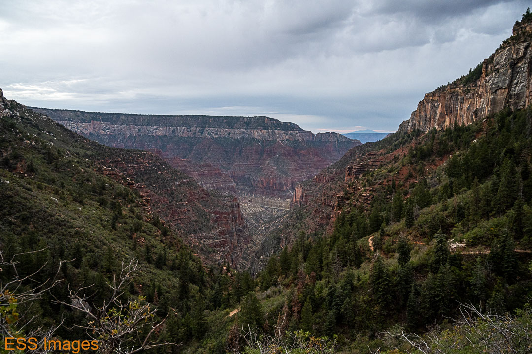
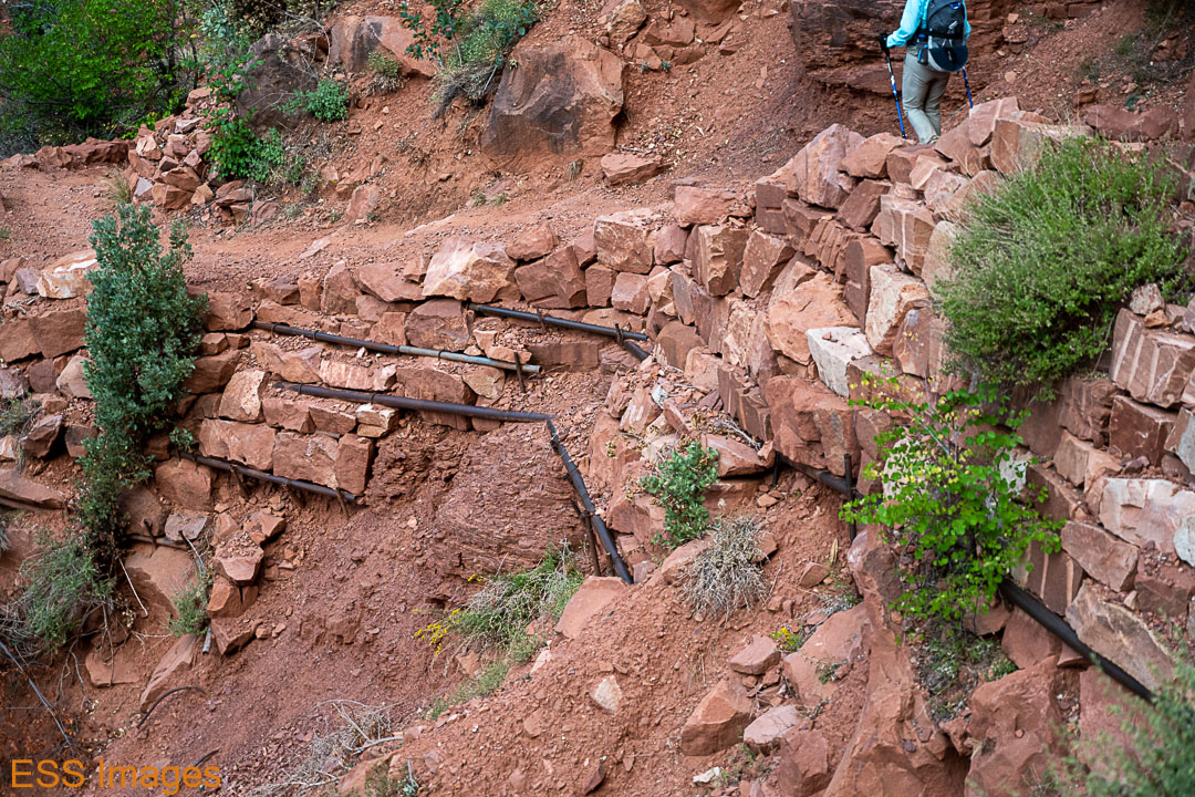
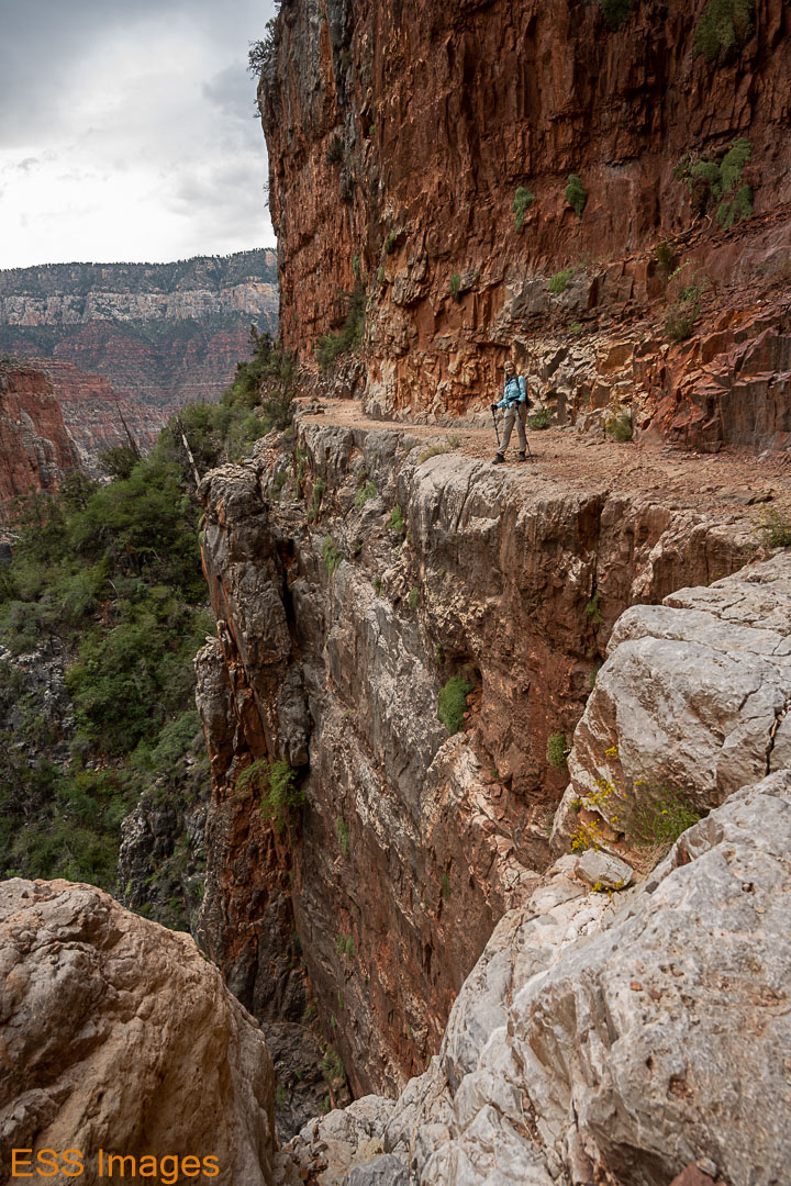
A little after 6 we reached the water stop at the Supai Tunnel and topped off the water bottle. Half an hour later we crossed the Redwall Bridge. Some of the trail after this point ran along a sheer cliff face, above and below! It was generally pretty wide, though, rarely less than 5 or 6 feet. About 8 o’clock we reached Roaring Springs (okay, we weren’t setting any speed records!), and just past the springs you reach Bright Angel Creek and Bright Angel Canyon.
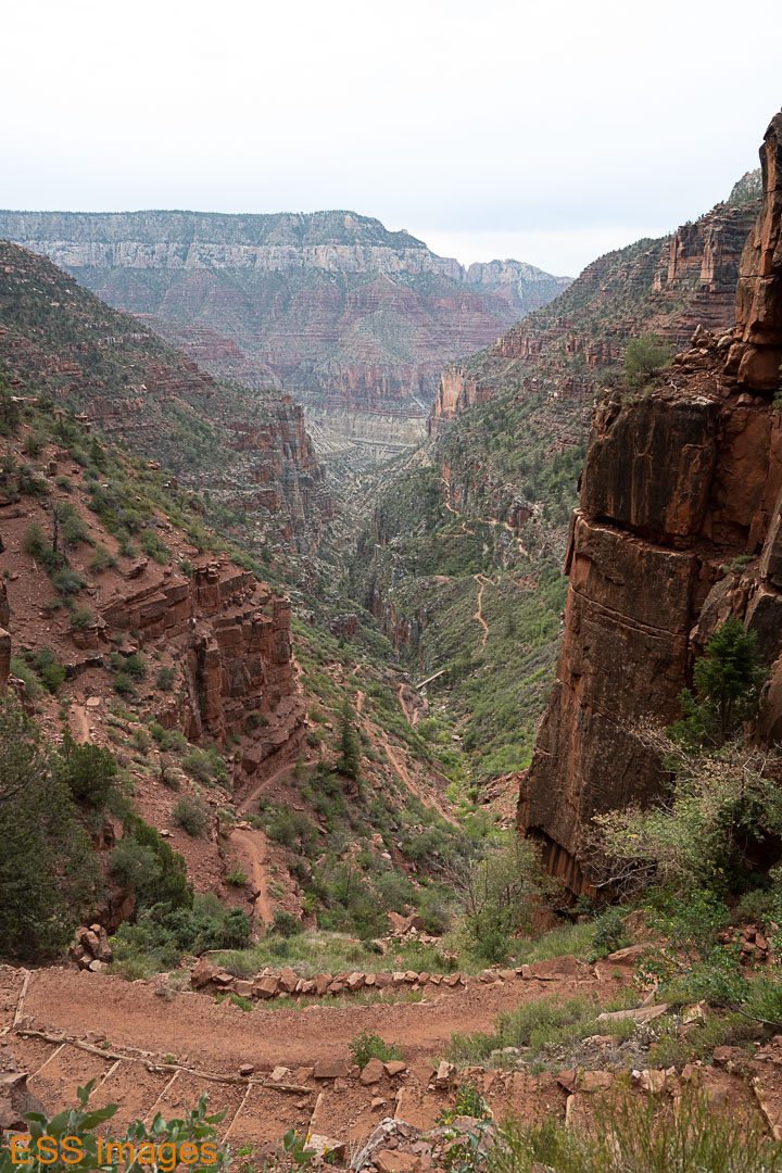
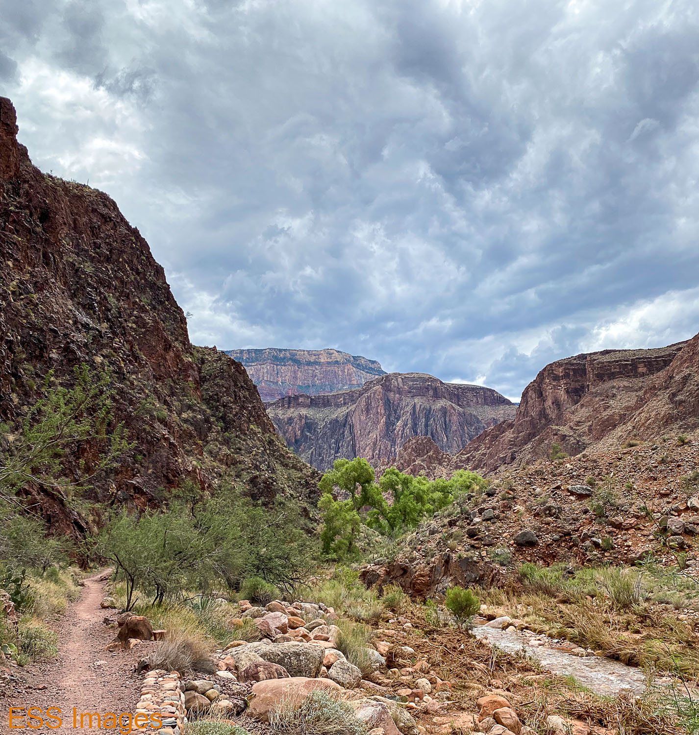
The remainder of the hike follows the course of Bright Angel Creek as it nears the Colorado River, down at the bottom of the canyon. The trail flattens out here so the downhill is much more gentle. Our knees were grateful. From the trailhead to the Manzanita Rest Area you go down over 3800 feet in 5 miles of trail. From there to the river you drop about 2000 feet in over 8 miles of trail.

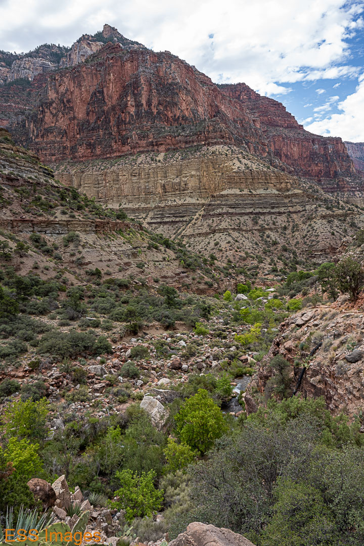


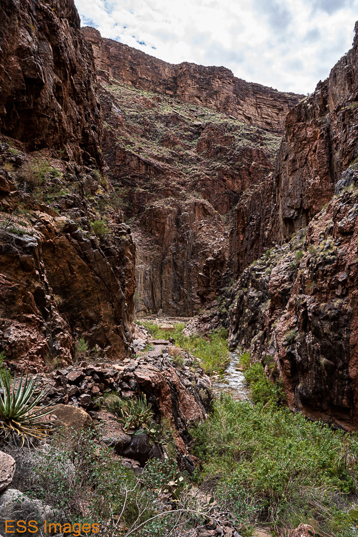

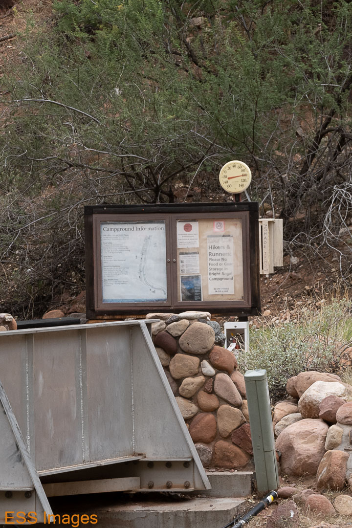
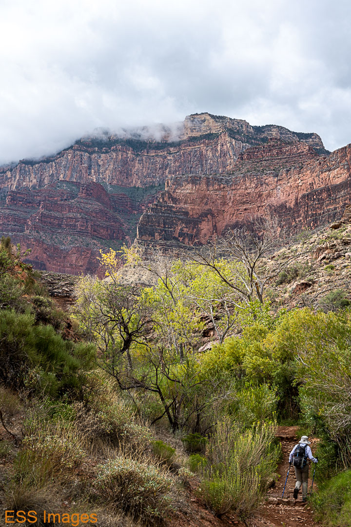
Except for a couple of places where the trail was blocked by rockfalls, the hike was uneventful. At the Cottonwood Campground we maxed out our water bottles in preparation for the longest water-free stretch of the hike (though we did have a lifestraw and water purification tablets, just in case!). It was, after all, late August, and we had been reading all the warnings about The Box and how you should try to pass it before 10 AM. It must have been noon or a little after before we got there!
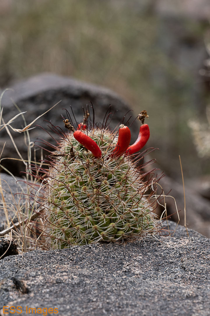
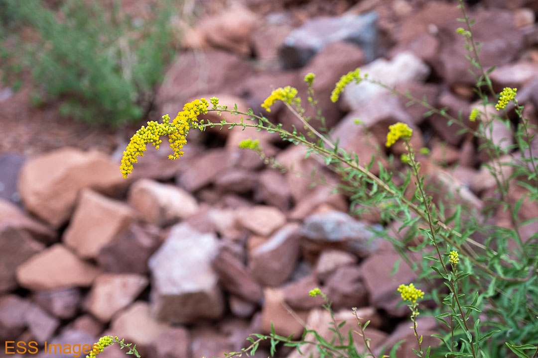
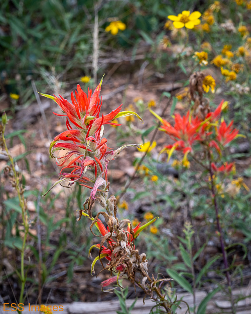
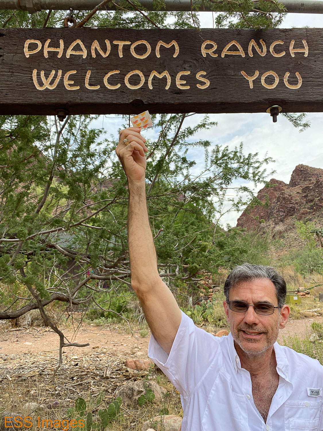
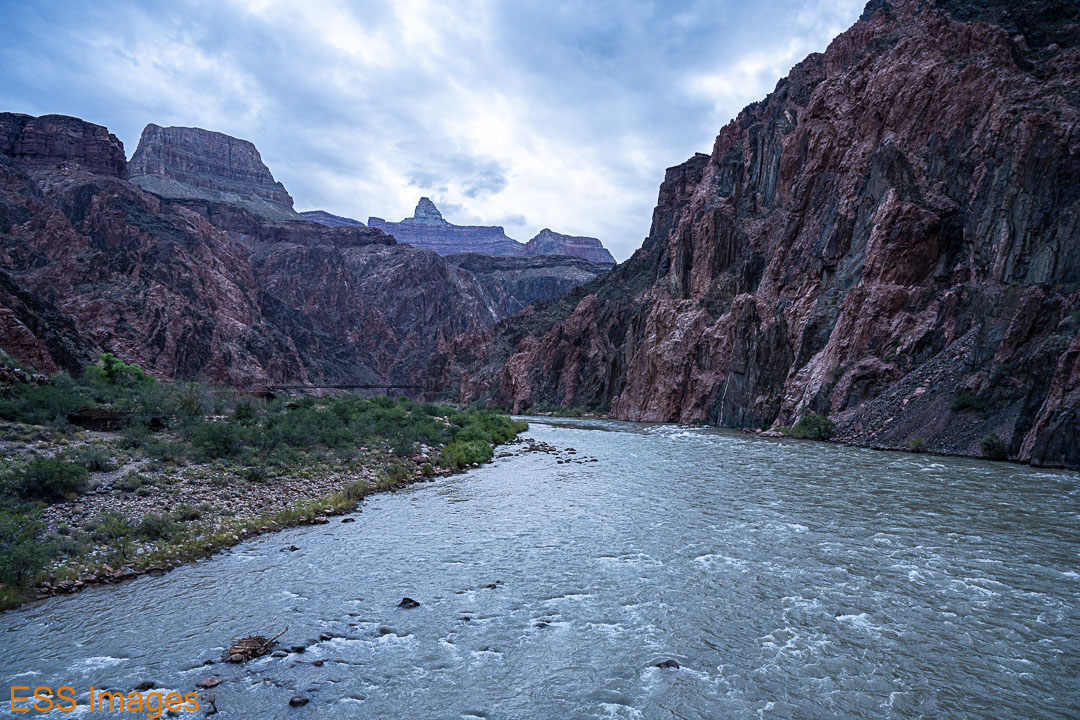
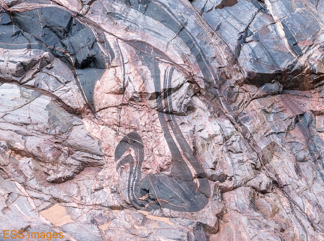
So we sauntered down the trail, enjoying the rock formations, the flora and fauna, the sound of the occasional waterfall in the creek. We stopped once to wet down, well, almost everything: our clothes, our cooling towels, our hats. And then we kept on going. And then we got to Phantom Ranch, around 2 o’clock. The Box had been quite…mild, I guess, most likely due to the cloud cover preventing the sun from heating up the rocks. When we got to the Ranch I would have bet that the temperature never even passed 90, but the campground thermometer said 100 under the cloudy sky.
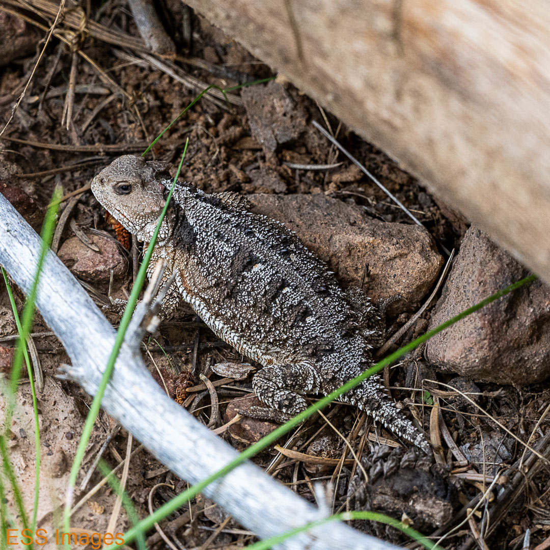
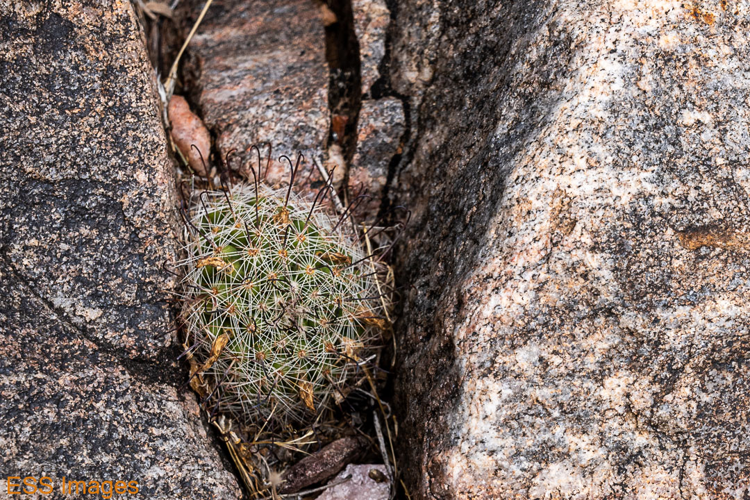
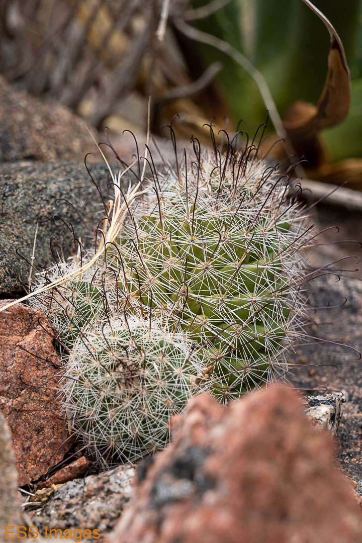
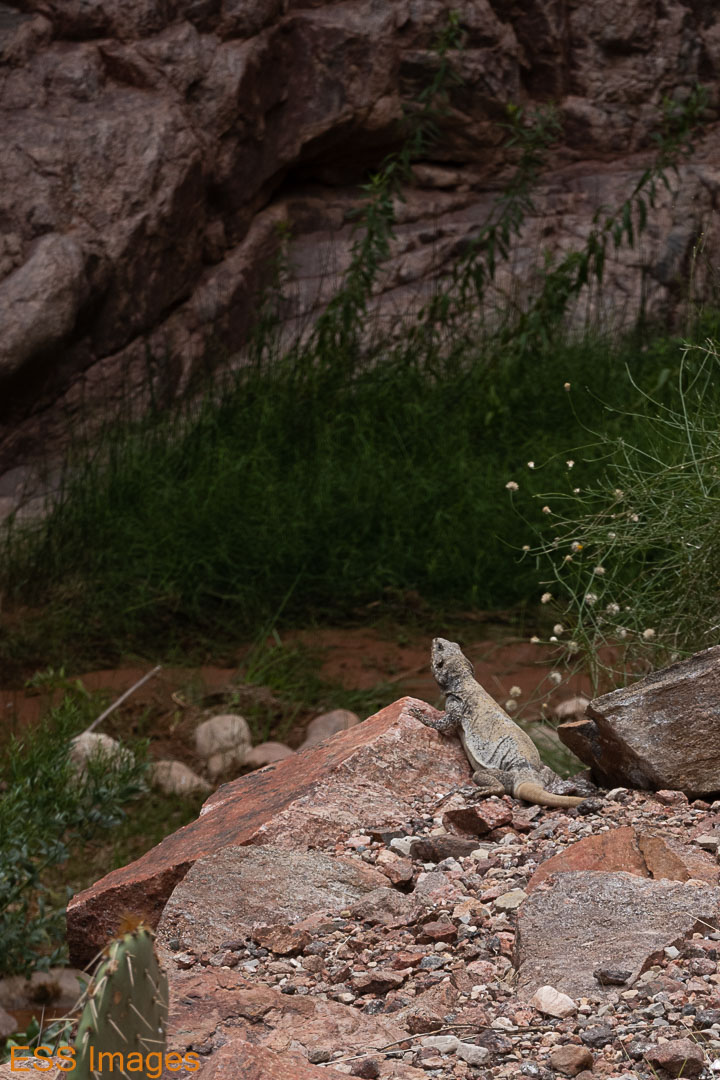
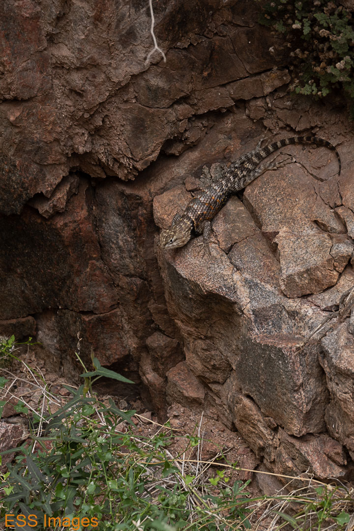
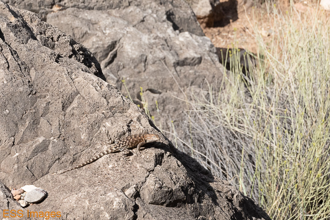
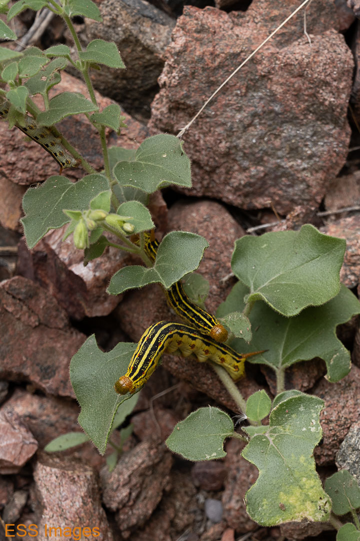
We didn’t see a lot of wildlife on the way down, a few lizards and the occasional caterpillar. I’m told those are “white-lined sphinx moth” caterpillars. I don’t know when the moths will be out. The large lizard looks a lot like a Chuckwalla, or at least some variety of iguana. It was very shy, moving off before we got anywhere near it. The spiny looking one with the orange splotches appears to be a Desert Spiny Lizard. And the other…
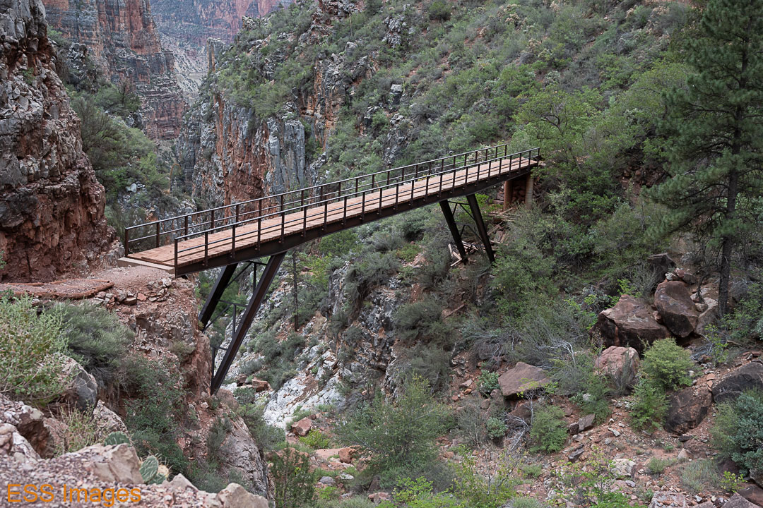
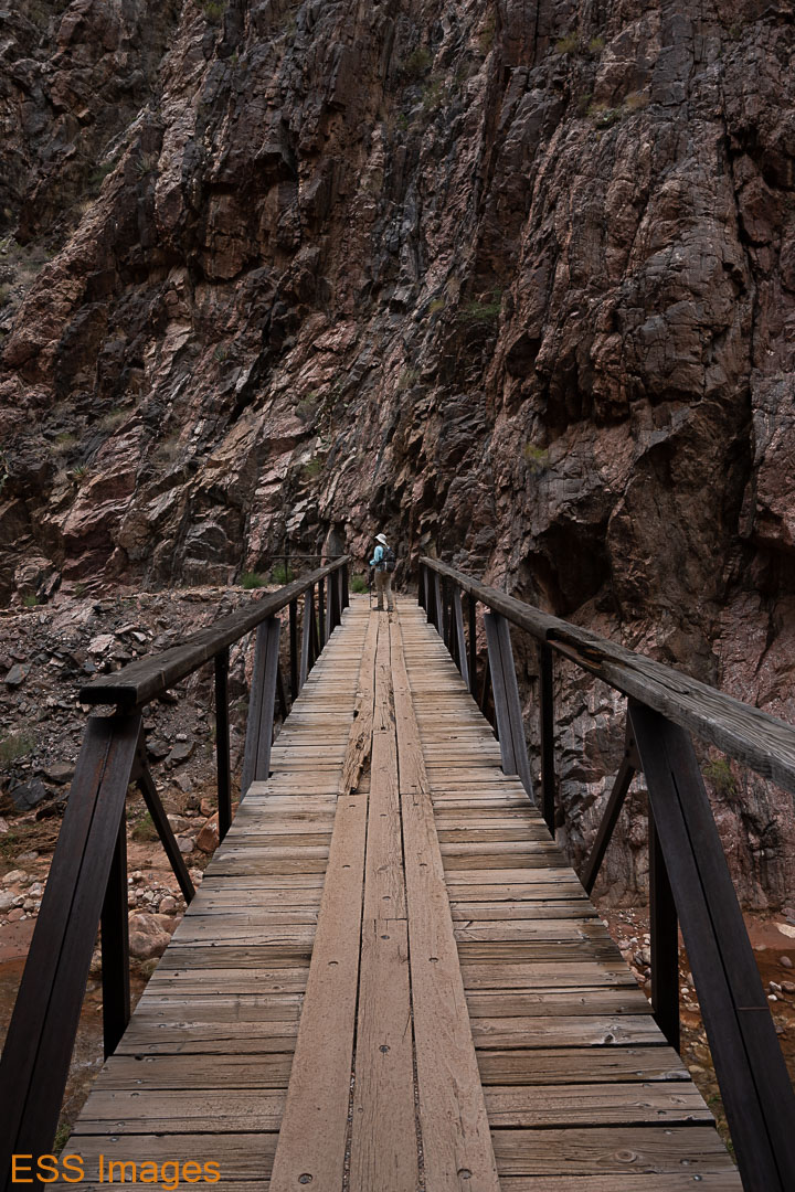
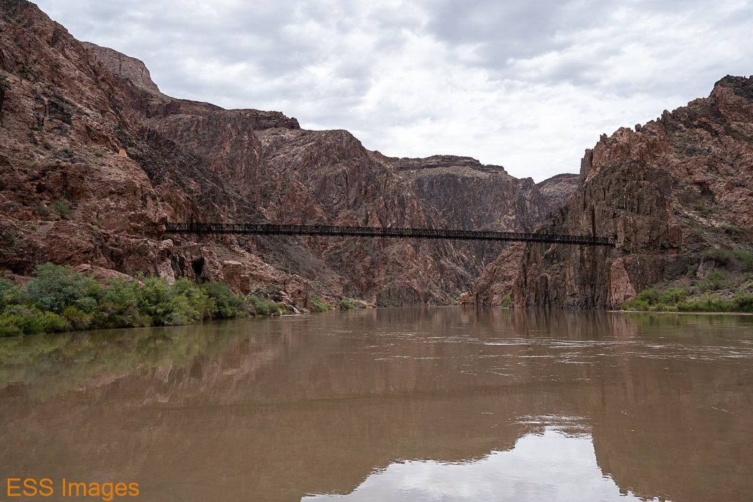
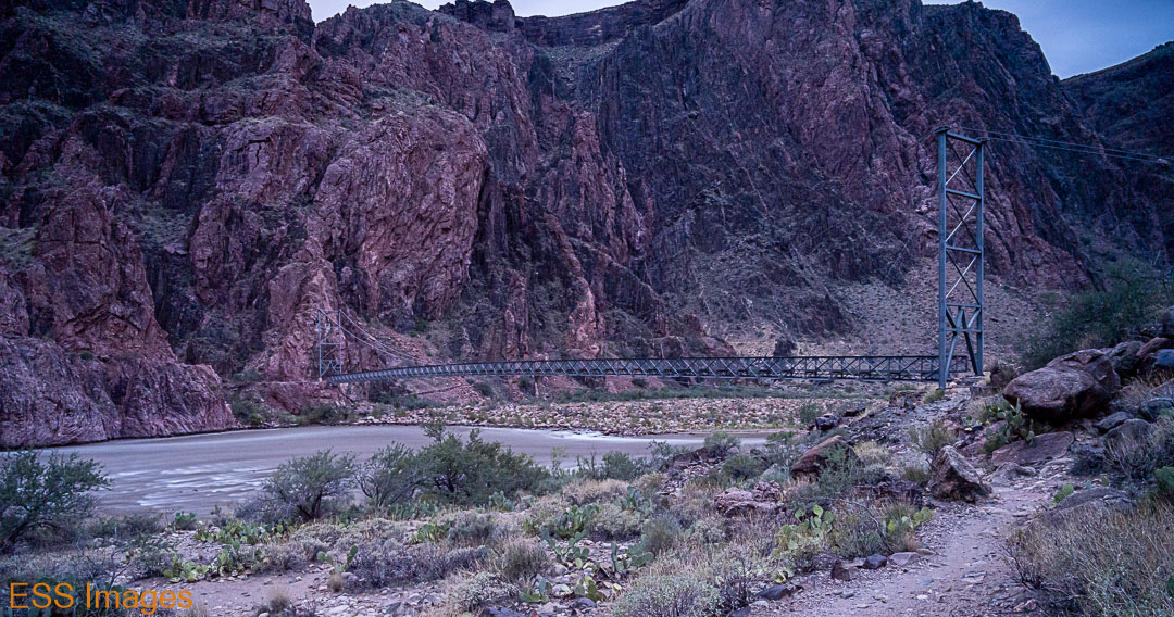
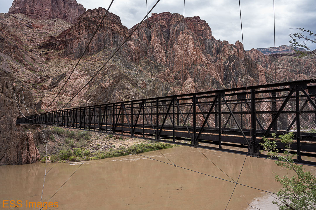
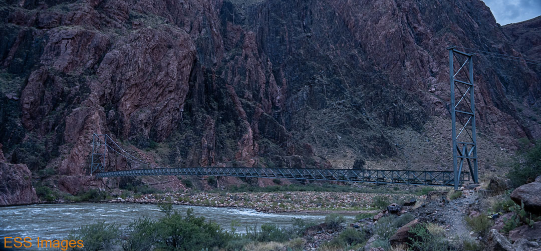
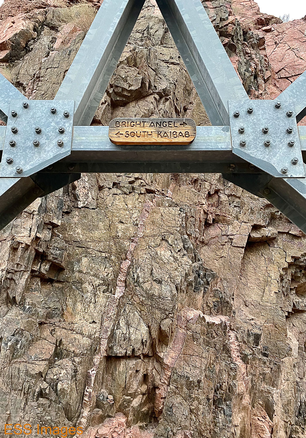
After we checked in to our cabin, we decided to go see the Kaibab Trail Suspension Bridge, the one we wouldn’t be crossing on our way up the North Rim. It’s a National Historic Civil Engineering Landmark, built in 1928. And a lovely bridge it is, known as the Black Bridge to distinguish it from the Silver Bridge on the Bright Angel Trail. I had plans for this bridge and the night sky but the cloud cover thwarted my intentions. 😦

We got back to the ranch in time for the 5:00 feeding, I had a steak and Leigh had the veggie stew. The steak was only fair, but I was glad of it after a long day of nuts, jerky, and protein bars! The gentleman we ate with said his was great, so don’t judge just by my experience. And if they open up for indoor dining, it will no doubt be even better.
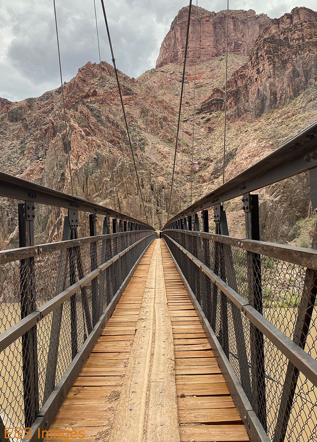
Afterwards, as darkness encroached, I was determined to go out and shoot even if I couldn’t see the sky! I grabbed my camera and tripod and walked across Bright Angel Creek (on the bridge! It’s wider down there!) and went to the Silver Bridge. I had perhaps waited a bit too long, but I took some really long exposures just for fun. Then I went back to the cabin to get a good night’s sleep – breakfast was at 5!
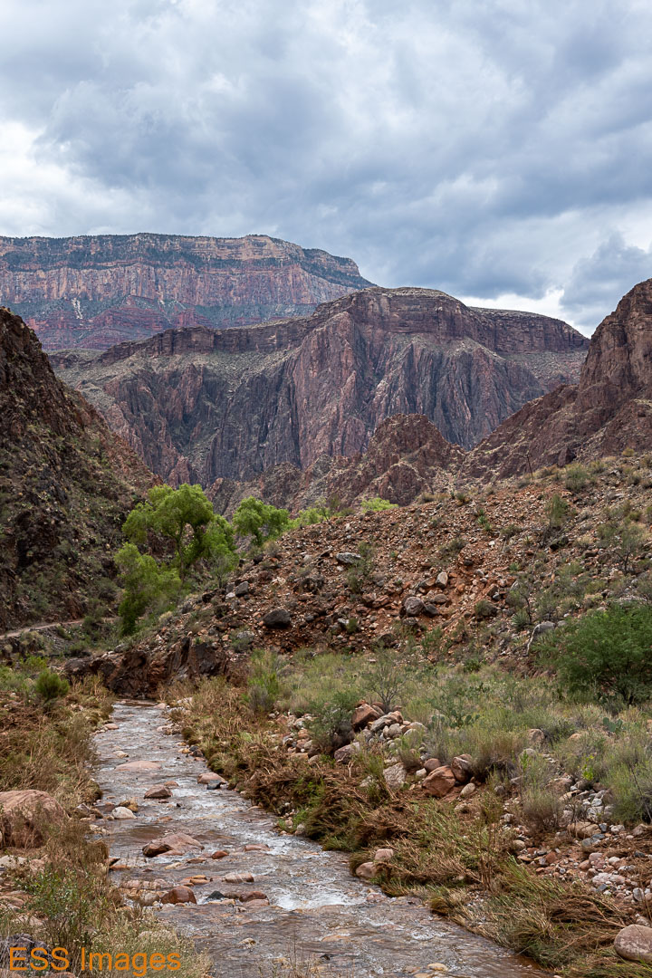
And a fine breakfast it was! Eggs & sausage, some pancakes, orange juice. More carbs than I usually eat in a week, but I was getting ready to climb out of the Grand Canyon, so I didn’t mind. We ate, dumped our trash, and hit the trail. Across the creek, past the campground (temperature: 80 degrees), and over the Silver Bridge to the River Trail.


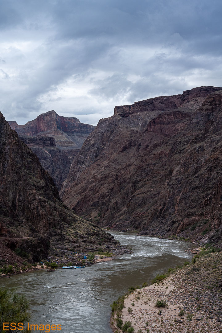
The River Trail, oddly enough, runs along the river for a while. It has a few ups and downs, just a little bit. As we approached the River Rest House, we saw a raft trip group that had been camped by the river. They appeared to be packing up the their tents and getting ready to climb into their (very large) rafts. You can see them in one of the pictures above.
At the rest house, we turned up Garden Creek and Bright Angel Trail. Yes, that’s right: the North Kaibab Trail runs along Bright Angel Creek in Bright Angel Canyon. The Bright Angel Trail runs along Garden Creek in…well, I haven’t found a name for that canyon. And, of course, Bright Angel Point is on the North Rim.
Anyway. From the Rest House (where we didn’t) you start going up. Not all that steeply, 1300 feet in 3.3 miles up to Indian Garden. One thing about this trail, unlike coming down North Kaibab, once you start upwards you don’t find yourself going back down very much. NK had a lot of up in its down!
One tip we had heard about going uphill here was “Don’t look up at how far you have to go – look back and see how far you’ve come!” That seemed like good advice, so we did, mostly. As you can see in some of these pictures:


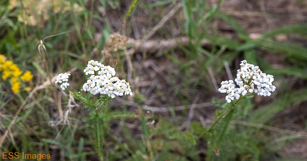
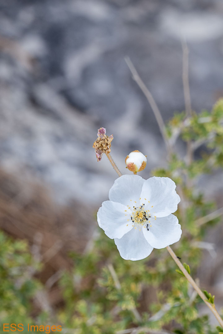
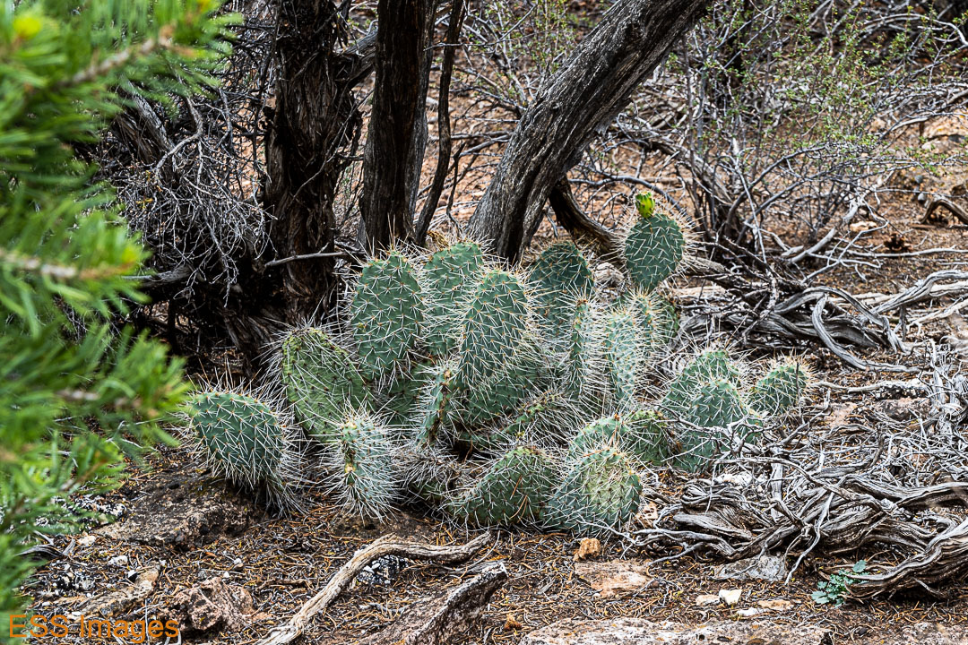
The first water stop you reach is Indian Garden, about 5 miles from Phantom Ranch. After hiking through scrub brush and cactus you suddenly find yourself among trees, and a few wildflowers. From above (as you can see below) it looks like an oasis in the middle of the desert. Which, I guess it is! I filled up my water bottles, anyway. We took a little rest here, chatted with the passers-by. There were a lot more people at this stop than we saw the whole way down North Kaibab the day before! I guess people hike down from the South Rim, or ride down on the mules. From this point onward, there was a lot of…evidence…of mules. Some carrying tourist, some carrying what I assume was supplies for Phantom Ranch. We had to step aside for them a couple of times.
It had been cloudy all morning and as we approached Indian Garden some rather threatening formations loomed over the rim. Finally, they decided to rain on us, just long enough for me to decide to pull out my poncho. As I put it on, the rain stopped. For a moment, I felt very powerful… 🙂 It kept looking threatening, so I kept the poncho on for a while. Eventually it got a little too warm, so I took it off. A little way up the trail, it started raining again! This time for long enough that Leigh got her poncho on too, and we were glad to have them! Fortunately, the trail never got muddy and slippery. And we did have our trekking poles.
After Indian Garden the trail gets a little steeper, about 1300 feet for 1.5 miles. And it’s about 1.5 miles between the water stops the rest of the way. From Indian Garden to 3-Mile Resthouse, then 1-1/2 Mile Resthouse, then the trailhead. We walked and chatted with our fellow hikers, stopped at the Resthouses for water and rest, and just kept climbing – and looking back, not up!

About 2:30 or so we popped up at the trailhead. We stood around a bit, took a few pictures, and then headed over to Bright Angel Lodge. Picked up the bag we had checked, got to our room and immediately went out again – to find an energy drink and some celebratory ice cream! Then we went back to the room and had a celebratory bath and cup of tea. We had a dinner reservation for later, so we rested up.
That night, we went over to the El Tovar Dining Room for a fancy(ish) dinner. It’s a very nice place and it wasn’t very crowded. Having had Buffalo Tenderloin Monday night and a steak down at Phantom Ranch, naturally I had … a steak! The peppercorn filet, quite tasty. Leigh had the tomato basil soup and a shrimp cocktail, also quite tasty. And cheesecake for dessert. And back to our room for a good night’s sleep so we could catch the 8:00 shuttle back to the North Rim to pick up the chariot – and the rest of our luggage.
We caught the Trans-Canyon Shuttle in the morning. I rode shotgun, John (the driver) and I chatted about the sights we were passing, how long he’d lived there, and the kinds of things you chat about on 4-hour rides. John dropped us off at the NK Trailhed, where the chariot and the luggage were parked. We took a quick trip down to the General Store at the campground, got some ice, drinks, and snacks. Then we headed back the way we had just come!
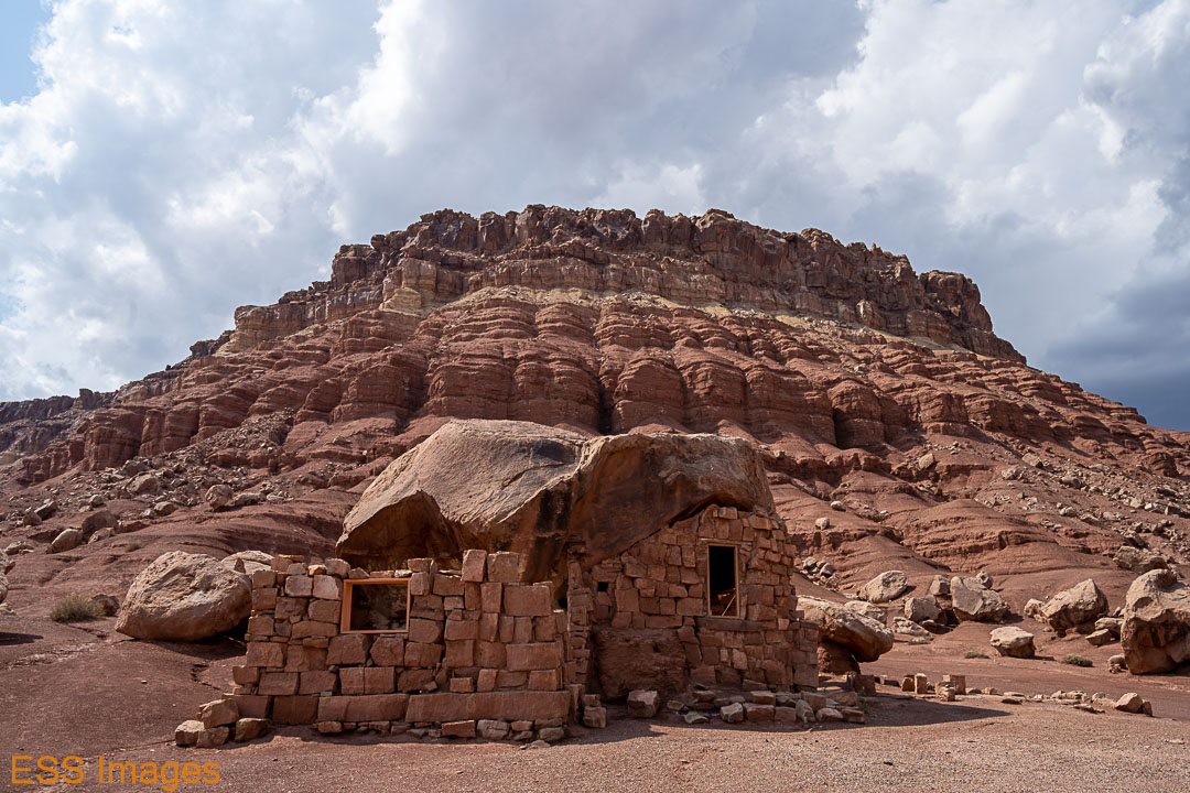
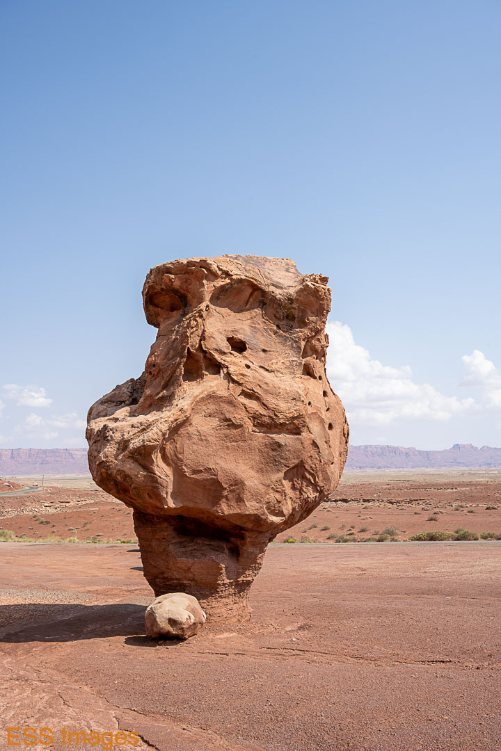
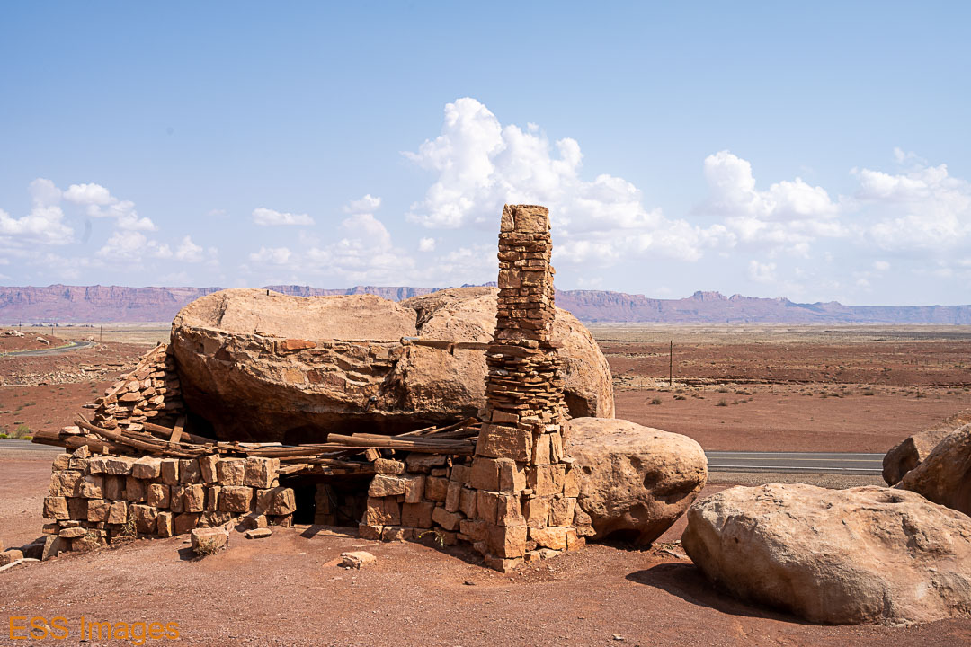
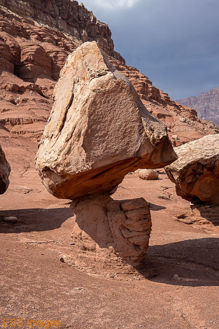
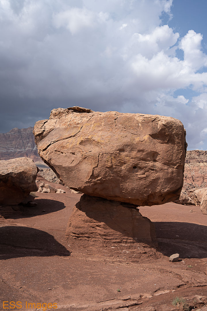
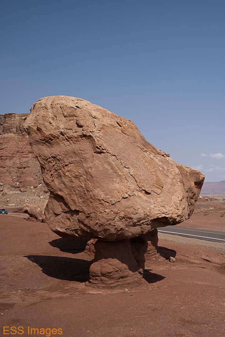
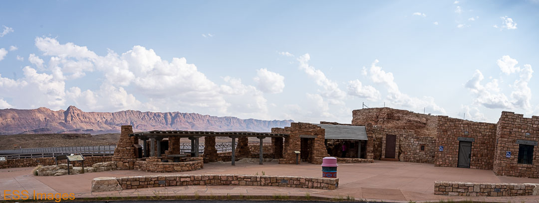
This time, however, we could stop wherever we wanted! For example, on 89a, north of the park, are the “Cliff Dwellers” ruins, old stone buildings built around and under the amazingly shaped boulders strewn across the area. And several Navajo selling jewelry. Of course, the Vermilion Cliffs are all around.

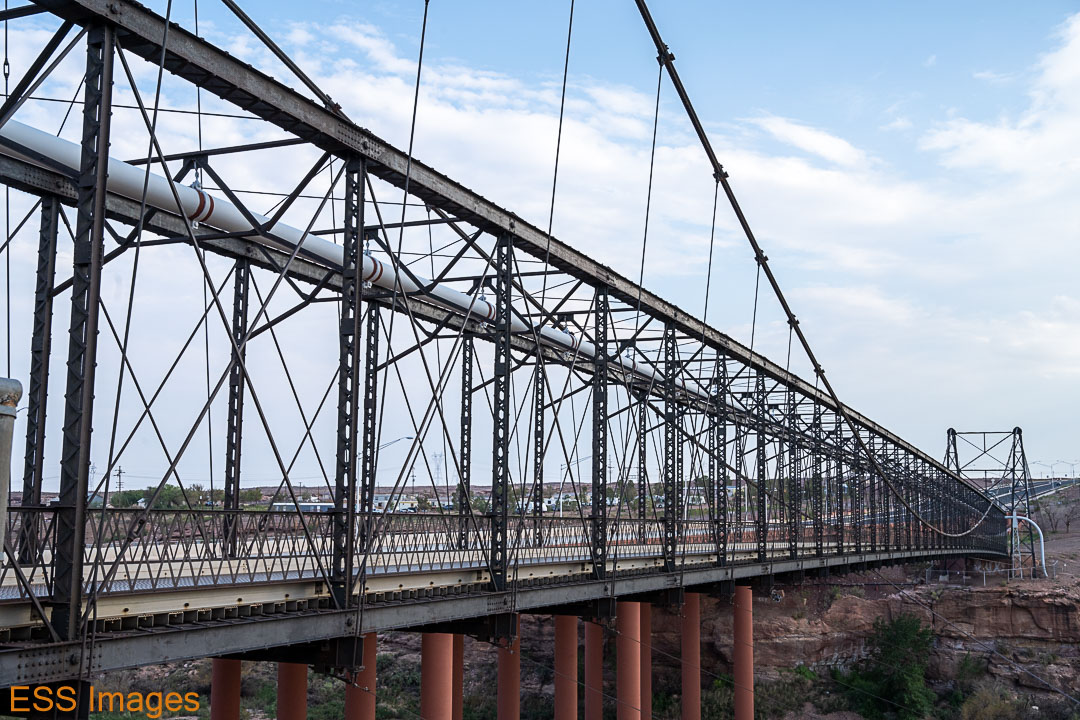
The next stop up the road is the Navajo Bridge(s). The original bridge was built in 1927/28 and was used up until 1995, when the new bridge opened. It was only 18 feet wide, which was then adequate for a bridge with unpaved roads on either side! When they decided it was no longer suitable, a wider but otherwise similar bridge was constructed less than 100 yards downriver. See the photos for comparison! And the “Wayside Observation Shelter” was built between 1939-41 by the Civilian Conservation Corps.


Our last stop before we turned back toward the South Rim was the Cameron Suspension Bridge in Cameron. The town came after the bridge, which was named after a U.S. Senator. Though it later became part of US Route 89, it was originally out in the middle of nowhere,at the edge of Navajo and Hopi land. It provided+ a safe way to cross the Little Colorado River, especially for sheep and cattle. Having been replaced in 1959, it now carries only a gas pipeline.
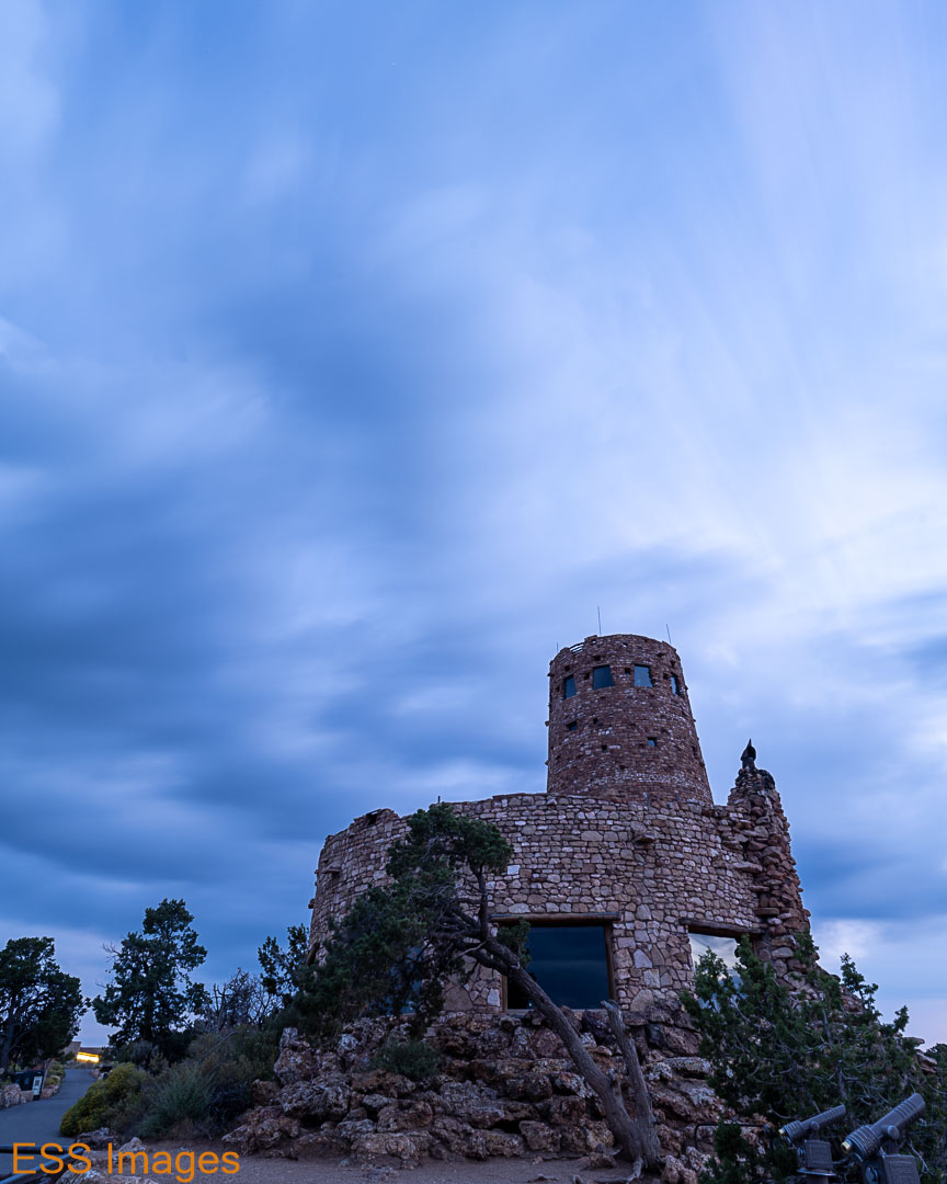
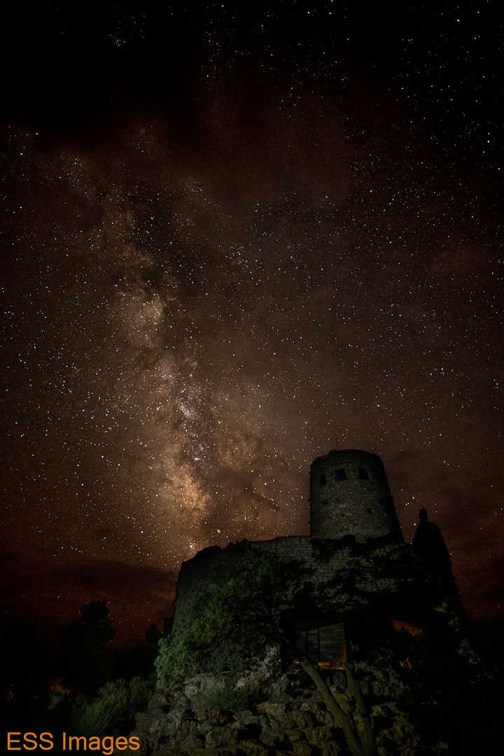
A couple of miles south of Cameron is the turnoff for AZ64 back to the South Rim of the Grand Canyon. I wanted to be at the Desert View Watchtower for sunset, and we made it in plenty of time. The Watchtower was built in 1932, designed and supervised by Mary Elizabeth Jane Colter, “The Architect of the Southwest.” It was designed to blend into its surroundings and be a place of rest – I can attest to the first but not the second, as it closed well before we got there.


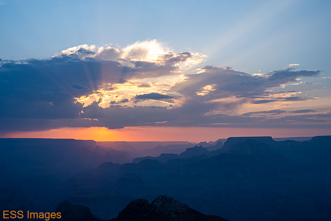
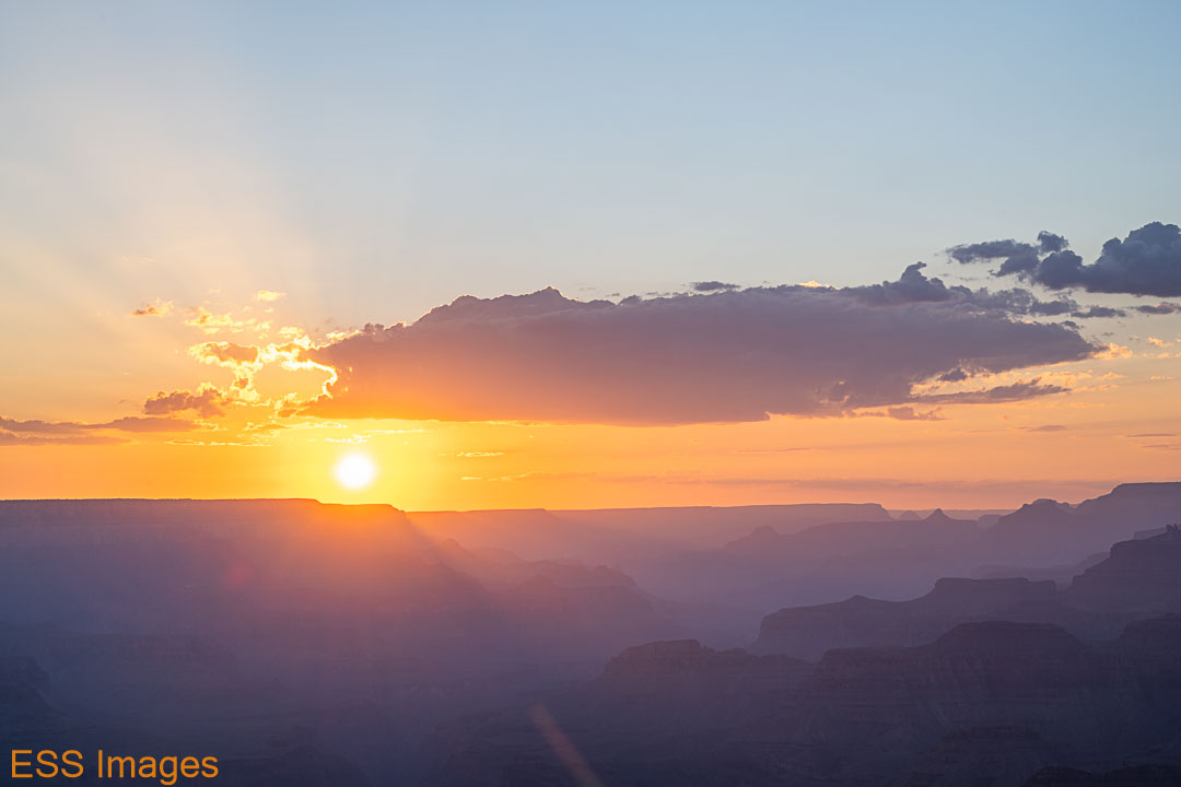
So we found a nice place near the tower to watch the sunset with a couple dozen close friends! Hazy, still, but a lovely sunset nevertheless. Then we went out to a different spot to take some shots of the watchtower and the sky. The clouds were dense and moving quickly. Not as quickly as I would have liked – I had hoped to get some Milky Way shots, but well past dark it was still too cloudy. So I packed up my gear and we walked back to the car. I was feeling a bit discouraged and we sat there talking for a while. We kept looking up and finally the clouds started to break up a bit and I decided to drag the gear back down to the spot. It never did really clear up, but I got some interesting shots…
Our last day on the South Rim, we decided to sleep in a bit and then go to the El Tovar for breakfast. The Eggs Benedict was (were?) quite good. And Leigh would recommend the French Toast! Afterwards we went out to Grandview Point. The view is lovely, but we were really there for the hike!
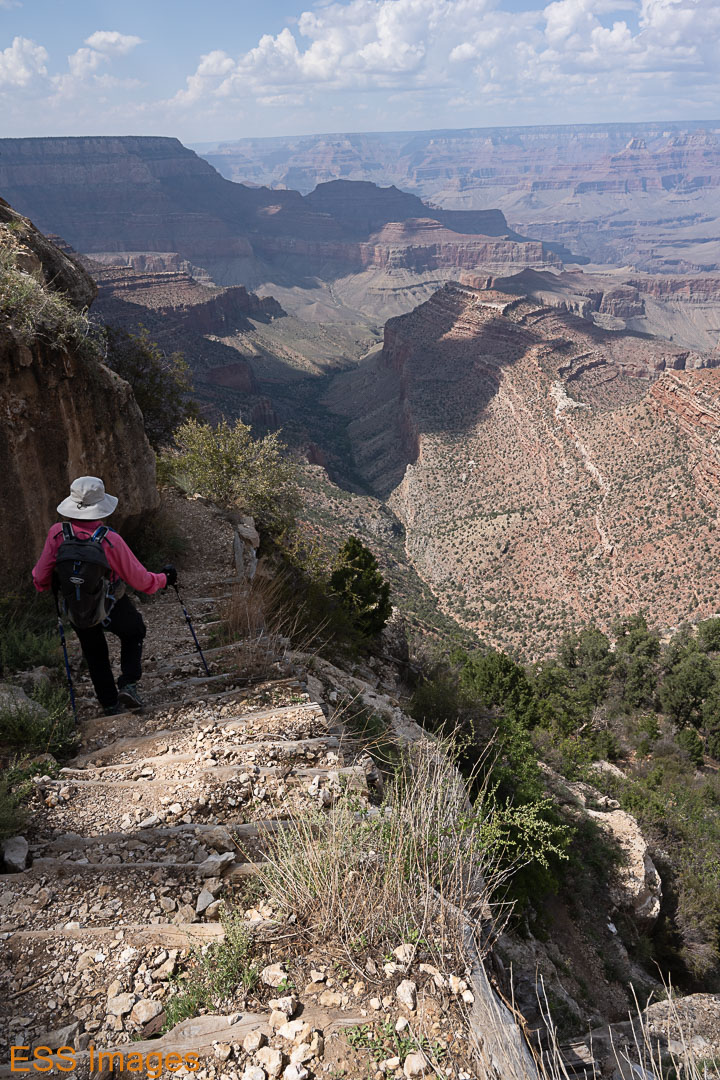
There’s a trail from Grandview Point down to Horseshoe Mesa(Alltrails). It’s a great trail – if you’re good with heights! we only went down a little more than a mile, but that was 1200 feet in elevation. And some sections of the trail are…very narrow. And some of the slopes alongside the trail are pretty much straight drops. So, don’t look down! It was a fun hike going down and a challenging hike coming back up. Next visit, we’re going to do the whole thing…


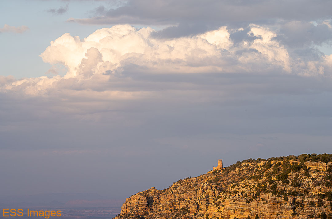
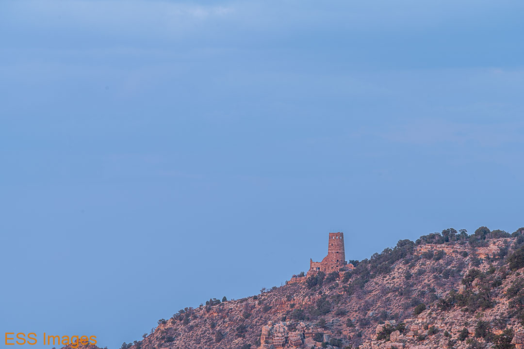
After the hike, we kept moving along the rim, first to Moran Point, then to Lipan Point. From Lipan point we watched the sunset and the changing light on the Watchtower, which was visible across the way. Another hazy sunset, but still lovely. the clouds behind the Watchtower didn’t catch much color, alas! After sunset, the sky clouded up more and we went back to the lodge and prepared for the journey home.
And so we bid a reluctant farewell ( as the old travelogues said) to the Grand Canyon. Our route back to Flagstaff took us past the San Francisco Peaks, that show up in the (distant) background of some of my shots from the north rim. Then we dropped the chariot at the (small) rental lot at the (not large) airport (Flagstaff was definitely the way to go) and jetted our way home.
