Joshua Tree

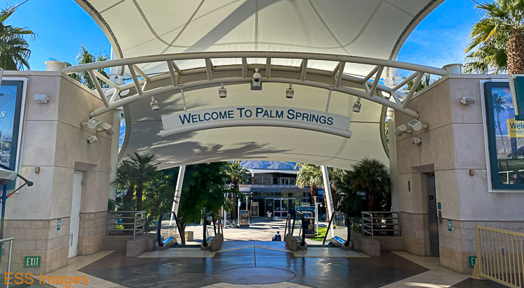
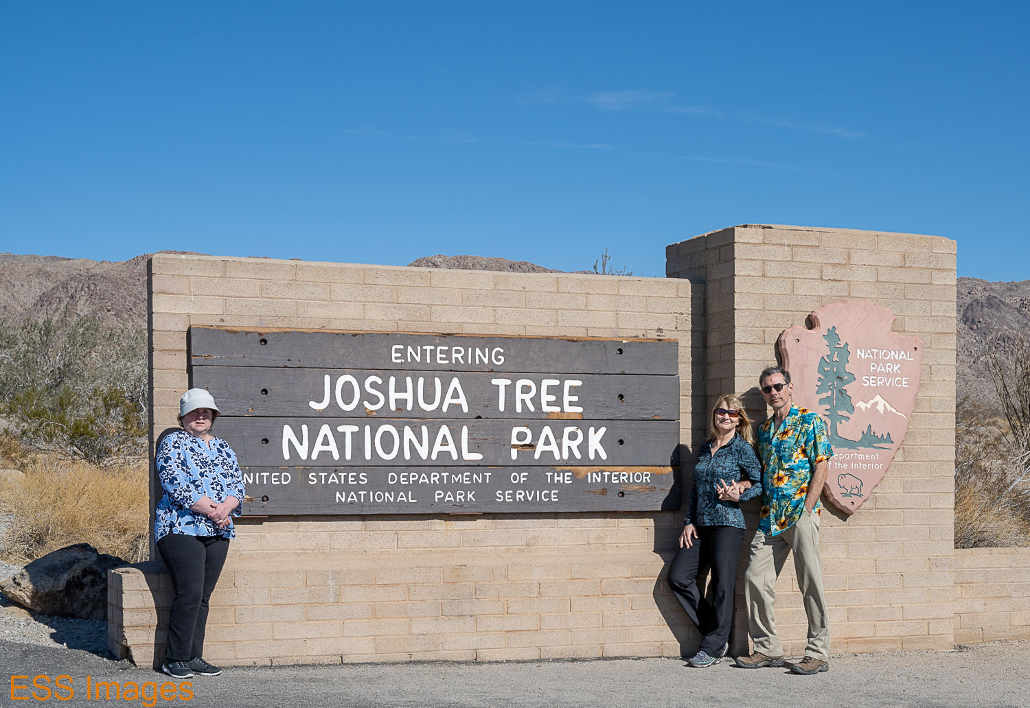
So, a friend of mine says (via email), “Hey, want to meet me in Palm Springs?” Leigh and I look at each other. “Weeeelllll…” Then I remember – Palm Springs is right next door to Joshua Tree National Park! Let’s do this thing! Even better: reasonably-priced direct flights from DFW! And our friends in Temecula will be around that week!

It was a little cool when we get off the plane and I thought “I wonder what the temperature is outside. Oh, wait, I am outside!” 🙂

We flew into Palm Springs (along with a large group heading to the Twentynine Palms Marine Corps Training Center), grabbed a car (with appropriate paperwork, don’t be alarmed!) and went to visit Temecula (about 90 minutes away). After several delightful hours with our friends, we drove the two hours up to Twentynine Palms, where we spent the next three nights.

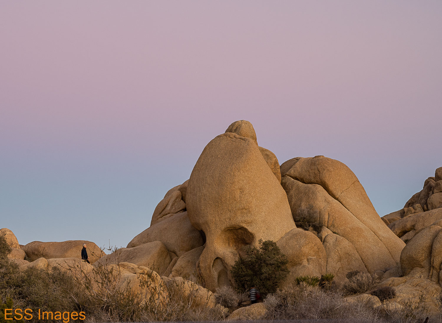
Twentynine Palms is conveniently located near the North Entrance to the park, while Palm Springs is really not close to any entrance. The town of Joshua Tree is close to what they call the West Entrance, though it’s also pretty far north! There are numerous hotels & motels along highway 62, and they weren’t crowded this week. Which seemed a little odd, the popular spots in the park seemed well populated with tourists! Especially Skull Rock…

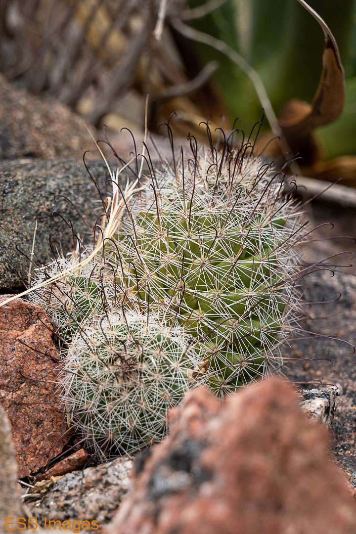
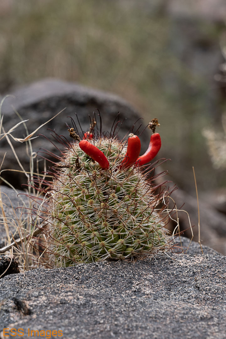
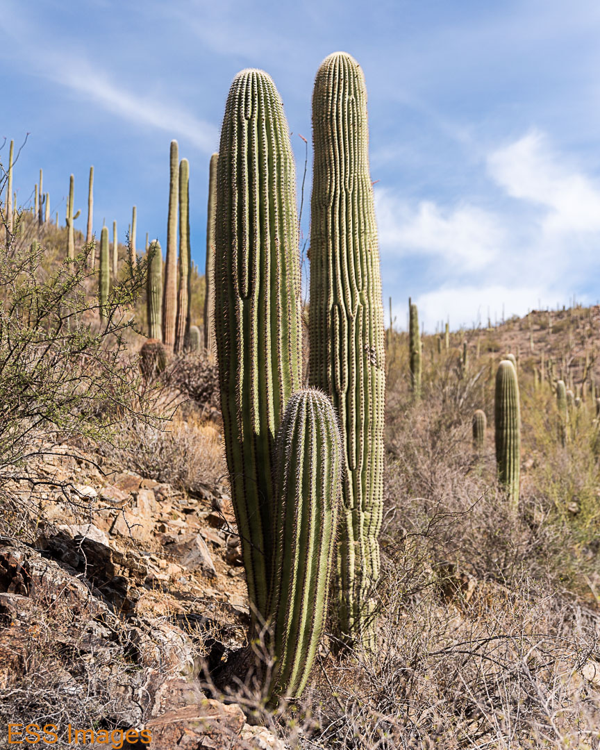
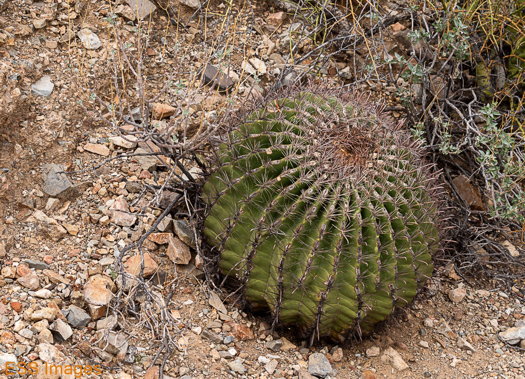
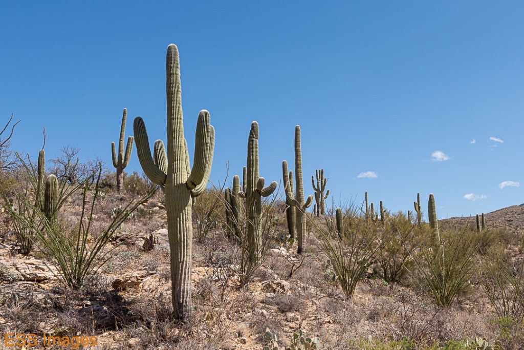
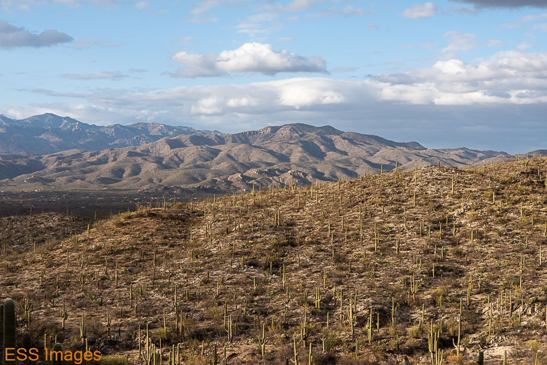
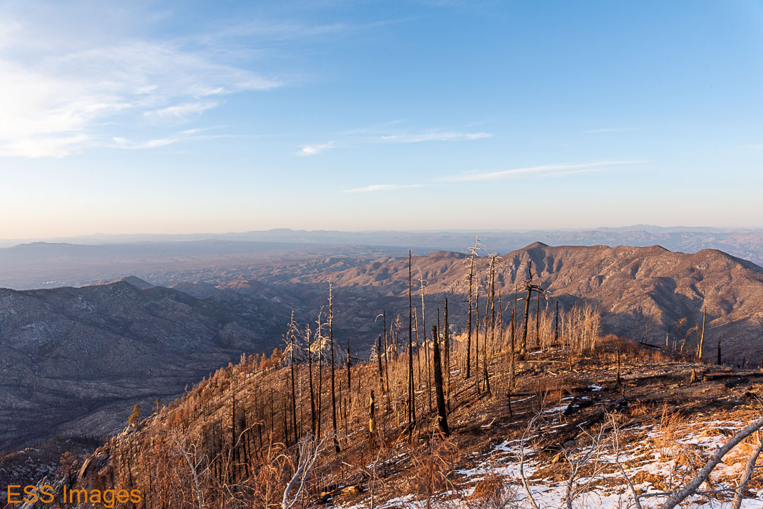
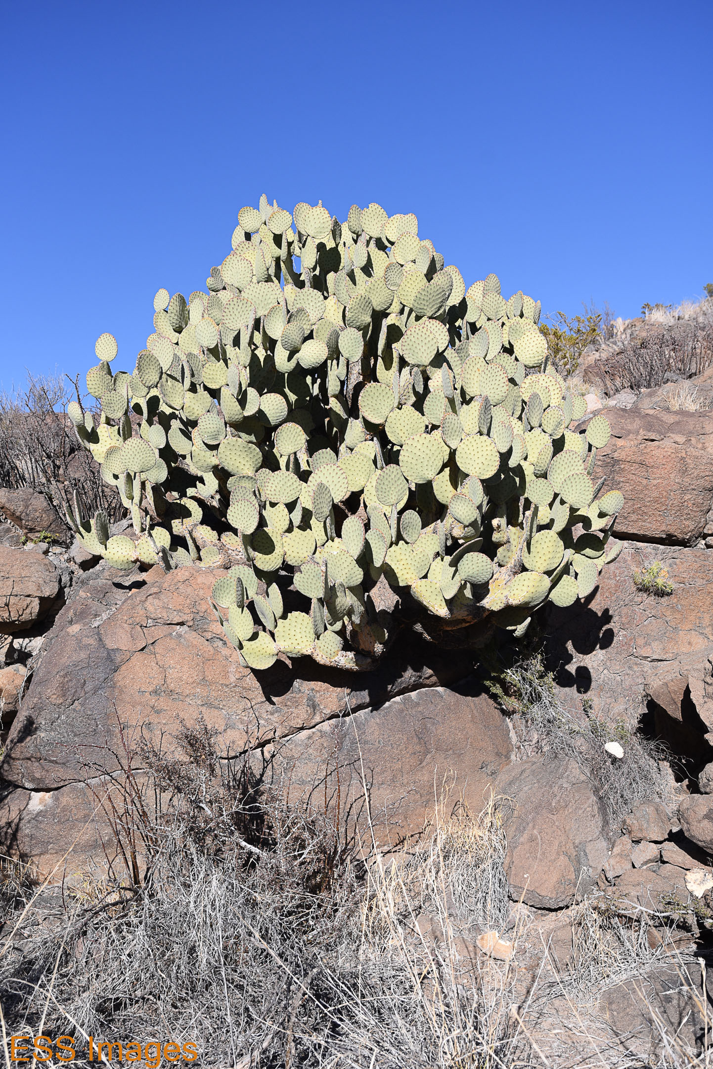
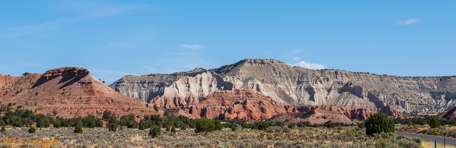
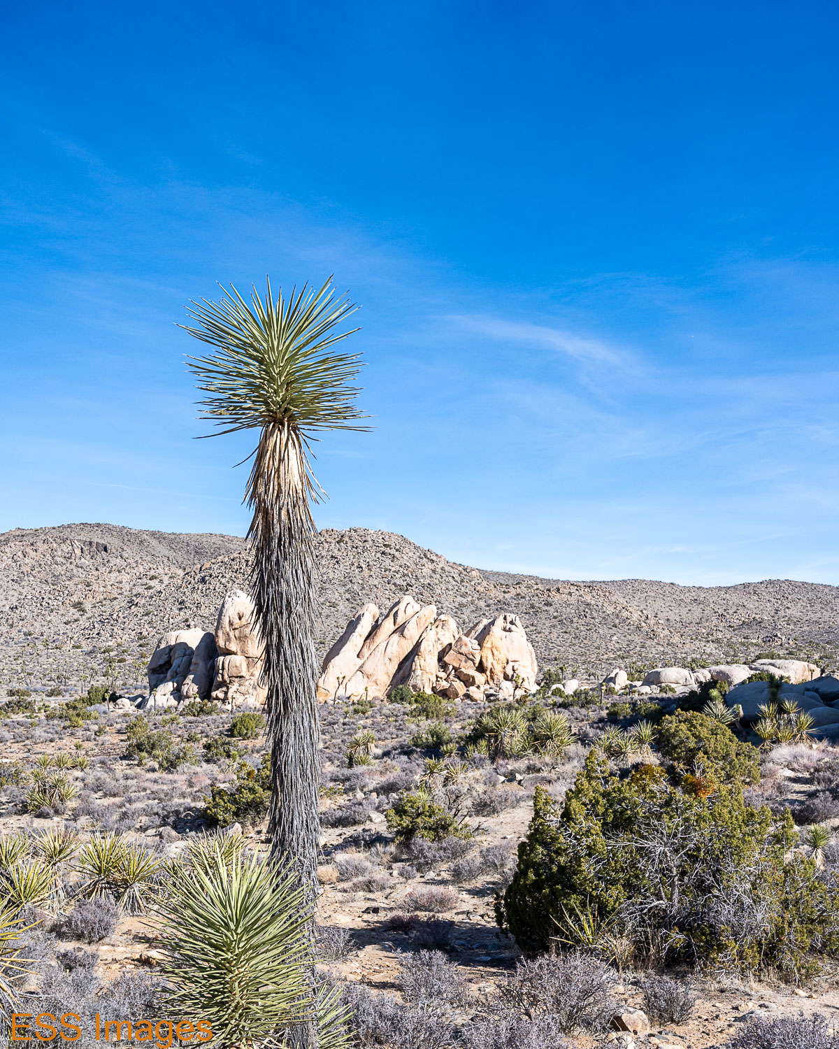
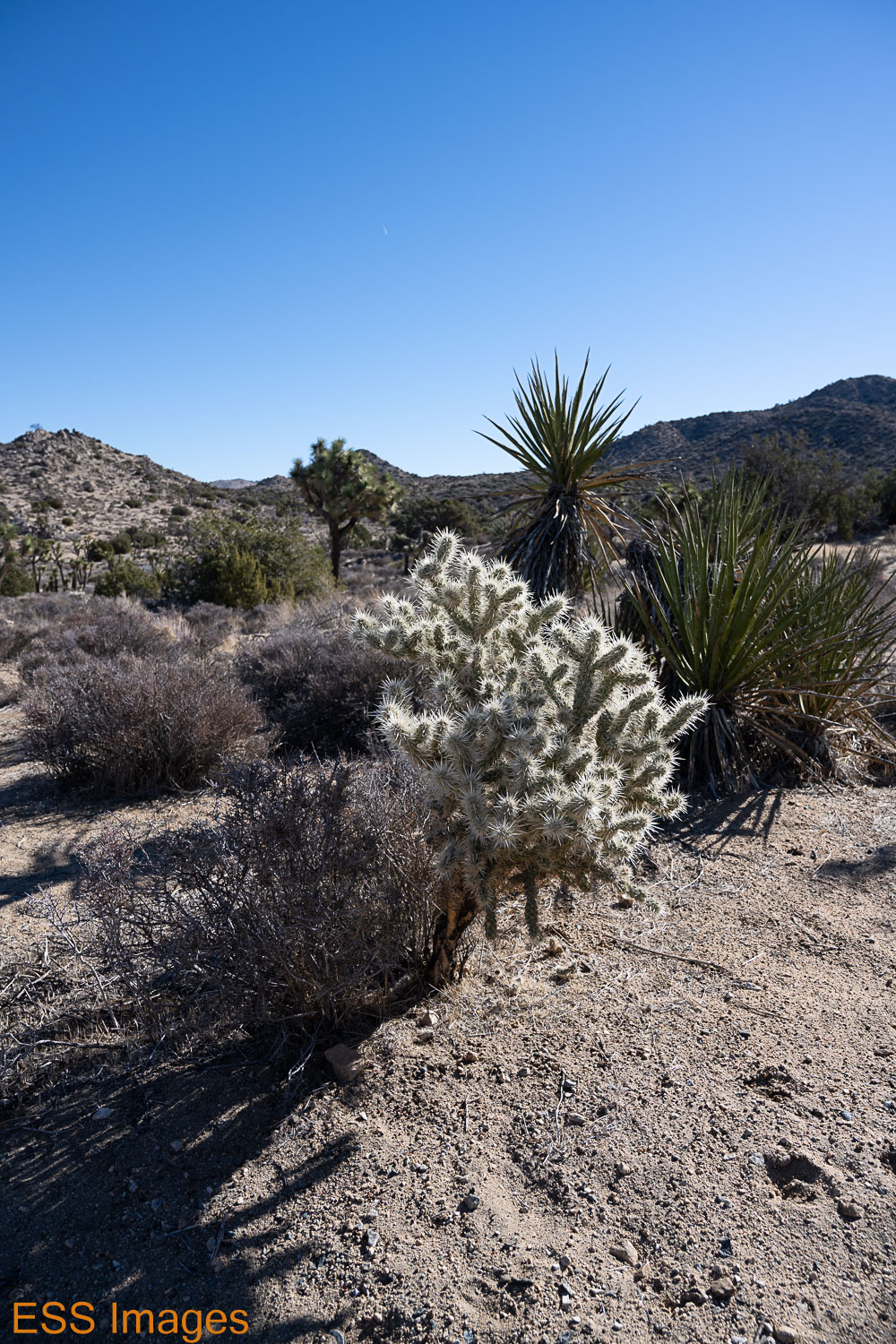
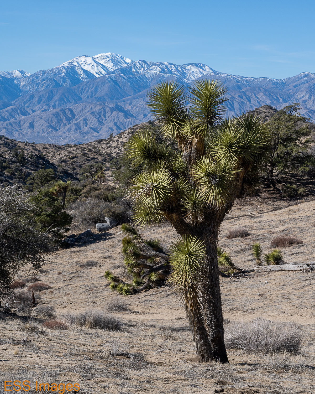
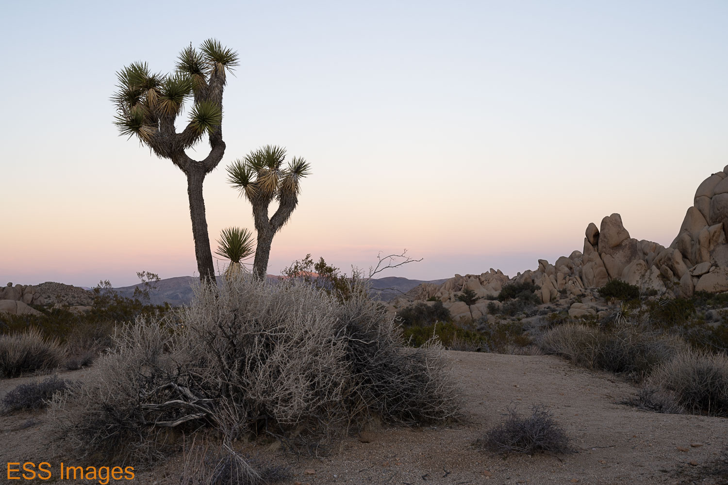
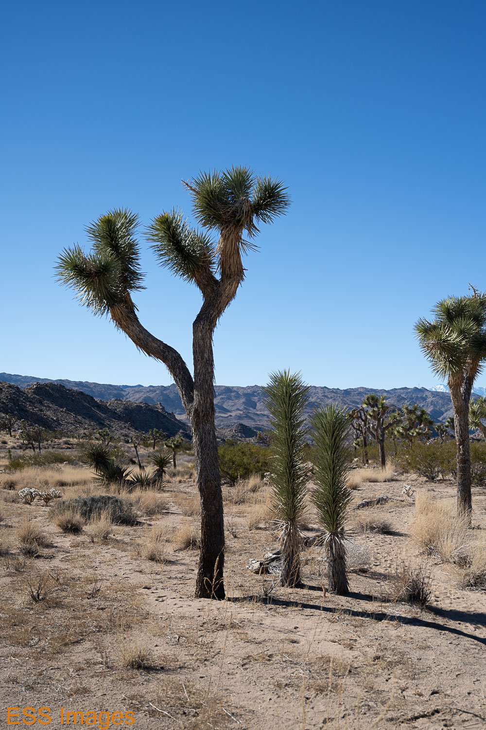
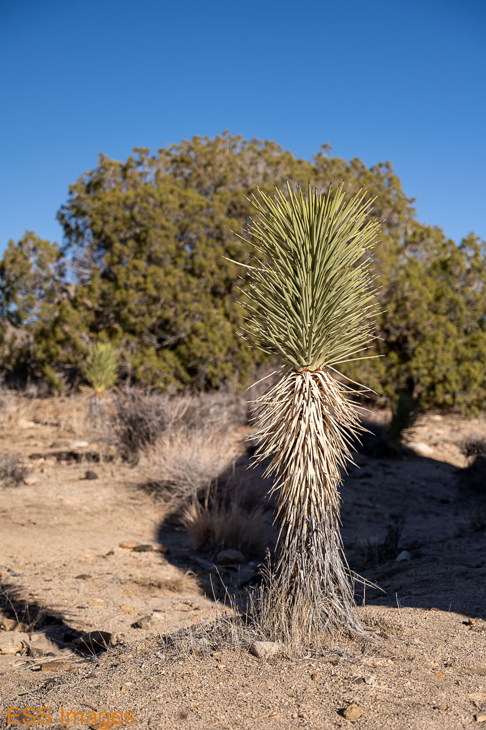
As the NPS will tell you, Joshua Tree contains parts of two different deserts – the Mojave and the Colorado (which is part of the Sonoran desert). The Mojave is at a higher altitude, so it’s a bit cooler and wetter…well, damper – it averages less than 5 inches of rain a year. And it has Joshua Trees! The Colorado Desert gets 2-3 inches, and has Ocotillo and more Cholla!

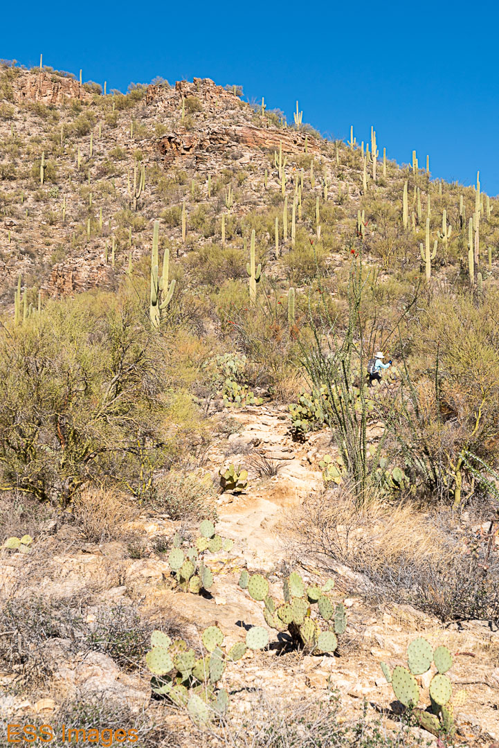
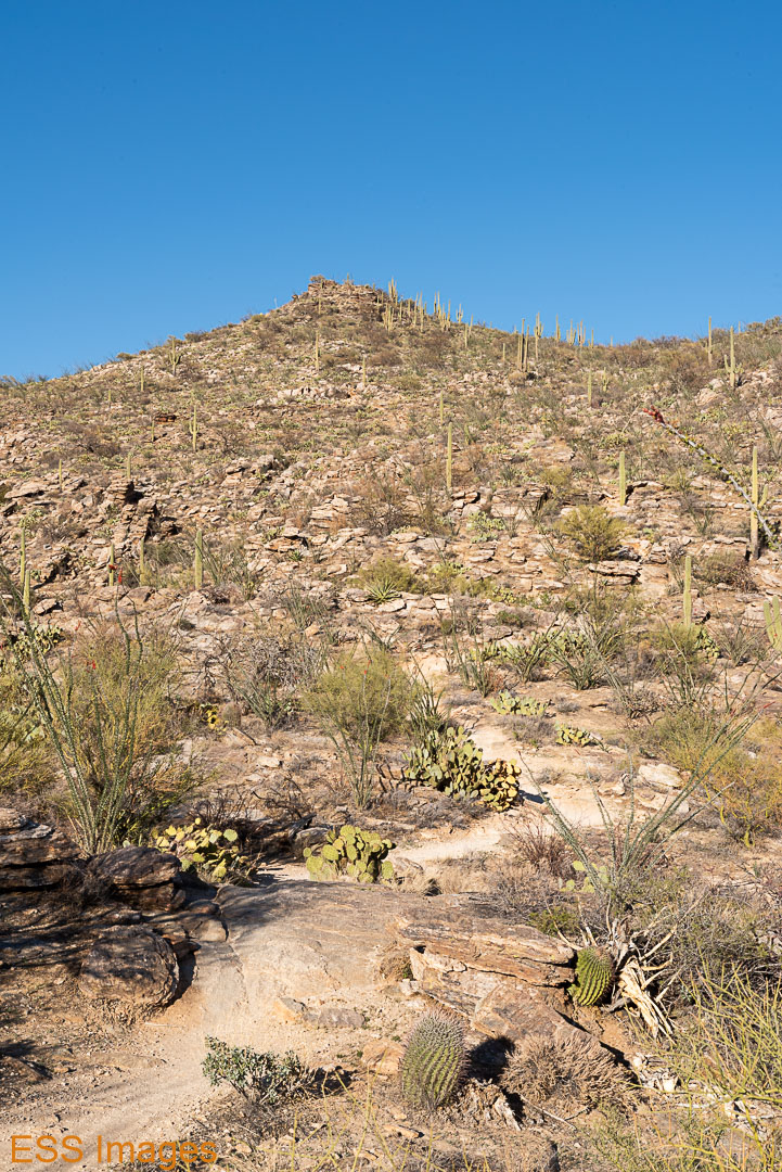
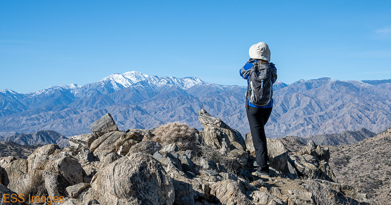
Bright and early the next morning, we slept in – it was cold out there! After giving it some time to warm up, we headed over to the Ryan Mountain Trail. Highly rated by our friends at AllTrails, it’s only 3 miles (out and back), just over 1000 feet in elevation. The top is over 5400 feet and we were just in from the lowlands in Dallas, so we thought it best not to go too extreme!

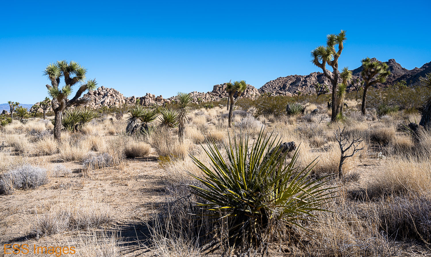
The parking lot was pretty full when we got there, but we found a spot. The trail was busy but not crowded. It starts uphill pretty much right away, passing between some rock outcroppings, yuccas, and a sprinkling of Joshua Trees.

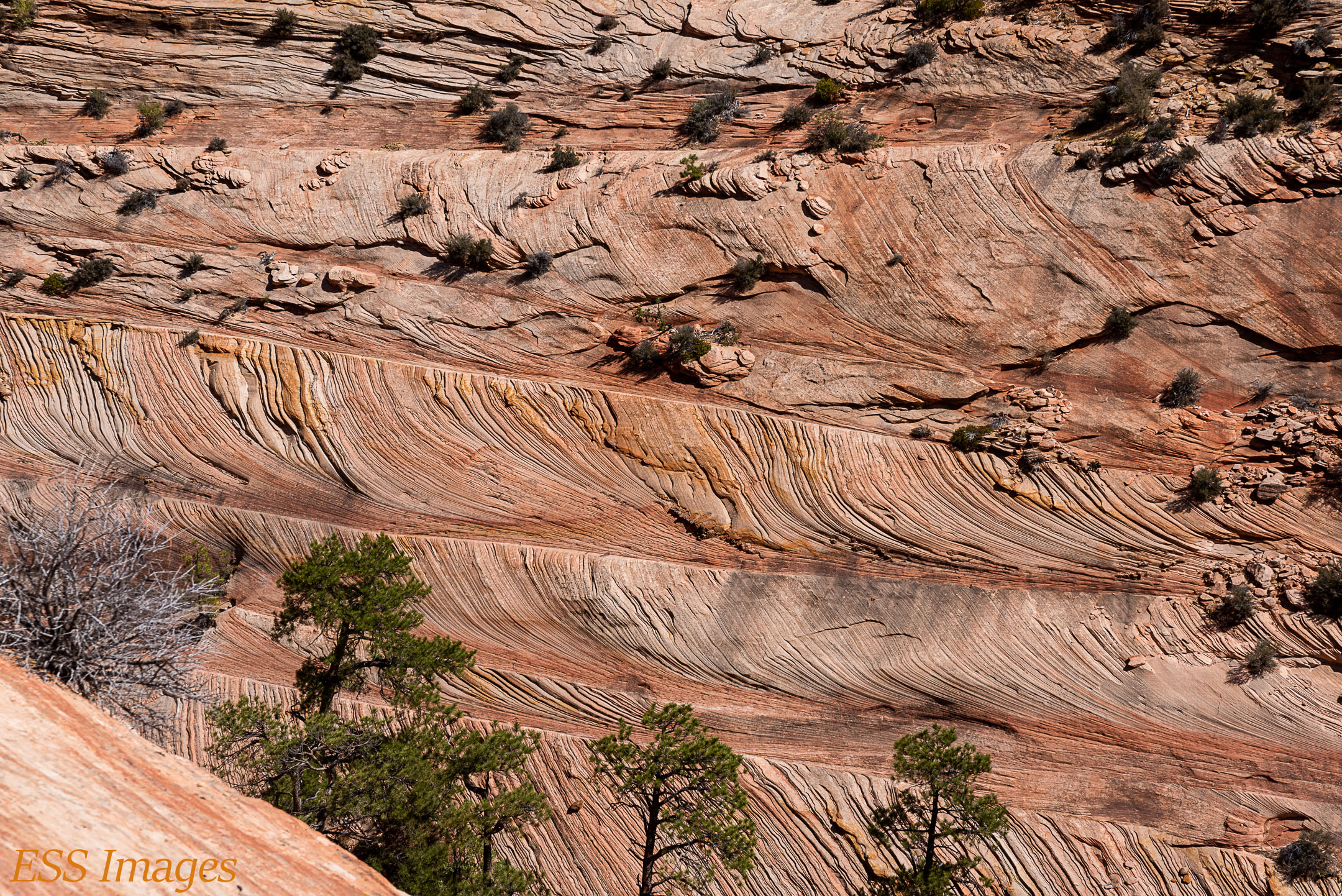
It’s well-defined, a bit rocky in places, and mostly a gentle slope. The views off to the west are amazing!

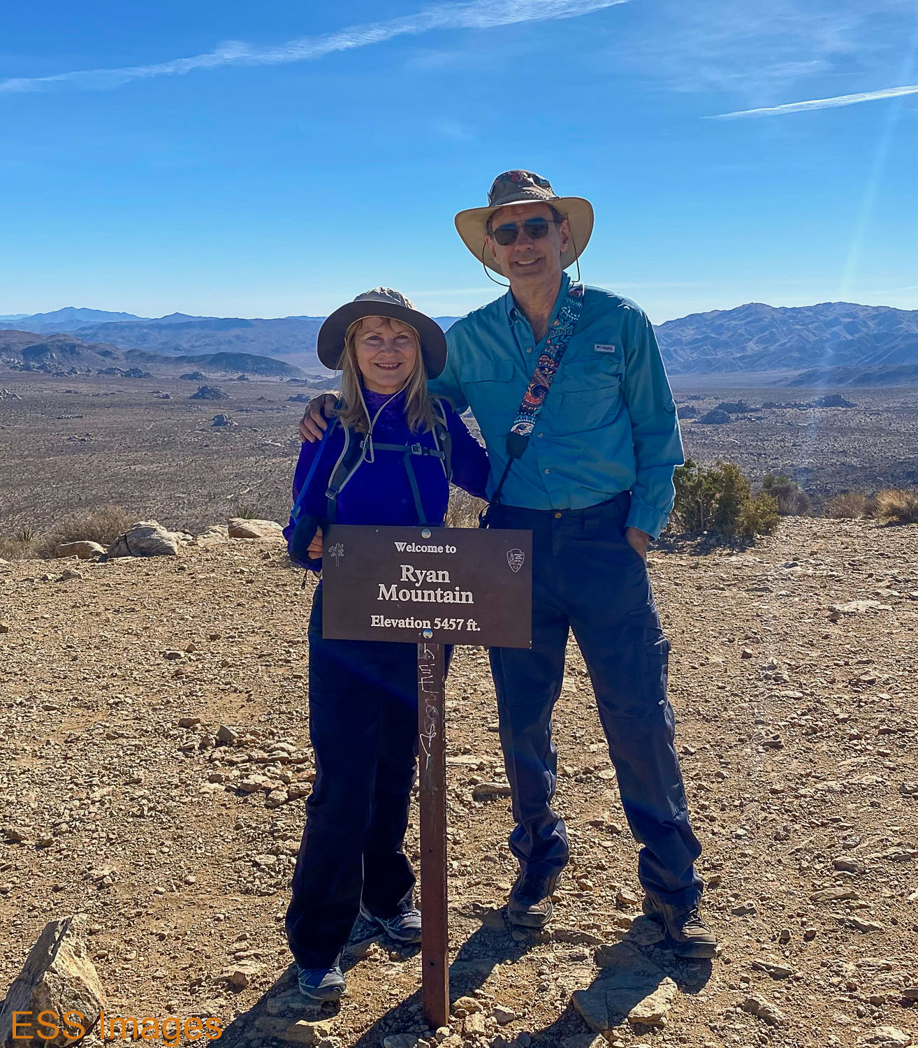
At the top we rested a bit and took other people’s pictures at the “Welcome to Ryan Mountain” sign.

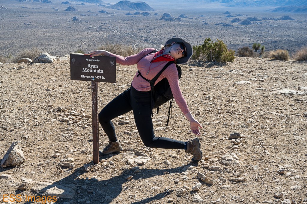
For example, this is our new friend Megan Trout, a voice actor, narrator, and theater performer in the Bay Area.

And, of course, the view from the top!

And then, as usual after walking up a mountain, we walked back down again!

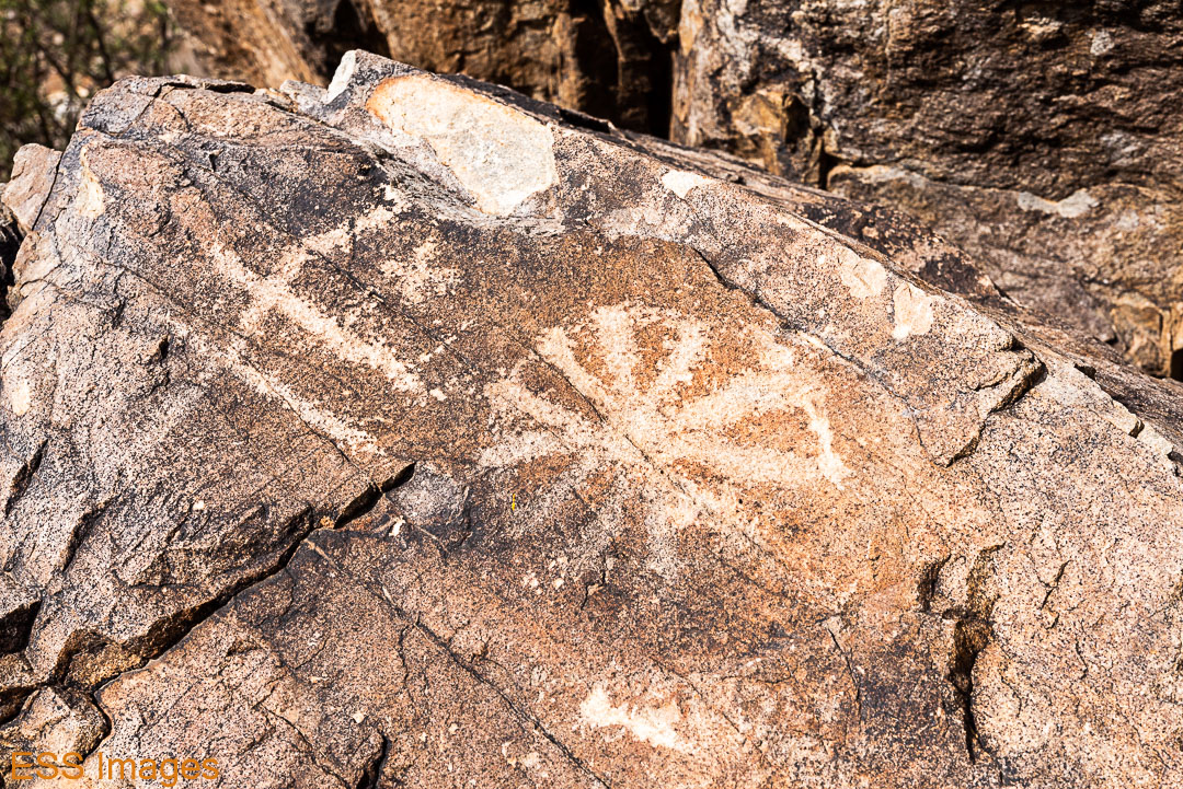
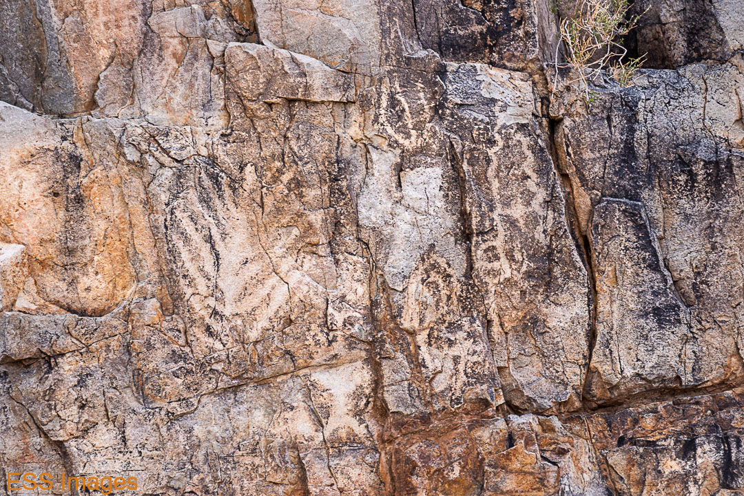
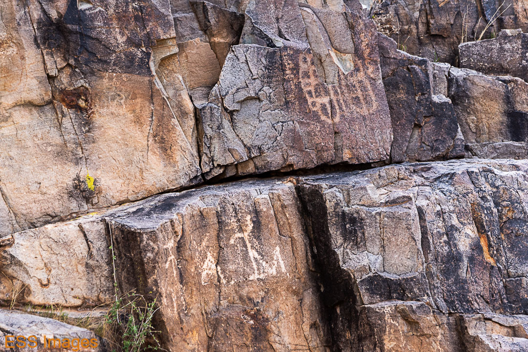
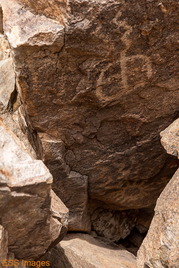
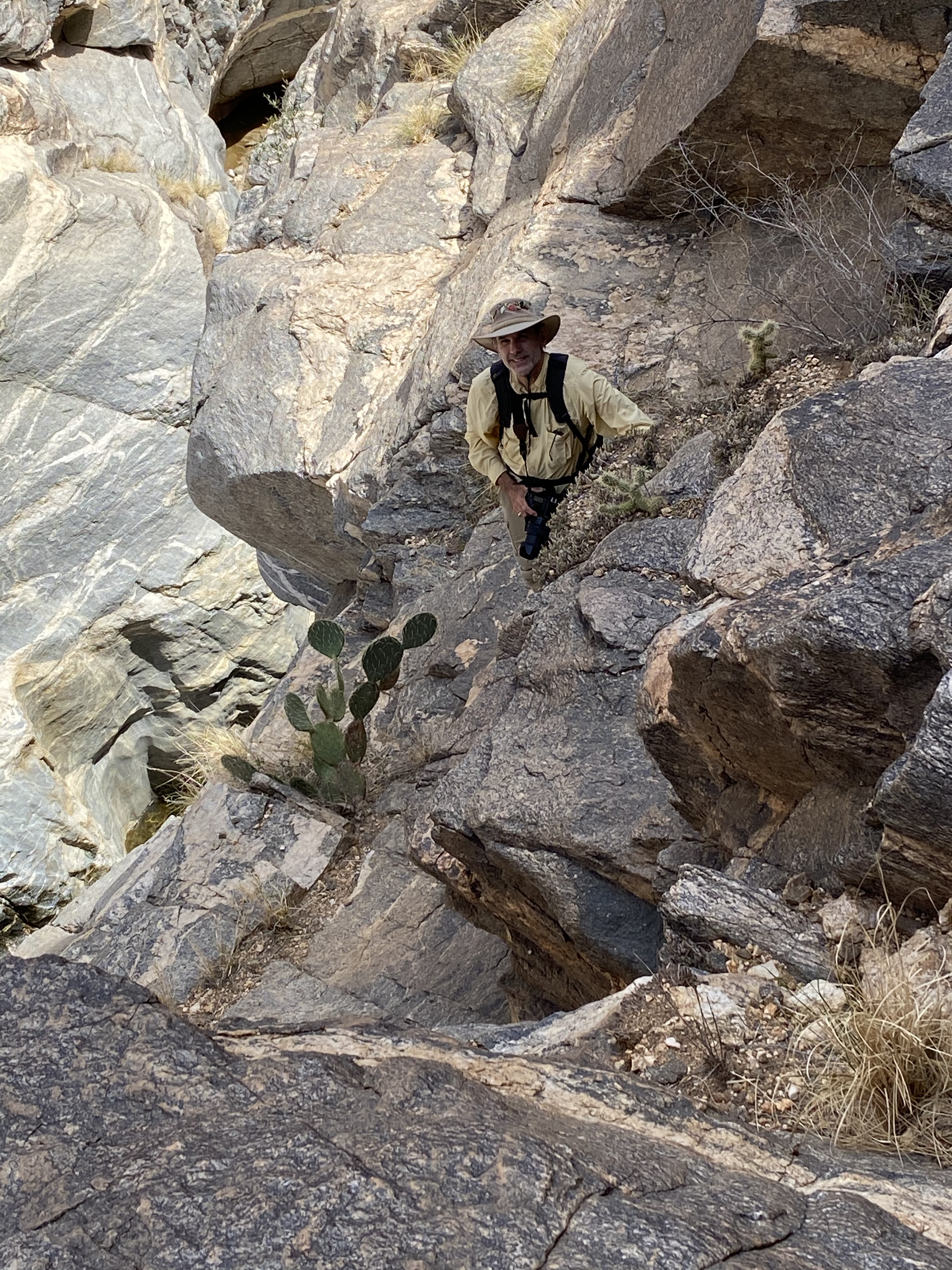
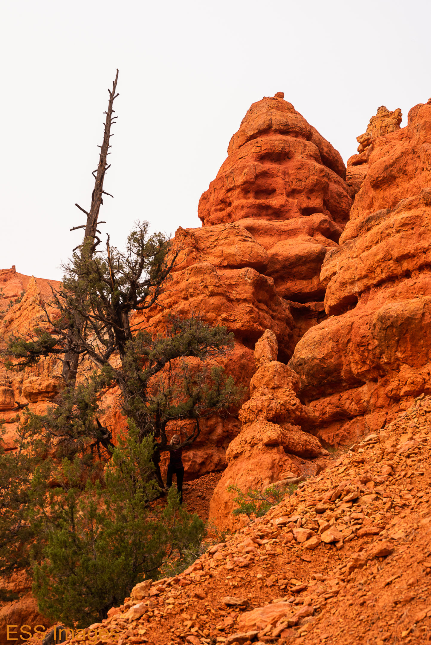
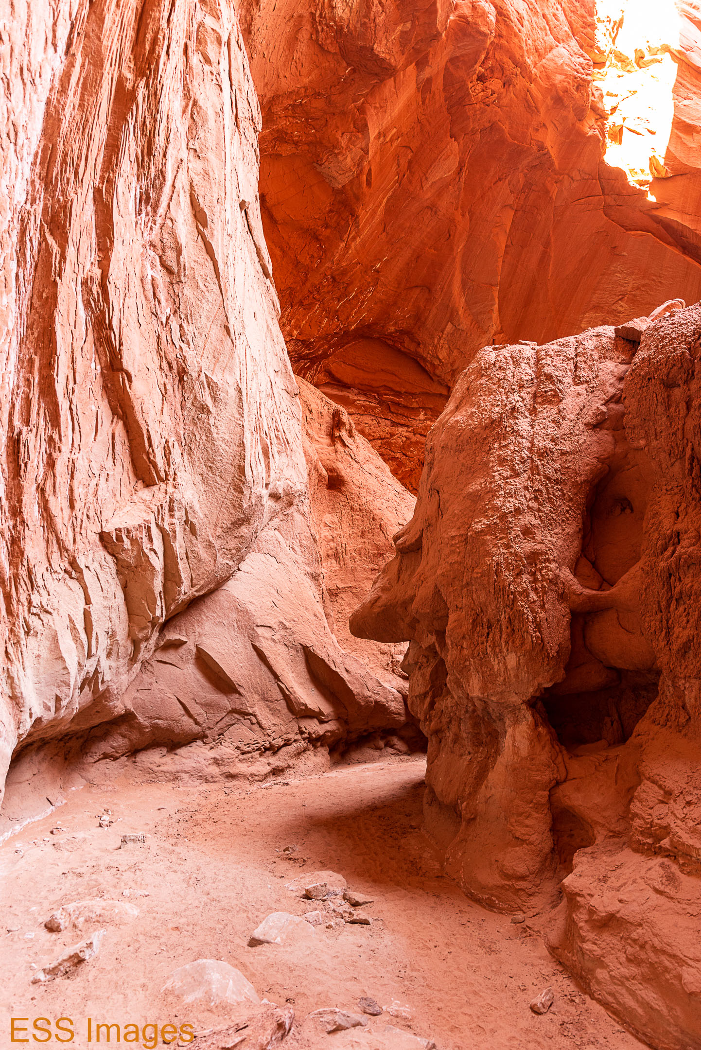
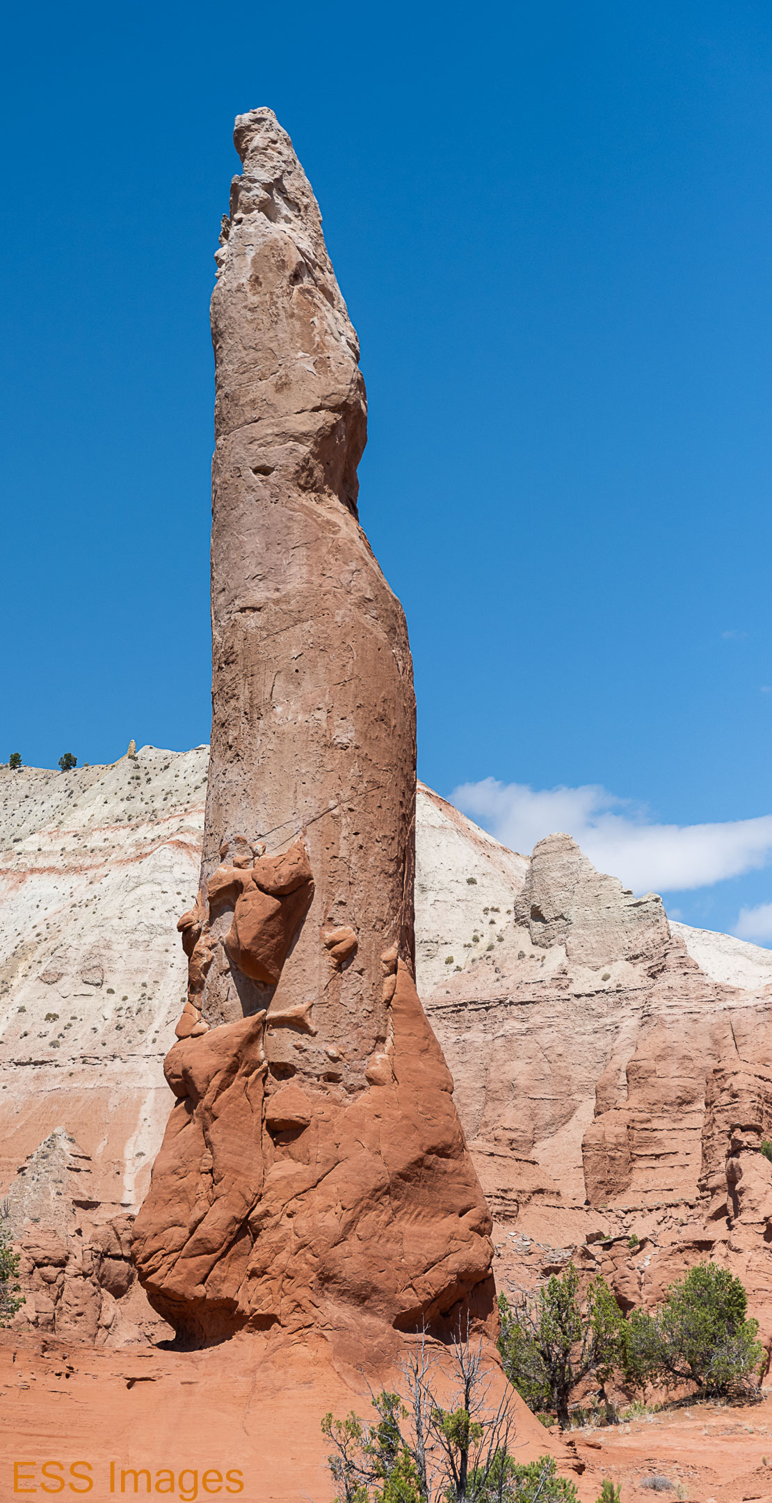
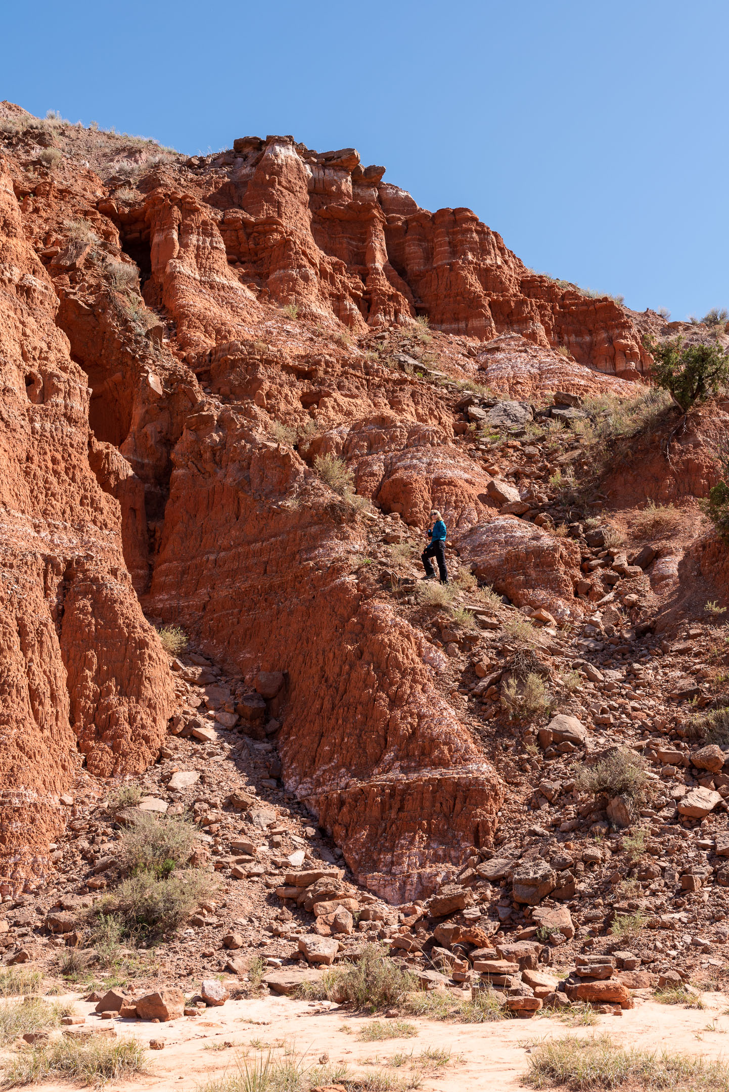
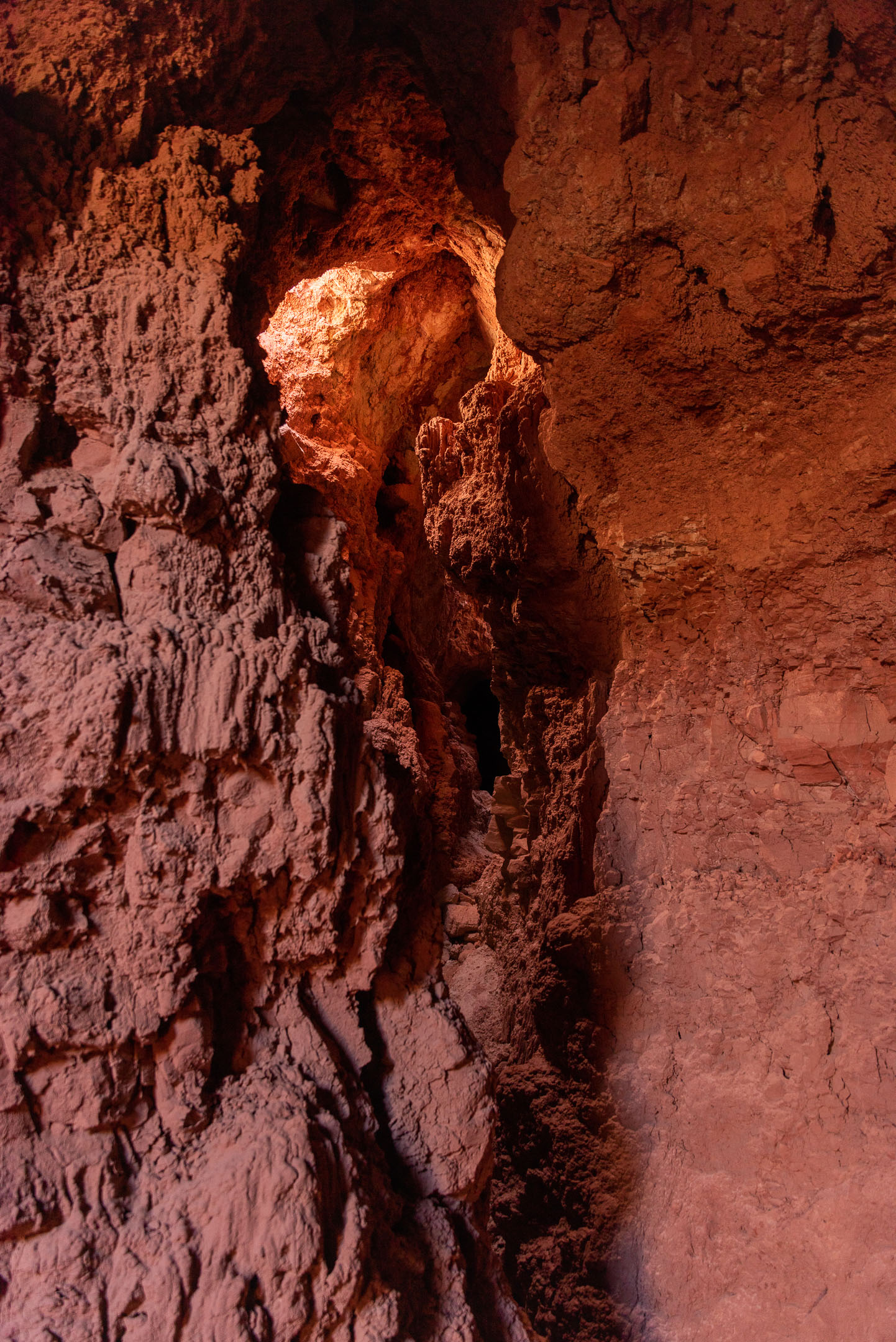
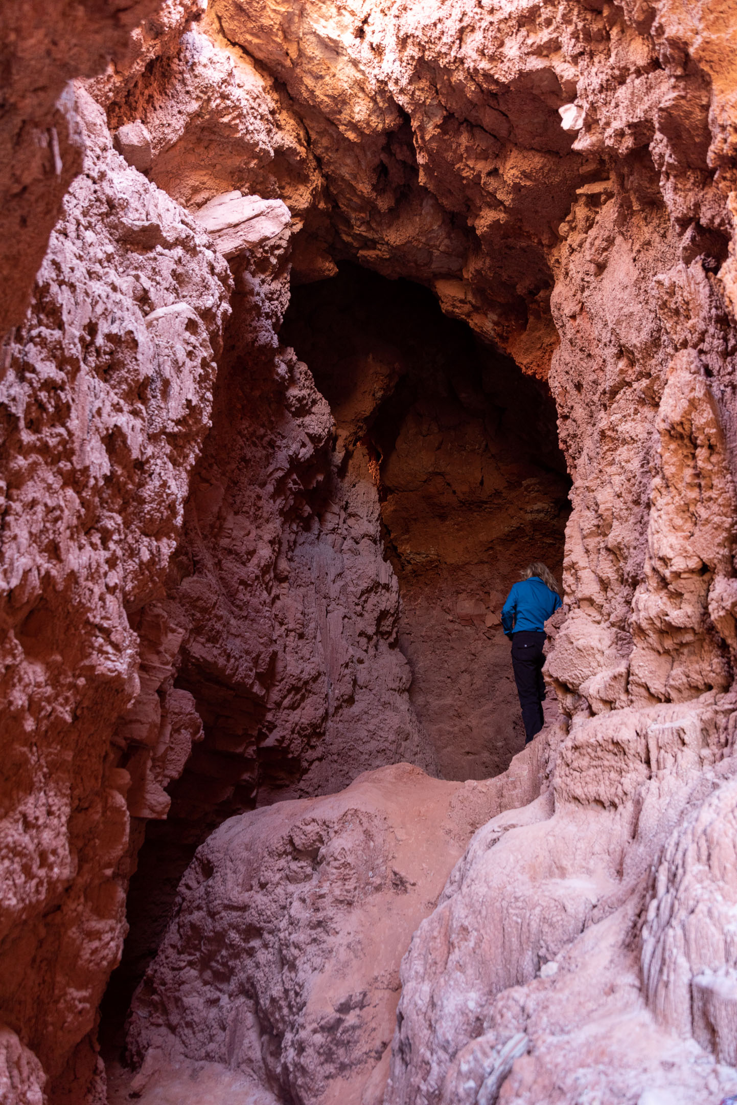
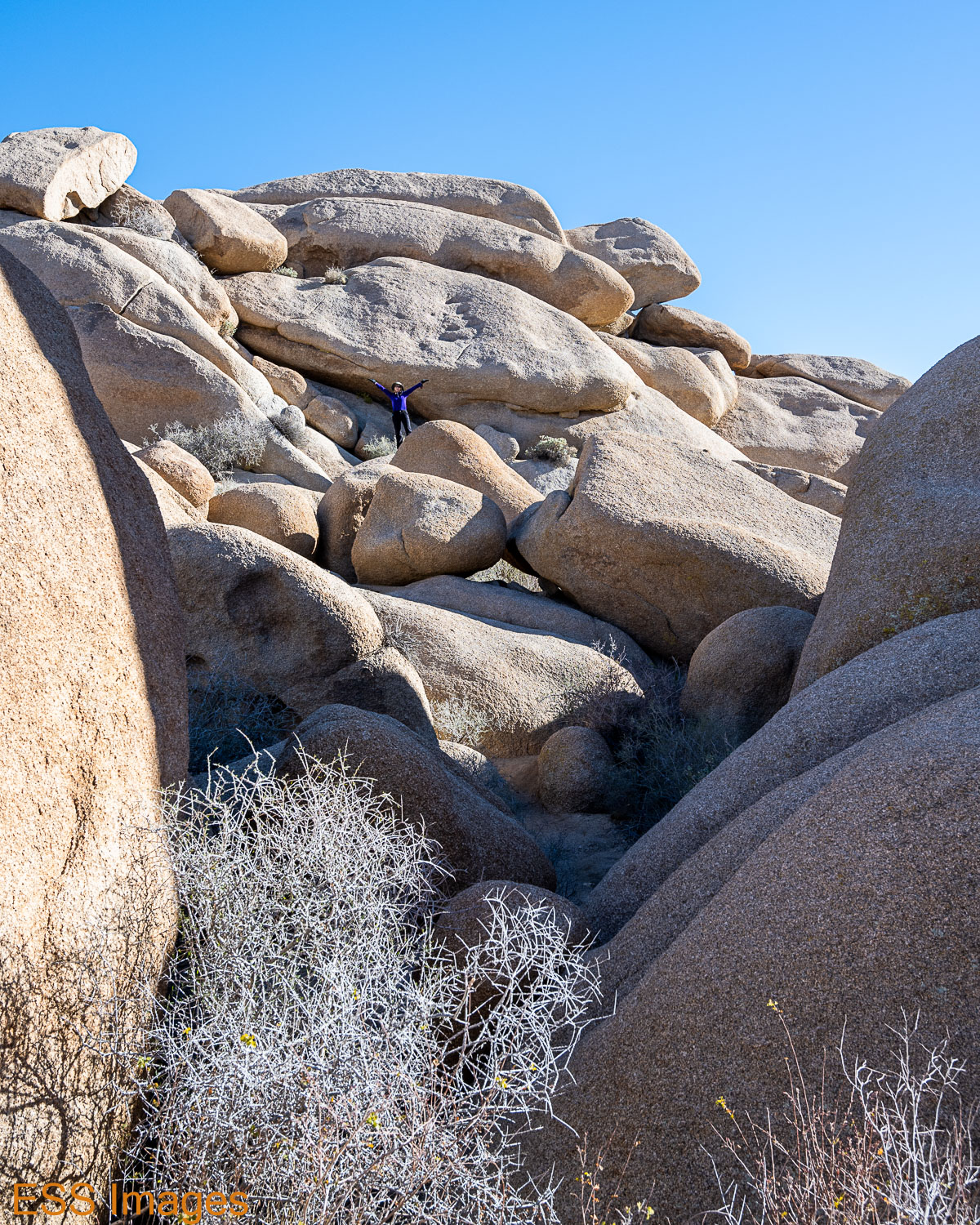
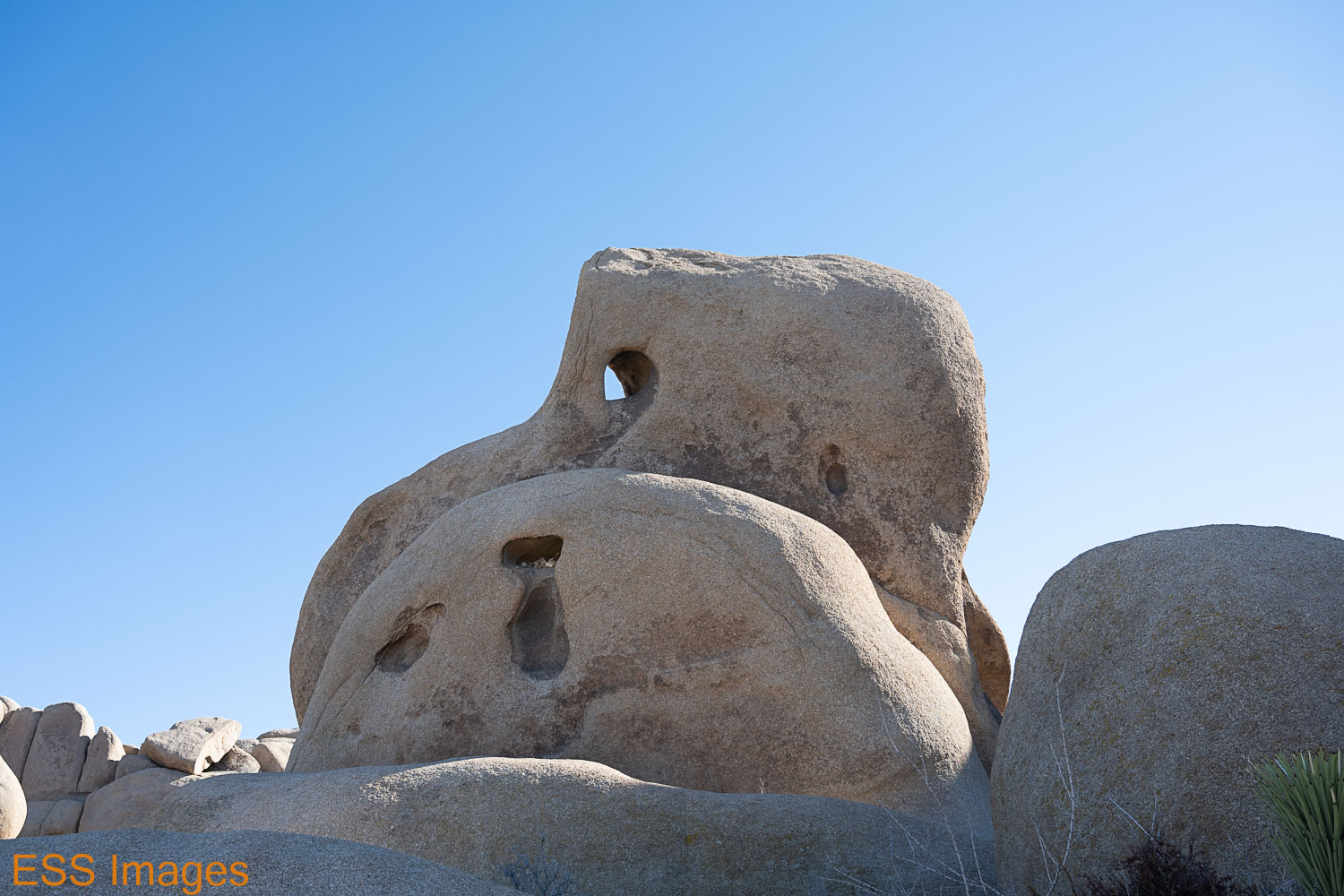
From there we went to seek Skull Rock. I say “seek,” not “see,” because in a spectacularly boneheaded (rock-skulled?) move, I walked right past the thing itself! I thought I went where the sign pointed, and we found some great bouldering/scrambling/rock climbing, but completely missed the skull. In my defense…no, there’s no defense for that! 🙂 So we had a great time clambering around. We were lucky to get a nearby parking spot, there was a crowd!

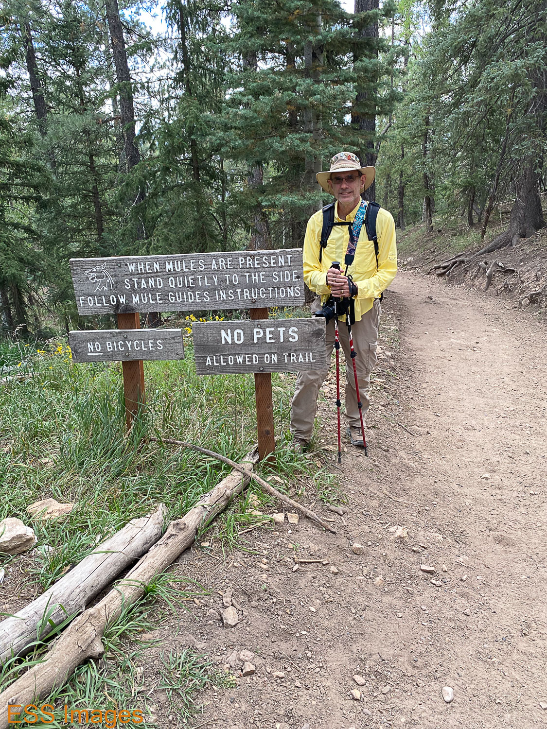
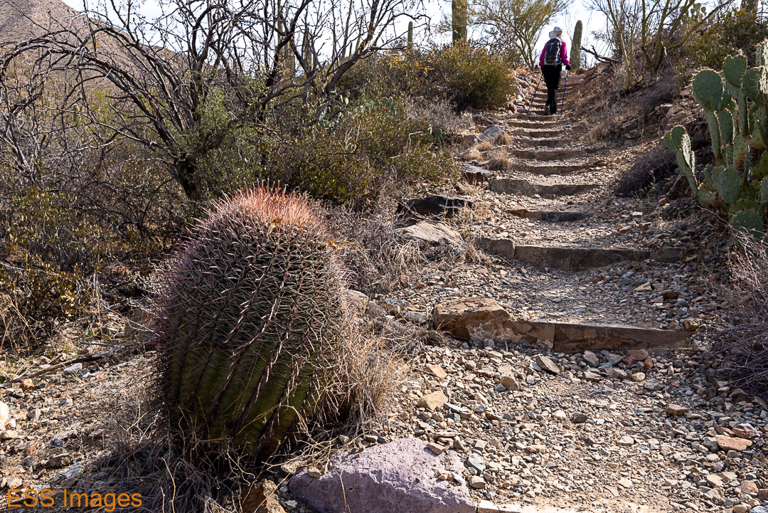
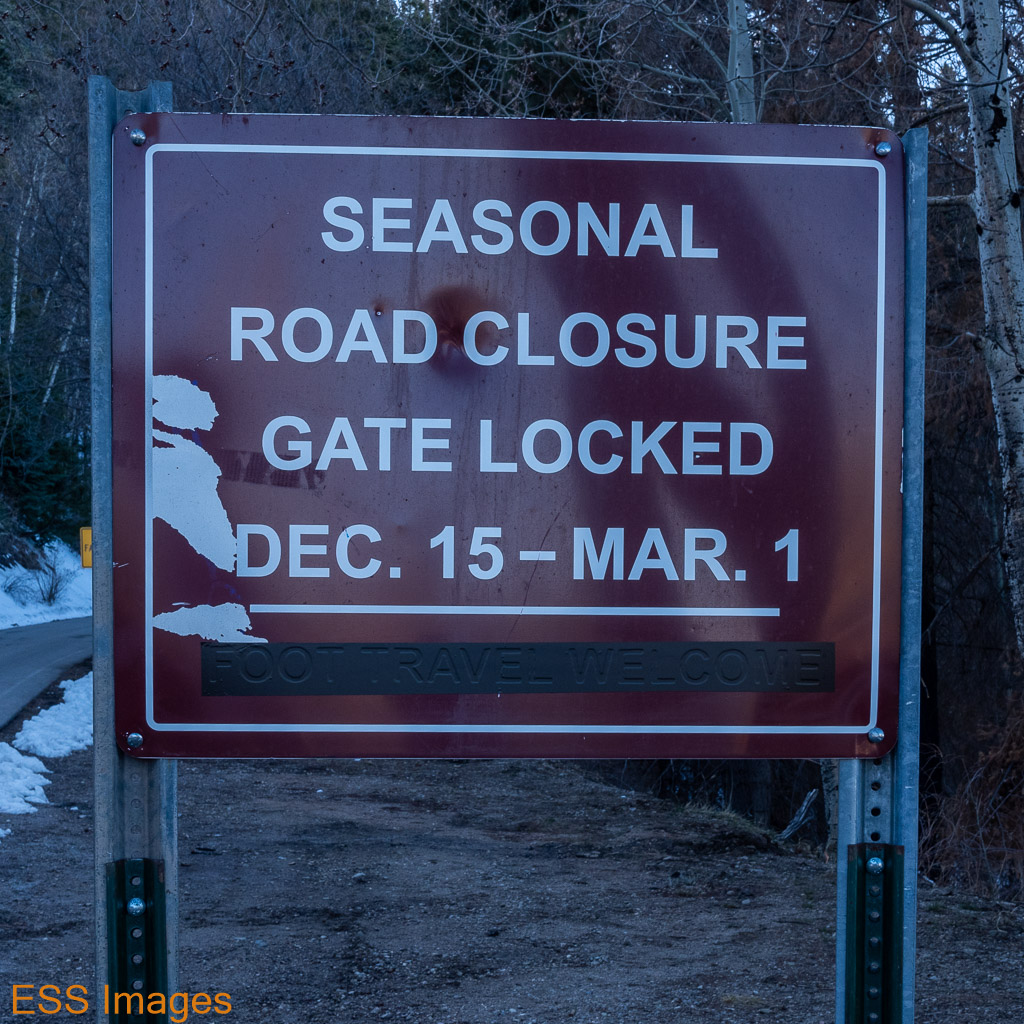
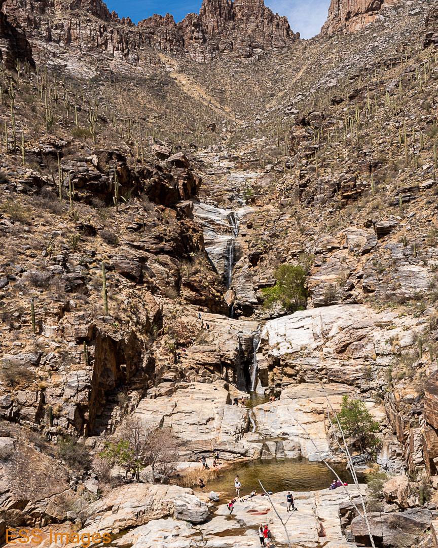
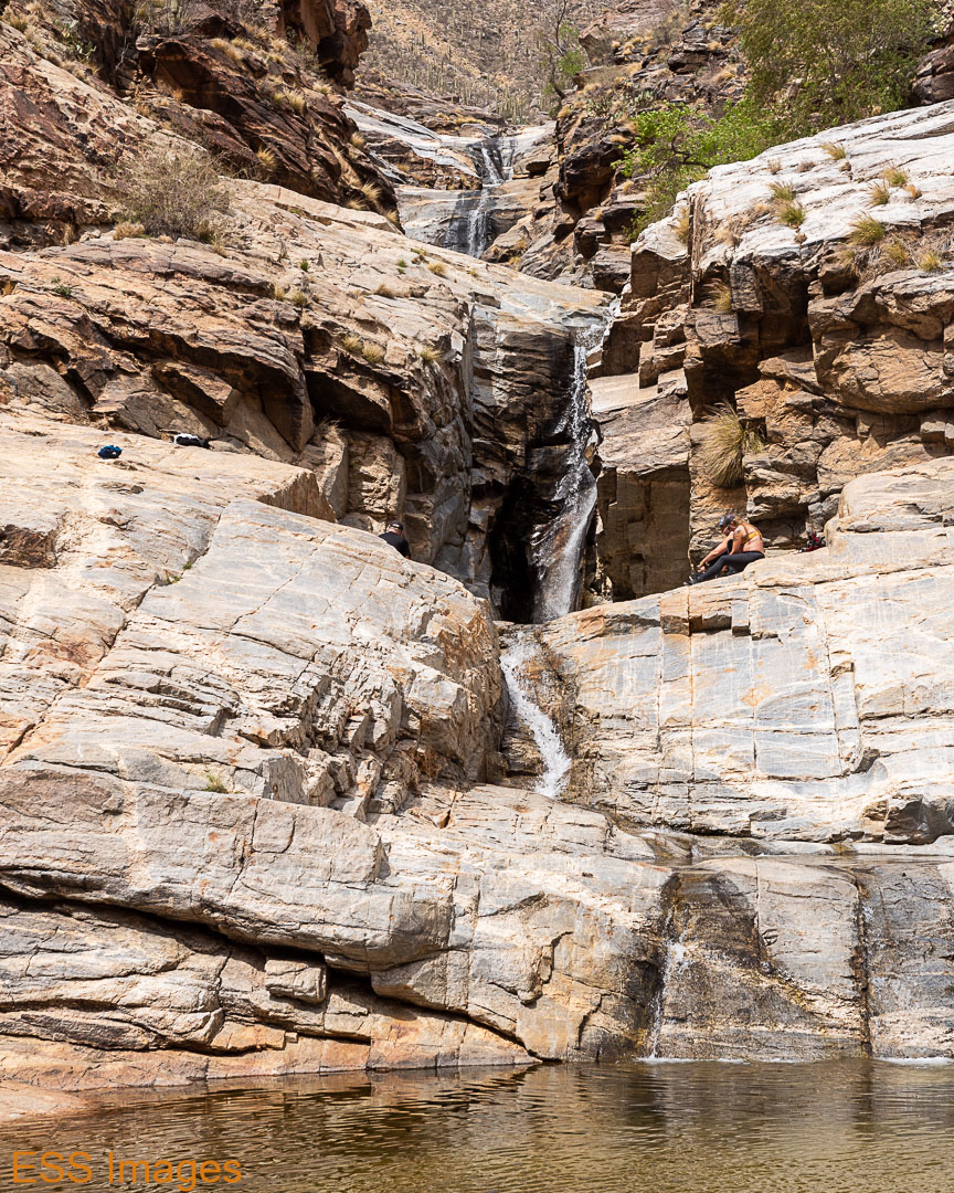
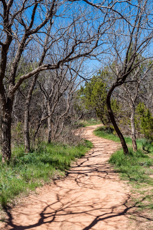
After that, I felt the need for a cup of tea, so we swung by the hotel on the way to the Fortynine Palms Oasis Trailhead. AllTrails rates this as moderate, with just over 600 feet of elevation. This trailhead is a few miles west of the North Entrance down a small road off of Highway 62. There’s a sign, but not a large one! We use Google Maps…

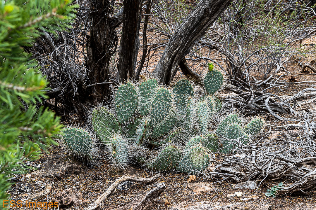
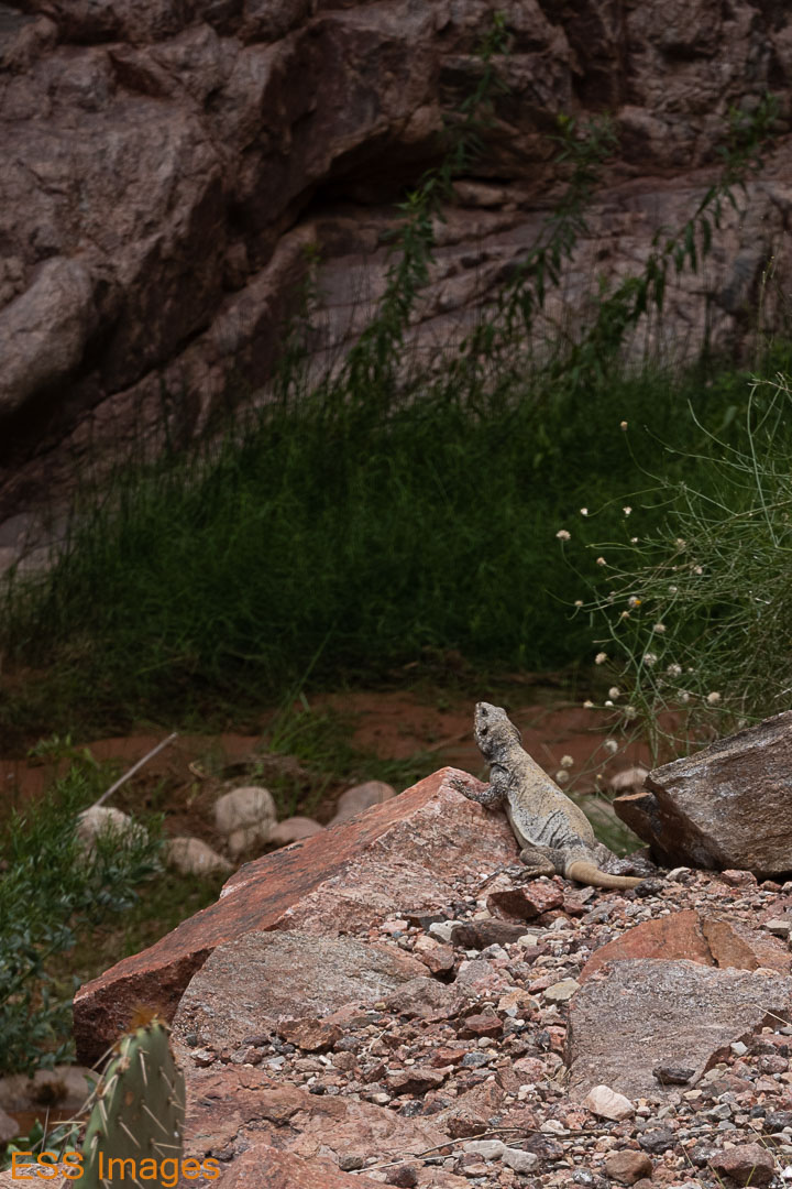
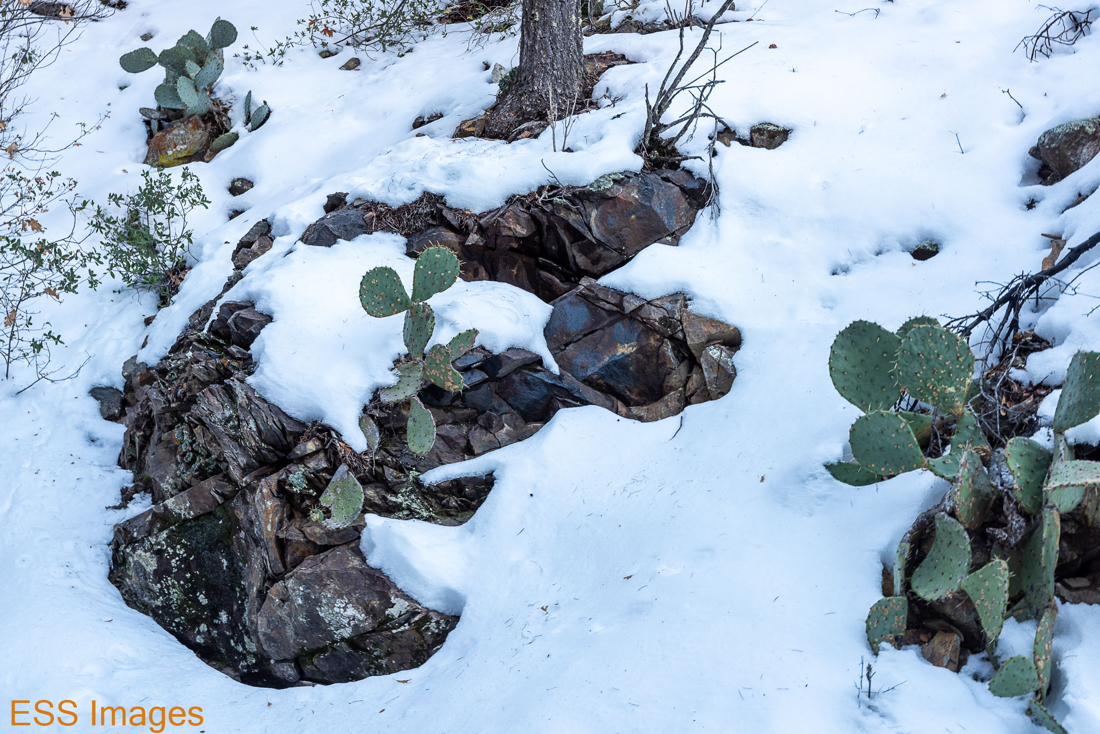
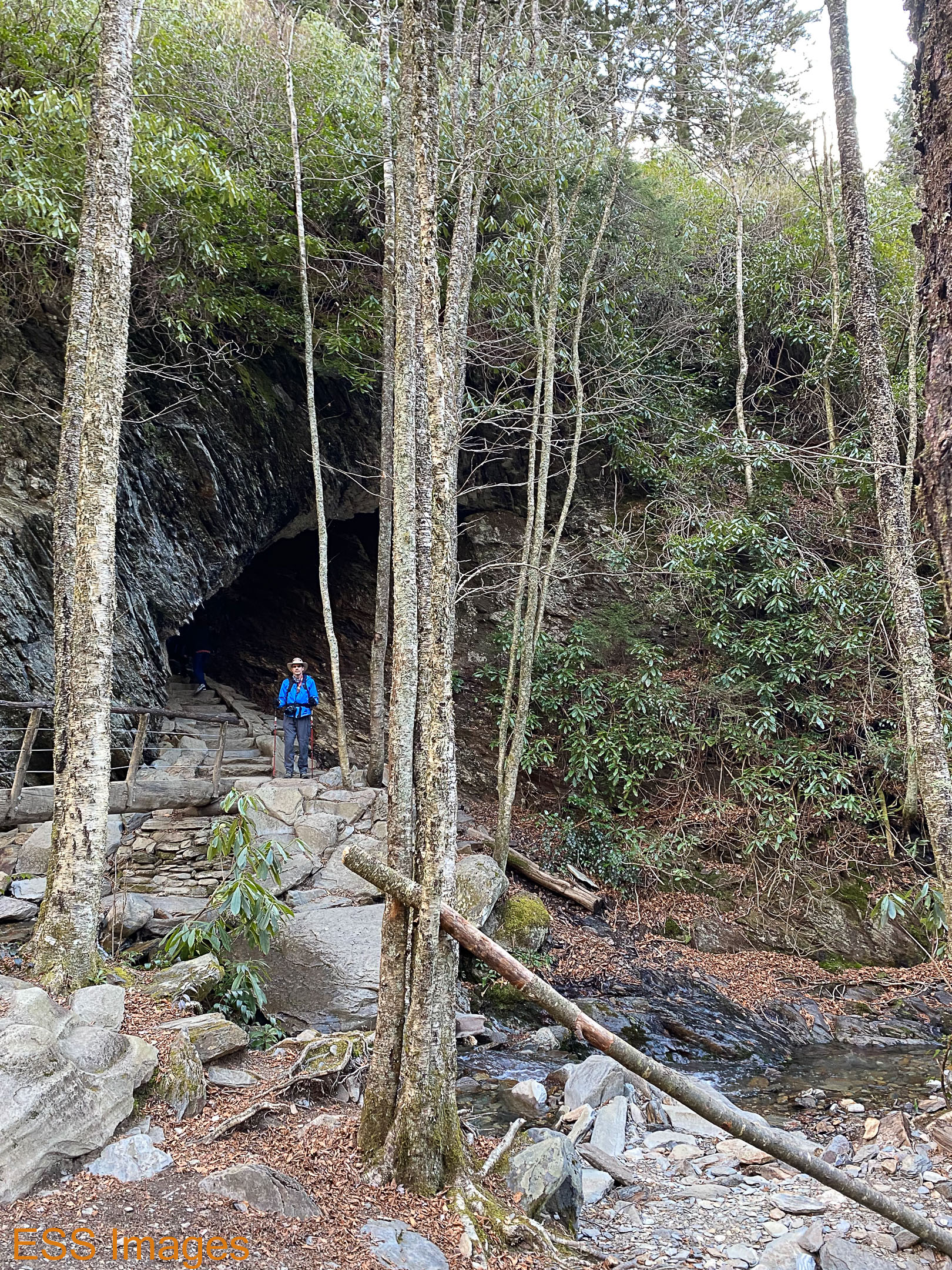
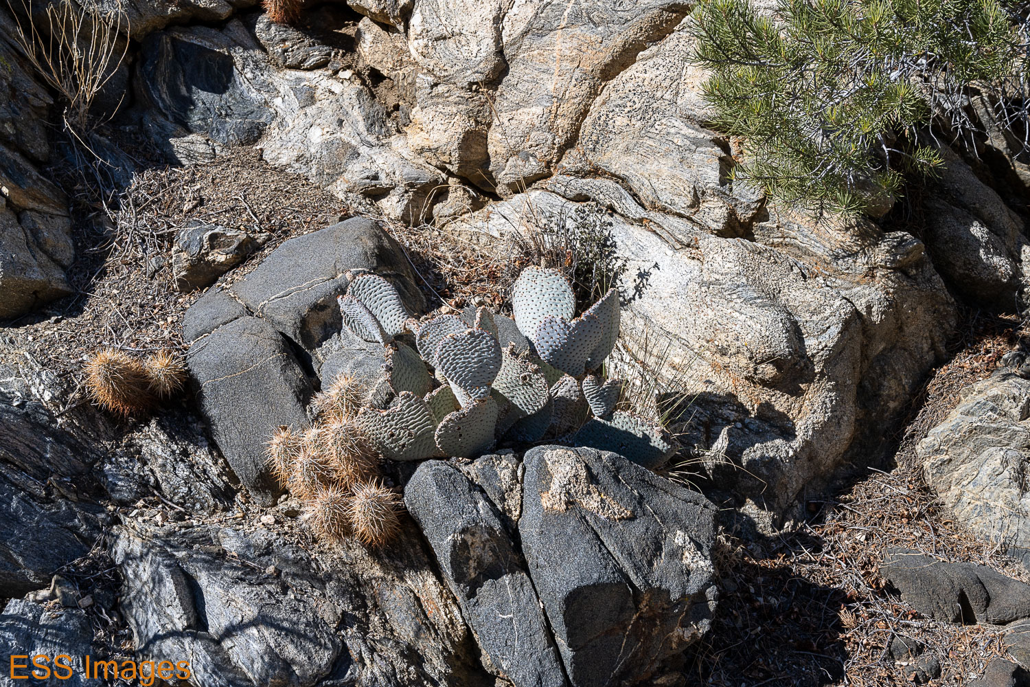
Fortynine Palms is a bit off the beaten path, but Alltrails still describes it as “heavily trafficked.” Parking was not crowded when we got there around 3:30 – be careful, the parking lot is closed (and locked, they say) at “nightfall!” The trail takes you up and over a ridge, through pretty normal desert-type terrain and vegetation. Again, scrub brush, yuccas, I don’t remember seeing any Joshua Trees.

The trail itself is fairly rough and rocky, which is my excuse for the tumble I took when going downhill toward the Oasis! No major harm done, though I did wish: 1) that I had been wearing my gloves and 2) that I had remembered to bring my darn trekking poles! If you plan on doing any moderate or hard trails with any elevation, I would strongly suggest you take trekking poles. I missed mine more than once besides this particular incident!

But we cleaned up my hands as well as we could, and soldiered on! Ours is not to reason why… 🙂 Also because I wanted to see the oasis:

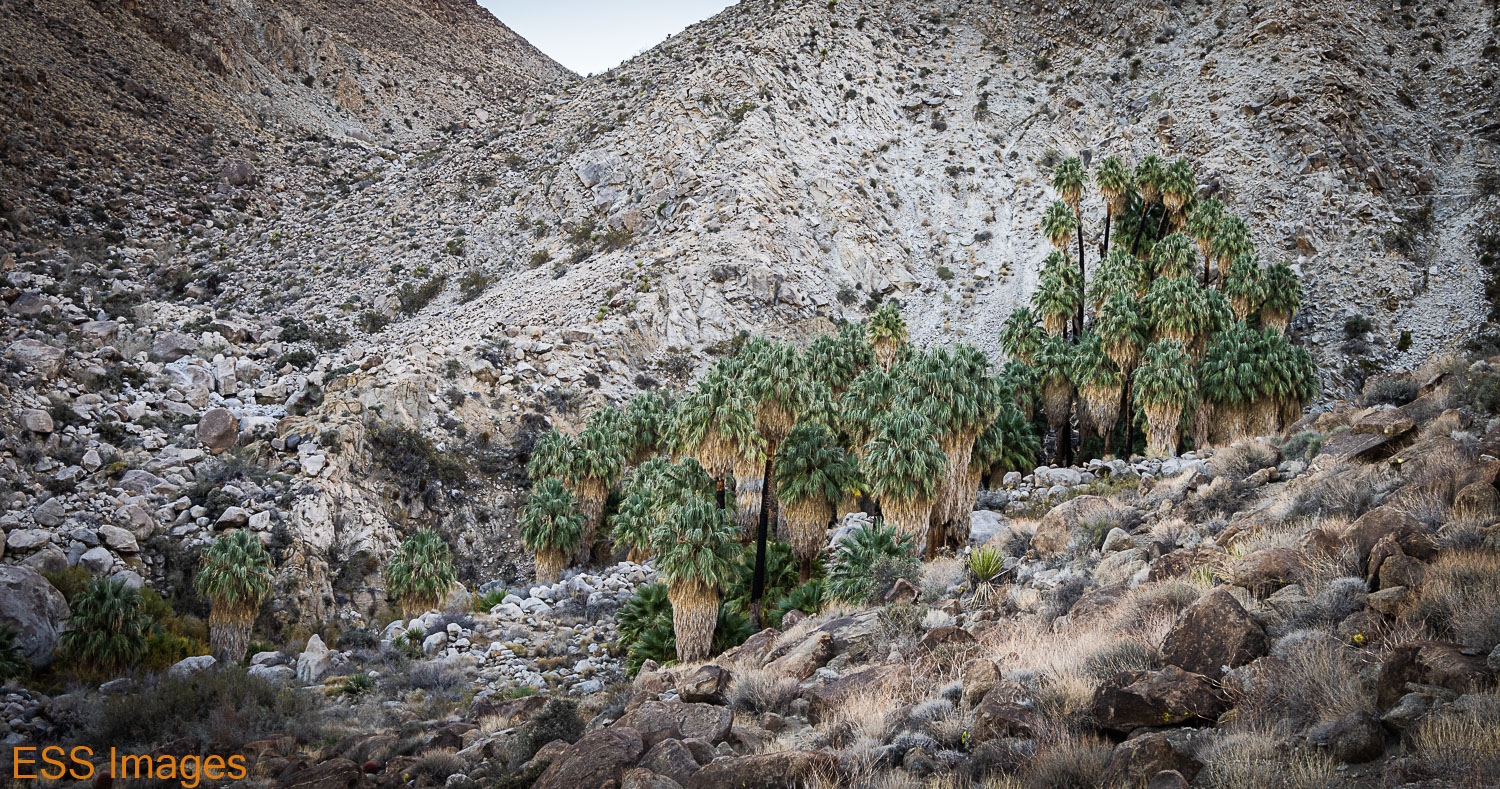
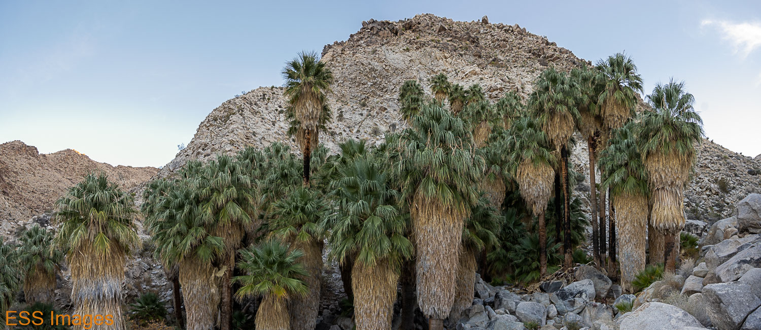
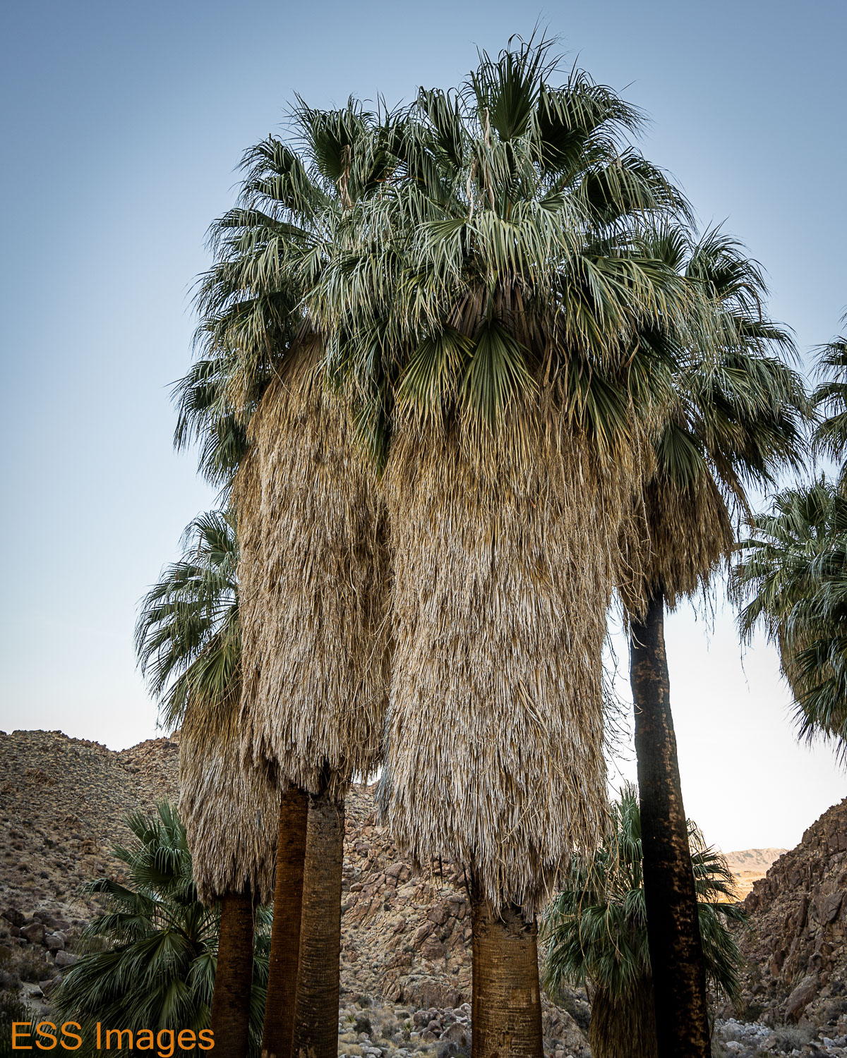
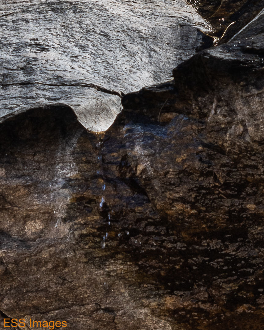
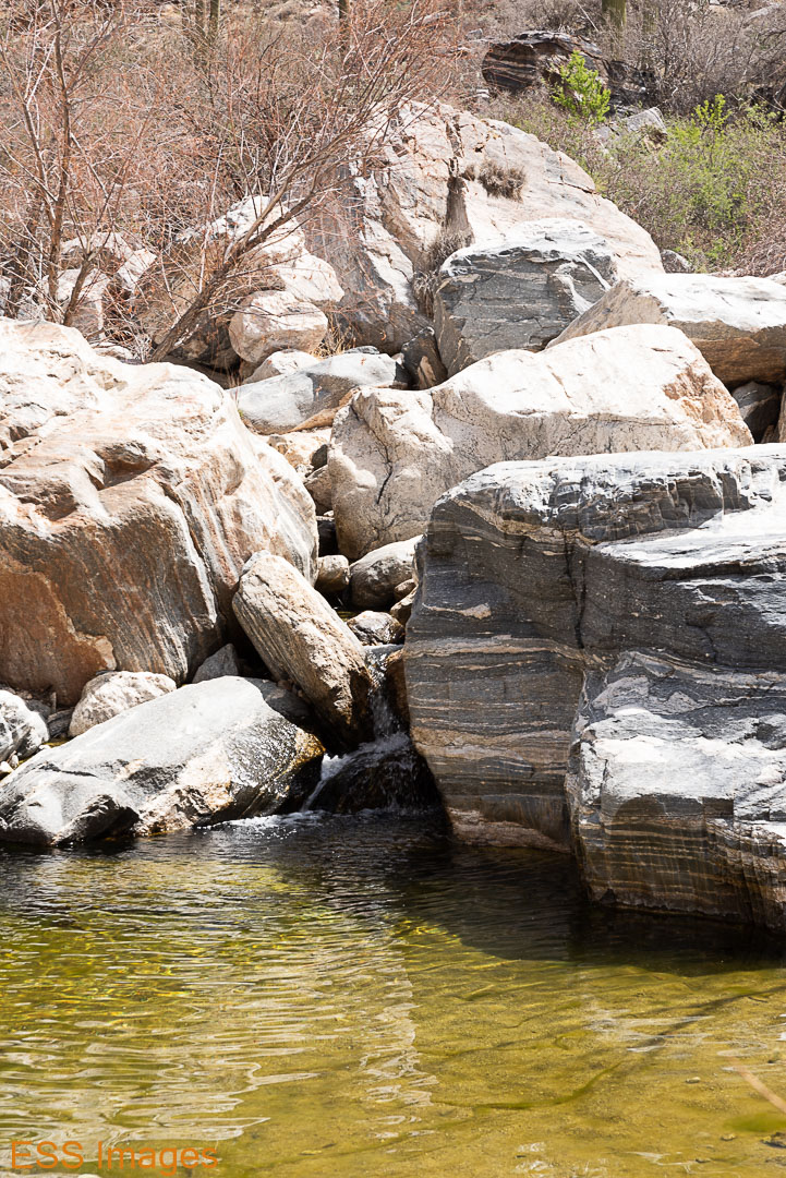
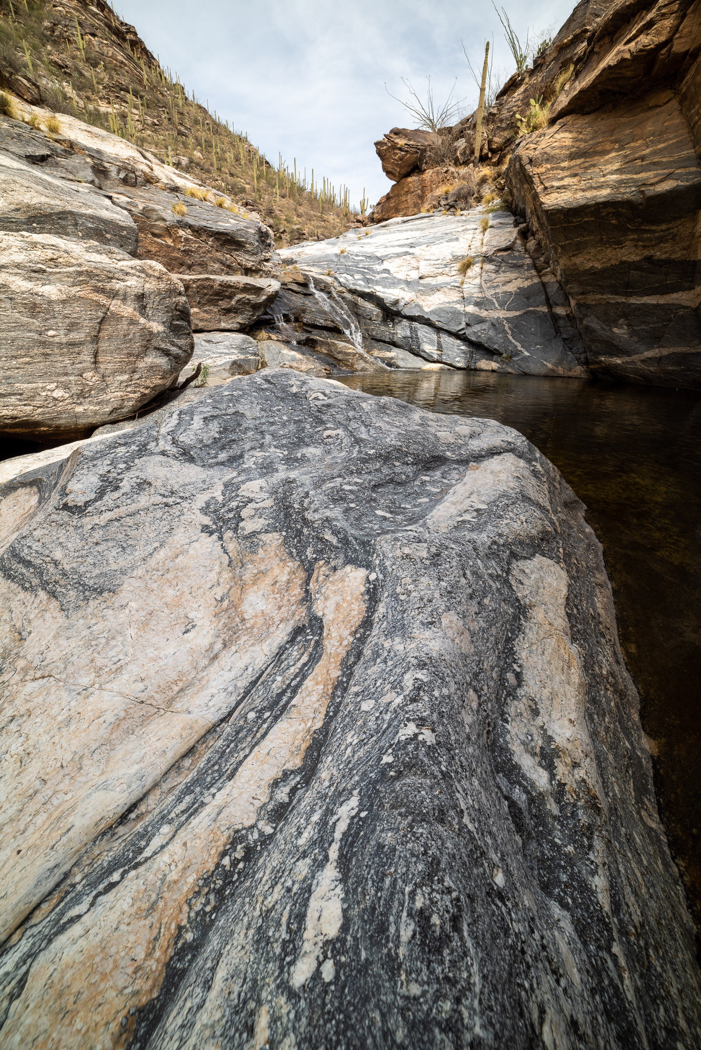
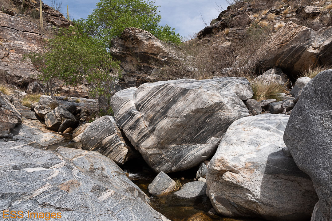
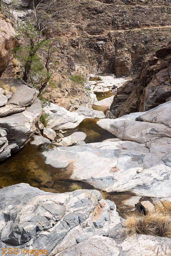
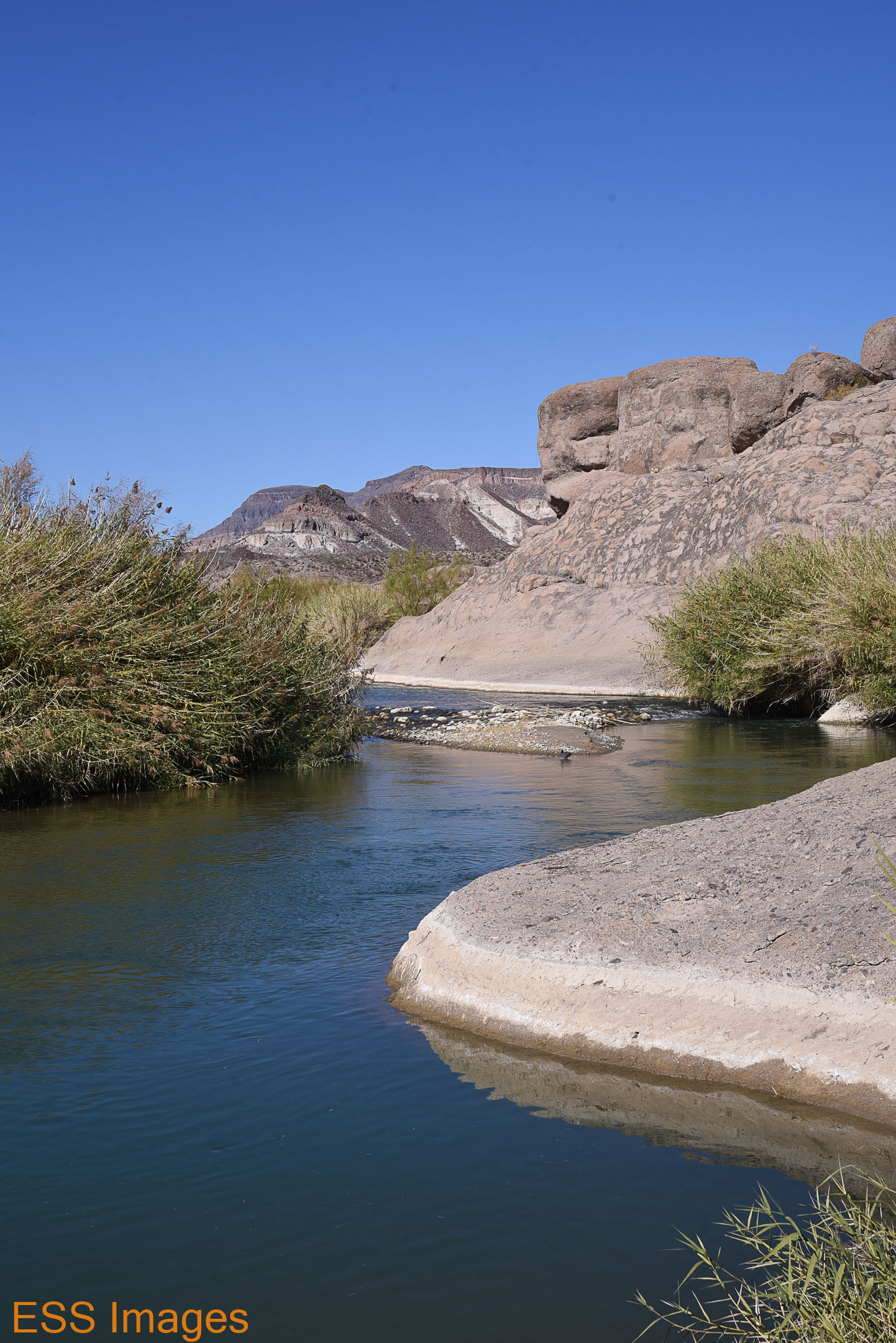
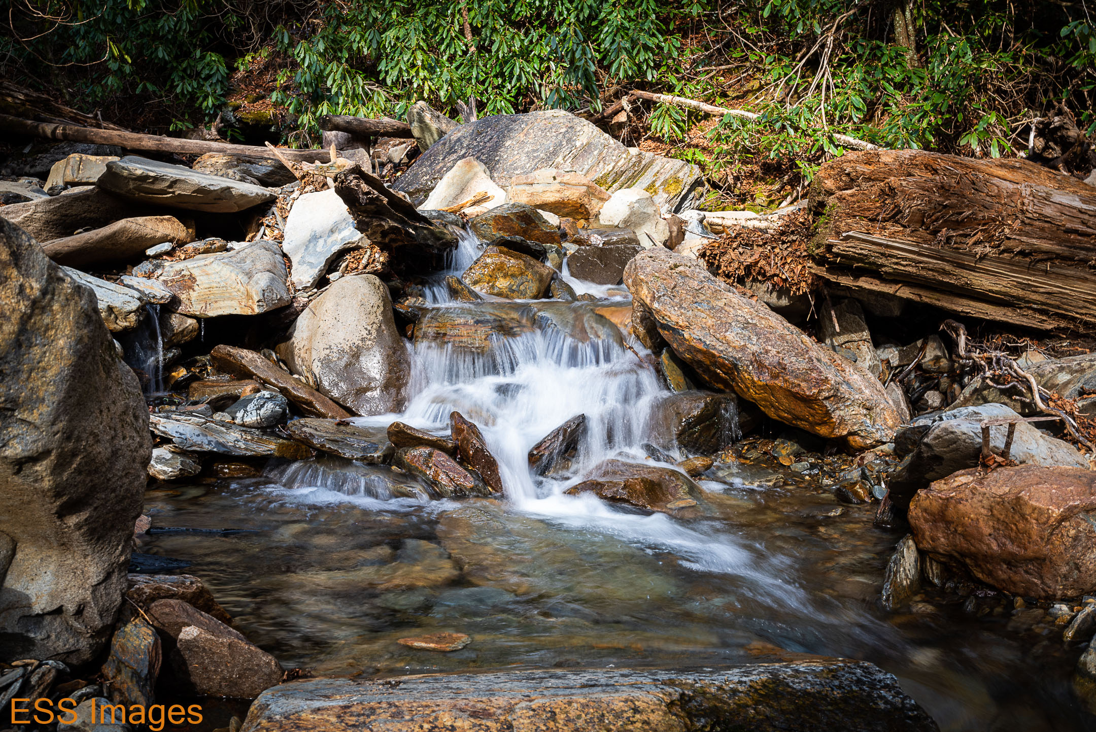
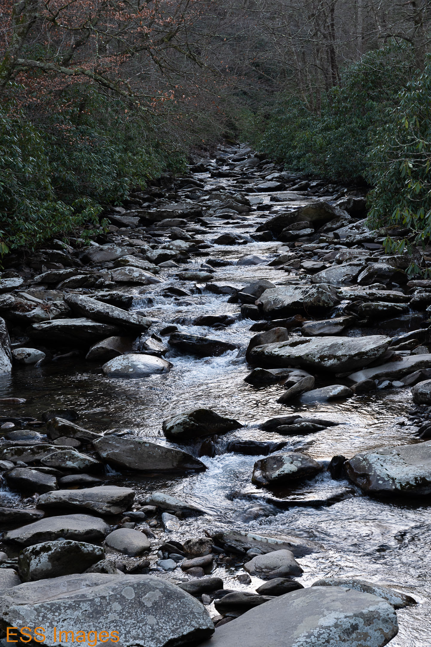
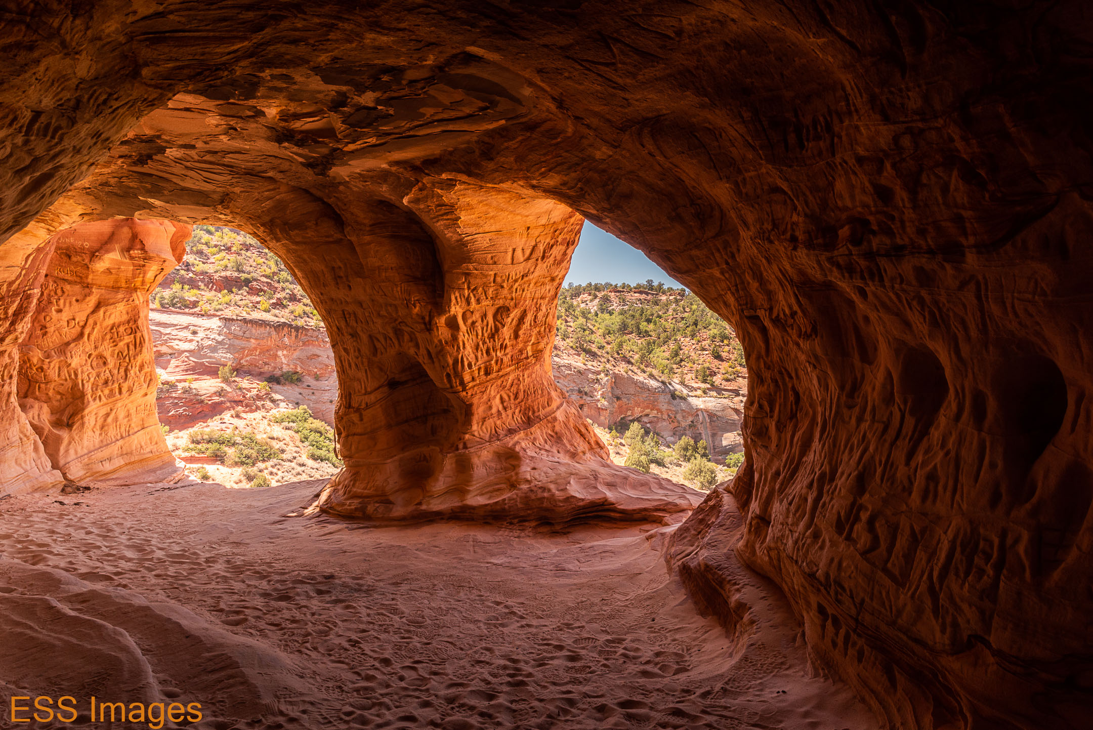
It’s a bit incongruous, seeing these huge palm trees rising up in the middle of the desert scrub, but they’re very cool. It’s fed by a spring and apparently there is sometimes open water there. We didn’t see any, but I must confess we didn’t look all that hard! These are California Fan Palms, native to the deserts of southern California. After enjoying the peace of the oasis for a while, we walked (much more carefully!) back to the car.

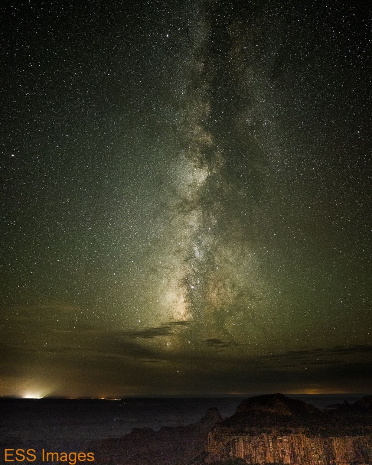
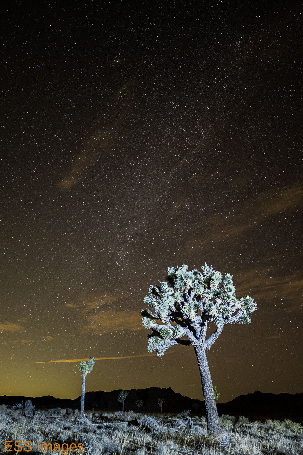
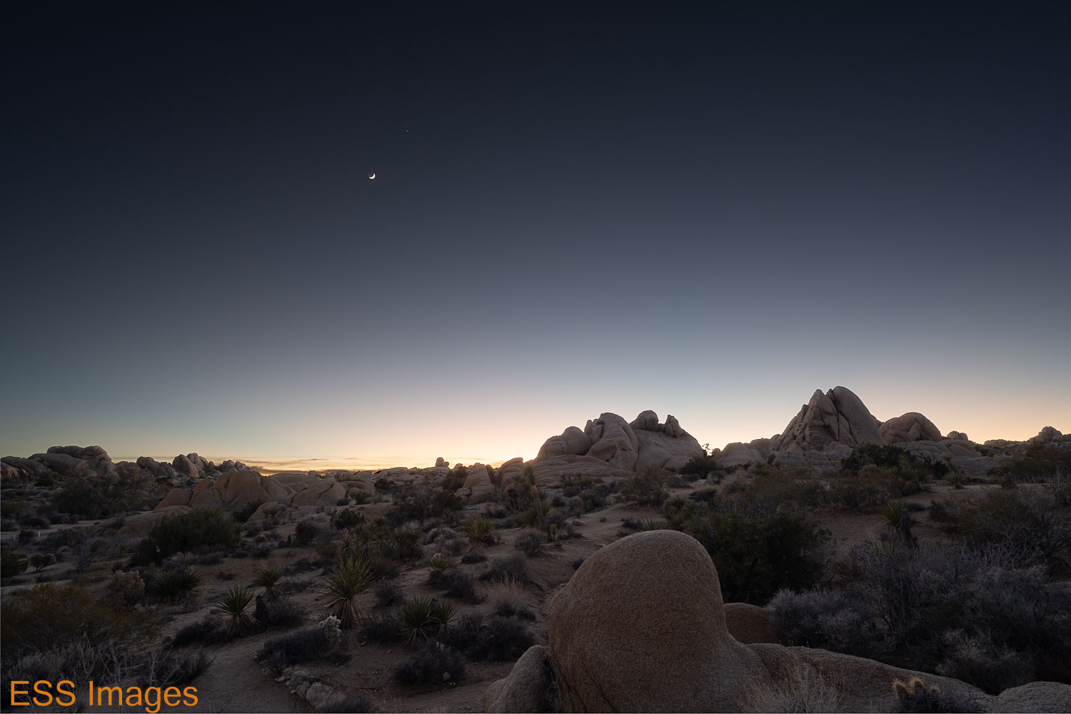
Our next expedition was to…CVS for bandages & such! We cleaned me up a little more thoroughly than with a water bottle & a hankie… 🙂 Then we headed out after nightfall to see how the sky was!

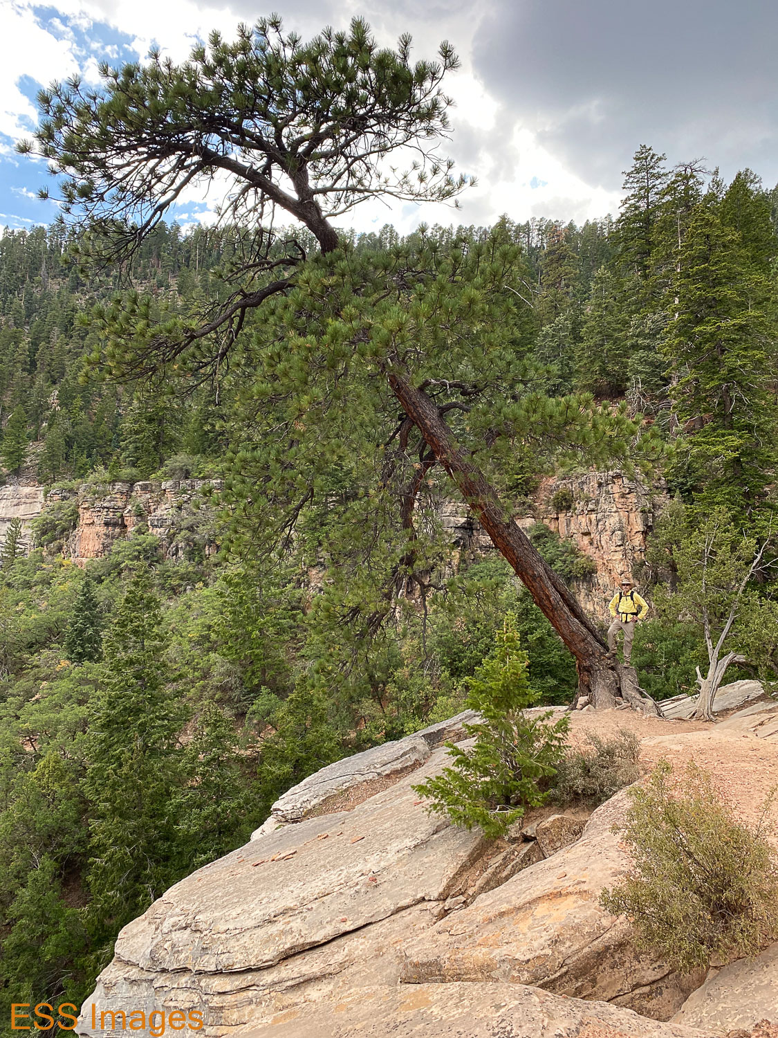
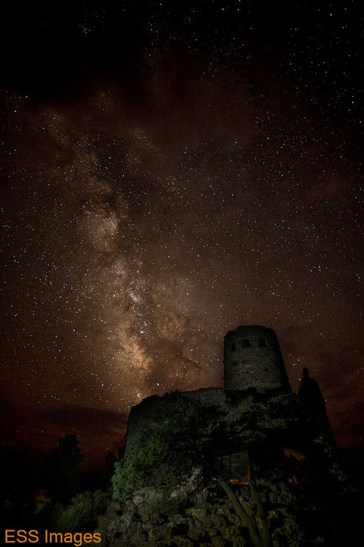
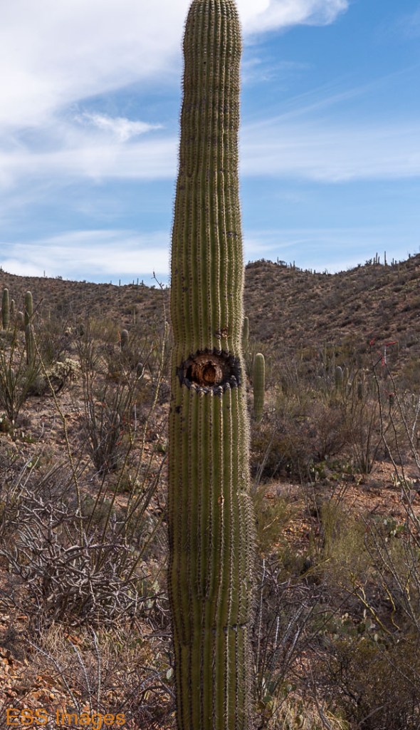
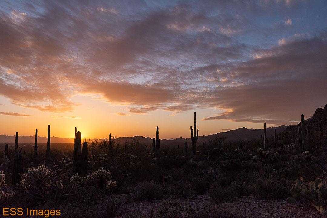
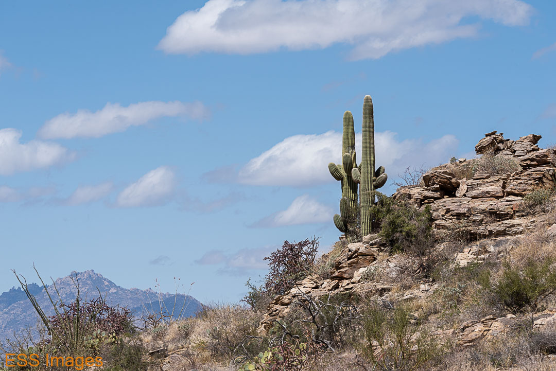
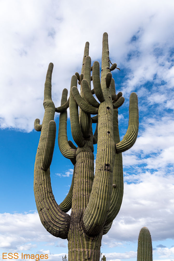
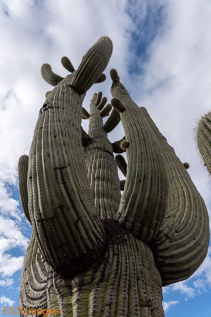
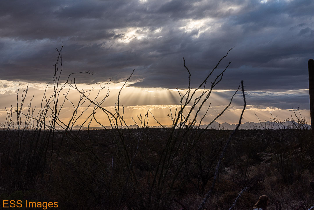
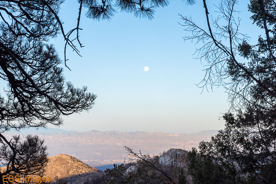
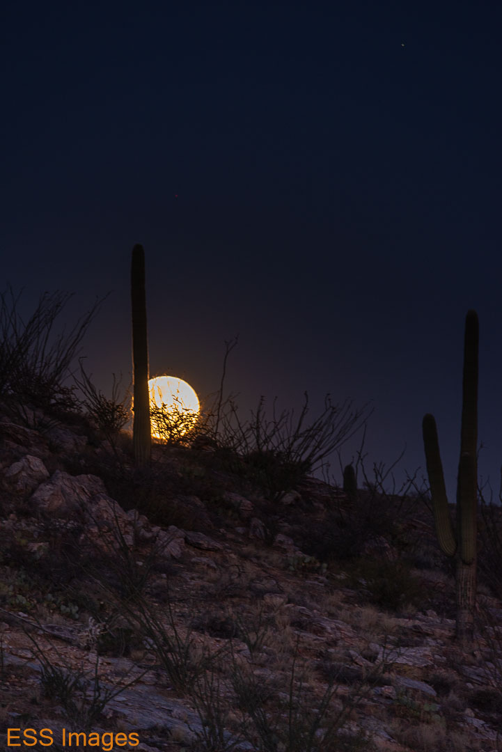
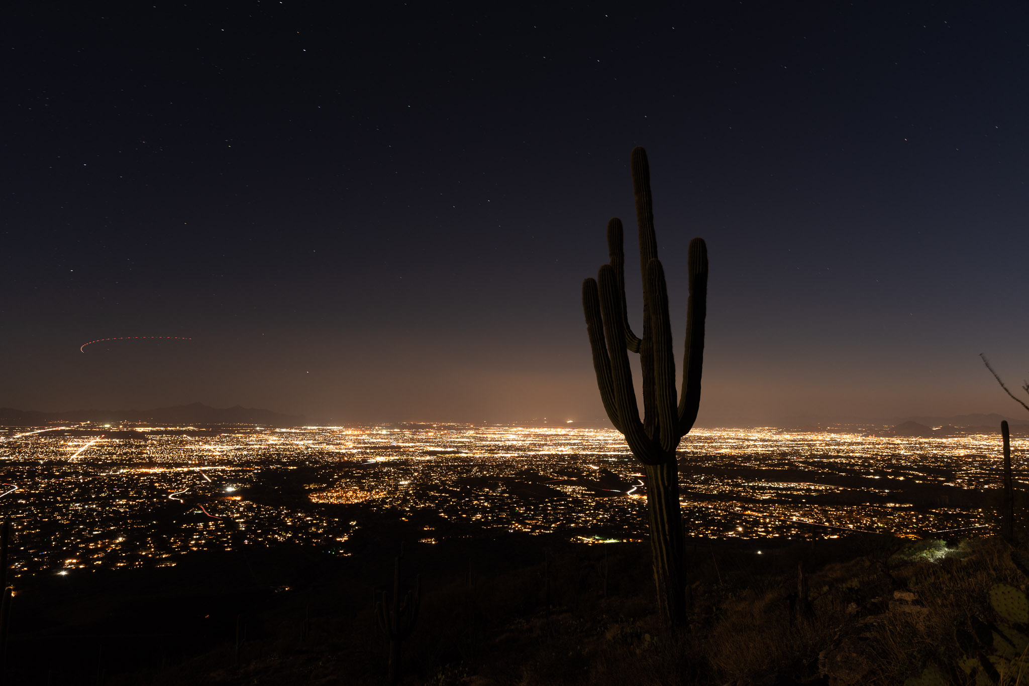
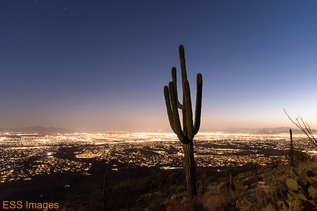
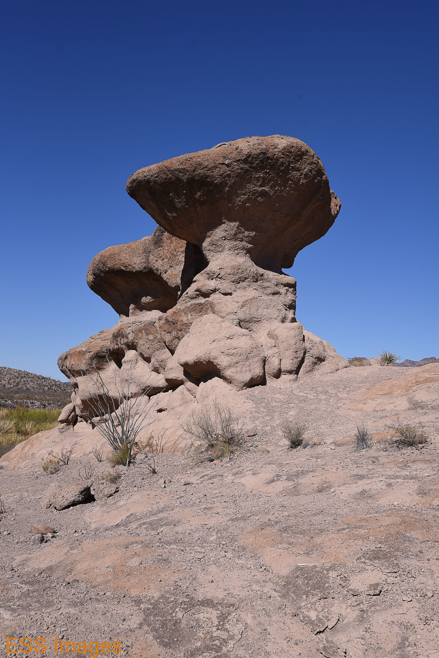
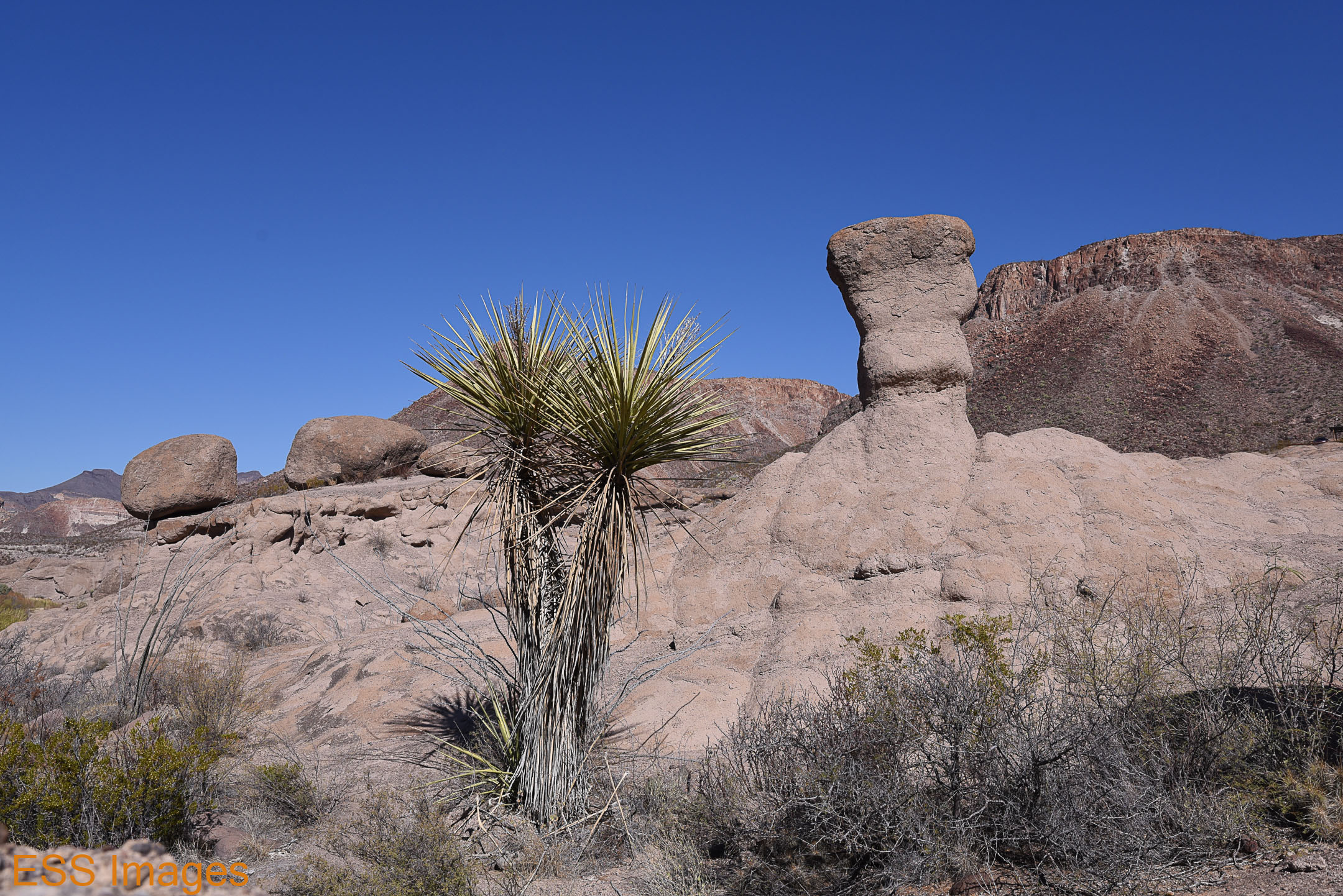
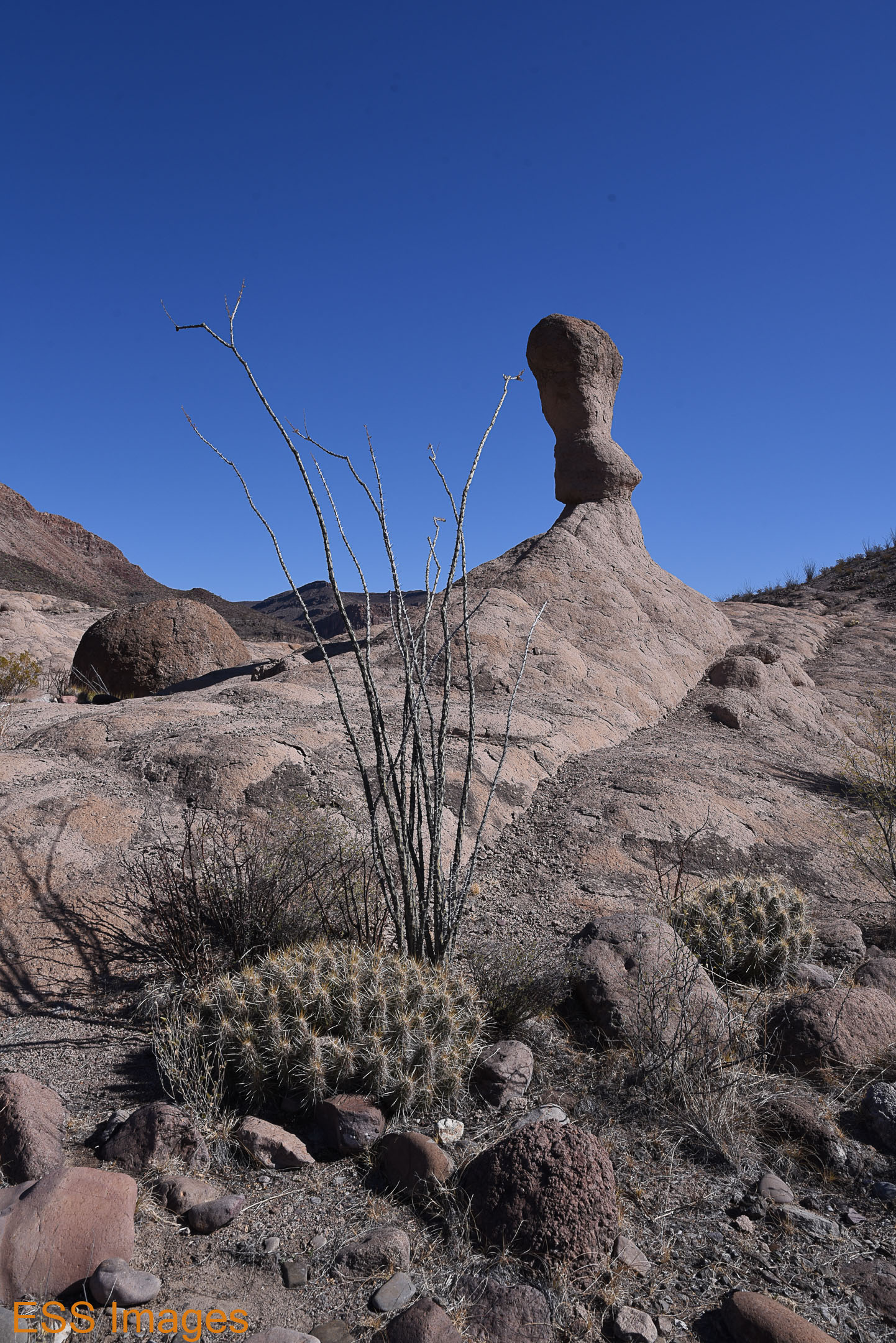
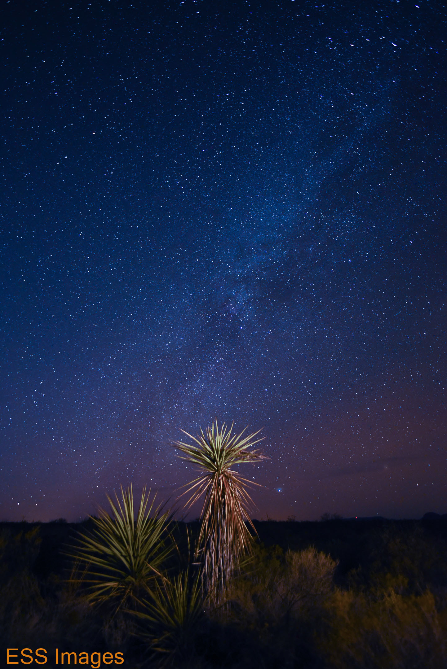
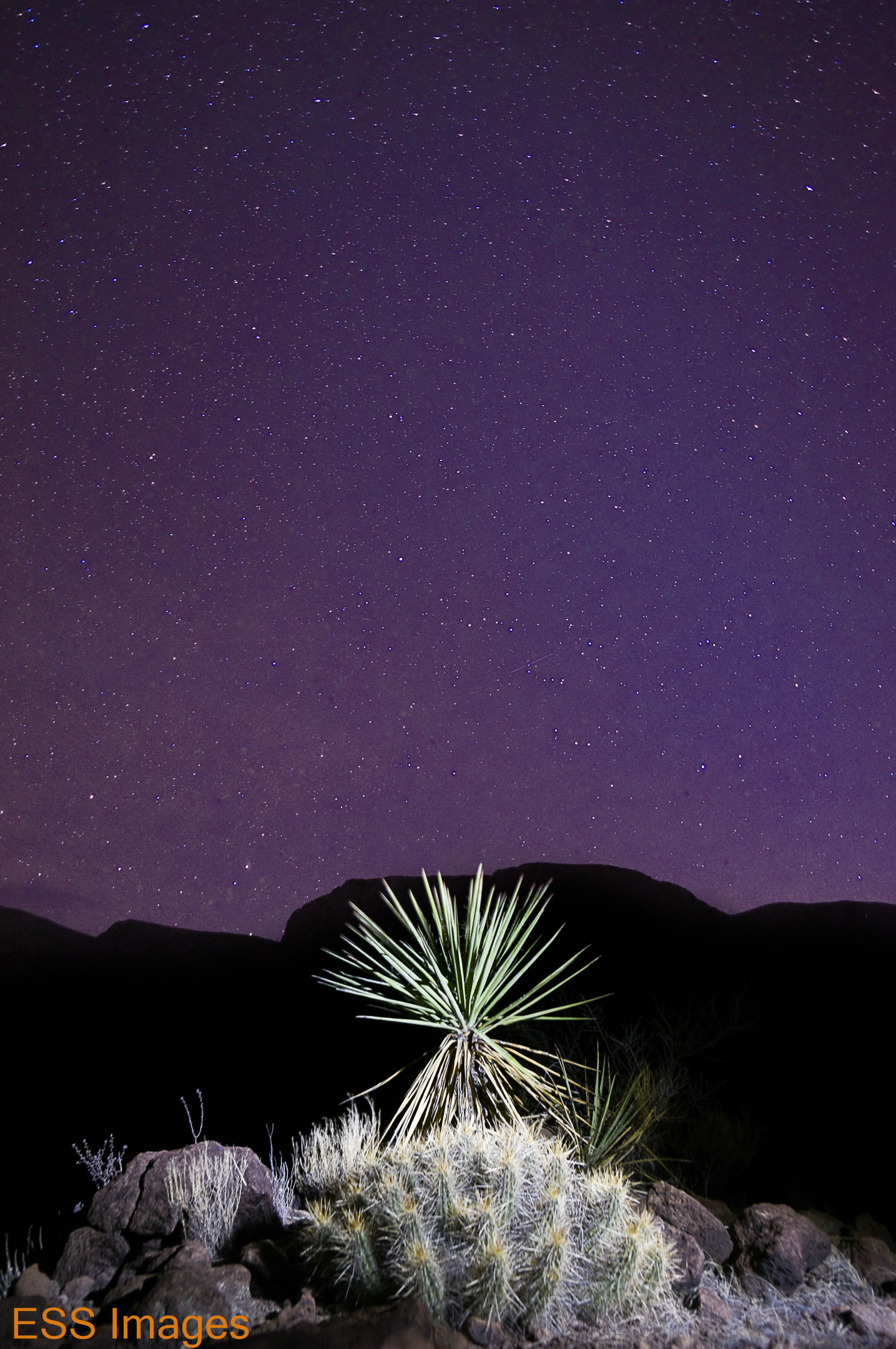
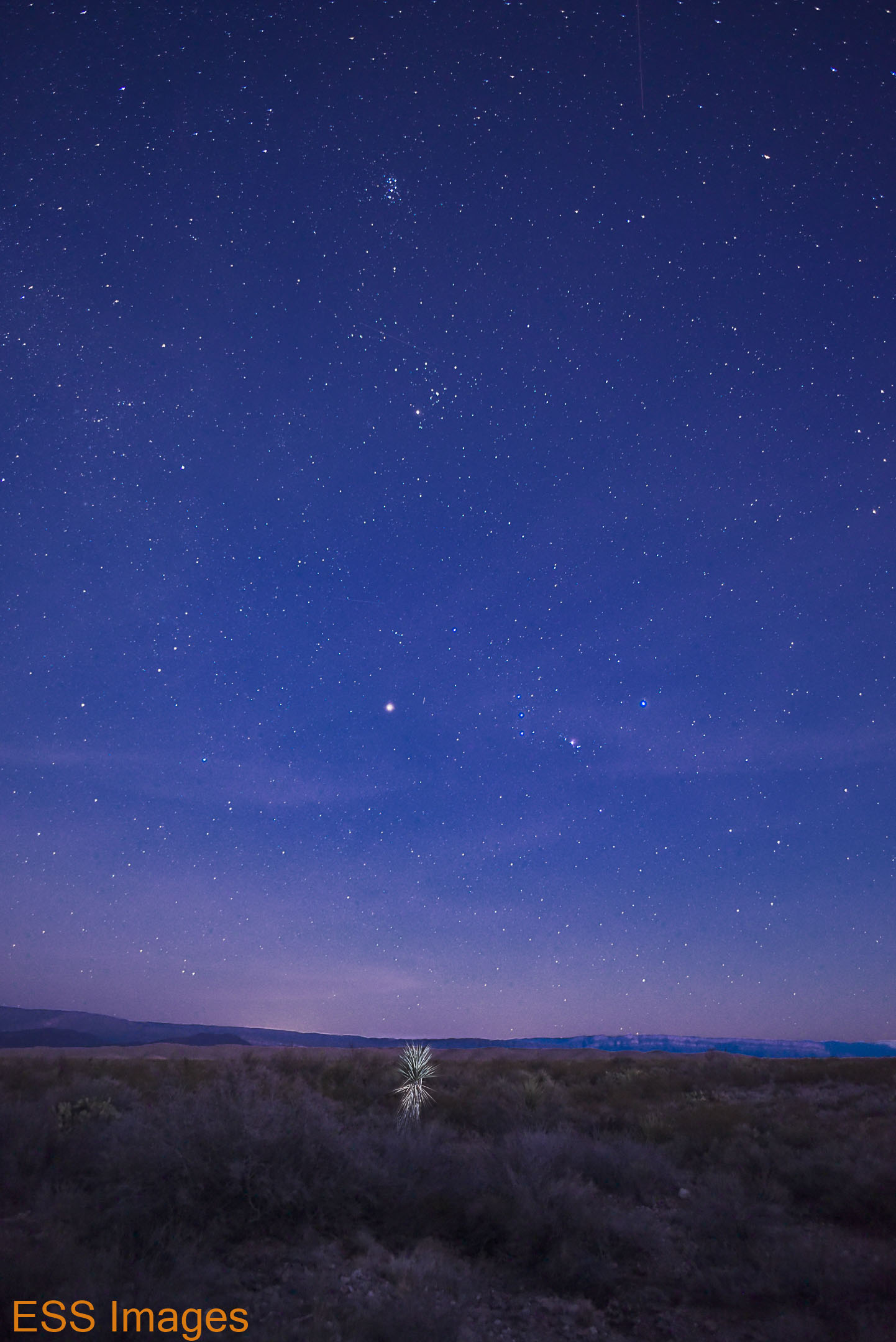
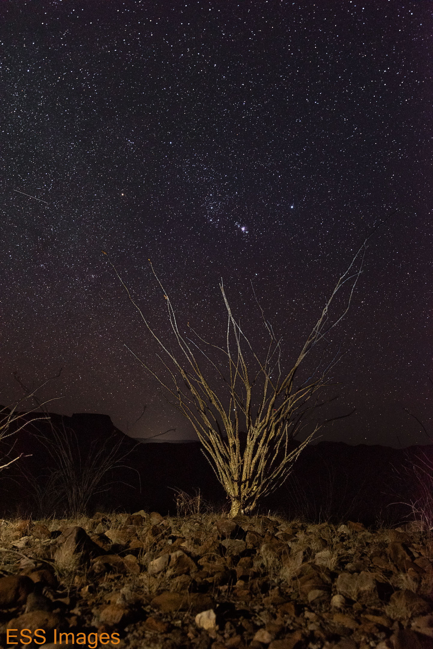
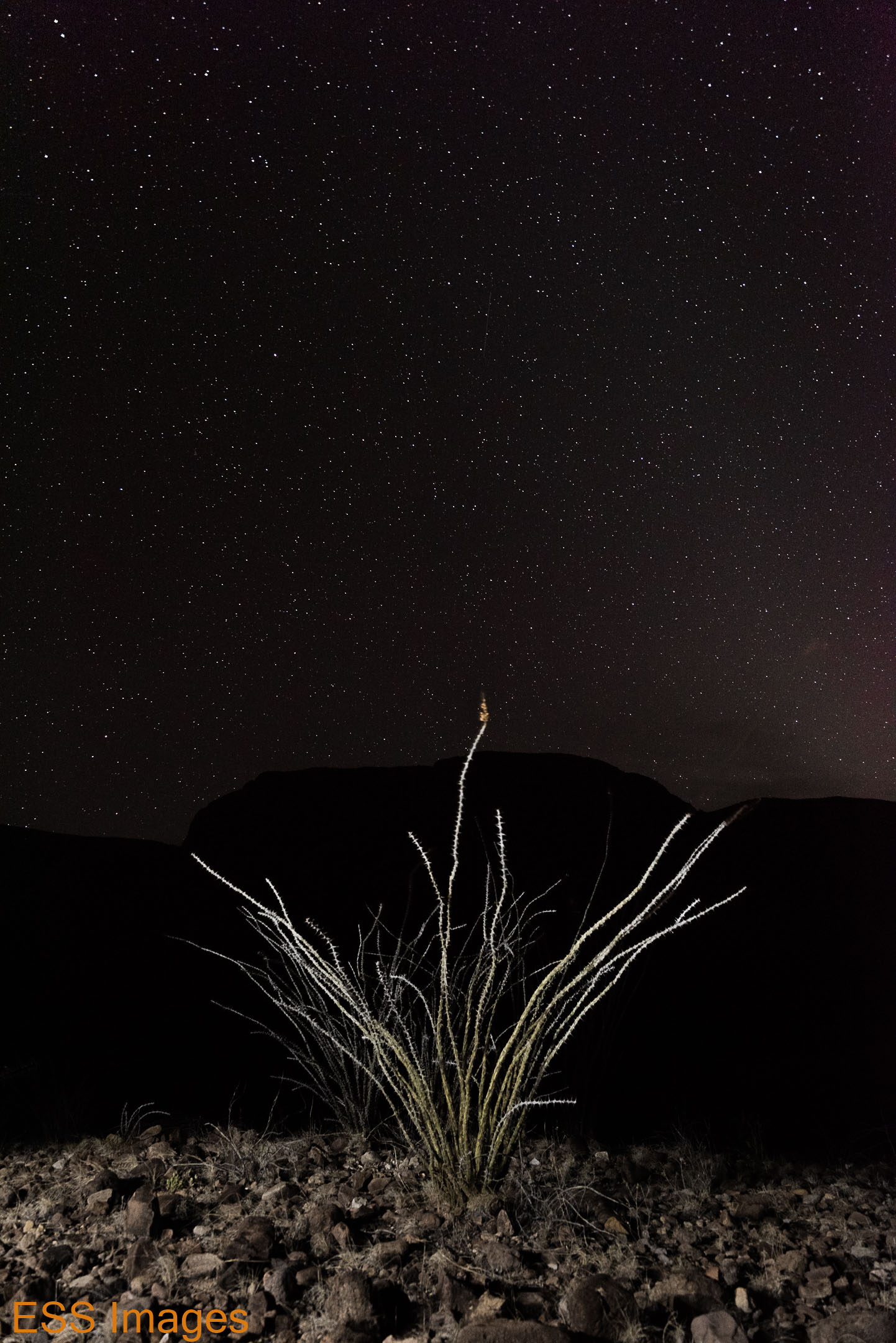
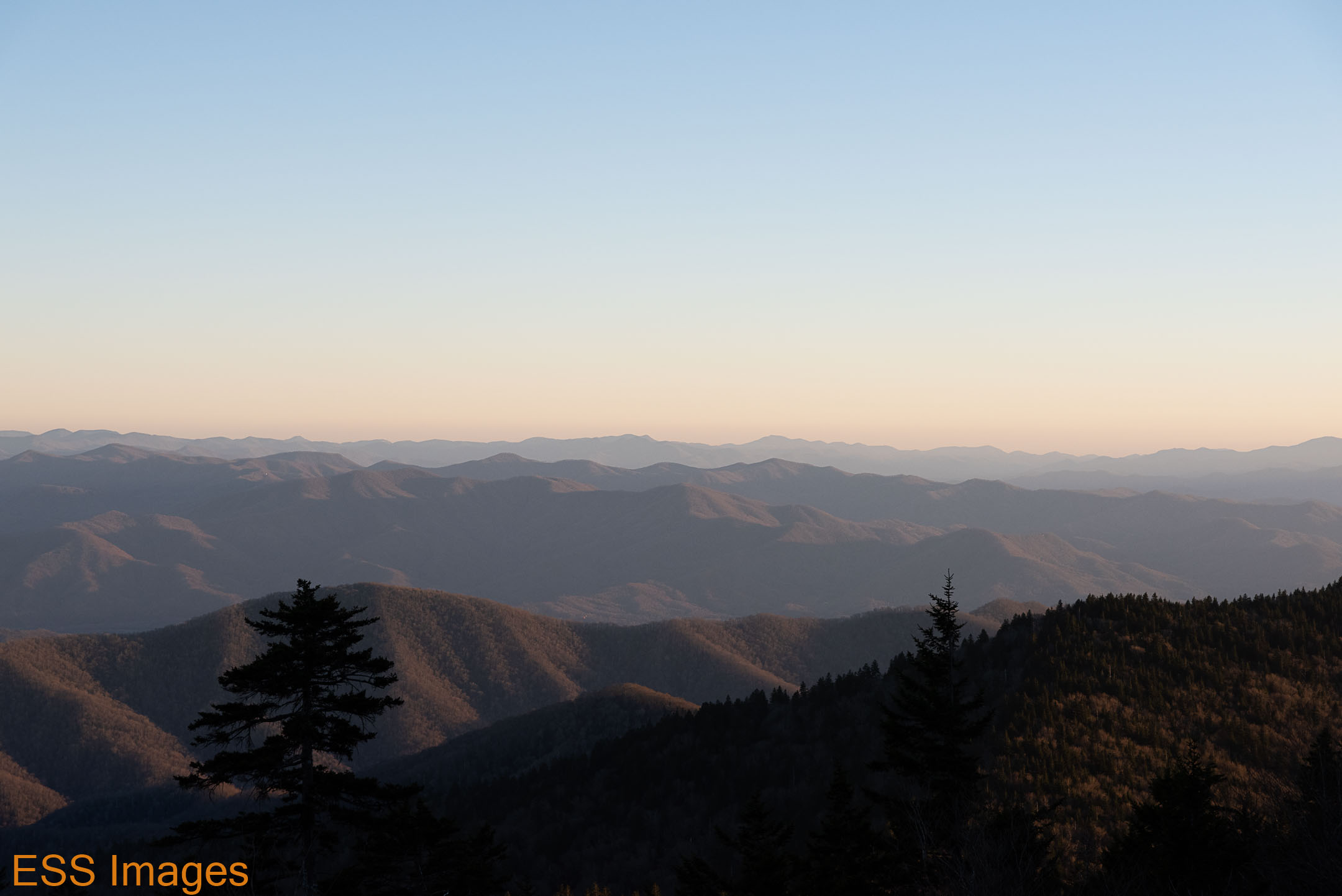
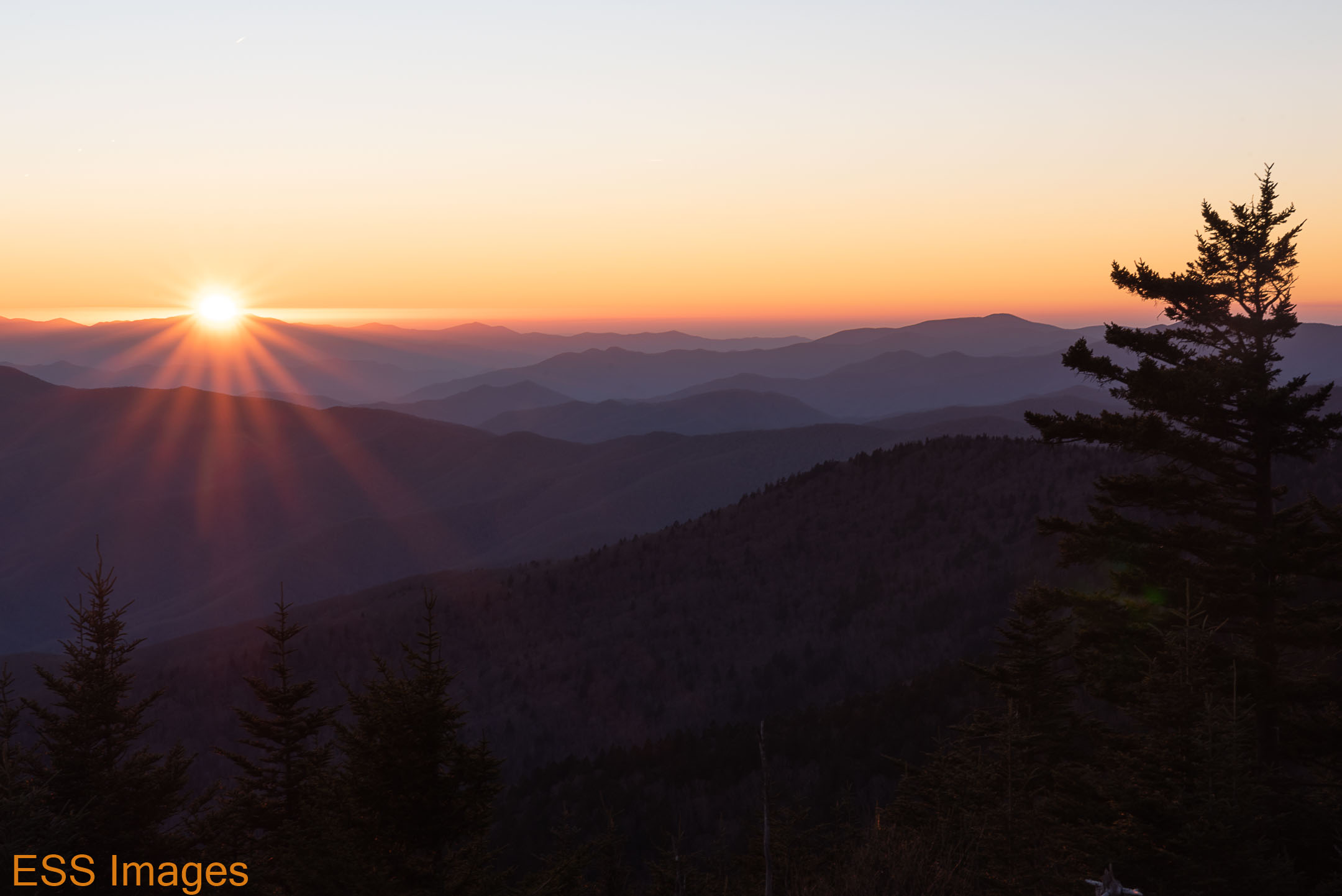
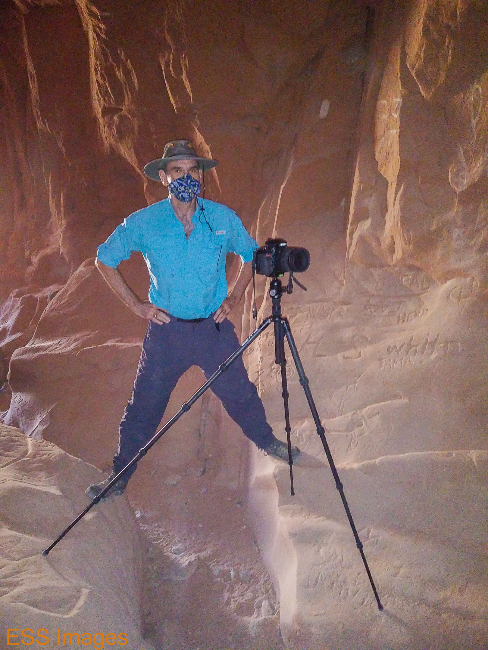
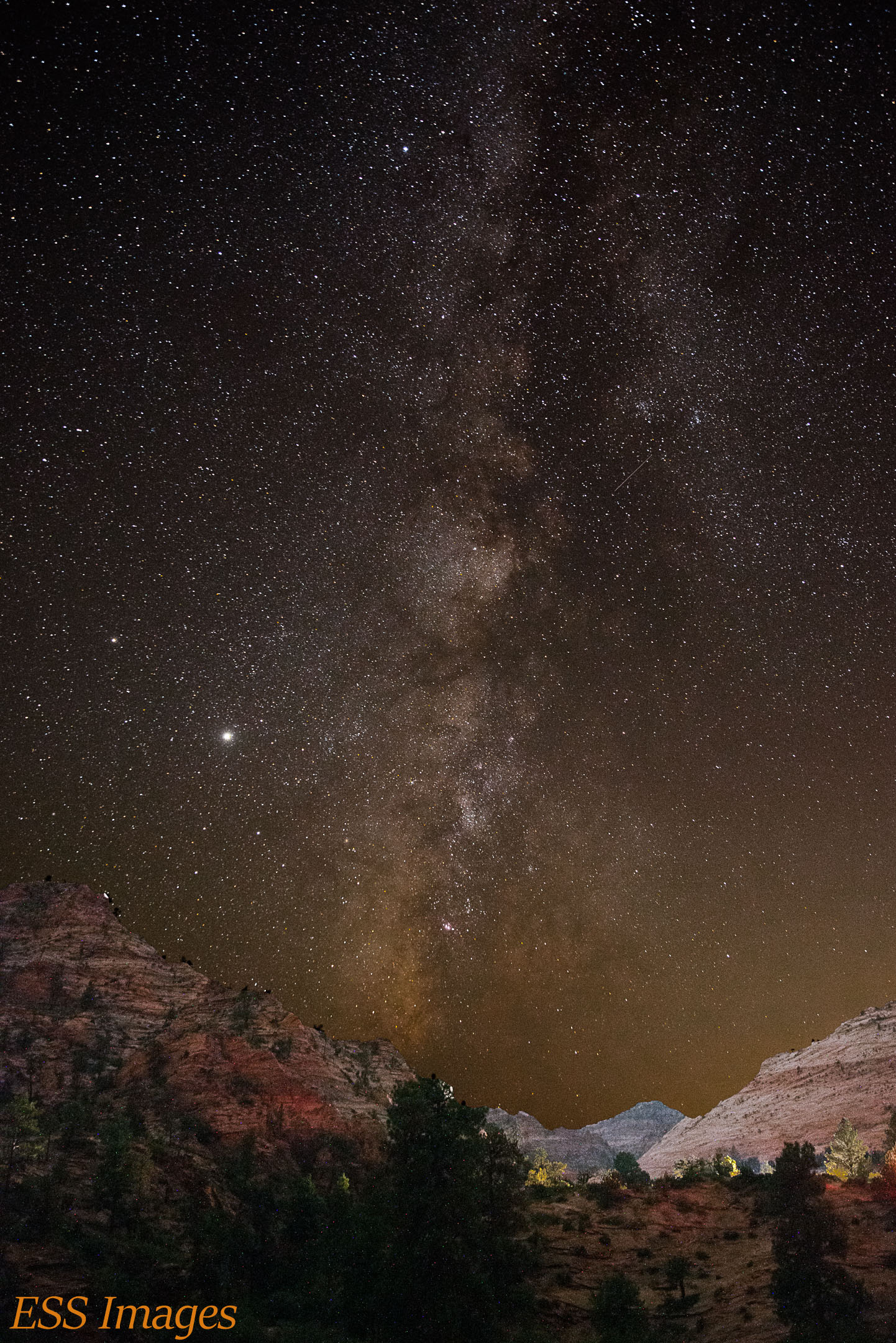
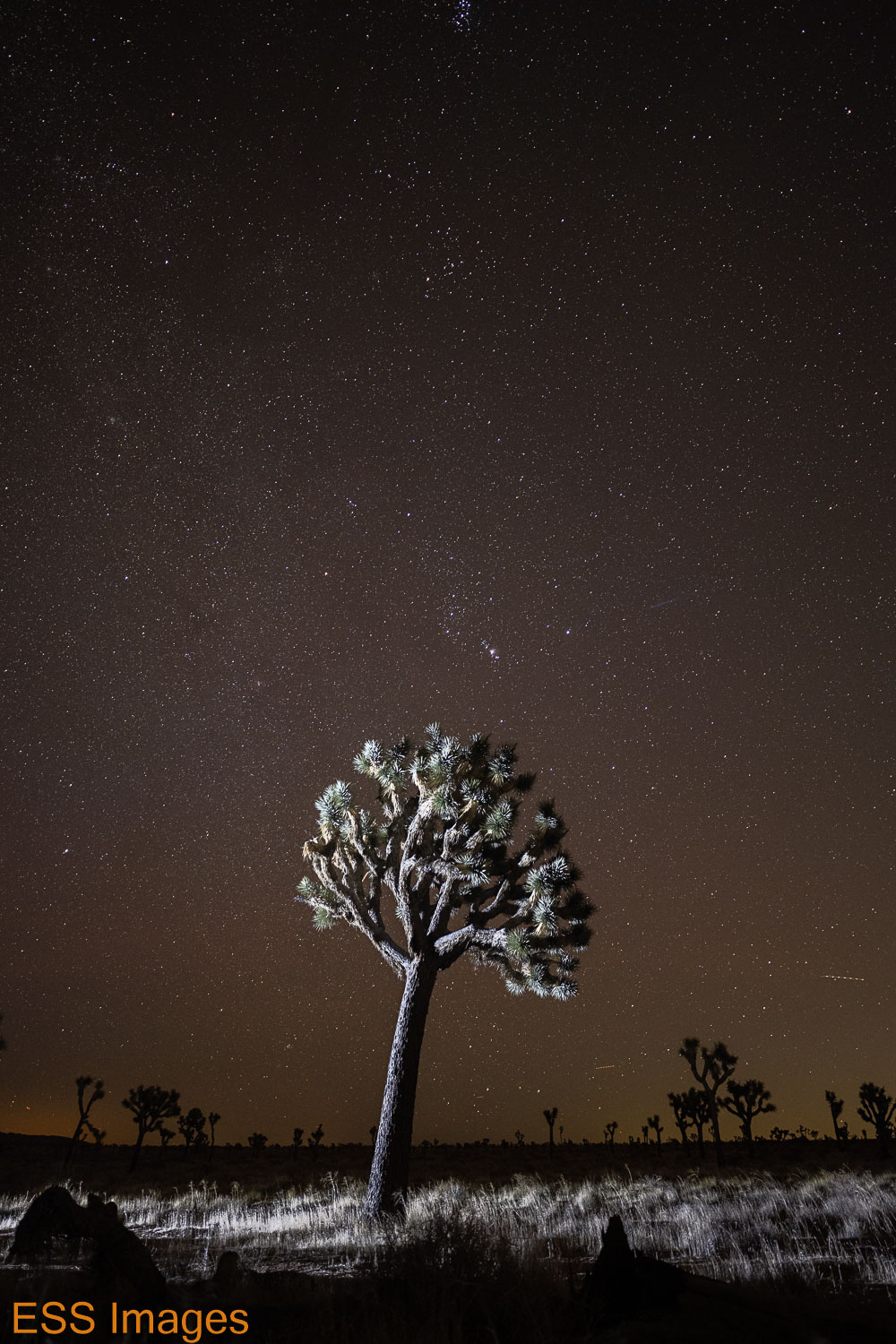
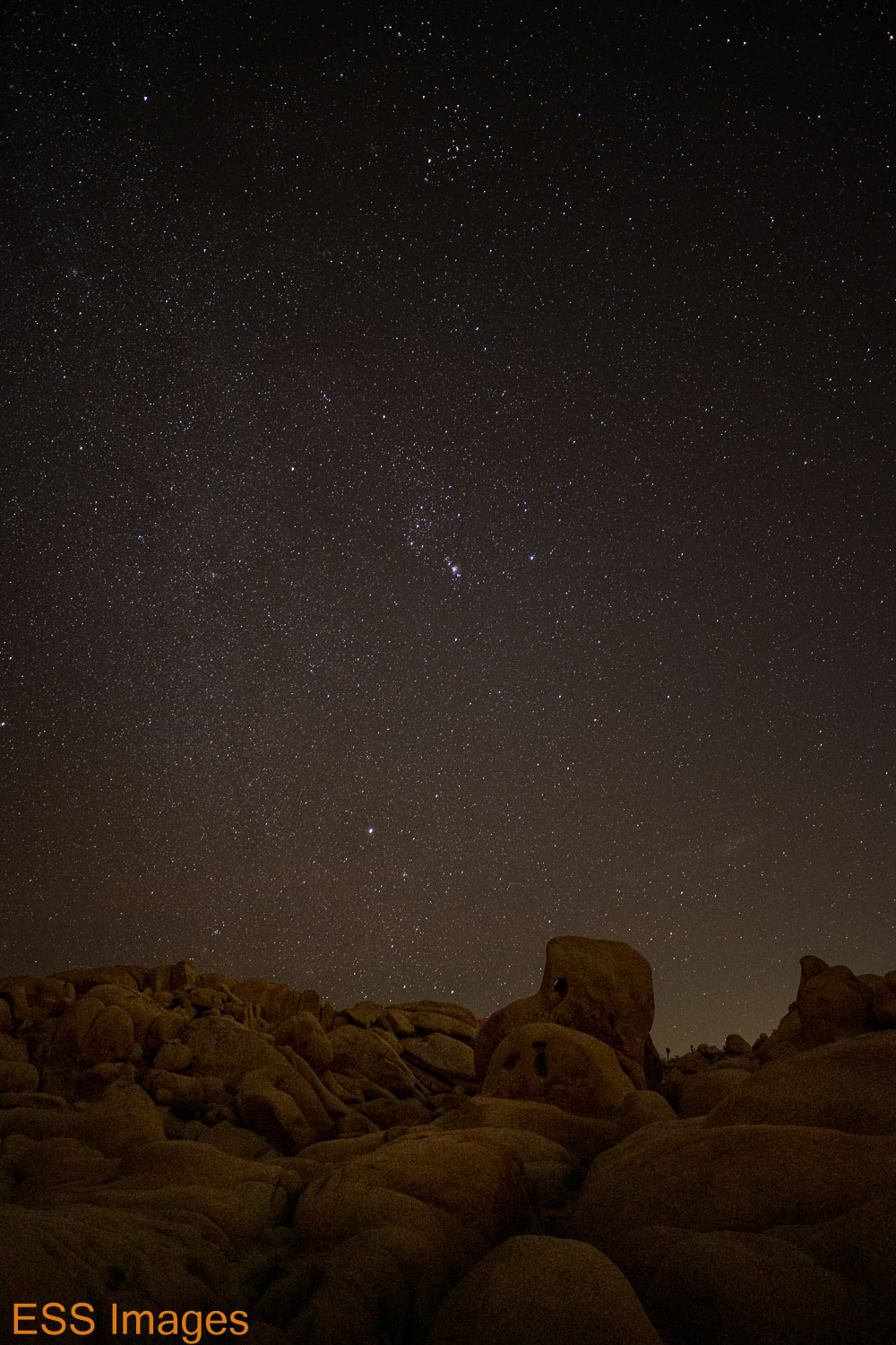
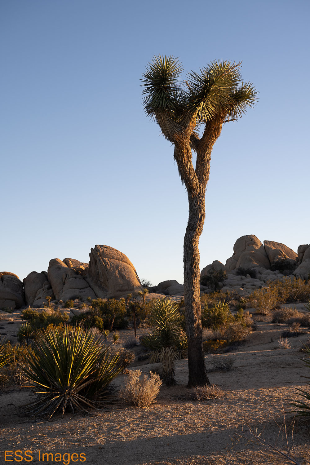
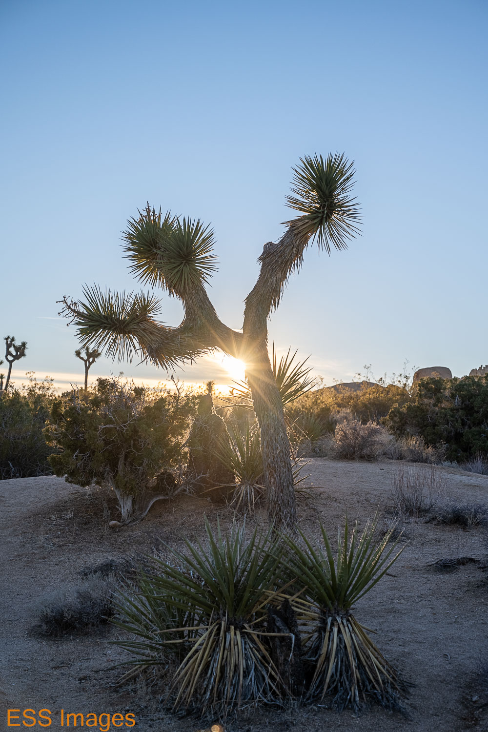
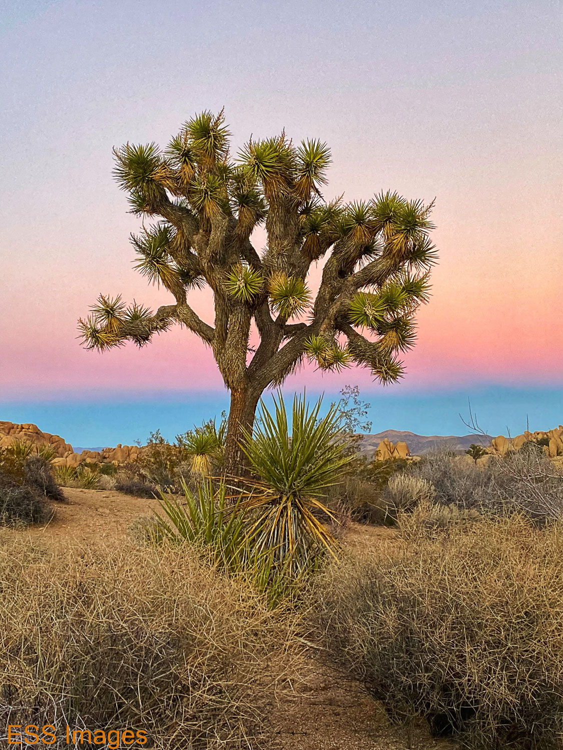
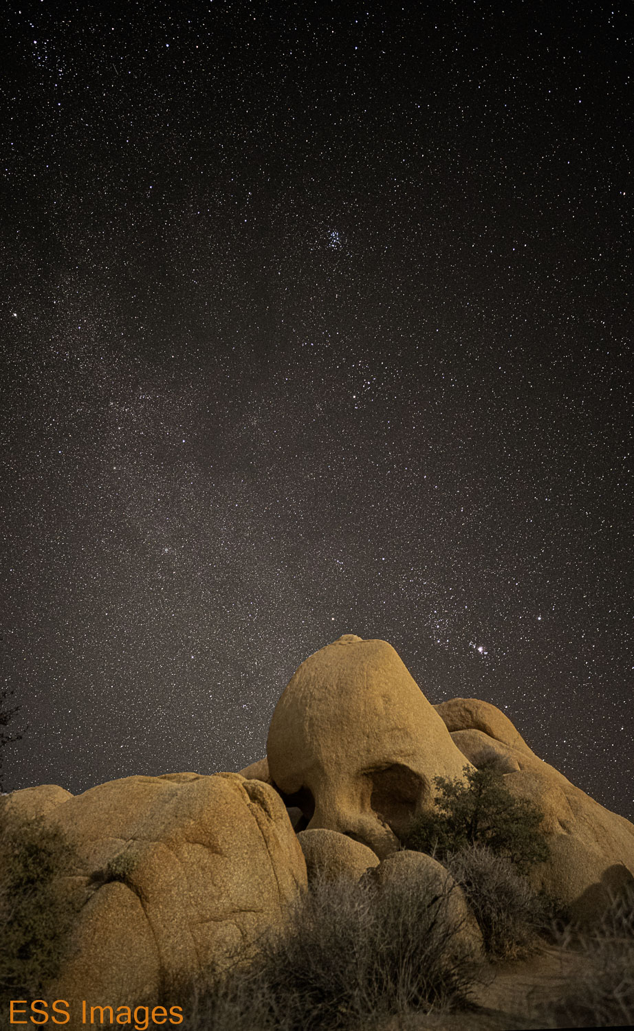
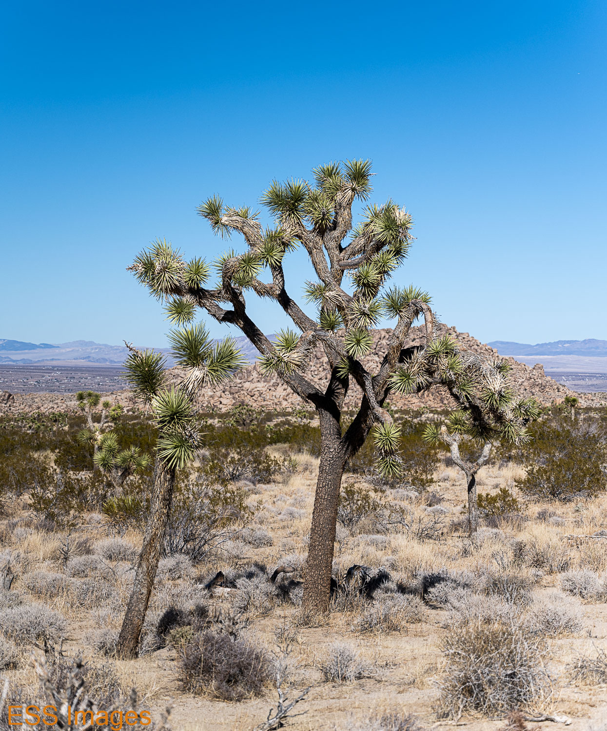
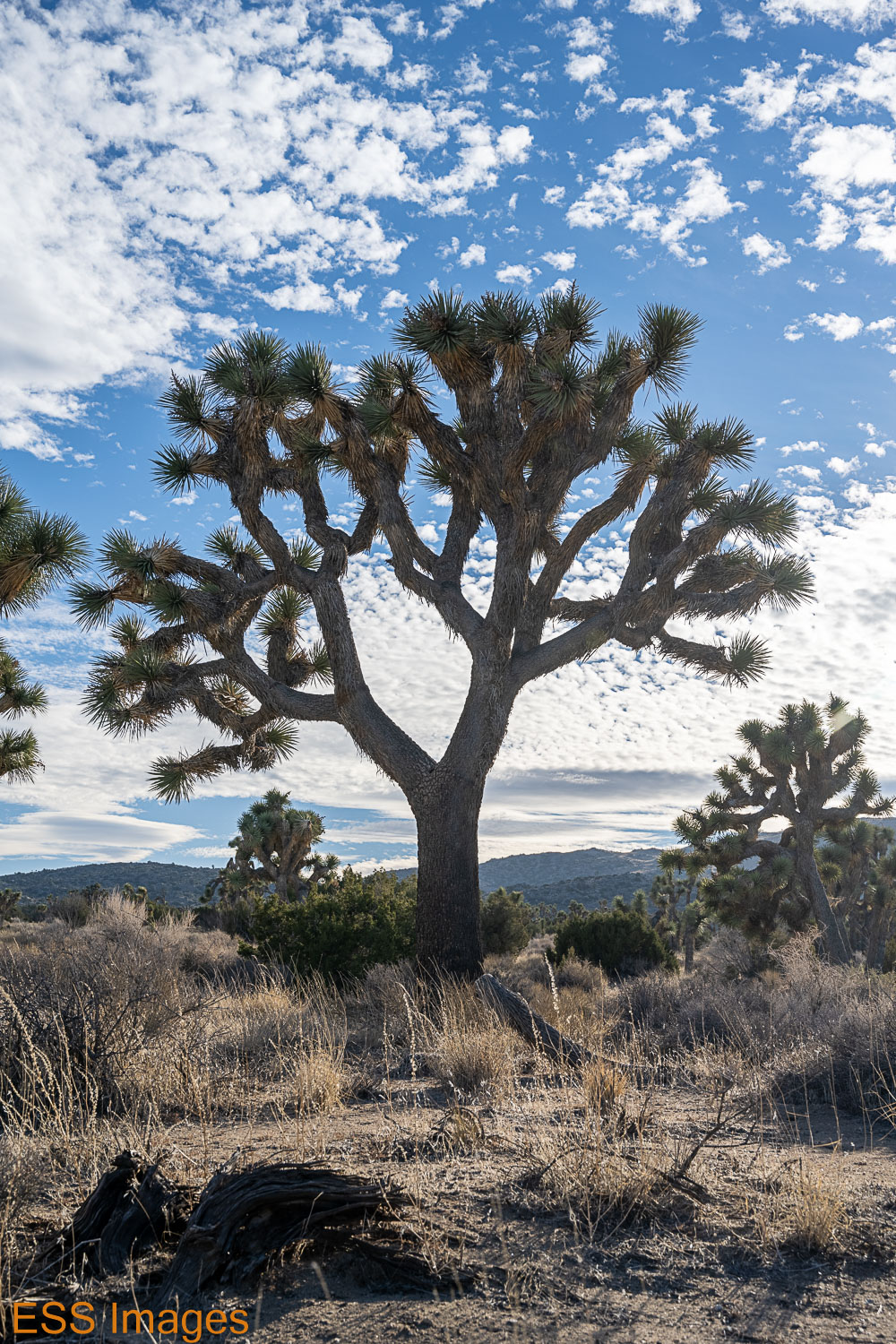
Well, looking toward the western horizon it was a bit bright. Perhaps something to do with a little town called Palm Springs being there. But that’s where a bit of the milky way was visible, so I tried a few shots that way. Then I started looking east, for Orion! I had to do at least one with a good Joshua Tree, so I found a tree I liked and shot it from several angles. If it looks like the tree is leaning a bit, that’s because it is! Then we went and found some interesting rocks to shoot before I called an early night.

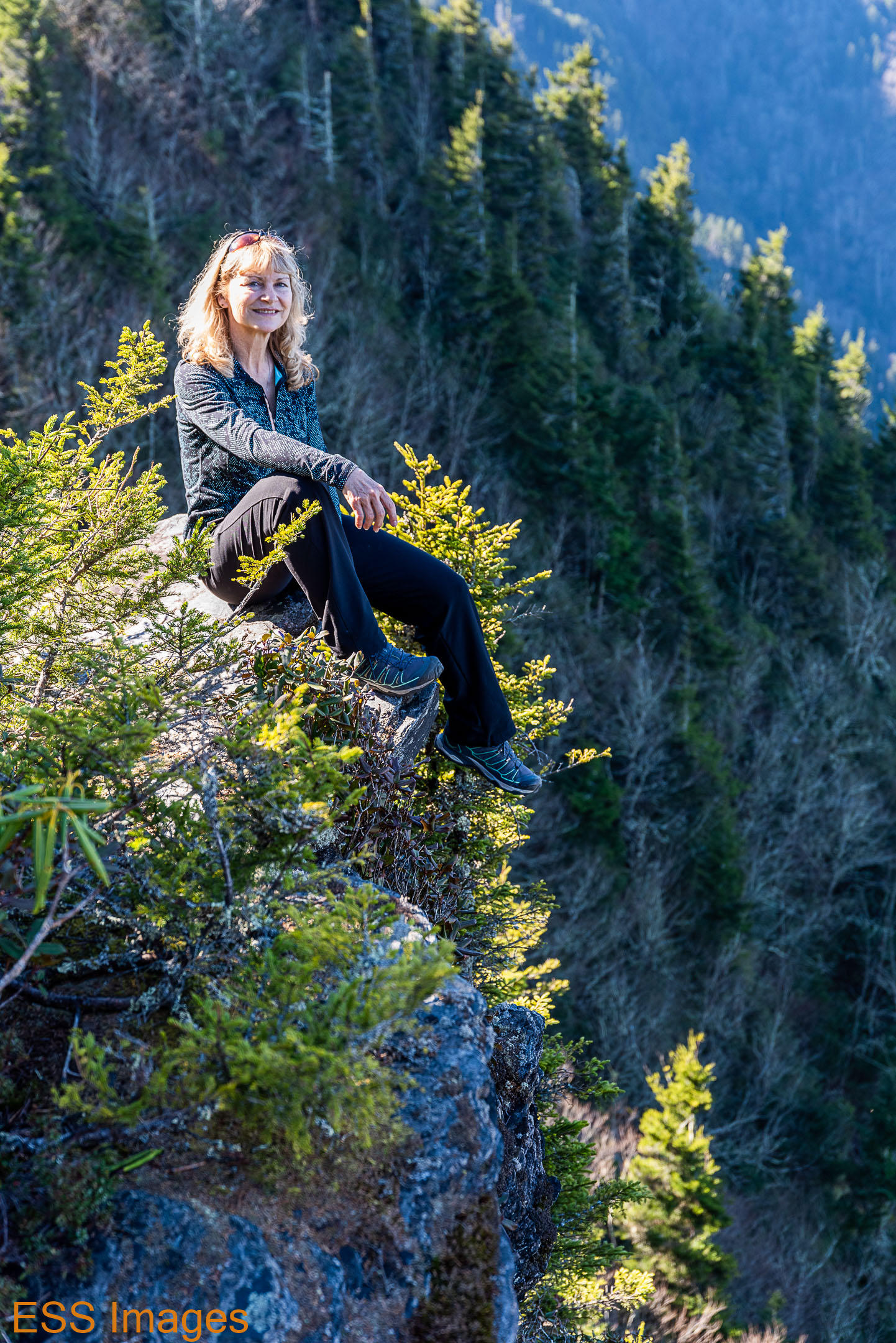
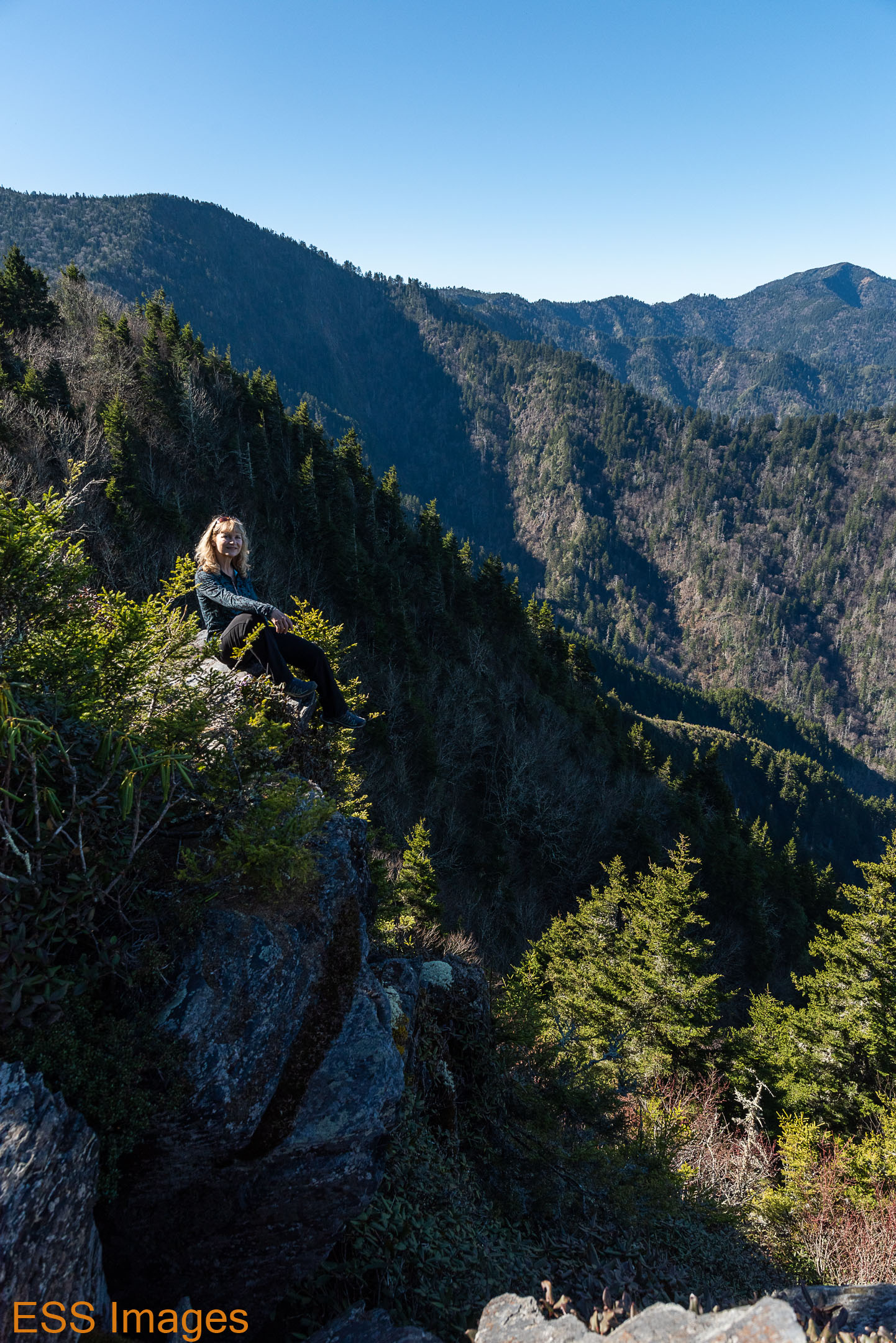
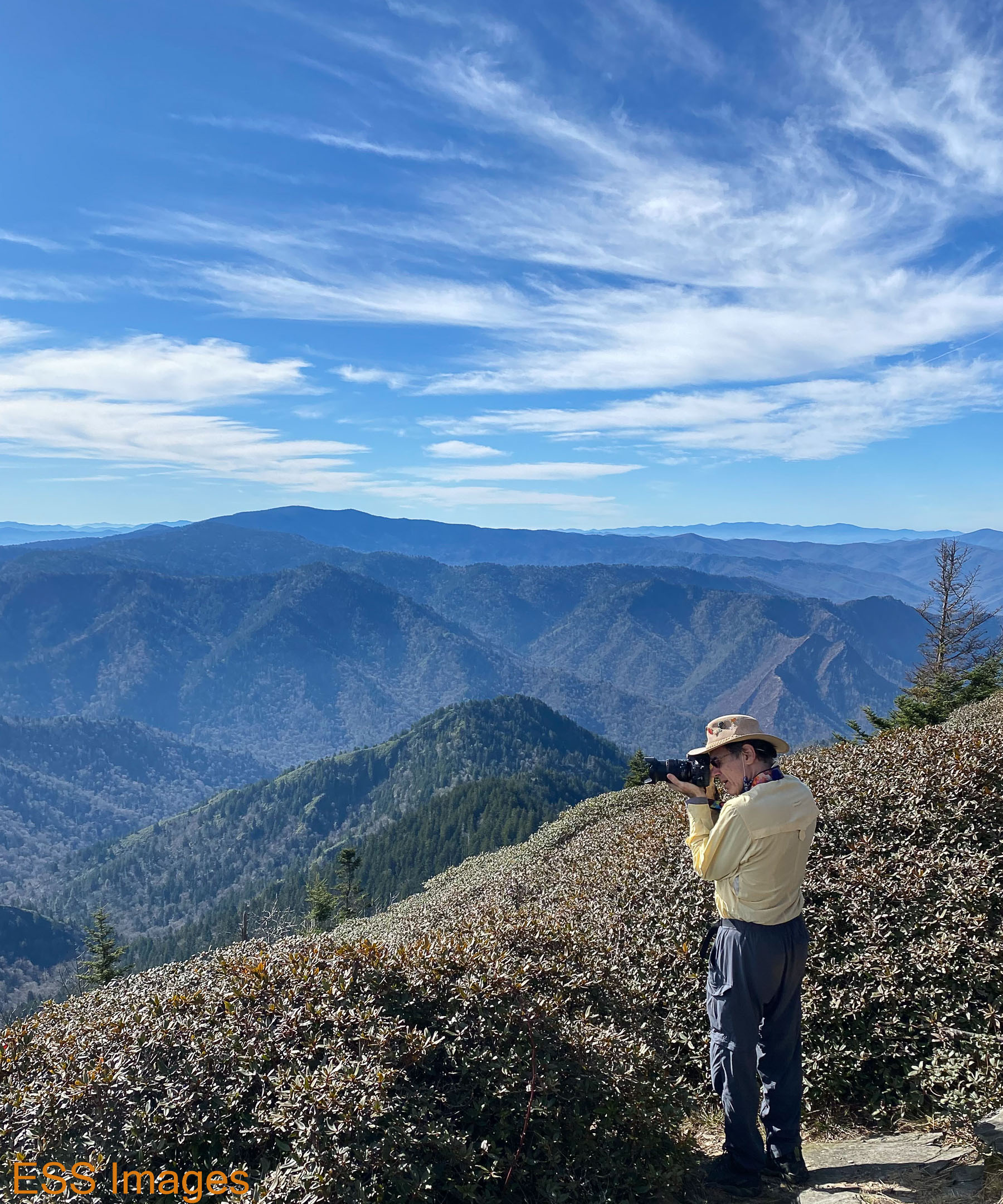
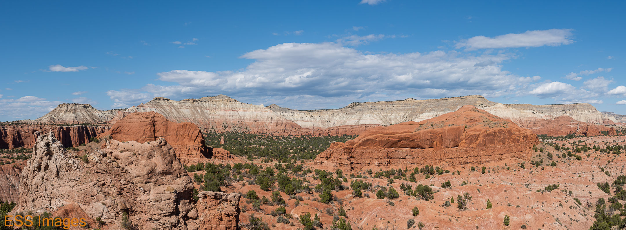
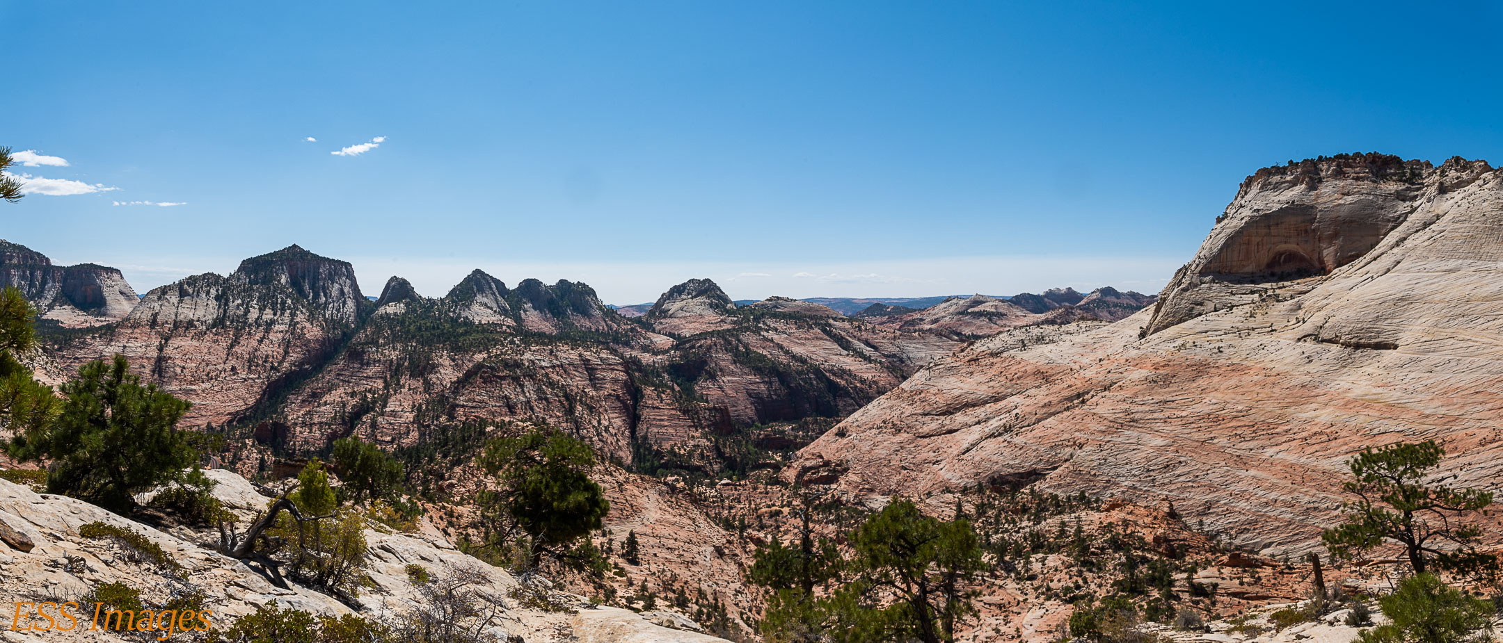
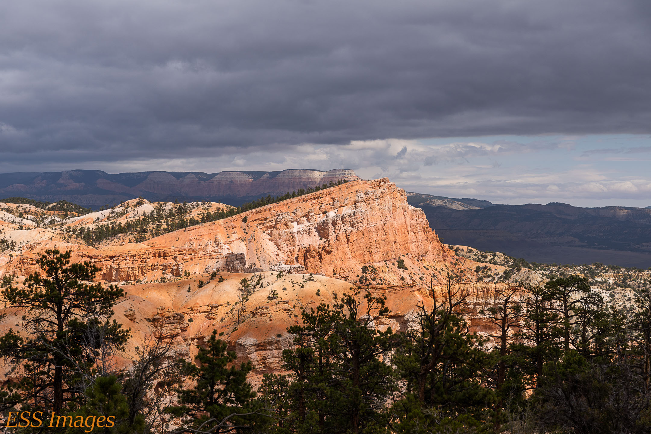
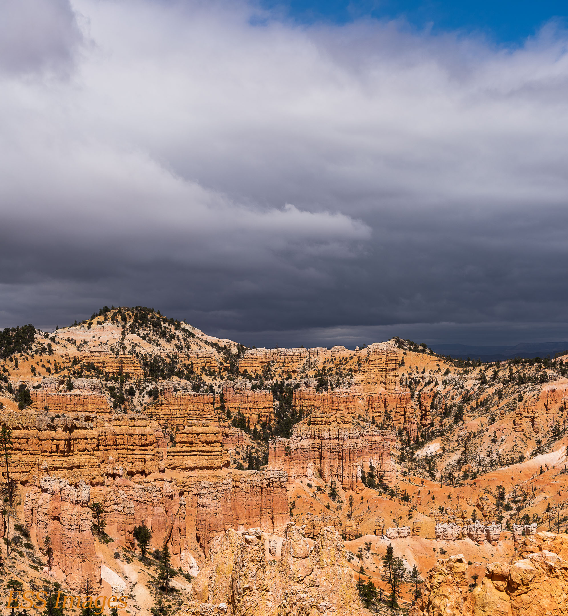
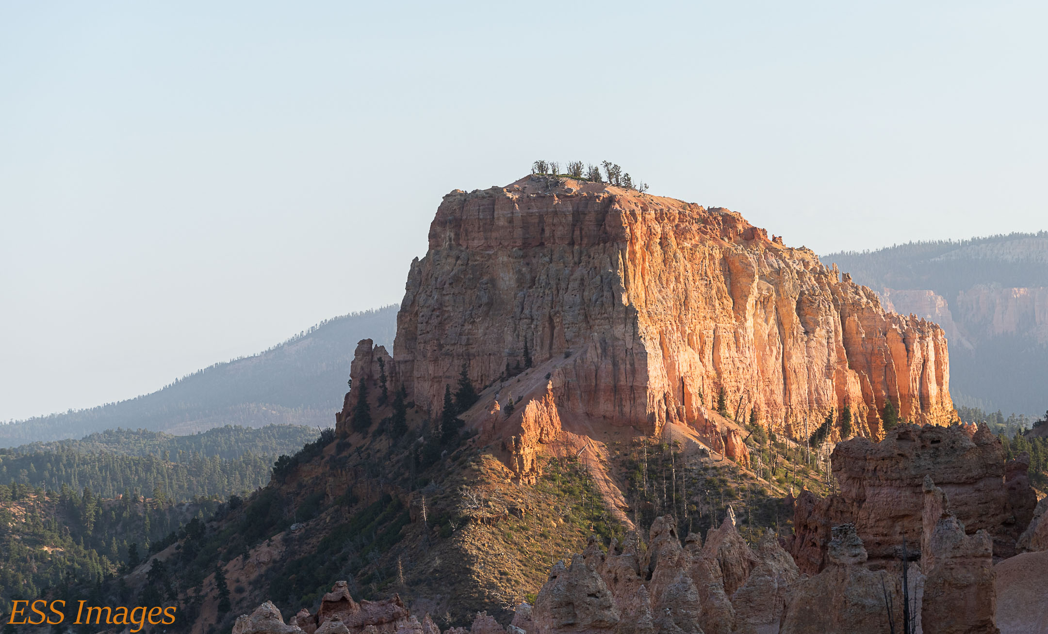
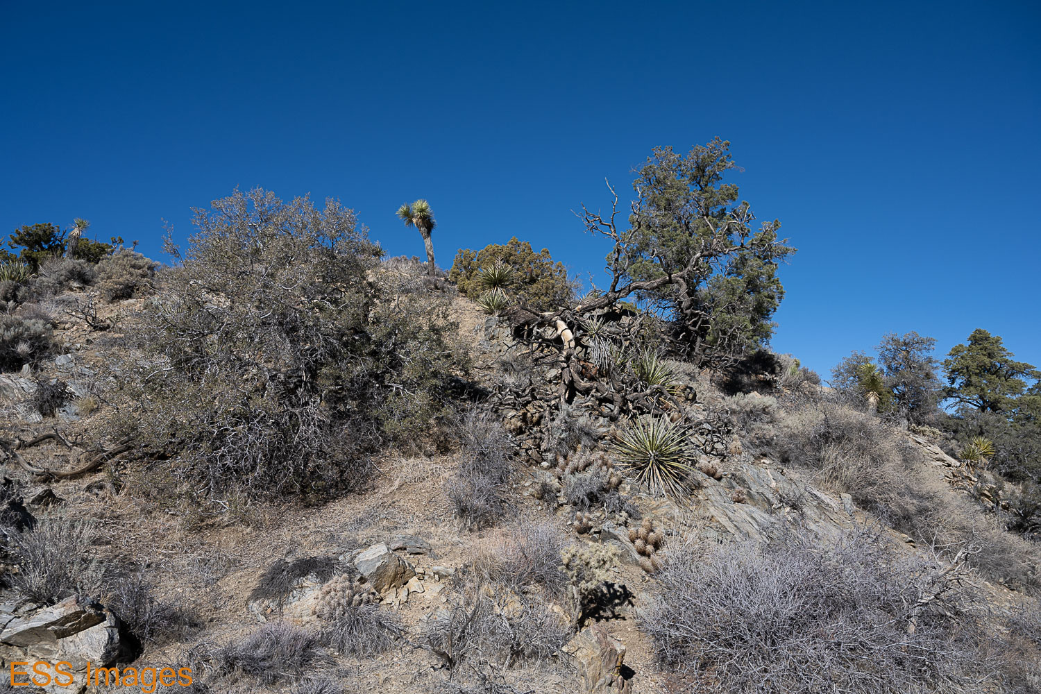
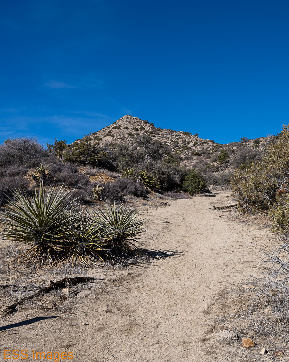
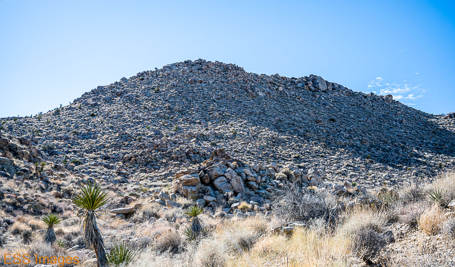
The next day was again a bit chilly early in the morning, so we delayed our start until it warmed up a bit. The target was the Panorama Loop and Warren Peak trail, a 7.7-mile moderate trail with 1689 feet of elevation. It takes you up and along a mountain ridge, then down and back up a nearby peak. As the name suggests, you get some nice panoramic views along the way.

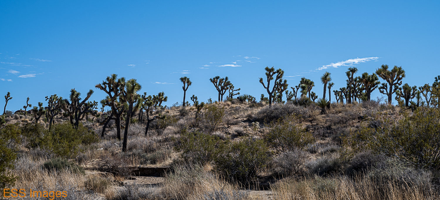
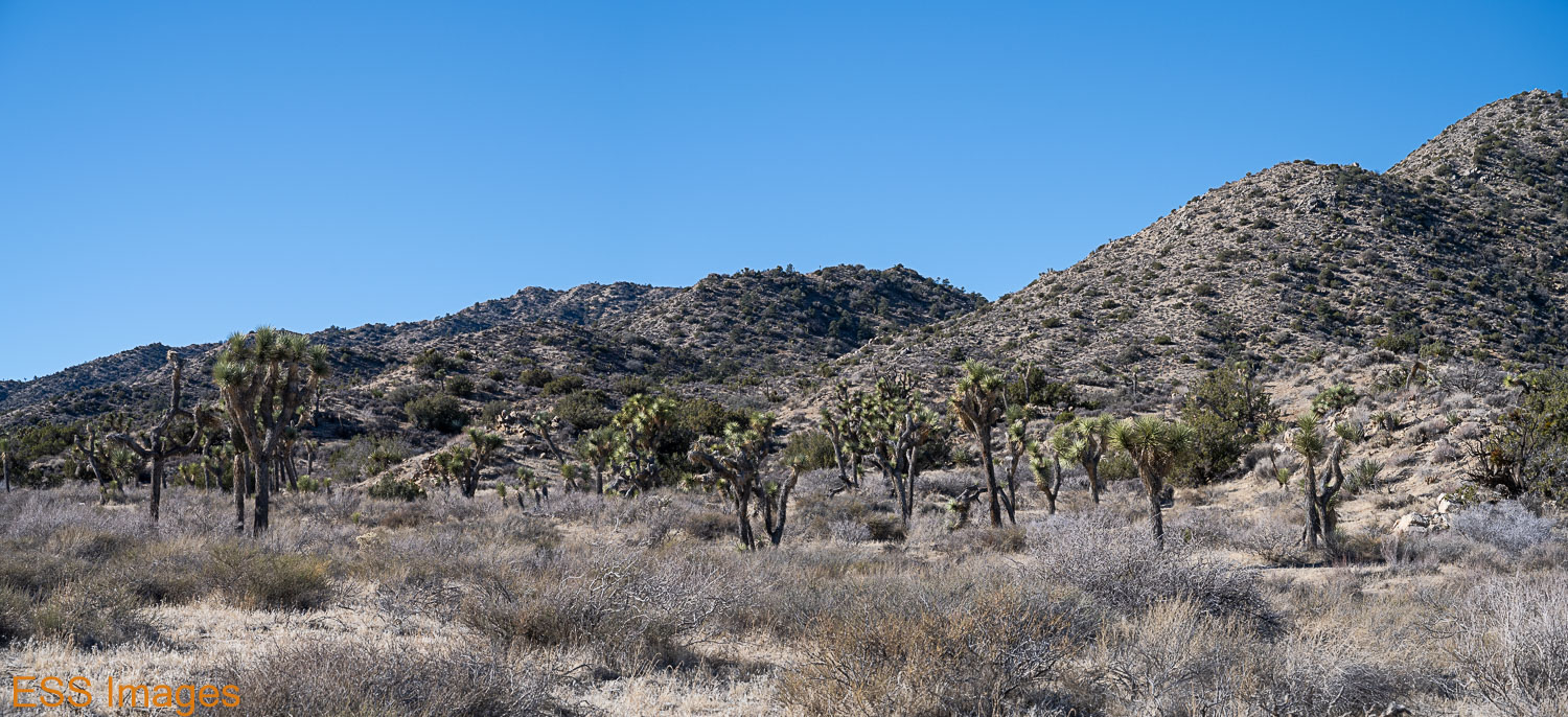
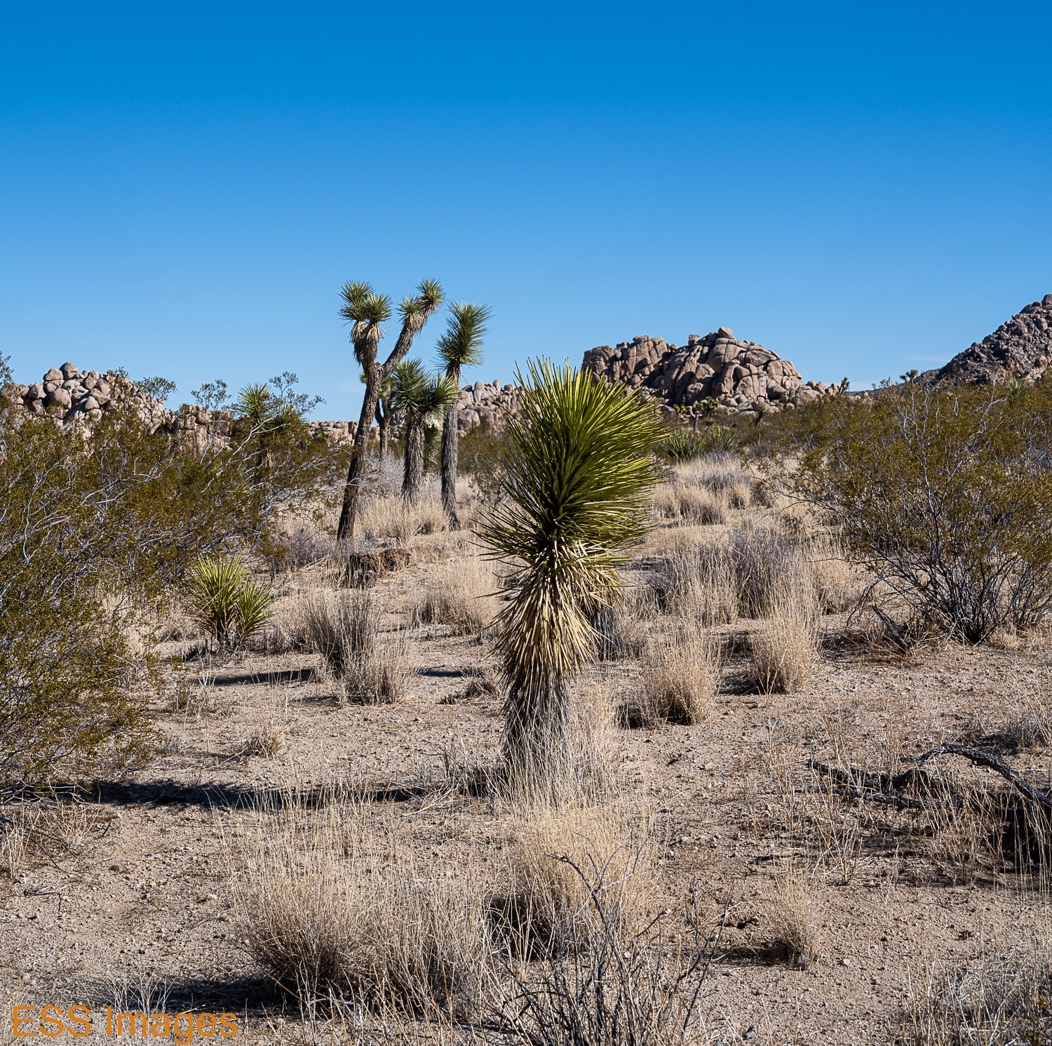
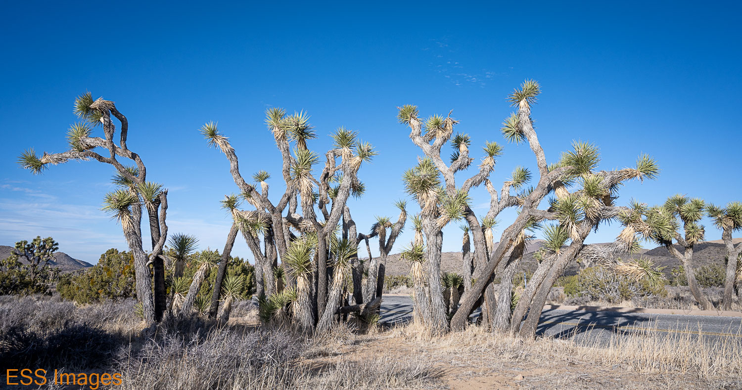
The trail starts near the Black Rock Campground and follows the Black Rock Canyon Trail. It’s a wide, sandy trail with a mild upslope and you pass through groves of Joshua Trees. It’s lovely but not incredibly exciting, and walking in the sand is a bit tiresome.

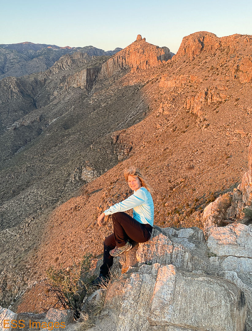
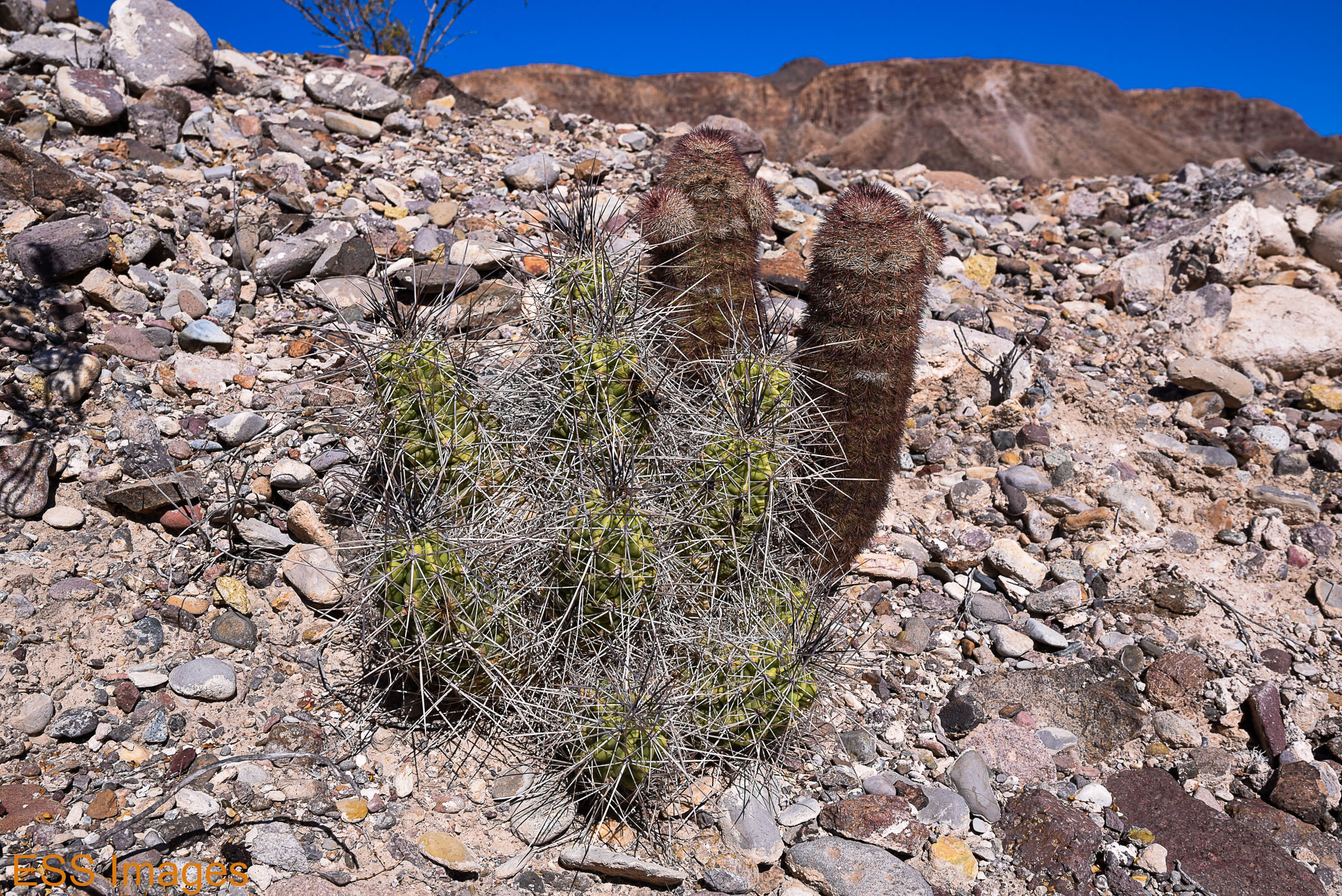
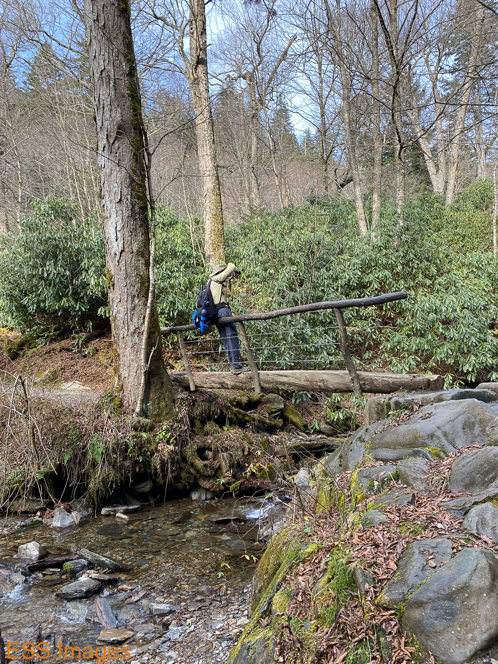
However, this trail runs into the Panorama Loop, a much more challenging and interesting hike! At the junction, we turned left, having been advised (by one of the reviewers on AllTrails!) to take the loop clockwise. I can’t remember their reasoning and I didn’t notice anything that would have made a big difference. Either direction will go a little bit better with trekking poles! Have I mentioned trekking poles? 🙂 You start off on a relatively flat stretch down a canyon, reminded me of some hikes out in west Texas, rocks & cacti & so forth.

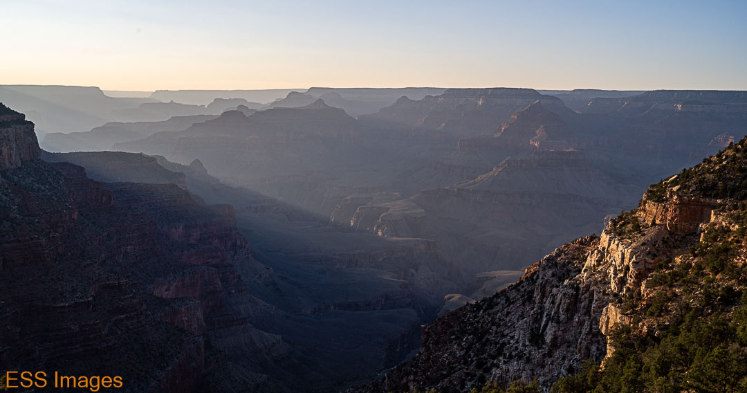
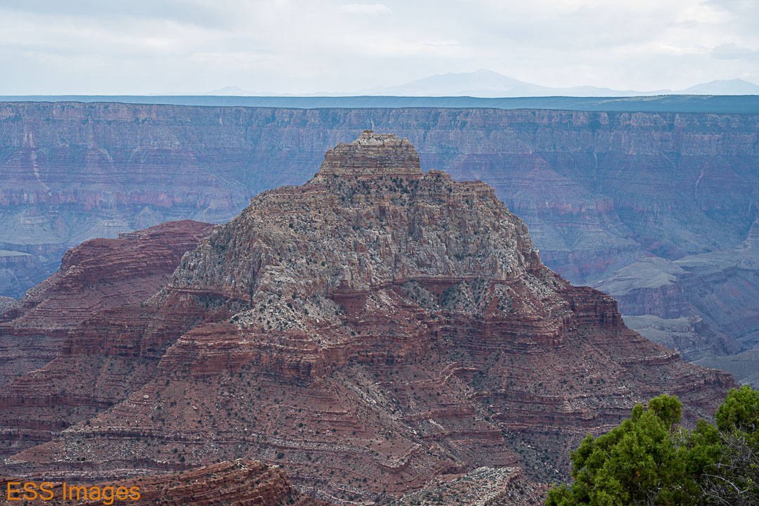
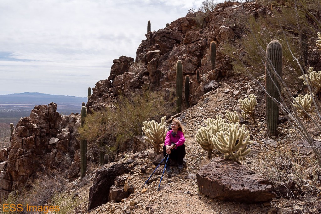
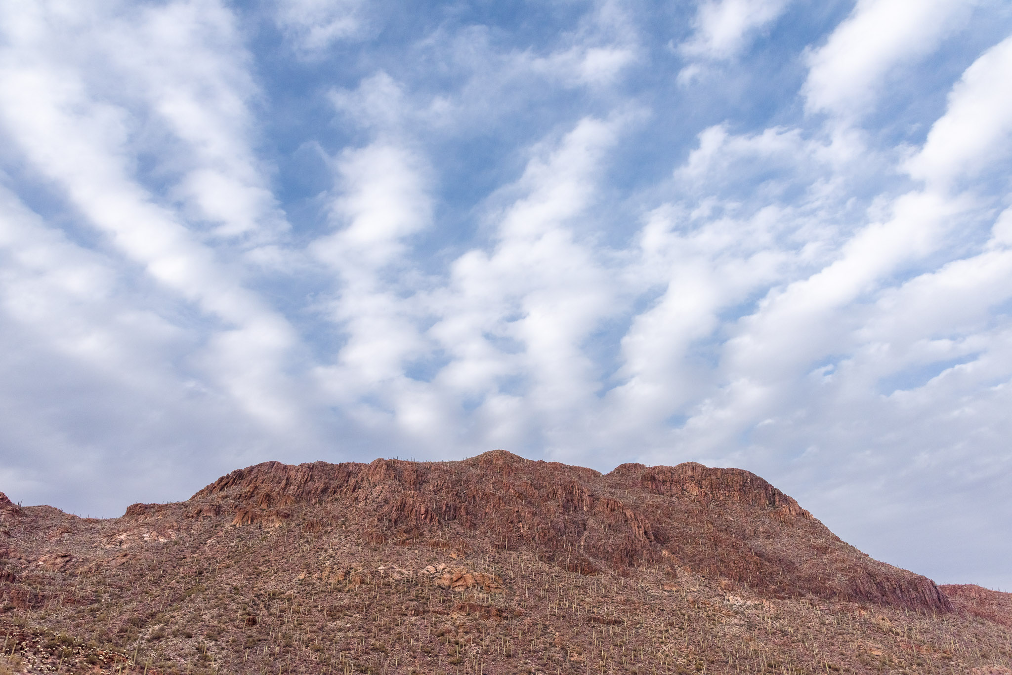
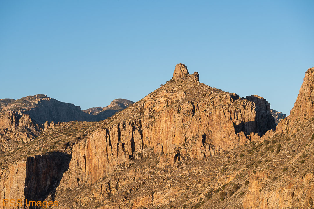
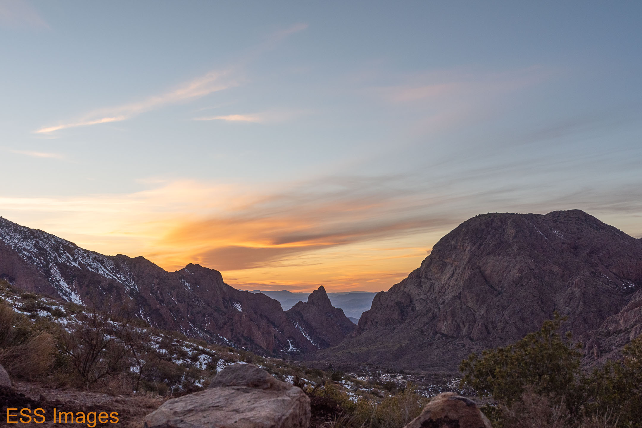
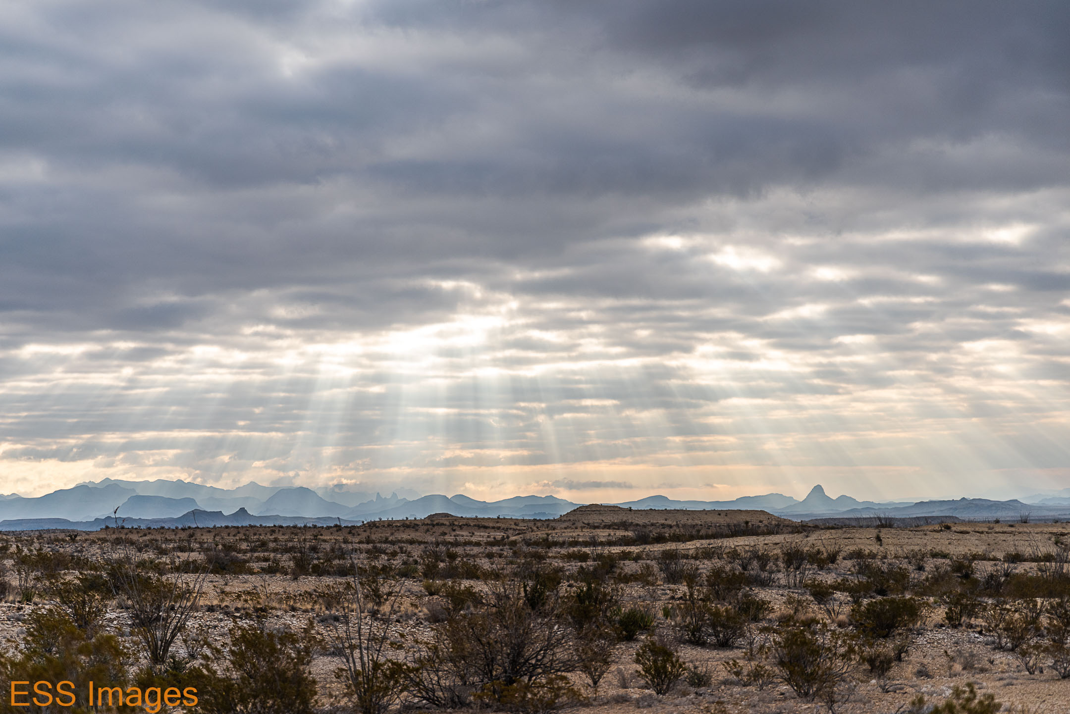
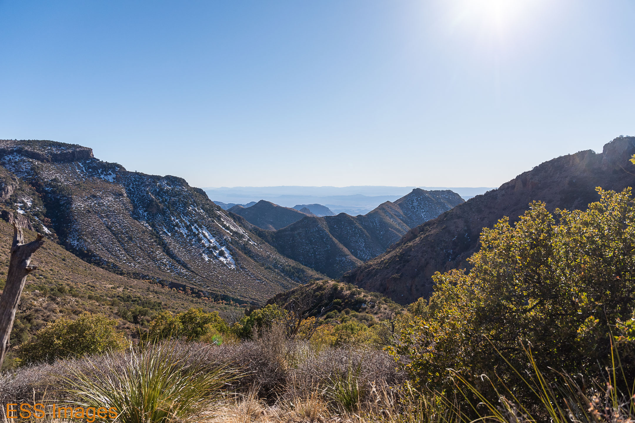
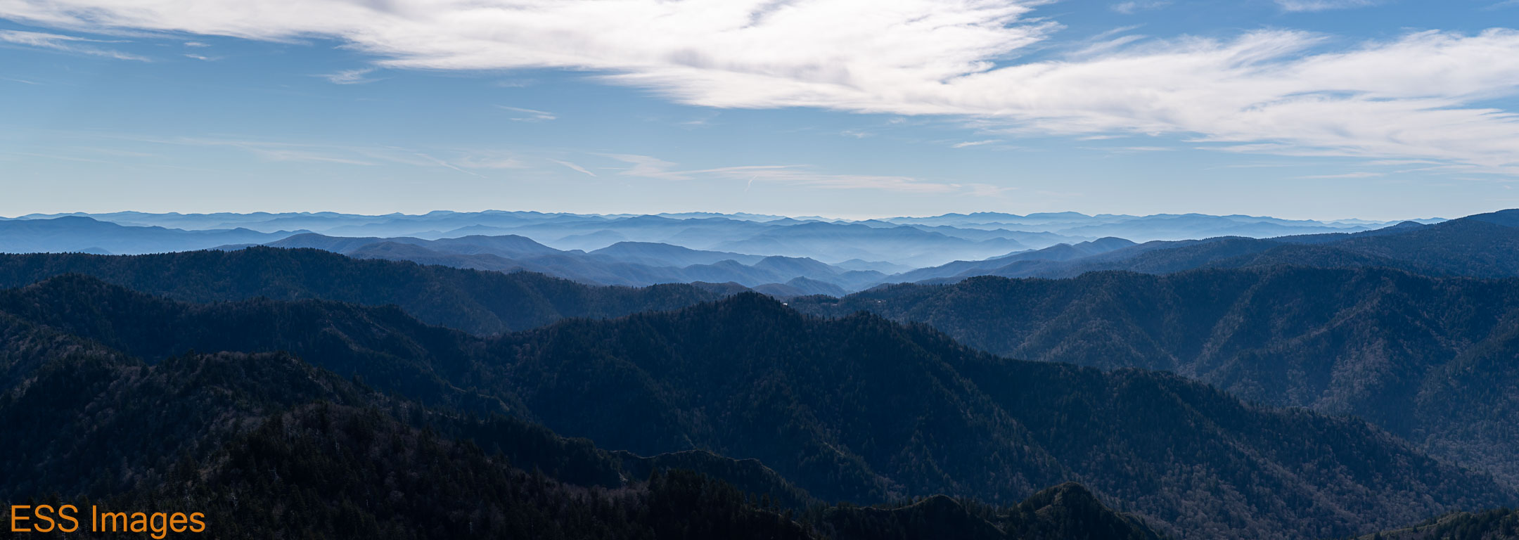
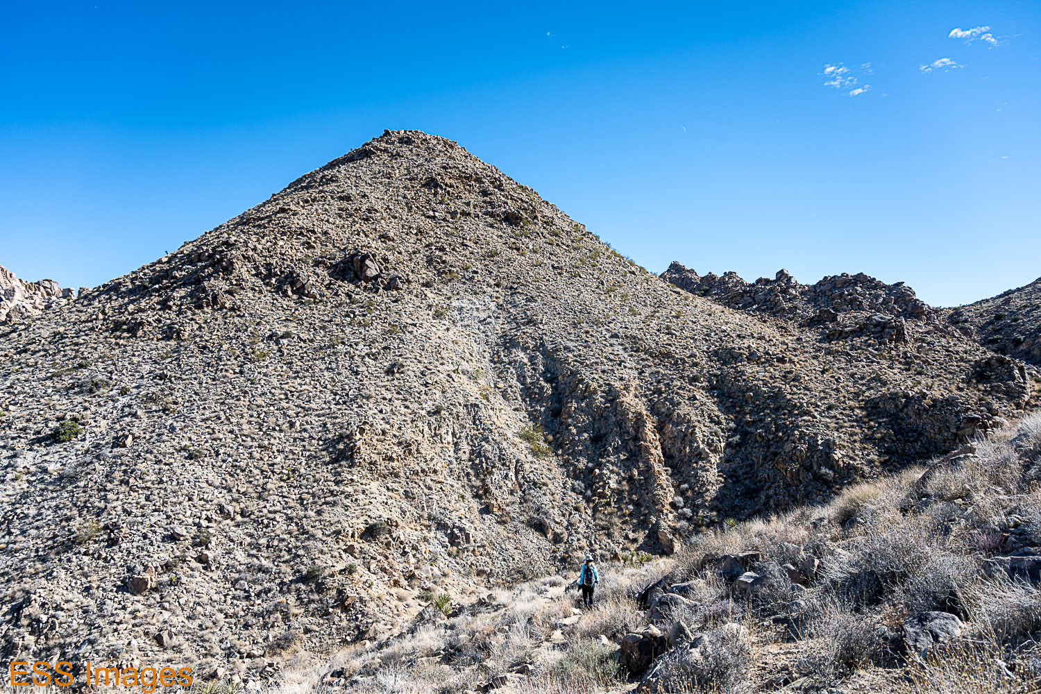
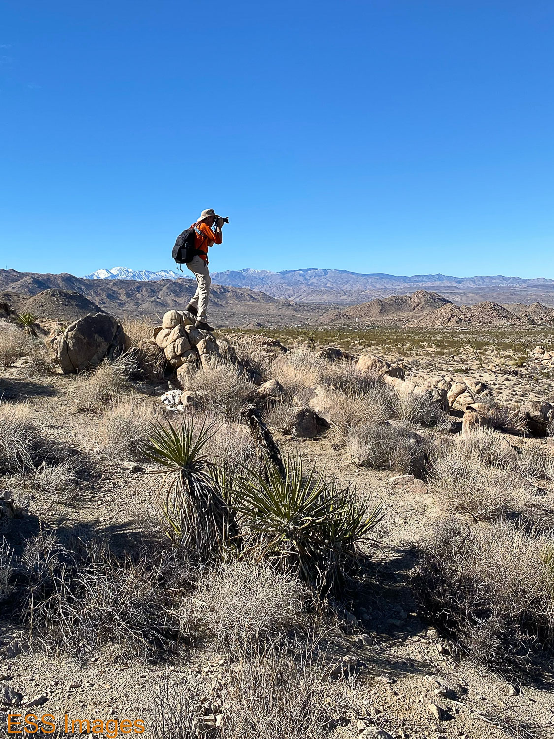
After a while you start climbing up the side of the ridge and soon you’re looking out over the canyon you were just traversing. The trail is rocky and occasionally steep, but not too difficult and the views are a definite payoff! Though the persistent layer of haze over Palm Springs is not all that lovely…

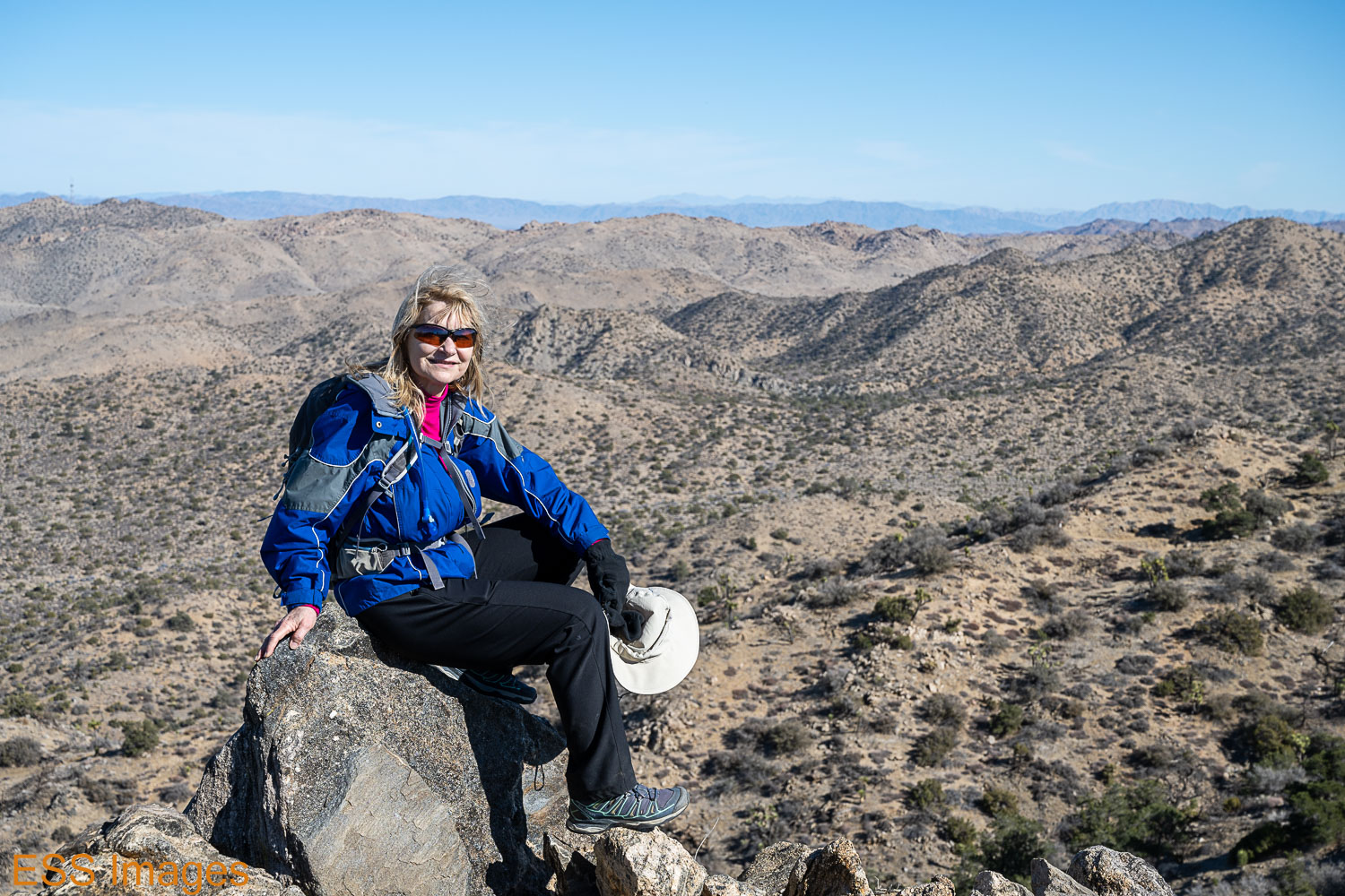
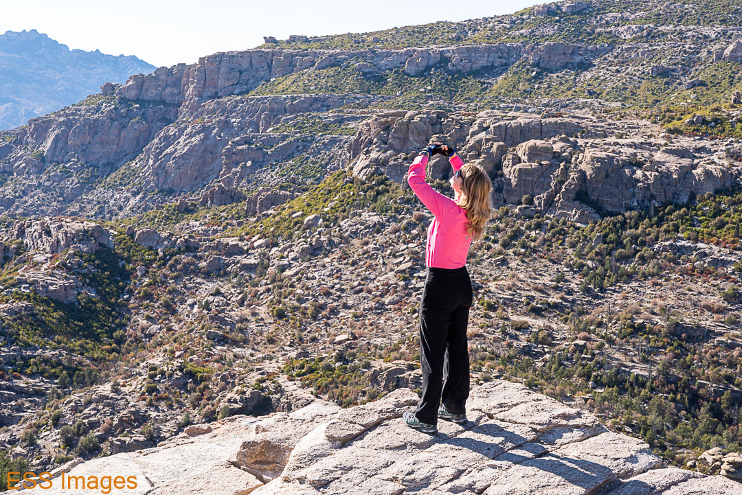
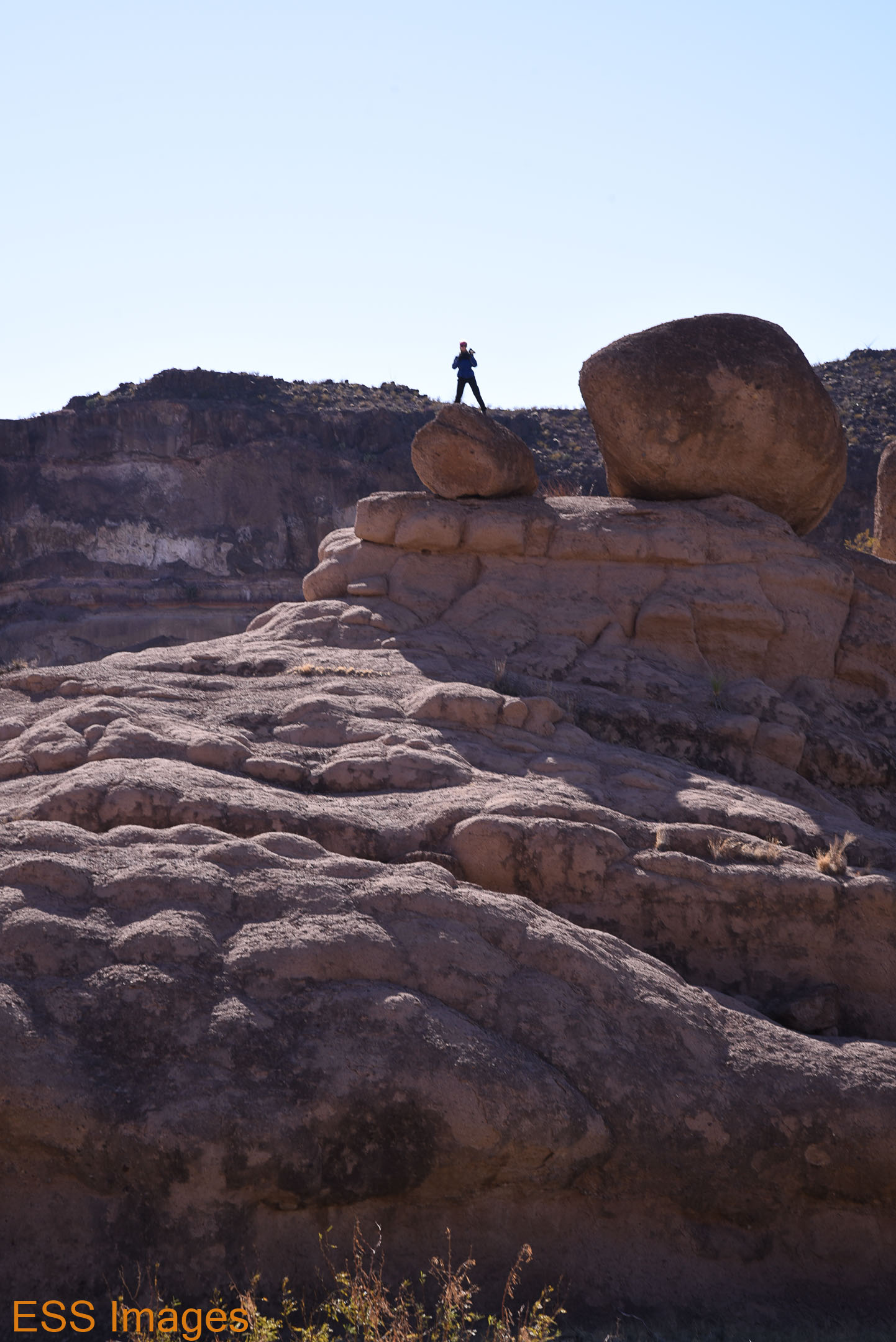
The highest point on the trail is along the ridge, approximately where Leigh is poised upon the rock. From that point we went downslope for a while, back toward the canyon we had been traversing originally. Still more Joshua Trees and cacti, great hiking!

Then we started back uphill…

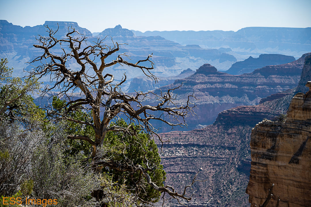
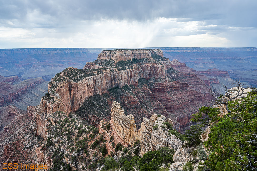
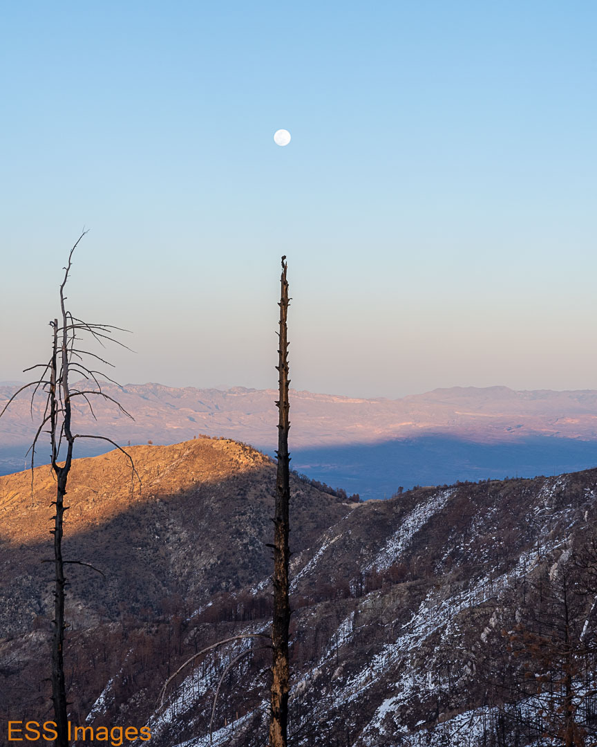
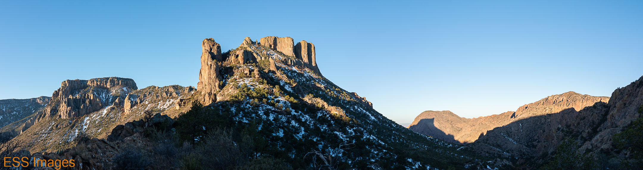
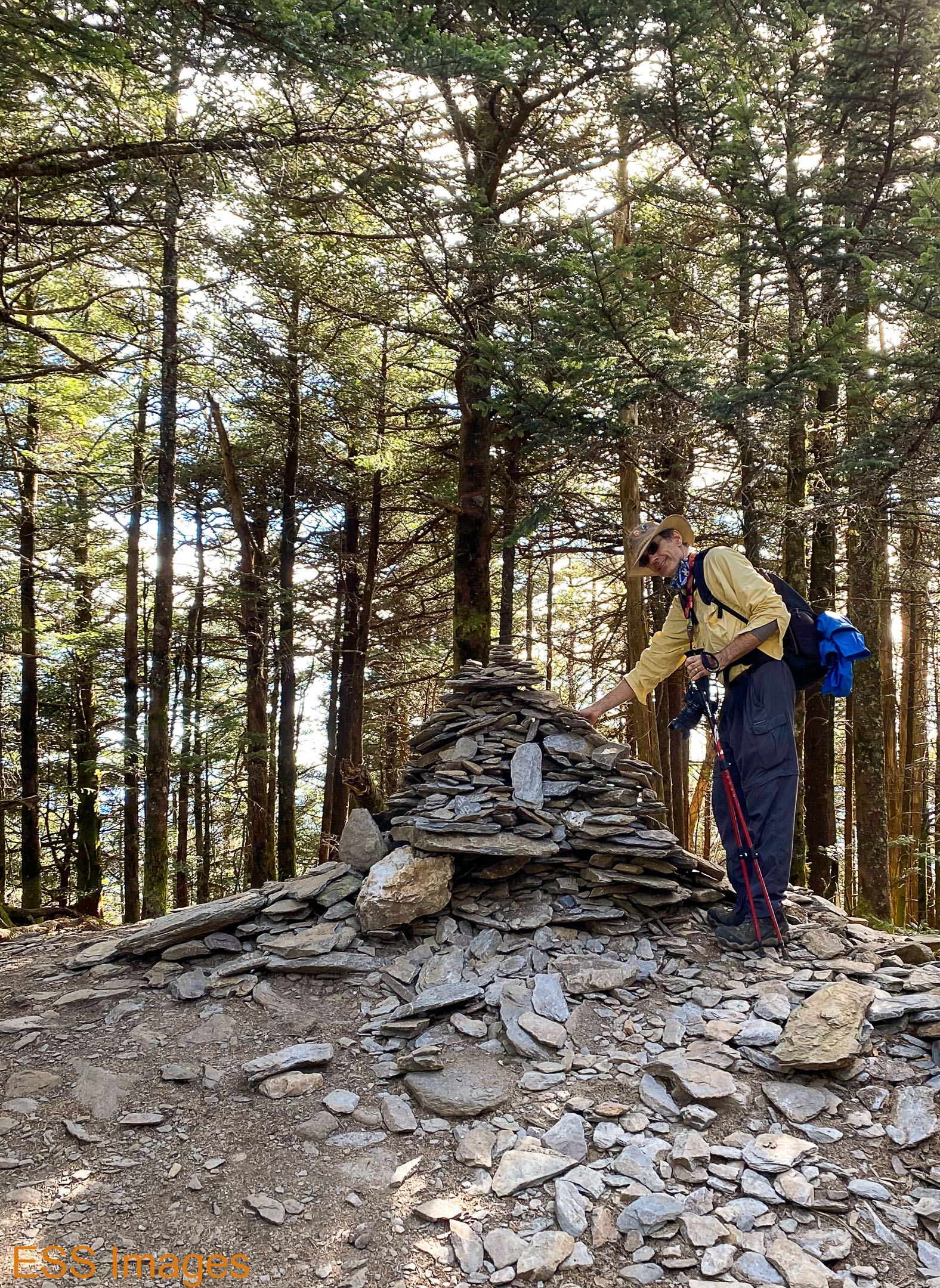
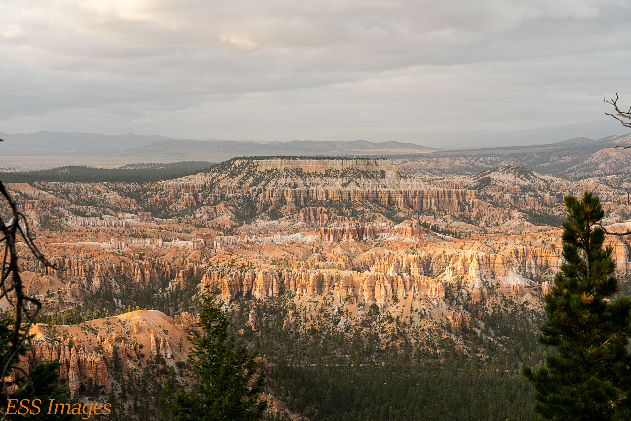
The trail up to Warren Peak was relatively steep in parts, but generally pretty good. There is a stretch that goes up a fairly steep wash that was fun! It would not have been amiss to have trekking poles here. The view from the top was not all that different from the panorama view earlier. But I liked the dead tree… 🙂

And it was all downhill from there. Scrambling back down Warren Peak to the sandy-bottomed canyon and the almost level stroll back to the campground. Leaving there, we stopped at the room for a bit and headed back to Skull Rock, this time determined to get photos of the elusive beast itself… 🙂

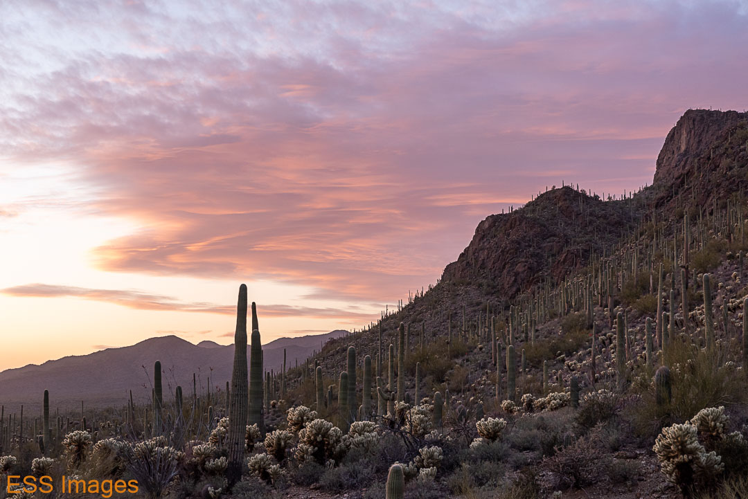
We got there in time to enjoy sunset among the rocks and Joshua Trees.

And then it got dark!

And so to bed!

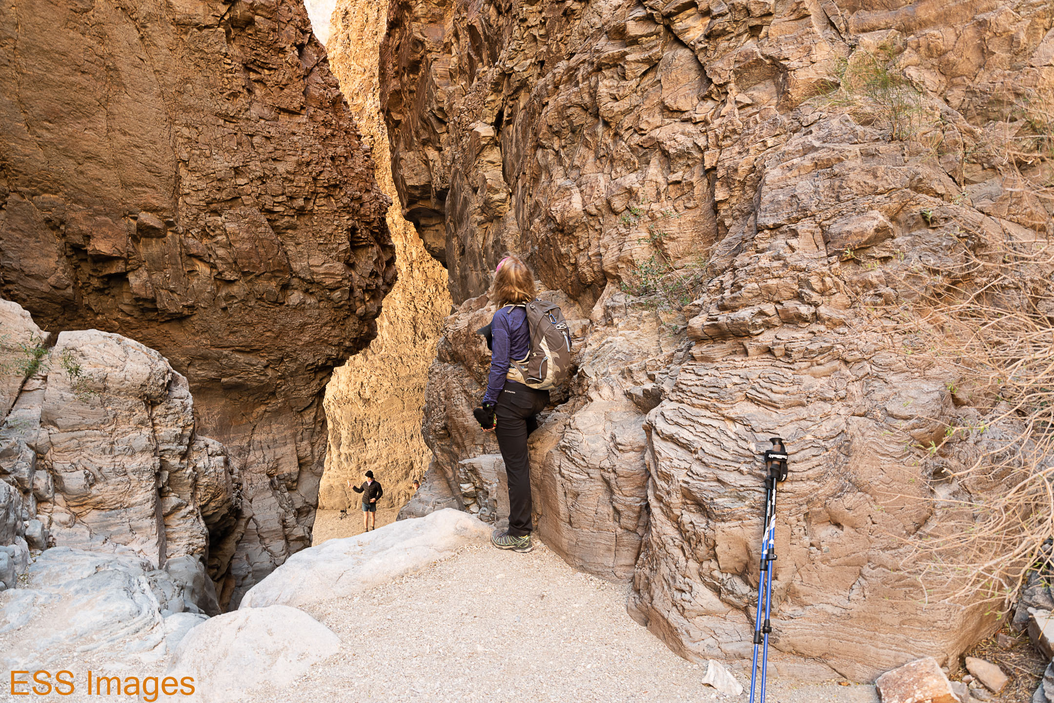
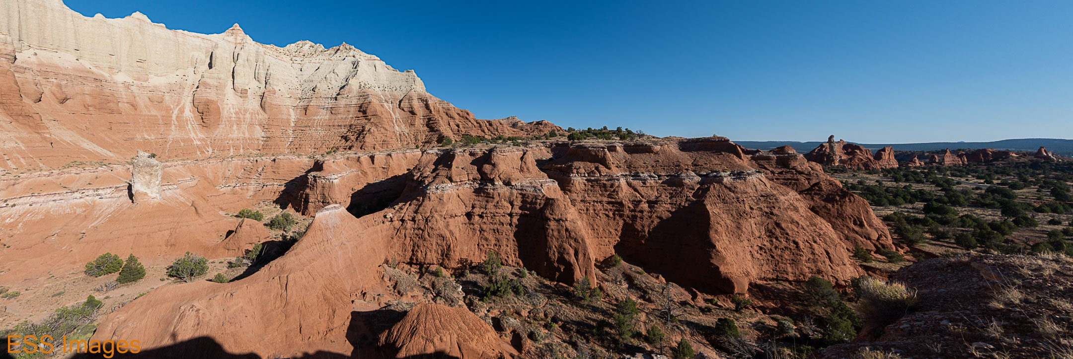
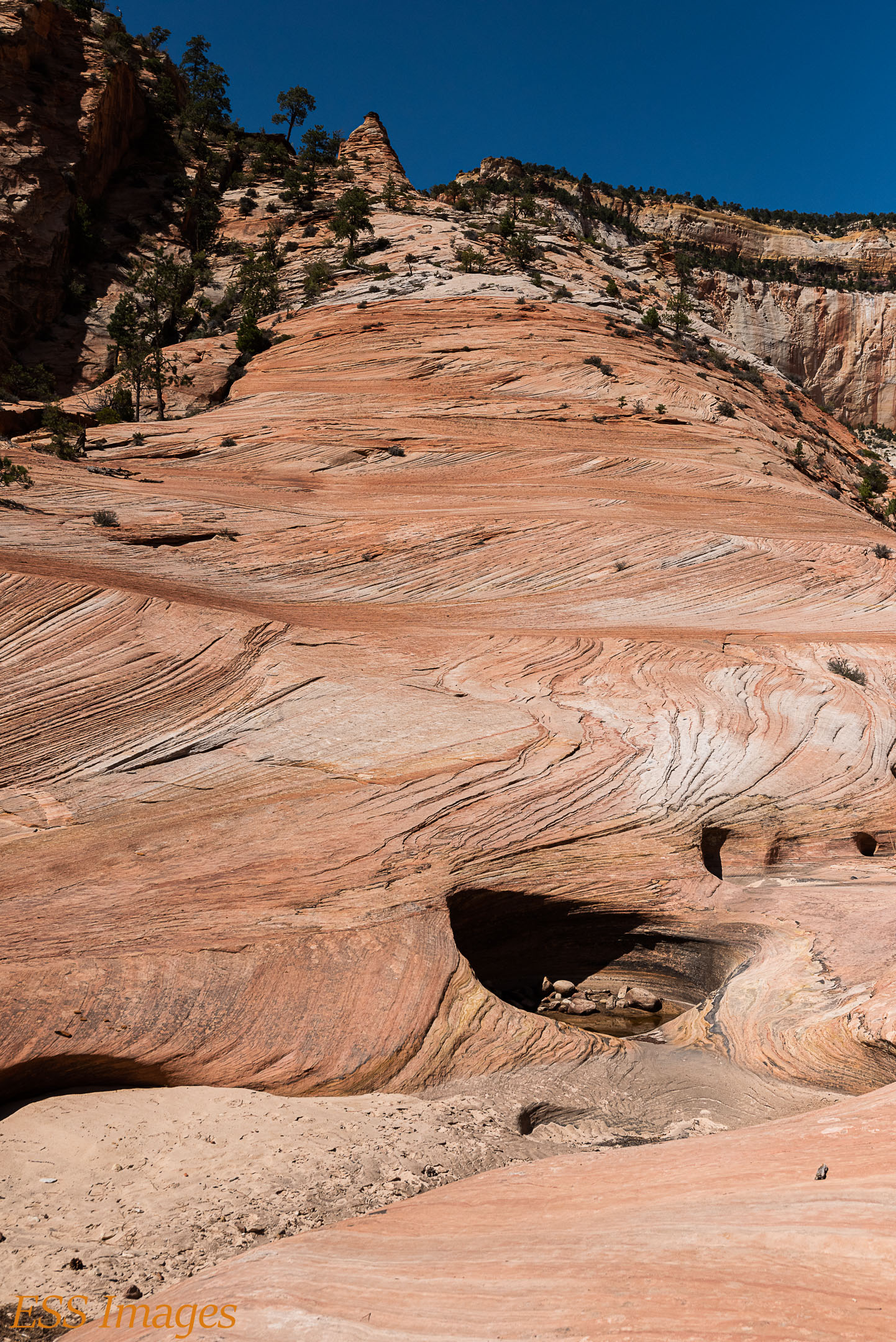
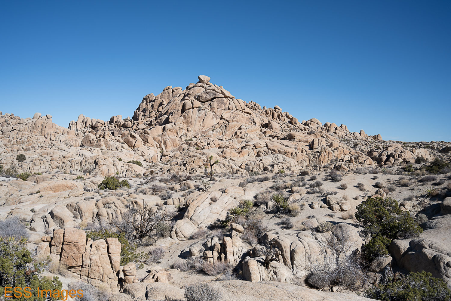
The next day was our last hiking day and we had to pick up a friend at the airport in Palm Springs. We chose a relatively short, flat trail near the west entrance to the park, the North Trail and North Canyon Trail loop, just inside the park. This trail had a different character than the others we had done, it was in among the huge rockpiles that populate this part of the park rather than up and down the mountains.

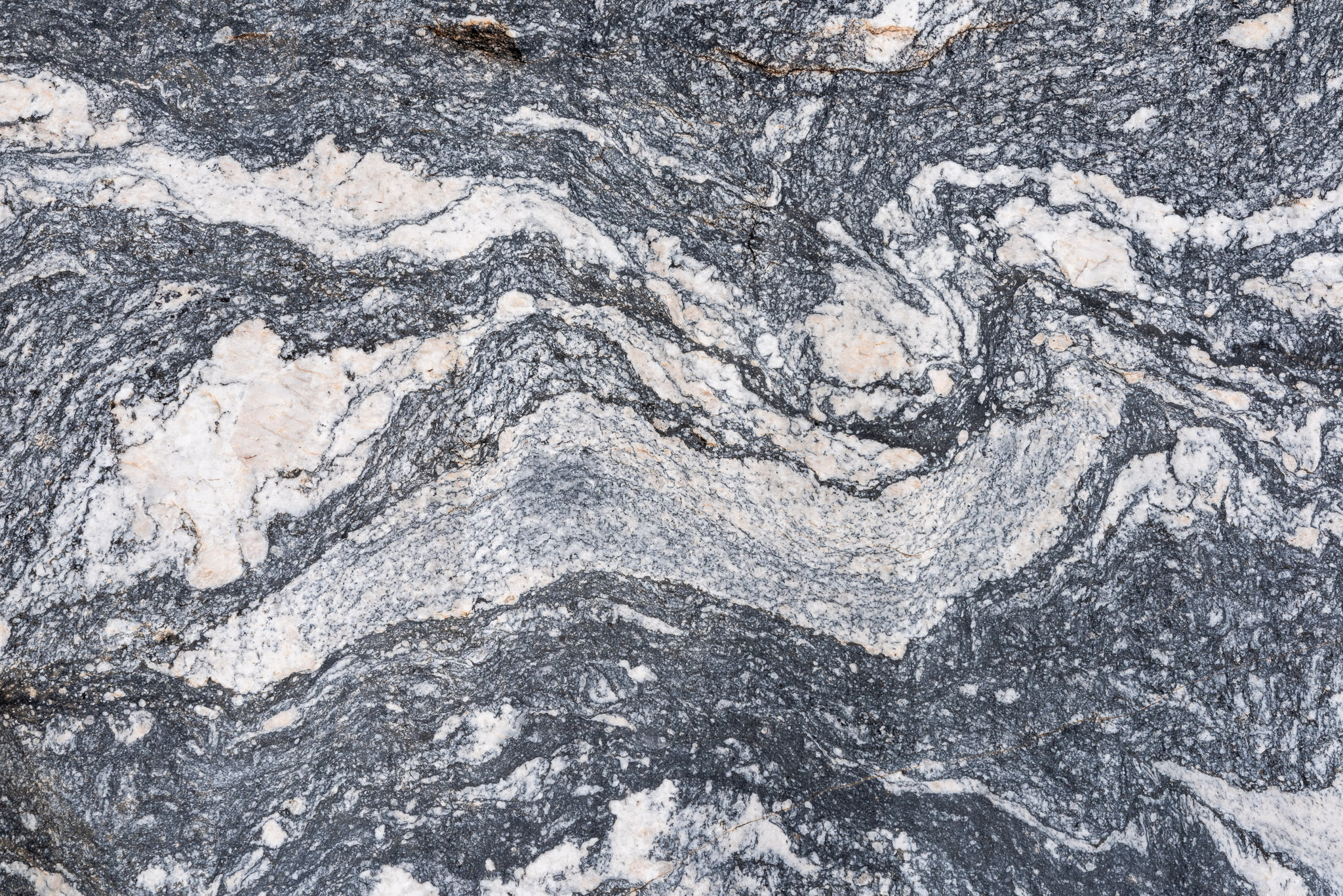
They say the big rock formations were magma extrusions formed underground and then everything around them eroded away. I wasn’t there so I’ll take their word for it!

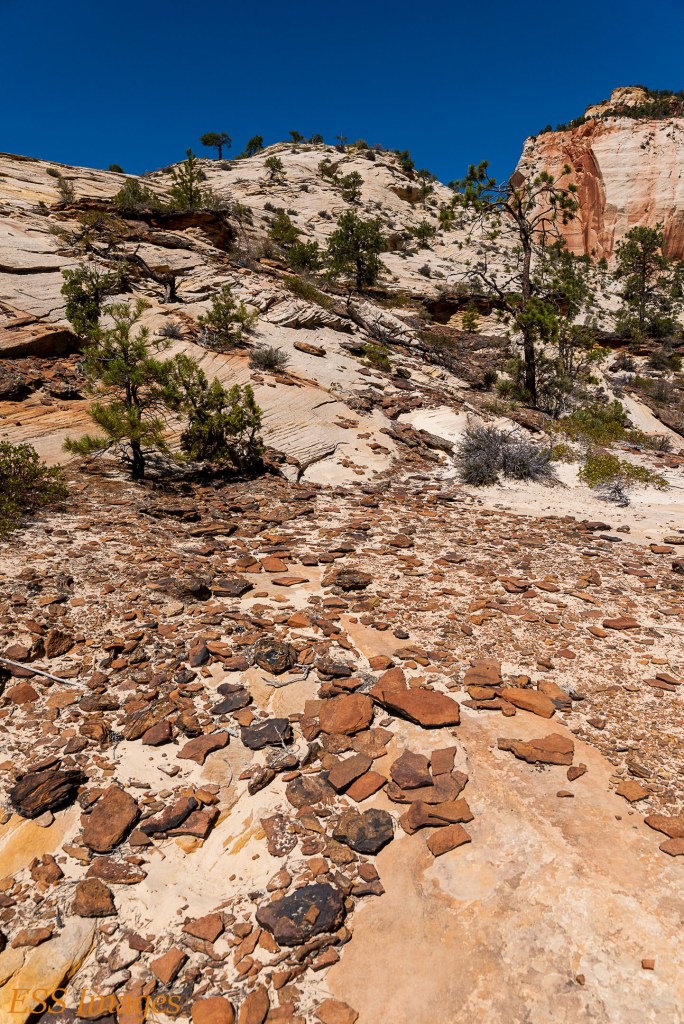
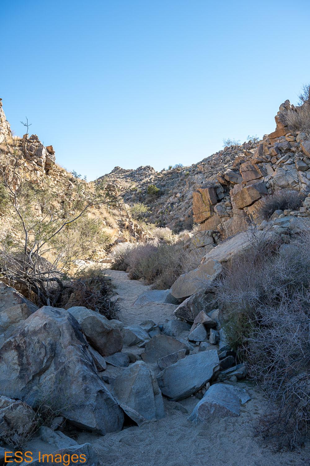
There’s no parking area for this trail, we parked along the side of the road a couple of hundred yards down from the unmarked trailhead. Following the trail on AllTrails, we walked away from the road toward the edge of a rockpile. There were rock ridges all around us, along with the usual flora.

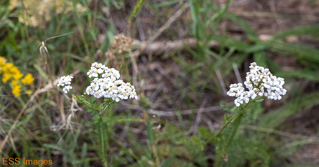
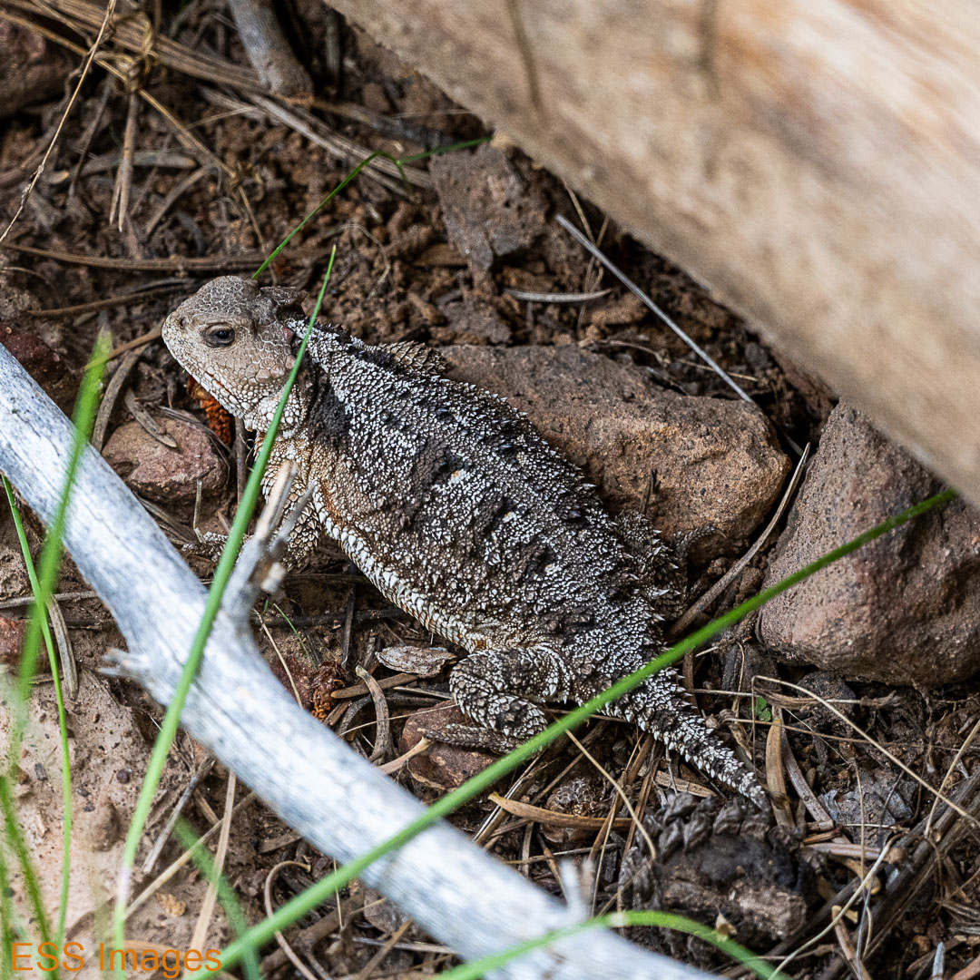
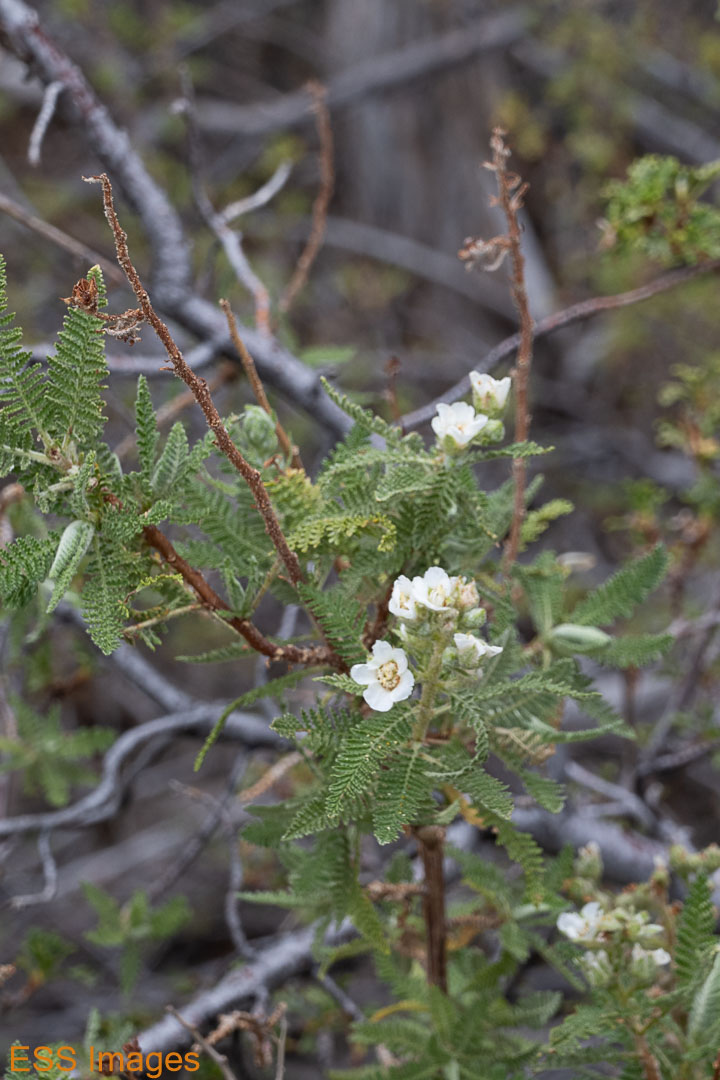
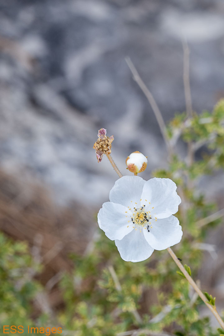
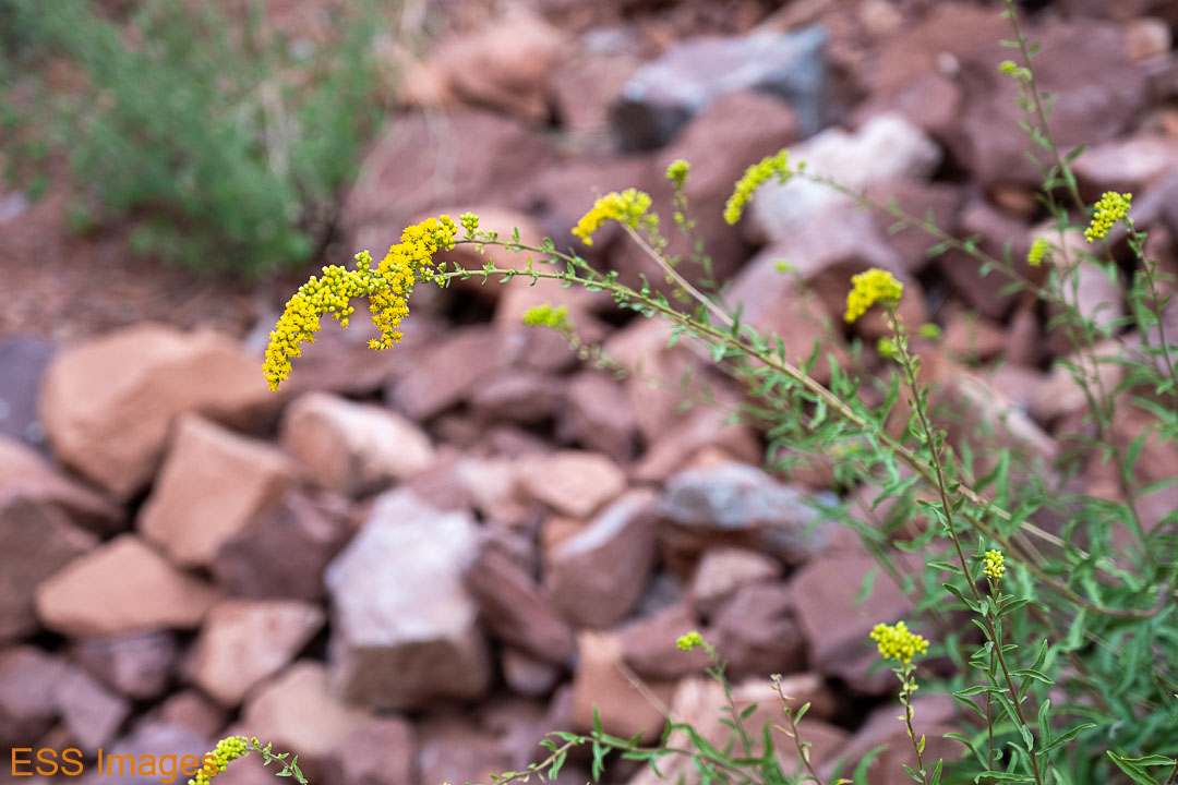
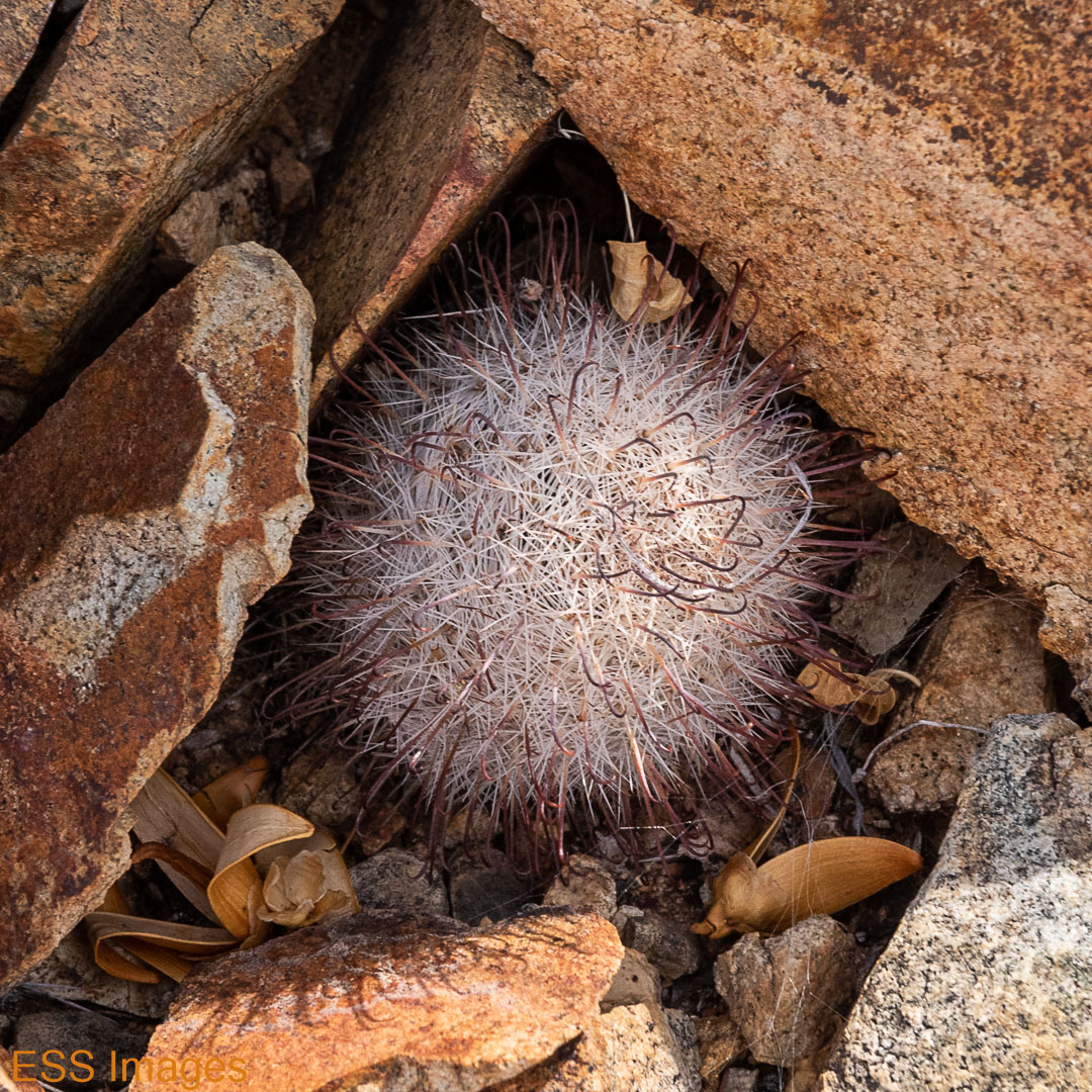
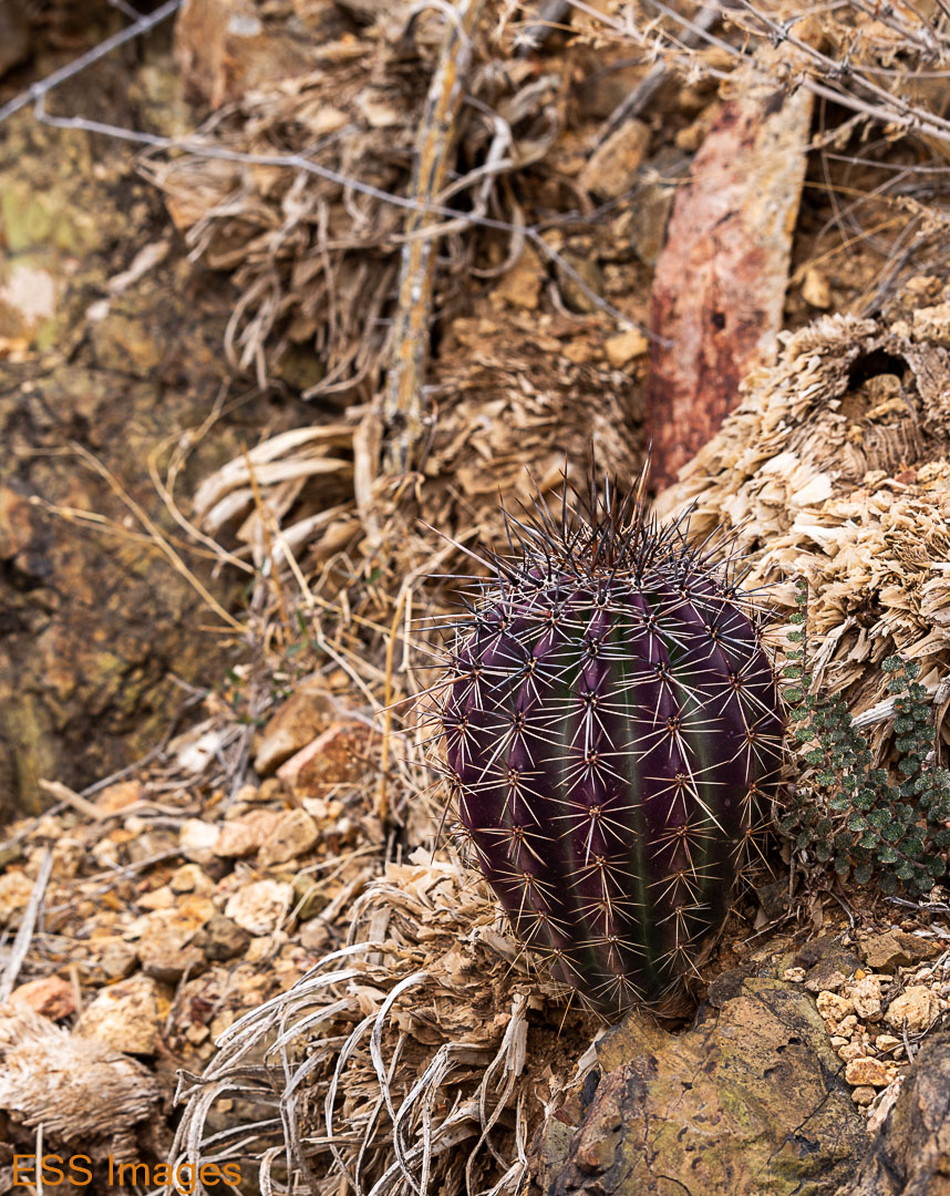
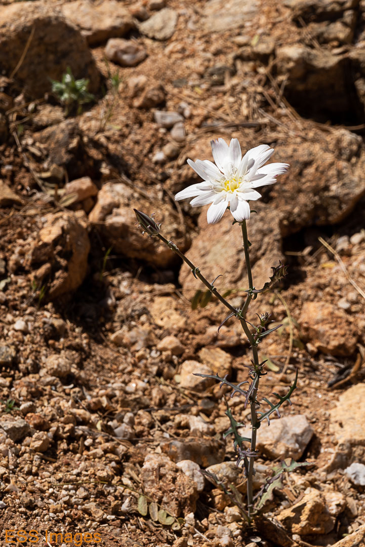
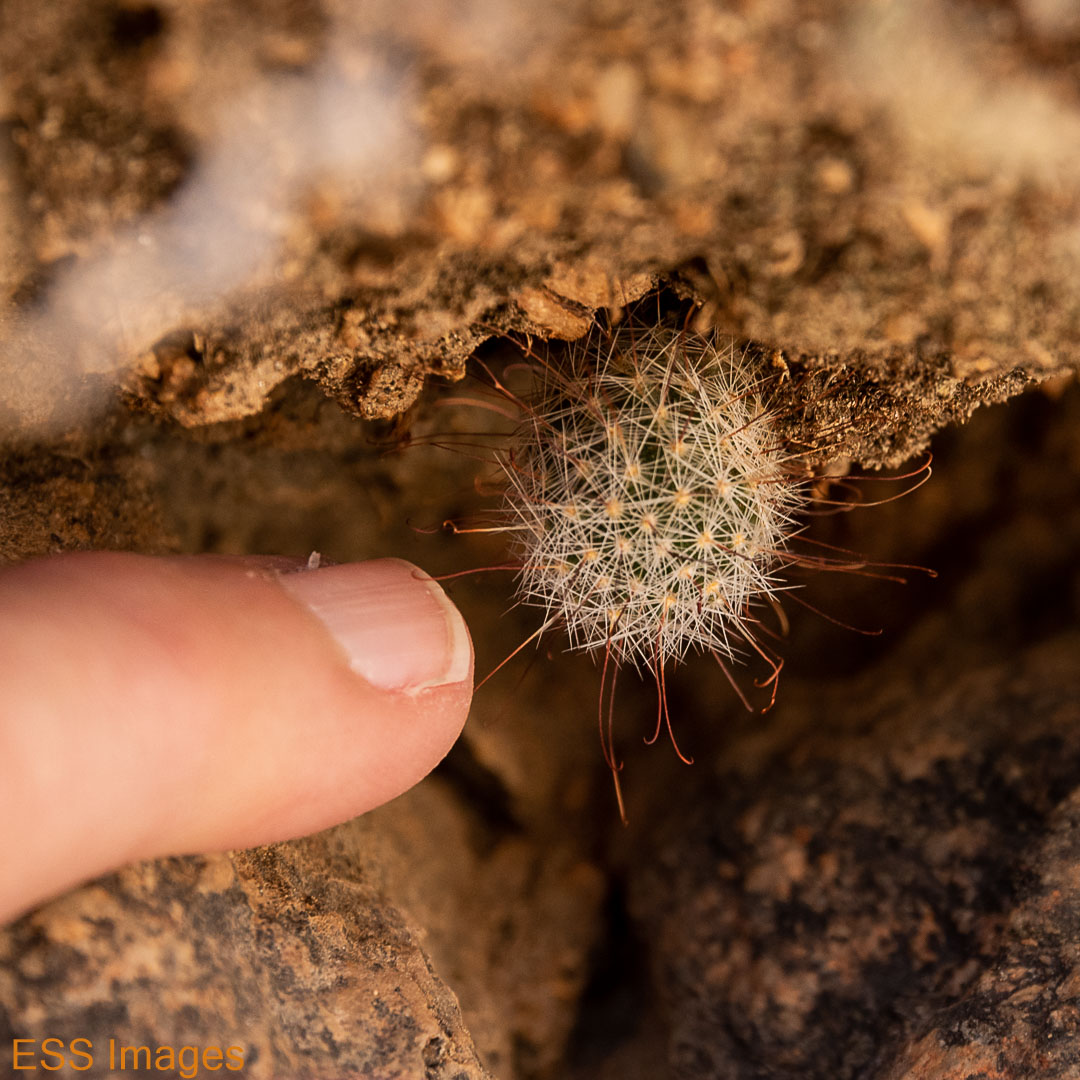
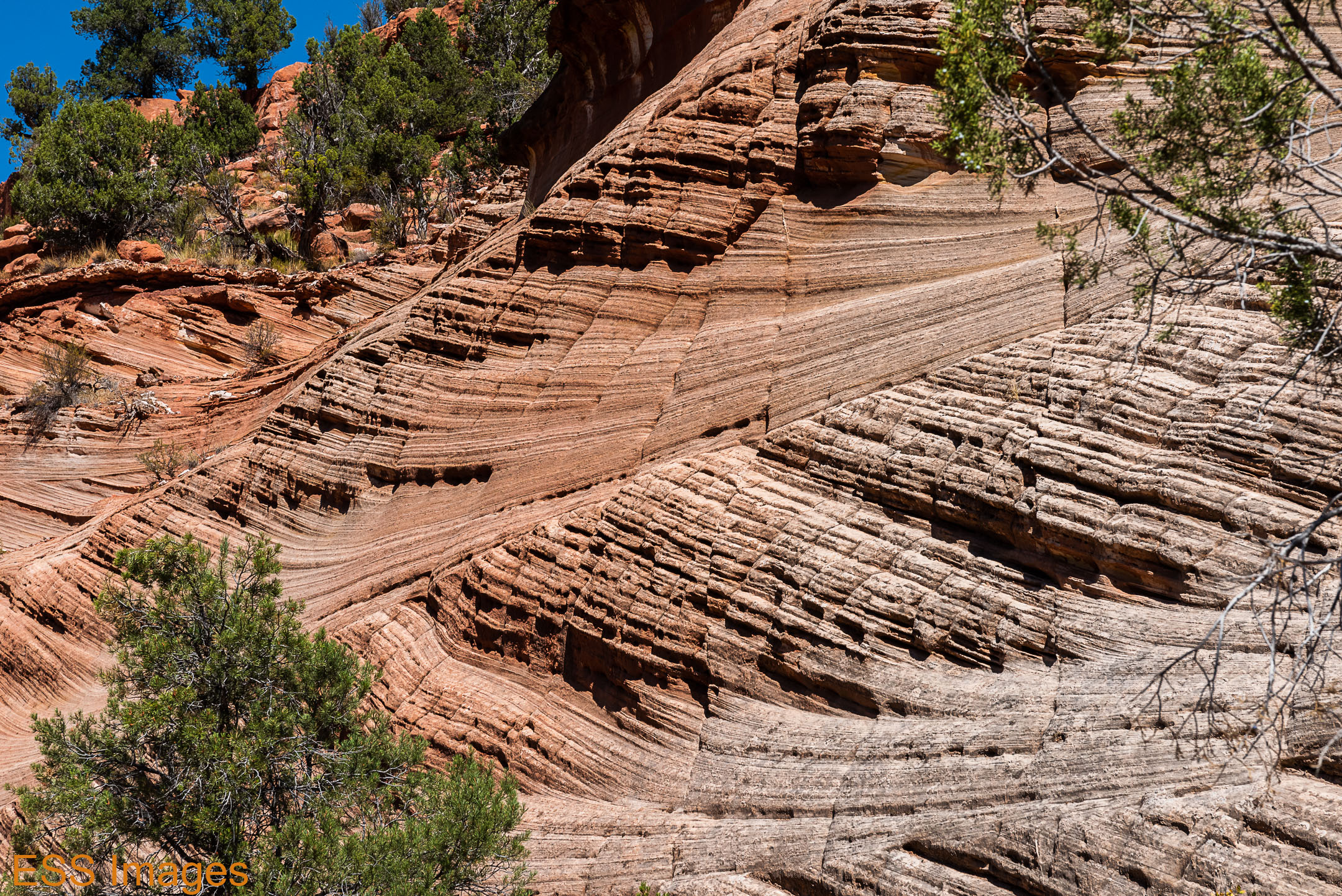
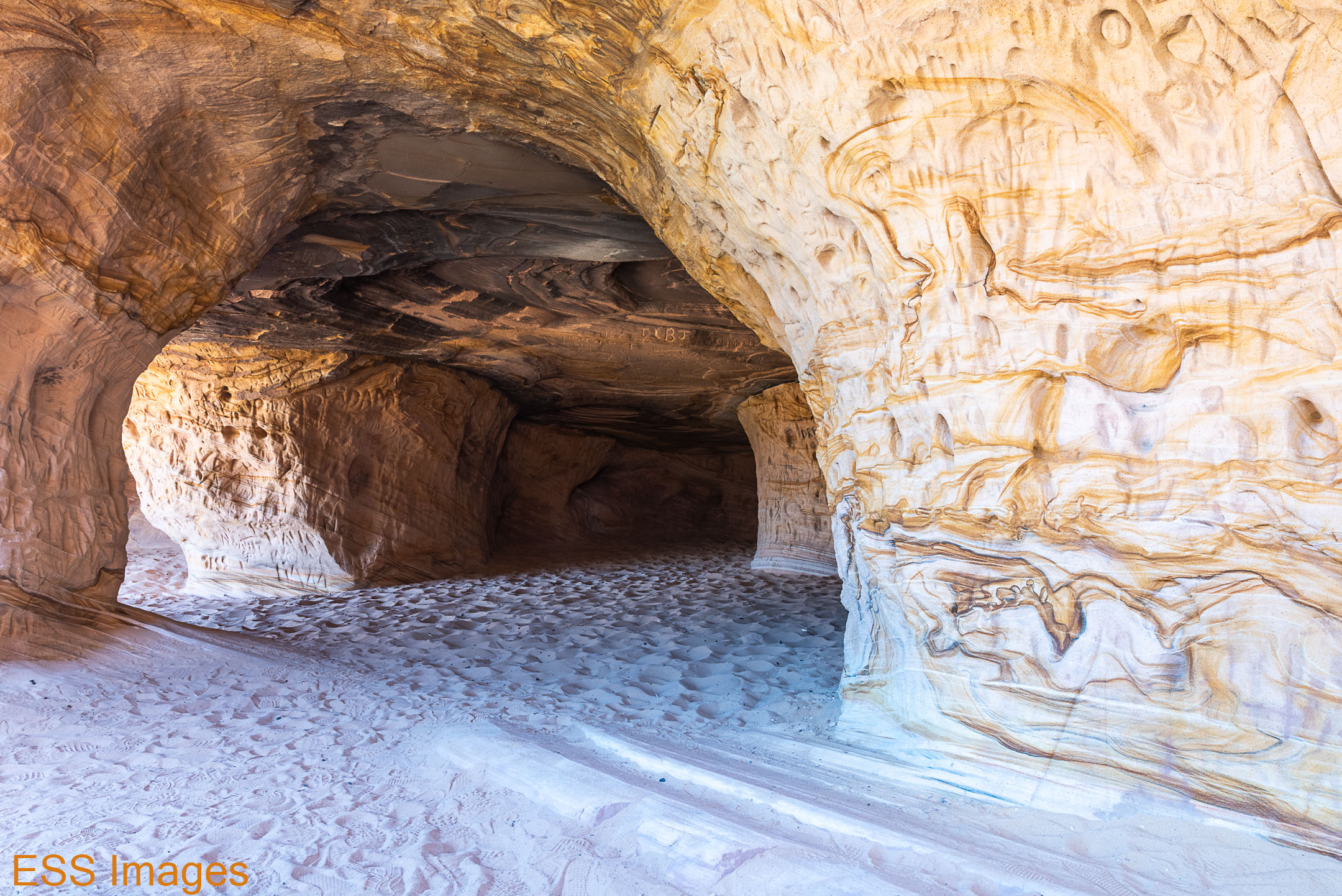
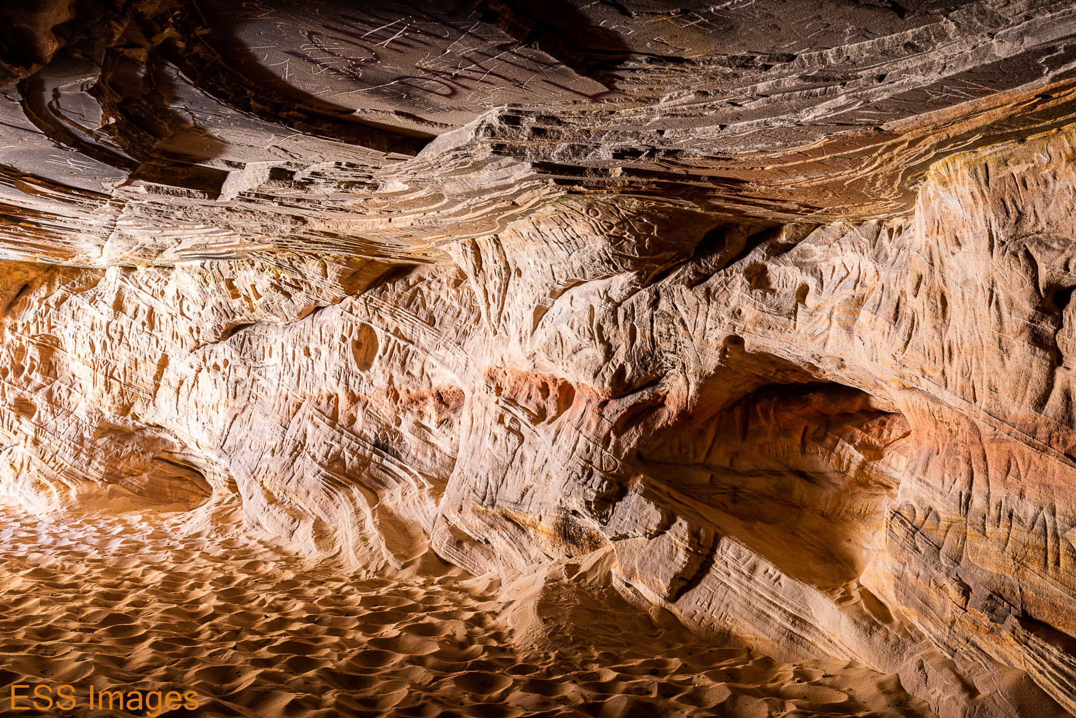
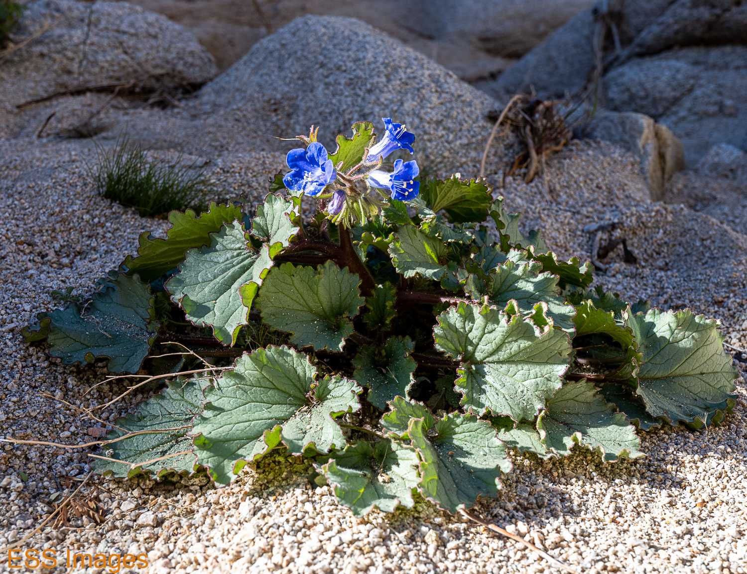
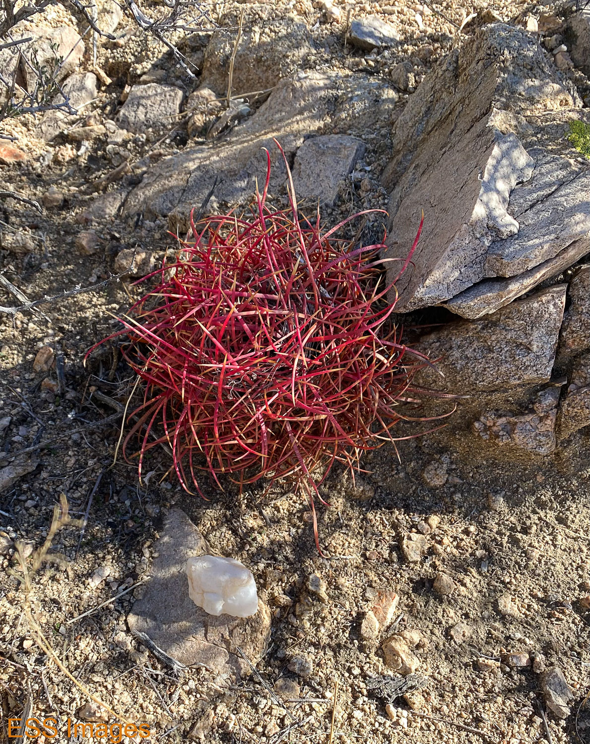
Around the corner of the main (as far as I can tell, unnamed) rock mountain we came to the side trip that I guess is the North Canyon Trail. It goes down a dry wash at the saddle between two of the mountains. Like most dry washes I’ve run across in deserts, it’s sandy on the bottom with periodic rock/boulder interruptions. There were a couple of scrambling moments. The rock walls were amazing and a little bit scary – some of those boulders didn’t look all that secure! And since most AllTrails trails are described as having “beautiful wildflowers” I had to include a picture of the one we saw… 🙂

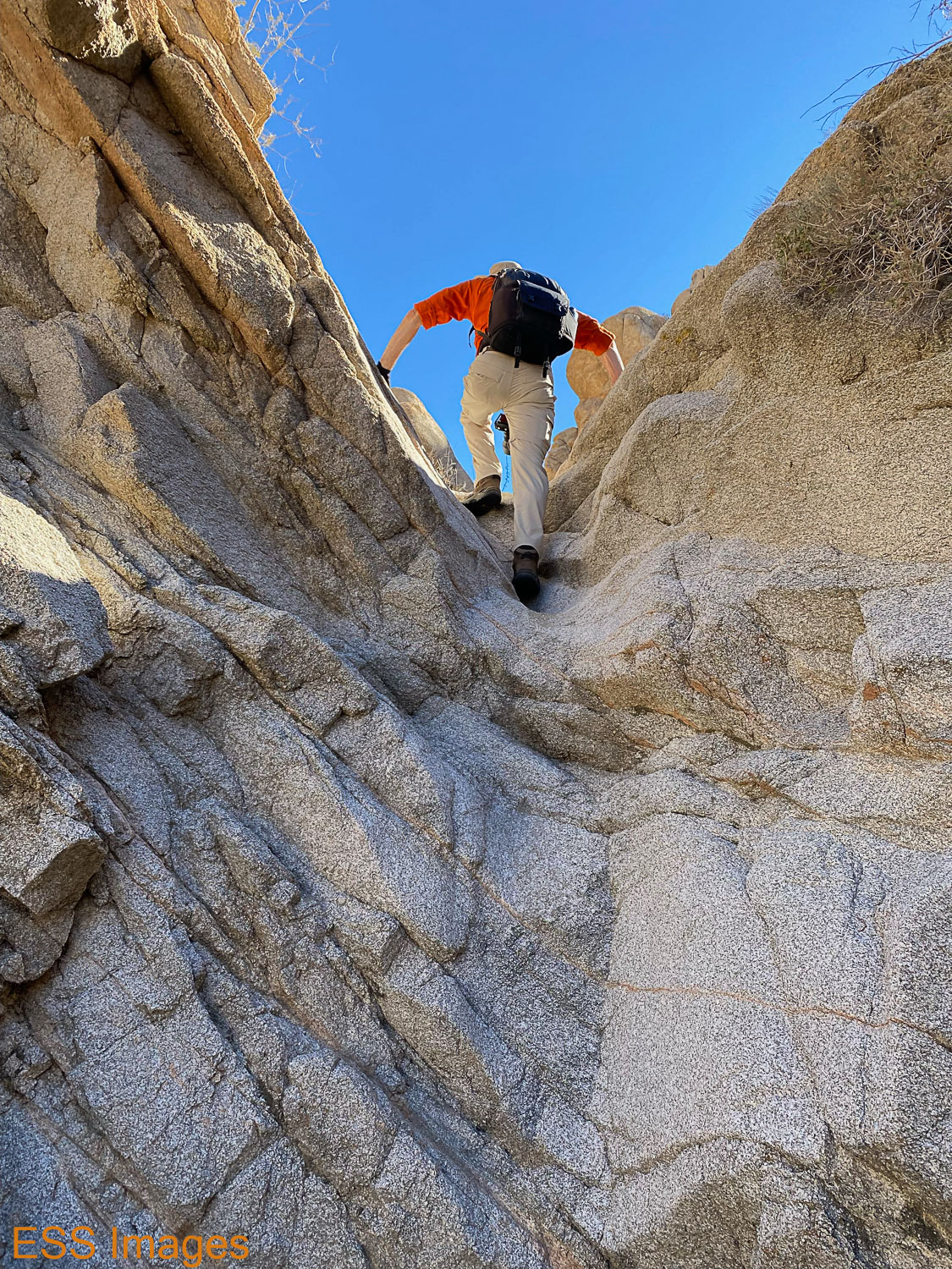
That was the most fun part of the trail, partly because we didn’t stop at any of the tempting boulders and walls to do any climbing. You could spend hours out here clambering over the rocks.

Once you get out of the ravine and over the saddle, the trail levels out and goes the rest of the way around the mountain. There are a number of trails across the flatlands over there, so we had to be careful not to take a wrong turn – mostly so AllTrails would give us credit for the trail! 🙂 Most of the crossing trails would have gotten us back to the car.

That was the end of our hiking in Joshua Tree! Back to the car and off to the airport (only a little late!) and the rest of the day being sociable with an old friend! We went back to Palm Springs and went out to a nice Italian restaurant – Trilussa, quite enjoyable.

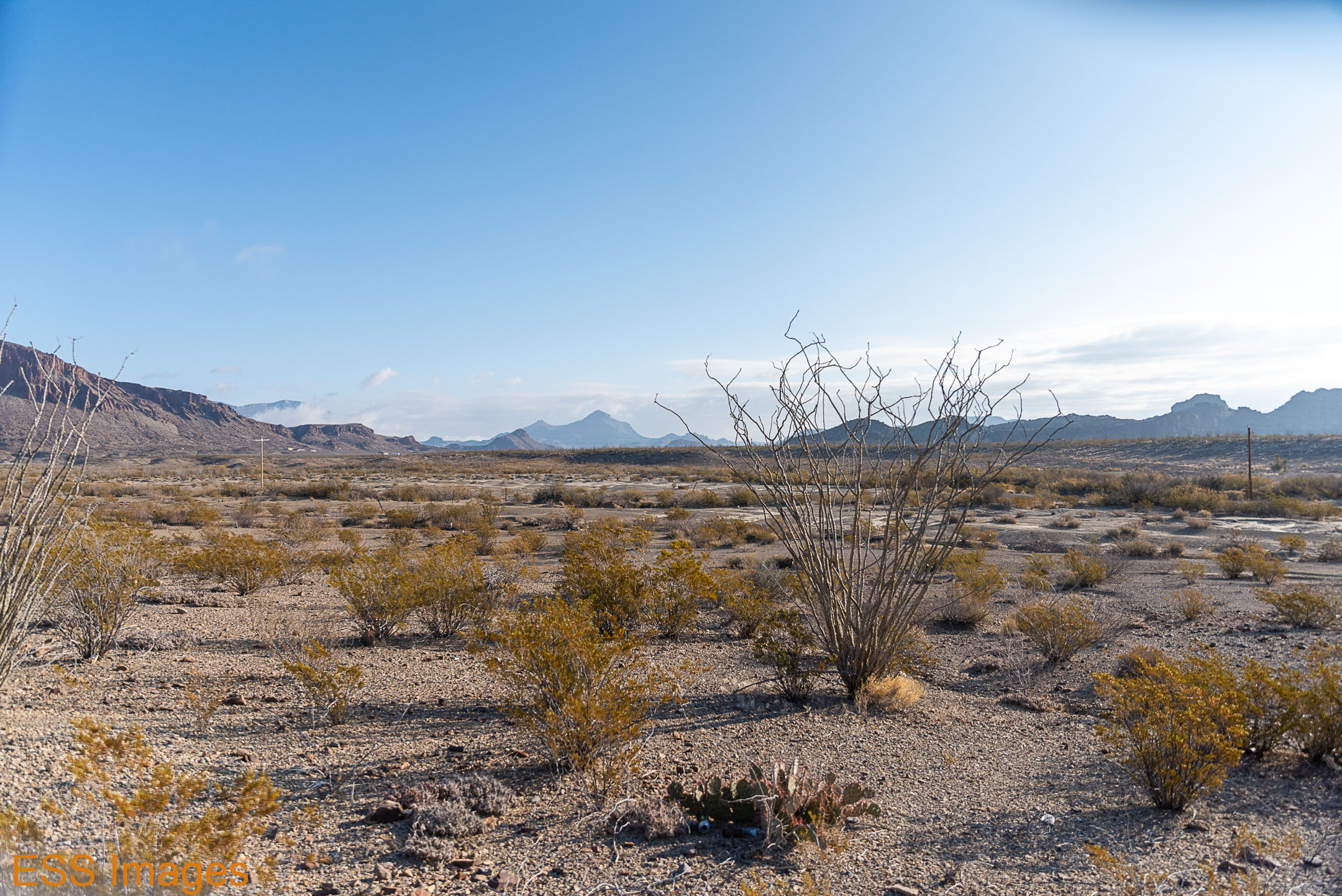
And since we moved our base of operations to Palm Springs, we thought we’d head into the South Entrance of the park and see what was going on there! The southeastern part of the park is (as I think I mentioned) in the Colorado Desert, which is part of the Sonoran Desert (the hottest American desert! We just thought we’d do a loop starting in the south and then up to show our friend a bit of what we’d already seen. And see some new things!

Palm Springs not being close to the entrance, it took us about an hour to reach the Cottonwood Visitor Center inside the south entrance. (One thing to watch for, the visitor centers at the north and west entrances are just off highway 62 and not actually inside the park!) We looked around, grabbed a paper map, and made sure we had our passport stamps and such.

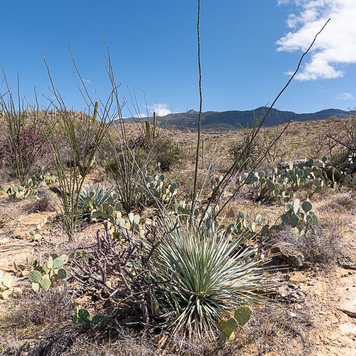
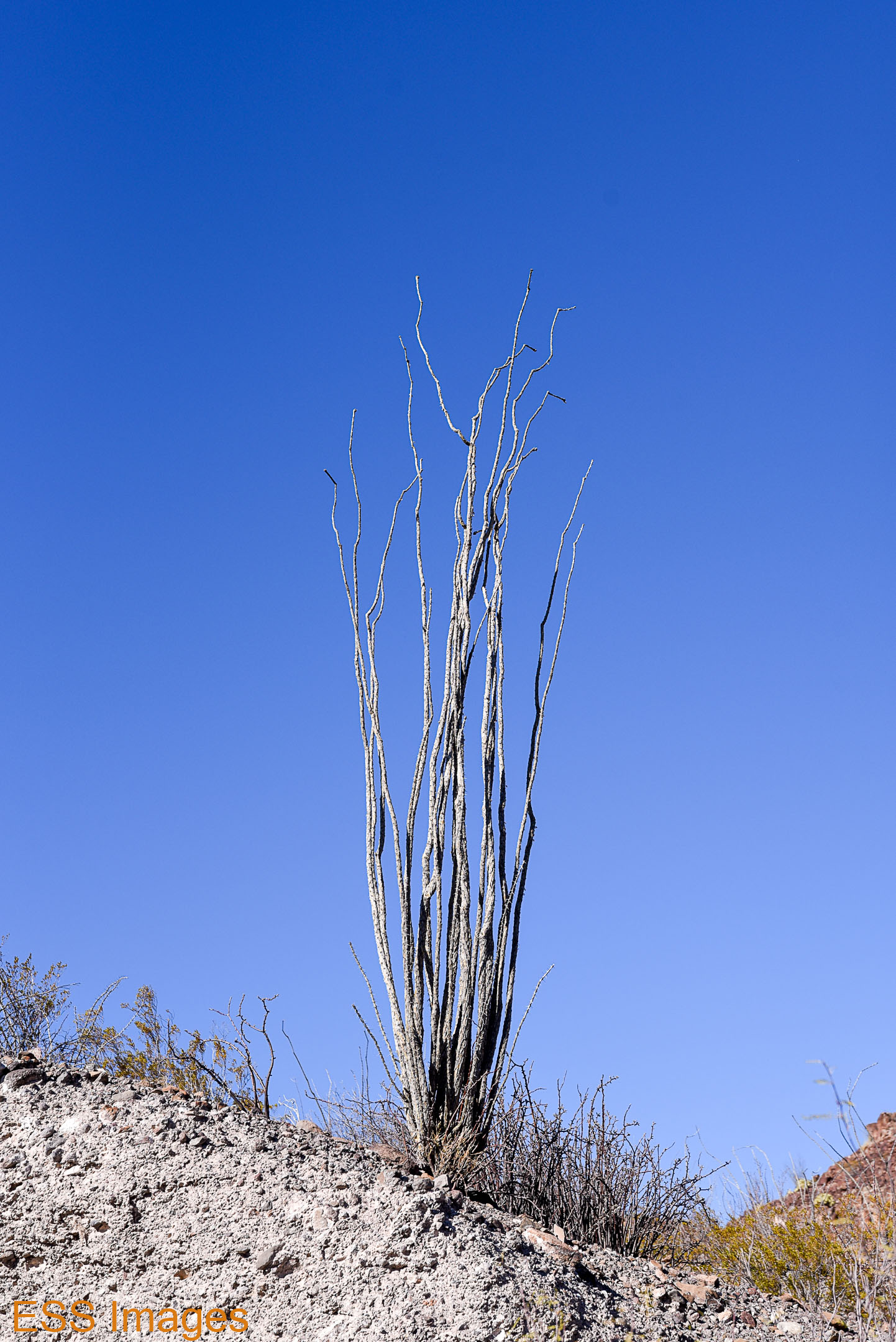
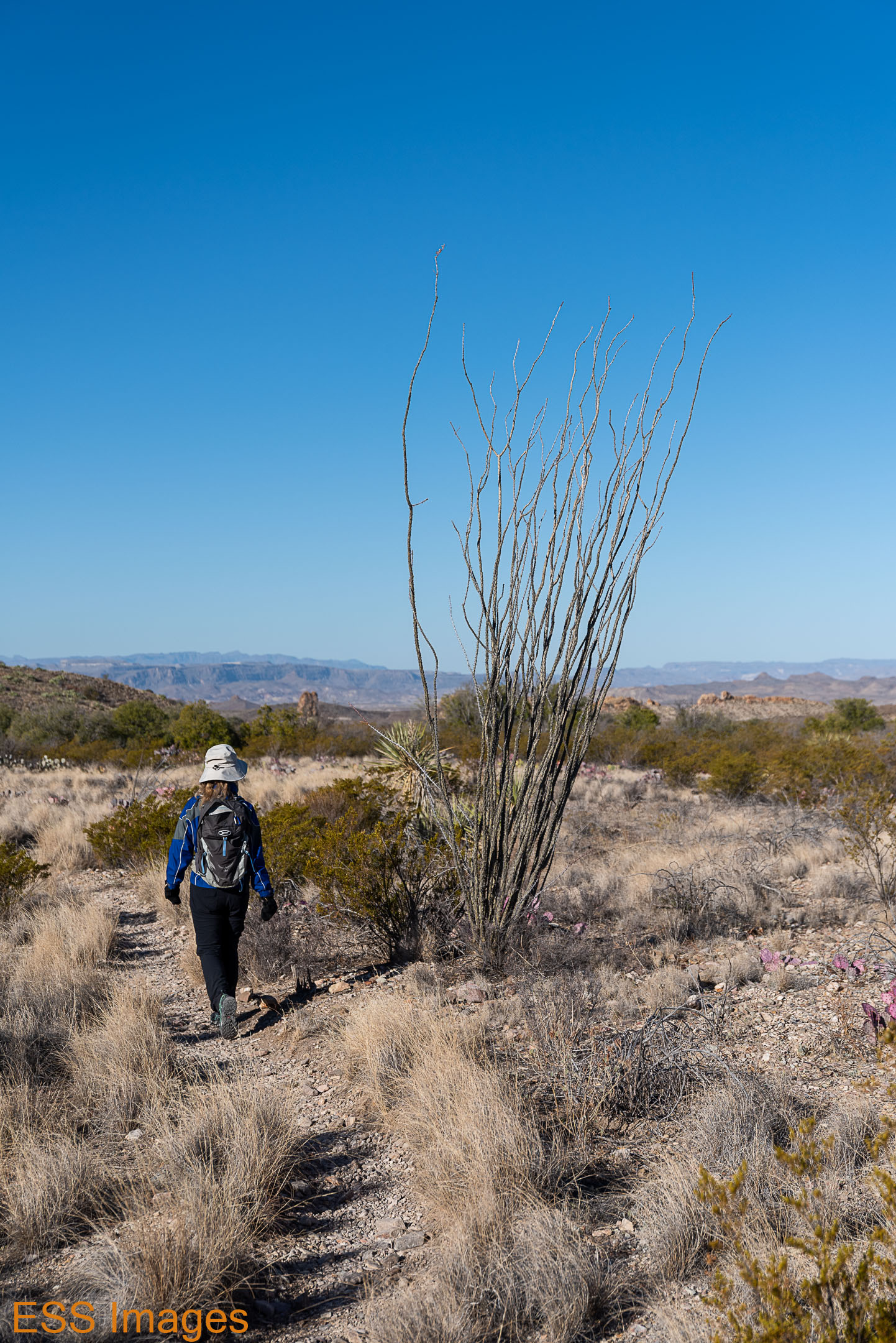
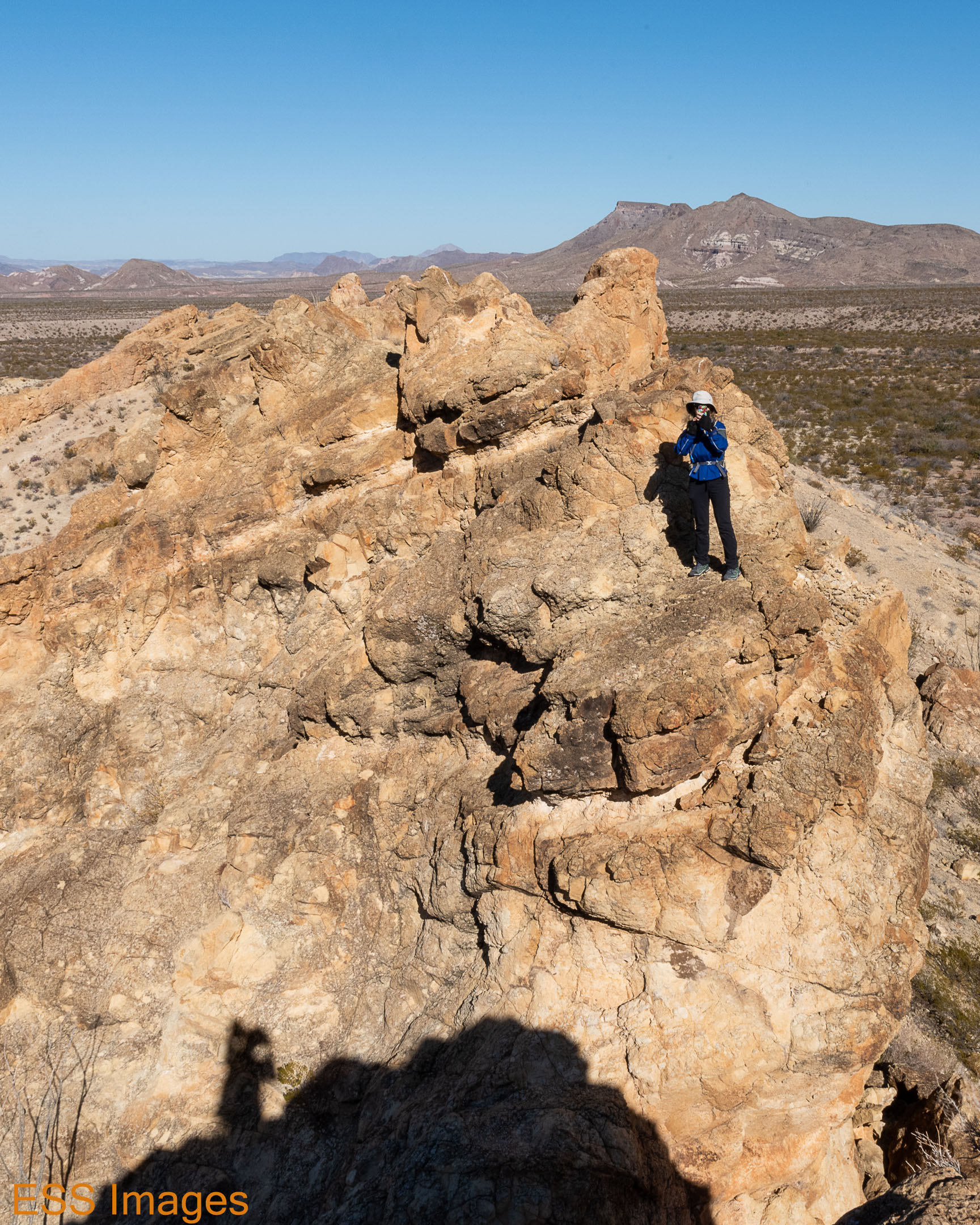
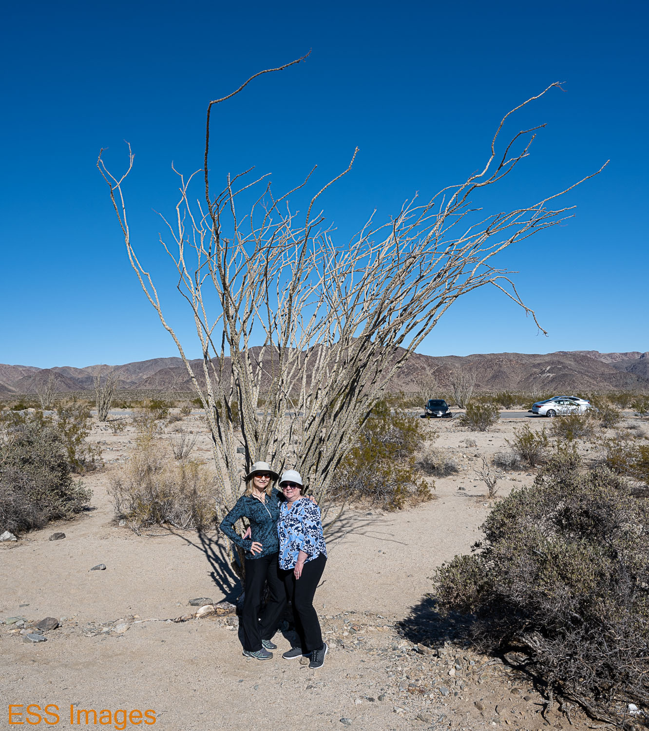
From there we drove up Pinto Basin Road into and through Pinto Basin. Crossing Porcupine Wash and Fried Liver Wash, we stopped to check out the Ocotillo Patch. As some of you may remember, I’m rather fond of Ocotillo. I spend a lot of time around them down in Big Bend Country and I’m still working on the best way to capture them. With my wife and friend in front of one is a good way!

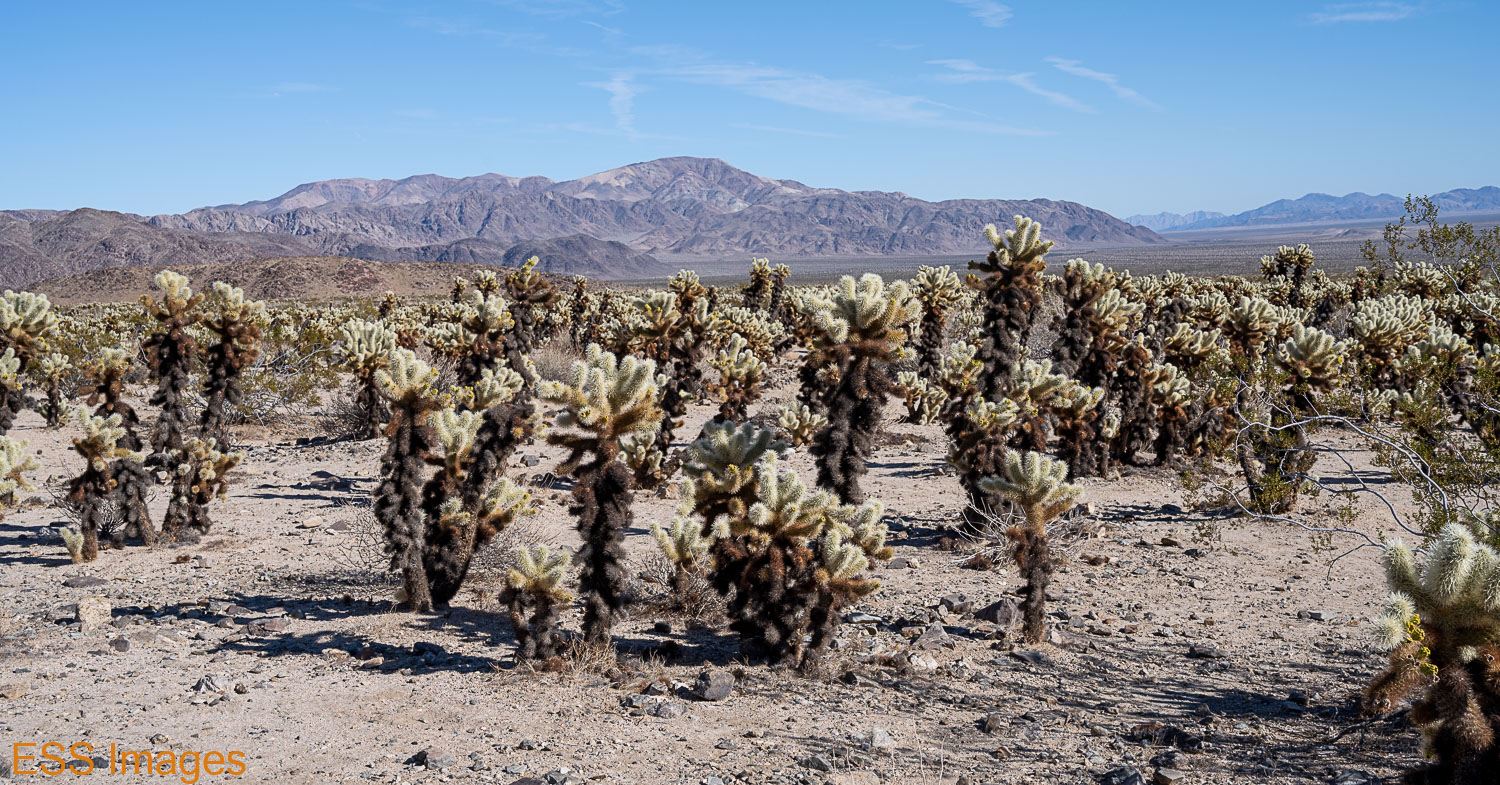
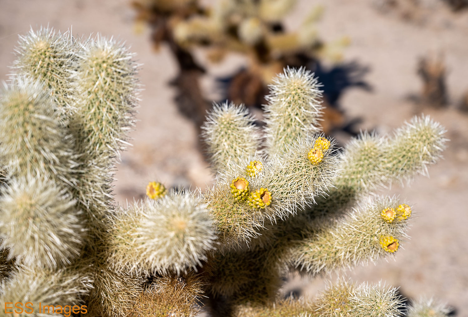
A little way past the Ocotillo you come to the Cholla Cactus Garden, a large area of cacti that you need to be careful around. Sometimes known as “jumping cholla,” their spines can be difficult to remove. I carry tweezers with me, but they might not be adequate to the task. Attached to one of the fence posts by the parking area, you can find the recommended tool: needle-nose pliers!

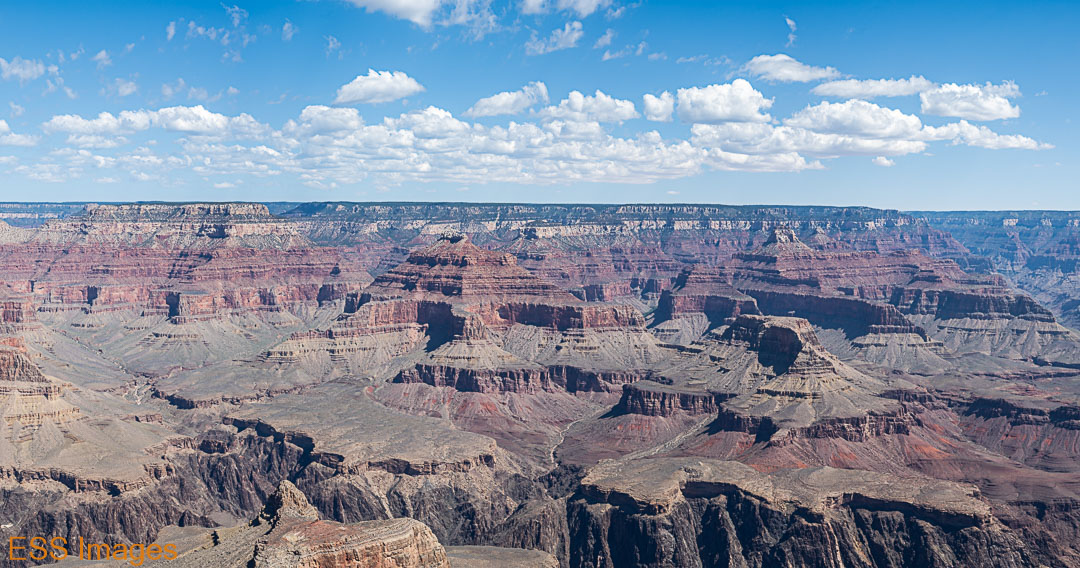
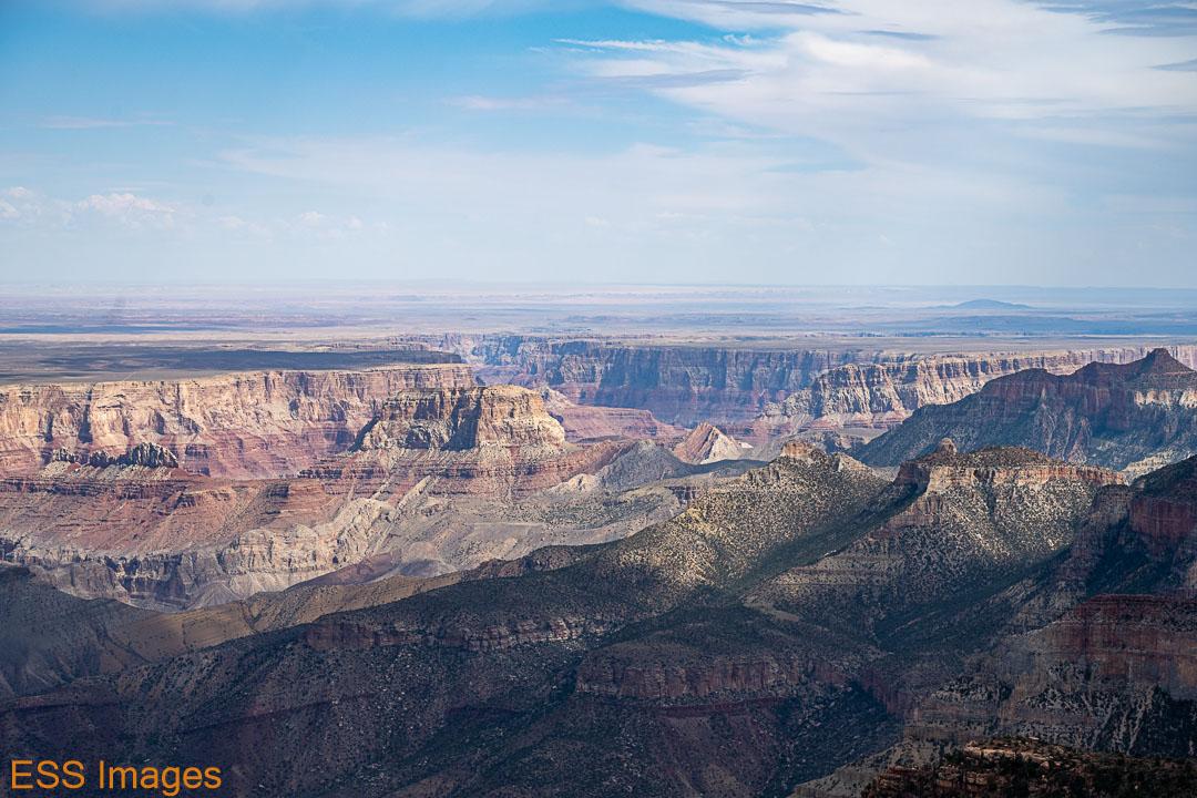
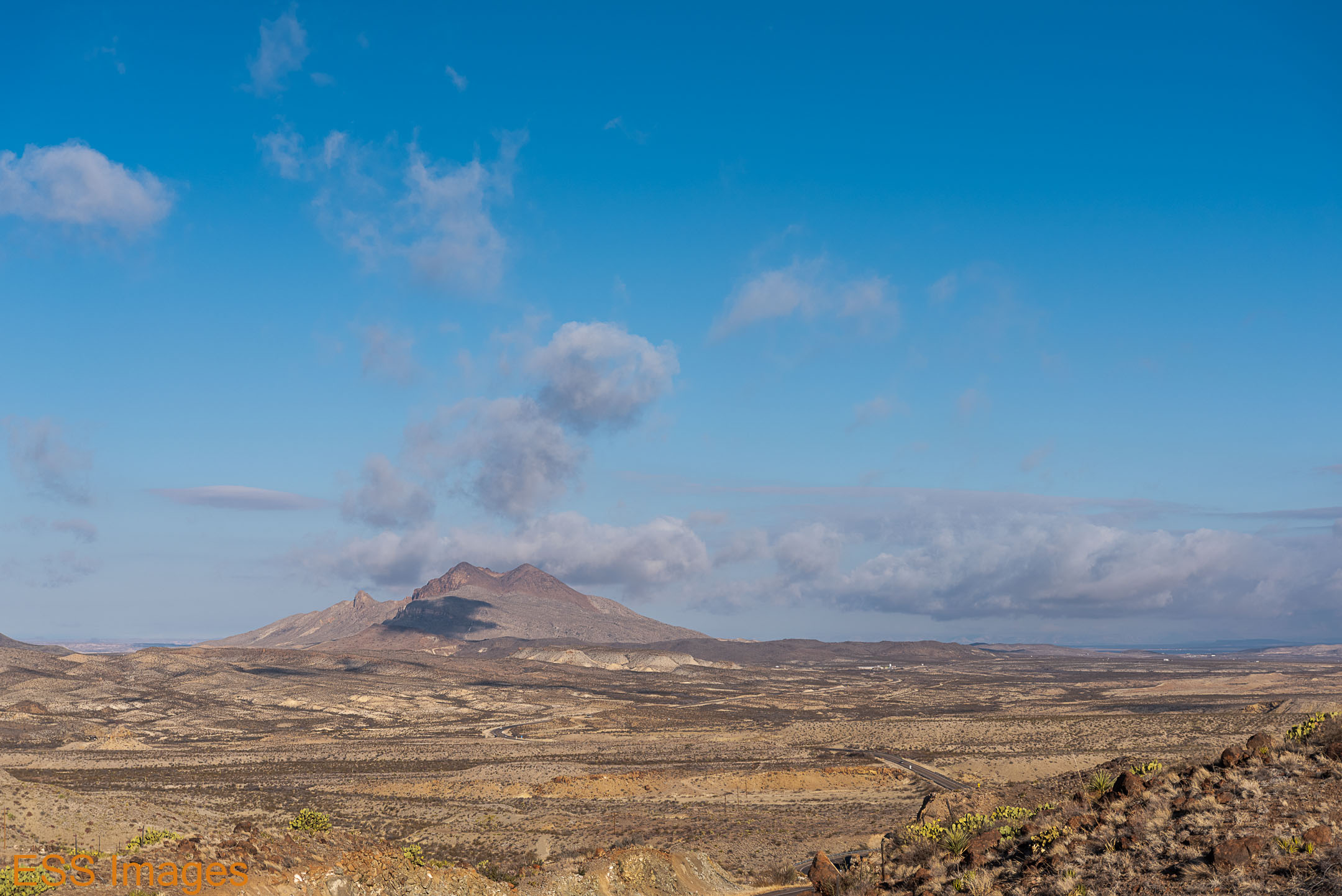
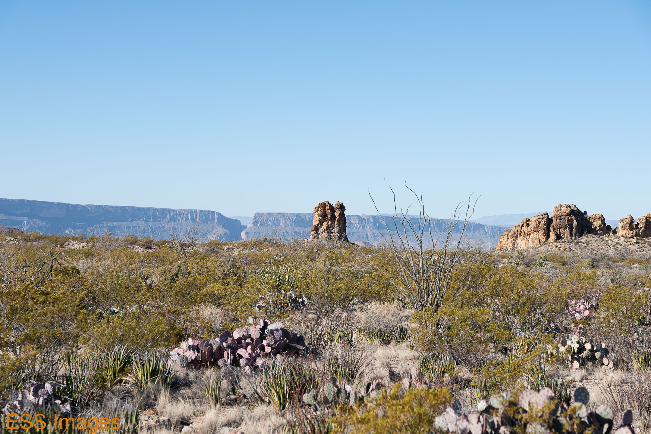
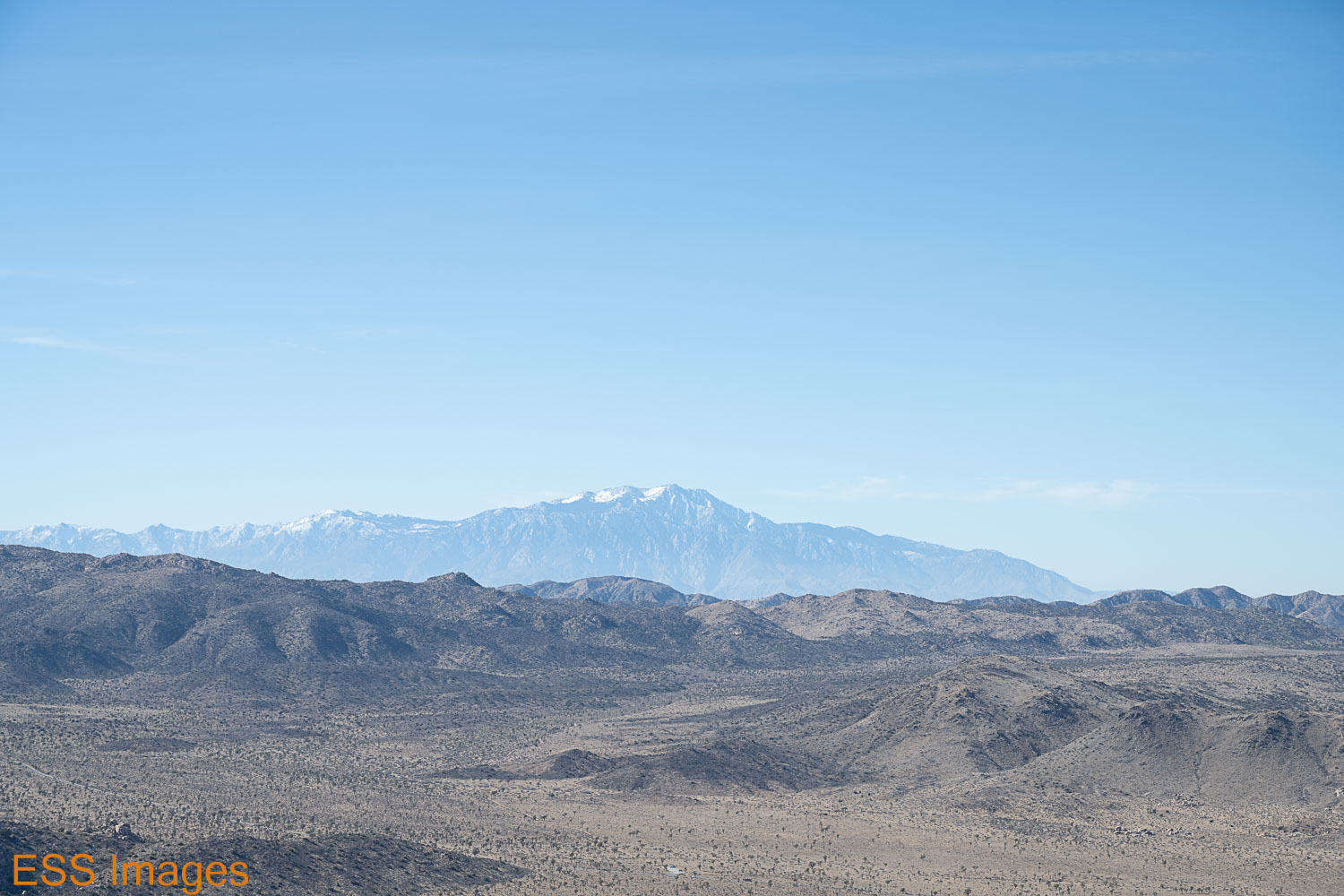
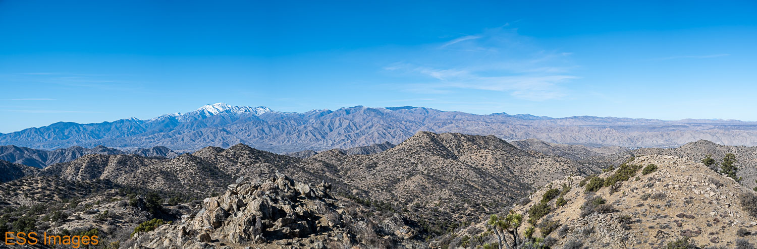
From there we went up to Keys View (by way of Skull Rock) to get a nice view of the…permanent haze over the Coachella Valley. The mountain in the back right is Mount San Jacinto, more than twice the height of any mountain in the park! In theory you can see the San Andreas Fault in there, but I can barely see the ground.

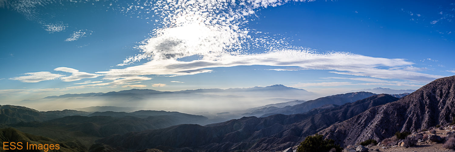
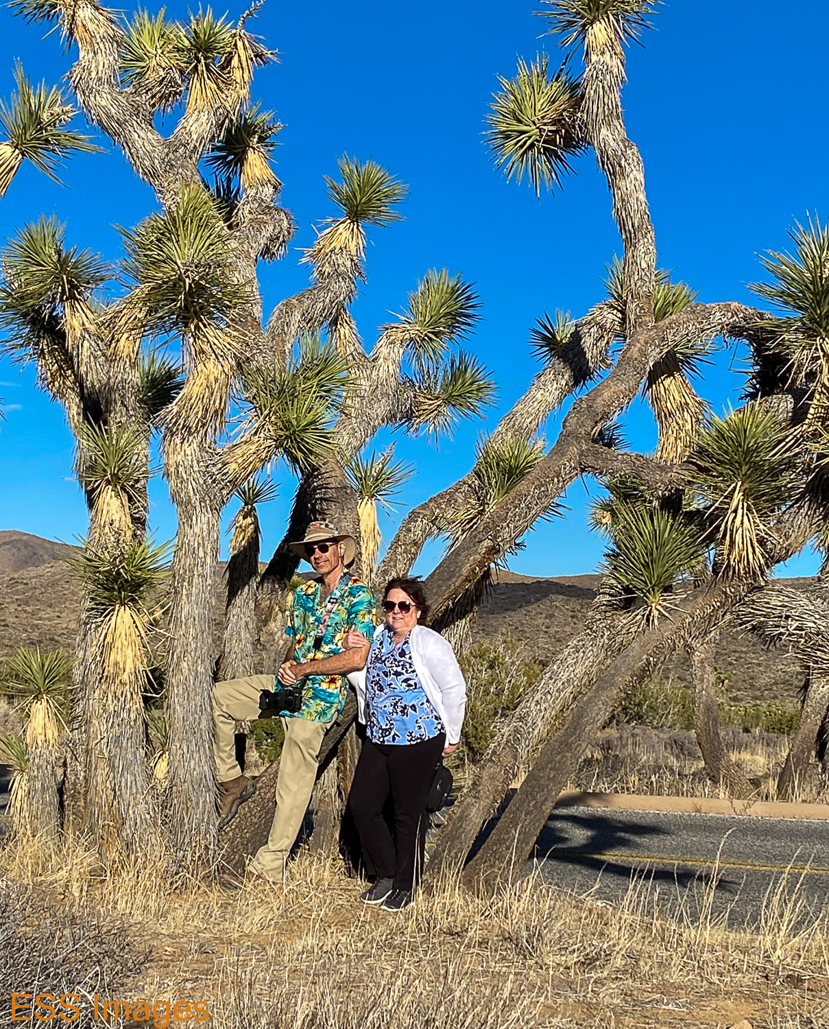
It was cold and windy up at Keys View so we didn’t hang around too long! On the way toward the park exit we stopped a few time for scenic Joshua Trees and such.

And that was the end of our adventures in Joshua Tree. It was a beautiful place and I can hardly wait until I get a chance to go back there! I’d like to go in the late spring or summer when the core of the Milky Way is high. And so is the temperature – average high in May is around 95, maybe that would keep the crowd down. Of course, June, July, and August average over 100…

I hope you’ve enjoyed our adventures in Joshua Tree! Don’t forget to visit my updated website – even though I haven’t added any Joshua Tree photos… 🙂

-Eric

The Grand Canyon : Rim-to-Rim and more!

Late August is not a highly recommended time for visiting the Grand Canyon, especially if you’re going to walk down to Phantom Ranch. But that’s when we had a cabin at Phantom Ranch, and we weren’t going to miss it! After all, I’d never been there before. And we’re from Texas, we can deal with heat.

So we flew up to Flagstaff, rented a chariot, checked into a hotel a bit south of the National Park, and drove on up for my first view of this fabled hole in the ground. How many times have you heard this: the pictures just don’t do it justice! But then, they really couldn’t. 277 miles long, an average of 10 miles wide and a mile deep, I would have needed a really wide lens to capture it all. Or a seat on the International Space Station!

Before I get too deep into this, here’s the National Park Services map page for the Grand Canyon, in case you want to see a high-level view. I have also included links to Alltrails trail maps for the trails we did.

Here’s our first view, near the Visitor’s Center (And just for reference, here are a few facts about the Grand Canyon courtesy of the NPS):

We got there fairly early in the day, so we thought we’d try a little hiking just to start getting accustomed to the altitude, so we headed over to the South Kaibab trailhead with the intention of hiking down past Ooh-Ahh Point to Cedar Ridge (following our friends at Alltrails!). But first, a precipice to sit upon! It’s only about a mile and a half down there, around 1100 feet of elevation. It seemed longer coming back up.

But the views along the way, magnificent! There’s a reason they call it Ooh-Aah Point.

We hiked on down to Cedar Ridge, took a bit of a rest, and started back up. Did I mention that it seemed (a lot!) longer going up? It was, after all, our first day at altitude. It’s difficult to train for that when you live in Dallas – altitude about 600 feet above sea level (at least where I am right now). We could get up over 700 feet in a tall building. The lowest point on this hike is just over 6000 ft! Someone should import some oxygen up there. But with regular rest stops (oh, I just wanted to take one more picture…) and plenty of water, we made it back to the top. I was glad that wasn’t the trail we were planning to use coming up from Phantom Ranch…

As an aside, I should mention the great mistake we made that day – we did not have our trekking poles with us for the hike. That was the last time we made that mistake! Both of us are in the habit of using two and we were glad to have them for the rest of our trip.

Someone we bumped into recommended going over to Yaki Point for the sunset, so we did. It was a quiet sunset, sky-color-wise, but the red/golden light on the canyon’s rock formations was beautiful.

The next morning we went to the Bright Angel Lodge and dropped of a duffel bag with some things we wanted to be waiting for us when we came up out of the canyon on Wednesday. Clean clothes to wear to dinner, for example! Then we paid a visit to the Bright Angel Trailhead where we would be arriving in a few days, and walked over and hopped on the Red Shuttle out towards Hermit’s Rest. We hopped off at a couple of stops to check out the view, did a (very) little hiking on the Rim Trail. After a brief visit to Hermit’s Rest, we went back to the village. There we hopped into our chariot for the quick, 11-mile journey to the North Rim Lodge!

Ha Ha. As you may know, in order to travel the 11 miles to the NR Lodge, you have to drive over 200 miles around the canyon, crossing it near the head (Marble Canyon, more later) where it’s only about 200 yards across. You drive past the Vermilion Cliffs, turn south into the Kaibab National Forest, and eventually reach the end of the road, where the Lodge is conveniently located. We checked in, dropped our gear in the cabin and went off to Bright Angel Point (see Alltrails!) – just a short walk from the lodge, but a marvelous view! We stayed there for sunset, then went to get a good night’s sleep.

The following morning we went back to Bright Angel Point for the sunrise. Again, the light was nice and the clouds were mostly absent. But it was that morning that I realized that the narrow canyon we could see below us was Bright Angel Canyon, the route we would be taking to get to Phantom Ranch! You can see it running lower right to upper left.

After a little breakfast (had to have my tea!) we decided to go hike the Uncle Jim Trail (on Alltrails), one that starts near the North Kaibab trailhead. The trailhead is a couple of miles up the road from the lodge, so we tossed our trekking poles into the chariot and cruised up there. Uncle Jim is about 5 miles long, you hike out to a loop, around, and back along the trail. Most of the trail is through the woods, but at the end of the loop there’s an overlook with an amazing view! Especially the view overlooking the North Kaibab Trail, which you can see zig-zagging down the side of the canyon!

It was a pleasant hike, in spite of the…high mule traffic on the trail. Not while we were hiking, they’d just left a considerable amount of evidence, especially on the early part of the trail. Once you get on the loop, it’s much better.

After Uncle Jim, we decided to hike down the North Kaibab Trail as far as Coconino Overlook (Alltrails). We thought it might be nice to go down this part of the trail while we could enjoy the view, as it would probably be dark when we next hiked that stretch! I tried to spot the Uncle Jim Overlook, but I couldn’t be sure…

After the much-longer climb back up to the trailhead we went back to the lodge and wandered around a bit, stopped in at the gift shop where we fell under the spell of the cashier talking us into joining the Grand Canyon Conservancy!

As a reward for joining the conservancy, they gave us Kai! In spite of appearances, he is not a skunk – he is a rare Kaibab Squirrel. So rare that he’s the only one we saw. In order to prevent him from becoming endangered we had to fasten his seatbelt. He was kind enough to guard our chariot while were were crossing the canyon.

Then we had a bite and waited for dark. And after dark, just for variety, we went to…Bright Angel Point! Looking south from there, we could see the lights on the South Rim – and the Milky Way. Even then the clouds wouldn’t quite leave us alone…

After sleeping in the next morning (you can only do so many sunrises) we took a fairly easy day, to rest up for the big event. We drove up to Point Imperial (Alltrails – it’s not much of a trail, but if you zoom out it gives you a nice topographic map of what we were looking at!), the highest point in the park (8803 feet, according to the sign). From there you can see where the canyon really widens out. It goes from 100 or 200 yards wide around Lee’s Ferry and Marble Canyon to about 2 miles across at a gap in the wall you can see from Point Imperial and then 5 miles and wider almost immediately. The prominent rock formation in the foreground is Mt. Hayden, according to the sign at the overlook.

After enjoying that view for a while, we moved on down to Cape Royal and Angel’s Window(Alltrails). On the drive down, there’s a spot with a great view of Angel’s Window, so we stopped there briefly. The tiny people walking on top of it should give some idea of the scale of the rock formation. From the Cape Royal parking area, you walk down the trial toward the point and take a left to go out onto it. It’s fairly wide and you’re fenced in, but if you don’t like heights, maybe not…

Then we walked on out to the Royal Overlook. From the Overlook you can see Wotan’s Throne and the Vishnu Temple. Some weather was making an appearance on the South Rim, so we watched it for a while. Looking at the map, it may have been near Grand Canyon Village. I was beginning to think that the amount of cloud cover did not bode well for my night-sky-photo hopes!

We went back to the lodge for a dinner in the main dining room (the buffalo tenderloin was only fair, my wife enjoyed the trout) and an early bedtime. Our plan was to be hiking down the North Kaibab Trail by 5:00 in the morning! We packed up our luggage and our backpacks and hit the sack.

Up early Tuesday morning, I had to have my tea and a protein bar for breakfast! Took everything we had left out to the chariot and drove the two miles up to the trailhead. We could have hiked it, but why? It’s far enough to Phantom Ranch without adding miles… (Here’s the trail map)

But we did indeed start hiking about 5! Okay, maybe closer to 5:15… We had our headlamps and more flashlights than we needed, especially since we could pretty much see without them by about 5:30. Here are a few shots from the early journey down:

A little after 6 we reached the water stop at the Supai Tunnel and topped off the water bottle. Half an hour later we crossed the Redwall Bridge. Some of the trail after this point ran along a sheer cliff face, above and below! It was generally pretty wide, though, rarely less than 5 or 6 feet. About 8 o’clock we reached Roaring Springs (okay, we weren’t setting any speed records!), and just past the springs you reach Bright Angel Creek and Bright Angel Canyon.

The remainder of the hike follows the course of Bright Angel Creek as it nears the Colorado River, down at the bottom of the canyon. The trail flattens out here so the downhill is much more gentle. Our knees were grateful. From the trailhead to the Manzanita Rest Area you go down over 3800 feet in 5 miles of trail. From there to the river you drop about 2000 feet in over 8 miles of trail.

Except for a couple of places where the trail was blocked by rockfalls, the hike was uneventful. At the Cottonwood Campground we maxed out our water bottles in preparation for the longest water-free stretch of the hike (though we did have a lifestraw and water purification tablets, just in case!). It was, after all, late August, and we had been reading all the warnings about The Box and how you should try to pass it before 10 AM. It must have been noon or a little after before we got there!

So we sauntered down the trail, enjoying the rock formations, the flora and fauna, the sound of the occasional waterfall in the creek. We stopped once to wet down, well, almost everything: our clothes, our cooling towels, our hats. And then we kept on going. And then we got to Phantom Ranch, around 2 o’clock. The Box had been quite…mild, I guess, most likely due to the cloud cover preventing the sun from heating up the rocks. When we got to the Ranch I would have bet that the temperature never even passed 90, but the campground thermometer said 100 under the cloudy sky.

We didn’t see a lot of wildlife on the way down, a few lizards and the occasional caterpillar. I’m told those are “white-lined sphinx moth” caterpillars. I don’t know when the moths will be out. The large lizard looks a lot like a Chuckwalla, or at least some variety of iguana. It was very shy, moving off before we got anywhere near it. The spiny looking one with the orange splotches appears to be a Desert Spiny Lizard. And the other…

After we checked in to our cabin, we decided to go see the Kaibab Trail Suspension Bridge, the one we wouldn’t be crossing on our way up the North Rim. It’s a National Historic Civil Engineering Landmark, built in 1928. And a lovely bridge it is, known as the Black Bridge to distinguish it from the Silver Bridge on the Bright Angel Trail. I had plans for this bridge and the night sky but the cloud cover thwarted my intentions. 😦

We got back to the ranch in time for the 5:00 feeding, I had a steak and Leigh had the veggie stew. The steak was only fair, but I was glad of it after a long day of nuts, jerky, and protein bars! The gentleman we ate with said his was great, so don’t judge just by my experience. And if they open up for indoor dining, it will no doubt be even better.

Afterwards, as darkness encroached, I was determined to go out and shoot even if I couldn’t see the sky! I grabbed my camera and tripod and walked across Bright Angel Creek (on the bridge! It’s wider down there!) and went to the Silver Bridge. I had perhaps waited a bit too long, but I took some really long exposures just for fun. Then I went back to the cabin to get a good night’s sleep – breakfast was at 5!

And a fine breakfast it was! Eggs & sausage, some pancakes, orange juice. More carbs than I usually eat in a week, but I was getting ready to climb out of the Grand Canyon, so I didn’t mind. We ate, dumped our trash, and hit the trail. Across the creek, past the campground (temperature: 80 degrees), and over the Silver Bridge to the River Trail.

The River Trail, oddly enough, runs along the river for a while. It has a few ups and downs, just a little bit. As we approached the River Rest House, we saw a raft trip group that had been camped by the river. They appeared to be packing up the their tents and getting ready to climb into their (very large) rafts. You can see them in one of the pictures above.

At the rest house, we turned up Garden Creek and Bright Angel Trail. Yes, that’s right: the North Kaibab Trail runs along Bright Angel Creek in Bright Angel Canyon. The Bright Angel Trail runs along Garden Creek in…well, I haven’t found a name for that canyon. And, of course, Bright Angel Point is on the North Rim.

Anyway. From the Rest House (where we didn’t) you start going up. Not all that steeply, 1300 feet in 3.3 miles up to Indian Garden. One thing about this trail, unlike coming down North Kaibab, once you start upwards you don’t find yourself going back down very much. NK had a lot of up in its down!

One tip we had heard about going uphill here was “Don’t look up at how far you have to go – look back and see how far you’ve come!” That seemed like good advice, so we did, mostly. As you can see in some of these pictures:

The first water stop you reach is Indian Garden, about 5 miles from Phantom Ranch. After hiking through scrub brush and cactus you suddenly find yourself among trees, and a few wildflowers. From above (as you can see below) it looks like an oasis in the middle of the desert. Which, I guess it is! I filled up my water bottles, anyway. We took a little rest here, chatted with the passers-by. There were a lot more people at this stop than we saw the whole way down North Kaibab the day before! I guess people hike down from the South Rim, or ride down on the mules. From this point onward, there was a lot of…evidence…of mules. Some carrying tourist, some carrying what I assume was supplies for Phantom Ranch. We had to step aside for them a couple of times.

It had been cloudy all morning and as we approached Indian Garden some rather threatening formations loomed over the rim. Finally, they decided to rain on us, just long enough for me to decide to pull out my poncho. As I put it on, the rain stopped. For a moment, I felt very powerful… 🙂 It kept looking threatening, so I kept the poncho on for a while. Eventually it got a little too warm, so I took it off. A little way up the trail, it started raining again! This time for long enough that Leigh got her poncho on too, and we were glad to have them! Fortunately, the trail never got muddy and slippery. And we did have our trekking poles.

After Indian Garden the trail gets a little steeper, about 1300 feet for 1.5 miles. And it’s about 1.5 miles between the water stops the rest of the way. From Indian Garden to 3-Mile Resthouse, then 1-1/2 Mile Resthouse, then the trailhead. We walked and chatted with our fellow hikers, stopped at the Resthouses for water and rest, and just kept climbing – and looking back, not up!

About 2:30 or so we popped up at the trailhead. We stood around a bit, took a few pictures, and then headed over to Bright Angel Lodge. Picked up the bag we had checked, got to our room and immediately went out again – to find an energy drink and some celebratory ice cream! Then we went back to the room and had a celebratory bath and cup of tea. We had a dinner reservation for later, so we rested up.

That night, we went over to the El Tovar Dining Room for a fancy(ish) dinner. It’s a very nice place and it wasn’t very crowded. Having had Buffalo Tenderloin Monday night and a steak down at Phantom Ranch, naturally I had … a steak! The peppercorn filet, quite tasty. Leigh had the tomato basil soup and a shrimp cocktail, also quite tasty. And cheesecake for dessert. And back to our room for a good night’s sleep so we could catch the 8:00 shuttle back to the North Rim to pick up the chariot – and the rest of our luggage.

We caught the Trans-Canyon Shuttle in the morning. I rode shotgun, John (the driver) and I chatted about the sights we were passing, how long he’d lived there, and the kinds of things you chat about on 4-hour rides. John dropped us off at the NK Trailhed, where the chariot and the luggage were parked. We took a quick trip down to the General Store at the campground, got some ice, drinks, and snacks. Then we headed back the way we had just come!

This time, however, we could stop wherever we wanted! For example, on 89a, north of the park, are the “Cliff Dwellers” ruins, old stone buildings built around and under the amazingly shaped boulders strewn across the area. And several Navajo selling jewelry. Of course, the Vermilion Cliffs are all around.

The next stop up the road is the Navajo Bridge(s). The original bridge was built in 1927/28 and was used up until 1995, when the new bridge opened. It was only 18 feet wide, which was then adequate for a bridge with unpaved roads on either side! When they decided it was no longer suitable, a wider but otherwise similar bridge was constructed less than 100 yards downriver. See the photos for comparison! And the “Wayside Observation Shelter” was built between 1939-41 by the Civilian Conservation Corps.

Our last stop before we turned back toward the South Rim was the Cameron Suspension Bridge in Cameron. The town came after the bridge, which was named after a U.S. Senator. Though it later became part of US Route 89, it was originally out in the middle of nowhere,at the edge of Navajo and Hopi land. It provided+ a safe way to cross the Little Colorado River, especially for sheep and cattle. Having been replaced in 1959, it now carries only a gas pipeline.

A couple of miles south of Cameron is the turnoff for AZ64 back to the South Rim of the Grand Canyon. I wanted to be at the Desert View Watchtower for sunset, and we made it in plenty of time. The Watchtower was built in 1932, designed and supervised by Mary Elizabeth Jane Colter, “The Architect of the Southwest.” It was designed to blend into its surroundings and be a place of rest – I can attest to the first but not the second, as it closed well before we got there.

So we found a nice place near the tower to watch the sunset with a couple dozen close friends! Hazy, still, but a lovely sunset nevertheless. Then we went out to a different spot to take some shots of the watchtower and the sky. The clouds were dense and moving quickly. Not as quickly as I would have liked – I had hoped to get some Milky Way shots, but well past dark it was still too cloudy. So I packed up my gear and we walked back to the car. I was feeling a bit discouraged and we sat there talking for a while. We kept looking up and finally the clouds started to break up a bit and I decided to drag the gear back down to the spot. It never did really clear up, but I got some interesting shots…

Our last day on the South Rim, we decided to sleep in a bit and then go to the El Tovar for breakfast. The Eggs Benedict was (were?) quite good. And Leigh would recommend the French Toast! Afterwards we went out to Grandview Point. The view is lovely, but we were really there for the hike!

There’s a trail from Grandview Point down to Horseshoe Mesa(Alltrails). It’s a great trail – if you’re good with heights! we only went down a little more than a mile, but that was 1200 feet in elevation. And some sections of the trail are…very narrow. And some of the slopes alongside the trail are pretty much straight drops. So, don’t look down! It was a fun hike going down and a challenging hike coming back up. Next visit, we’re going to do the whole thing…

After the hike, we kept moving along the rim, first to Moran Point, then to Lipan Point. From Lipan point we watched the sunset and the changing light on the Watchtower, which was visible across the way. Another hazy sunset, but still lovely. the clouds behind the Watchtower didn’t catch much color, alas! After sunset, the sky clouded up more and we went back to the lodge and prepared for the journey home.

And so we bid a reluctant farewell ( as the old travelogues said) to the Grand Canyon. Our route back to Flagstaff took us past the San Francisco Peaks, that show up in the (distant) background of some of my shots from the north rim. Then we dropped the chariot at the (small) rental lot at the (not large) airport (Flagstaff was definitely the way to go) and jetted our way home.

Saguaro, Saguaros, and More!

Saguaro National Park. Just saying it brings to mind that majestic cactus, standing tall and proud, branches reaching to the sky! And rightly so, everywhere you look, even places where you’d think nothing could grow, there they are. Such a ubiquitous symbol of the west, you see their profile everywhere, even here in Texas. Unfortunately, you won’t see any real Saguaros in Texas! They’re strictly in the Sonoran Desert: Arizona, California, and down into Mexico.

Rather on the spur of the moment, we decided to go hiking in Saguaro! With just a few days planning, we flew into Tucson, picked up the rental car (it was supposed to be an SUV, but you know those rentacar companies), and checked into our AirBNB. After a little grocery shopping, we settled in to make the important decision for tomorrow – West or East!

Saguaro has two sections (and two Visitor Centers), one on each side of Tucson, with slightly different personalities. The West side has lower mountains, scrub and grasslands, and more and younger Saguaros. The East is higher, the Saguaros are older, and the altitude allows some woodland along with the desert scrub. We decided to go west, in part to be closer to Gates Pass – a good place to be for sunset.

We got up bright and early for our first day of hiking… well, early enough for a cup of tea and a protein bar for breakfast! We had decided to go to Wasson Peak via King Canyon and Hugh Norris trail (again, from our friends at Alltrails!). Wasson peak is the highest point in the West section of the park, at 4687 feet. The trail has a mere 1863 feet of elevation change so we figured we could handle it even though we hadn’t trained.

The trail head is actually in the next park over, Tucson Mountain State Park, but you cross into the national park almost immediately. We began our hike on a parallel path, walking though a dry streambed while the trail was on the ridge above us. This had the advantage of taking us directly to some of the petroglyphs!

Cool petroglyphs, indeed, about 800 years old by the Hohokam, they say. Though one of them does look like an early Texas A&M! We climbed around on the rocks for a while and then went on our way. From there all the way up to the peak it was a delightful hike among a variety of cacti and other desert flora. Not so much of the fauna – I think we caught a glimpse of a lizard, the occasional bird. Lots of Saguaros, lots of (very happy looking) Ocotillos. A fair amount of Prickly Pear of different varieties.

The above cacti include Saguaro (naturally), a staghorn cholla, a silken pincushion. And some others… 🙂 I haven’t even learned my Chihuahuan Desert cacti yet, I should add the Sonoran Desert? I think the purplish one may be a young Saguaro.

Do you ever get the feeling you’re being watched?

You have to cross a little saddle to get to the peak, you can see the trail running around the side on the picture below. Lovely view of the Santa Clarita Mountains and Mt. Lemmon with its snow. We went to visit that later in our visit!

We took a different route down. The scenery was beautiful, and there were a multitude of cacti and other desert plants around.

On the way back down, Leigh stopped to cuddle with some Teddy Bear Cholla!

When we got back to the bottom it wasn’t long before sunset, so we headed over Gates Pass (back in the state park).

And thus ended our first day hiking in Saguaro.

The next day, we decided to head east! We had chosen the “Douglas Spring, Bridal Wreath Falls, Three Tank, Garwood Loop.” It sounds like a lot of trails, but it’s only a 7.1 mile loop. Less elevation than the previous day as well.

The trailhead is right at the end of Speedway Boulevard. There’s a small parking lot and some parking on the road. We got there just as someone was pulling out of the parking lot, which probably indicates that we didn’t get there very early! The weather was cool, though, as we started out.

The trail begins fairly flat, winding through the Saguaro Forest with a lot of ocotillo and other cacti mixed in, not to mention creosote and other scrub plants.

After a little while, you begin climbing uphill – generally at a moderate rate but it occasionally gets steep. We saw some delightful flowers, including some of the tiniest I’ve seen (earbud included for scale…). And while we heard some birds, the only flying thing I got close to was that butterfly!

At the top of the loop, you take a turn up to Bridal Wreath Falls. You cross (at this time of year, anyway!) a dry streambed a couple of times, then you head up a rock-strewn path into a small canyon where the full majesty of the waterfall awaits you:

If you look closely, you can see several drops of water falling off of the rocks! And you can see that the water flows a full three or four feet after it lands on the rock below! Okay, I suspect it’s more impressive during one of those summer storms that would wash you away if you stood where I was.

From there, we went back to the loop and continued (counter-clockwise) toward the trailhead. As we went up and down the trail, we did notice some changes in the frequency of the different plants. At one point there were very few Saguaro in view, and on one stretch of trail there were a bunch of agave.

I like this picture because it seems like most of the non-saguaro desert plants all growing on top of one another! We have an Ocotillo, a sotol, a prickly pear, a staghorn cholla, and the bones of at least two bushes that will no doubt come back with the next rain:

It was a really nice hike that I quite enjoyed, and would be tempted to do again at a different time of year just to see the seasonal changes.

After we finished the loop, we went over to the Rincon Mountain Visitor Center for a passport stamp and to look around. That’s also where the Cactus Forest Loop Drive starts and ends, a scenic loop through the terrain where we’d been hiking. Well, the flat part – you don’t go up in the mountains! We did the scenic drive and stopped a few times to check things out. This was where we found my personal favorite Saguaro:

As you can see, it’s about 5 or 6 times taller than Leigh. It’s probably not the tallest Saguaro we saw, but I think it was the coolest… 🙂

Here are a few more shots from along the drive:

The bird appears to be a Phainopepla nitens. I’m told… 🙂 A member of the silky flycatchers family, we saw a couple of them around Saguaro.

Towards the end of the drive you come to the Javelina Rocks and the Javelina Picnic Area. This was a spot recommended to me for a sunset, so we stopped and scrambled around on the rocks and strolled into the desert until the sun went down. Also I took a photo or two:

And home to a big salad and a good night’s sleep!

Saturday we had decided to check out the Arizona-Sonora Desert Museum, West of Tucson in the state park. This turned out to be a fine idea! They have an aquarium, a “zoo,” a natural history museum, and more. The part we liked best (and spent the most time wandering) was the Botanical Garden. They have an endlessly amazing, frequently amusing collection of desert plants that I just loved. I had never seen a “woolly jacket” prickly pear or a “cowboy whiskers” prickly pear before, and so many other things.

They also have hummingbirds, some in an aviary and some just wandering free. Have you ever tried to take a picture of a hummingbird? They are most uncooperative models! And my reflexes were a little slow…

After the museum, we were looking around and we saw Mount Lemmon! It’s the tallest peak in the Santa Clarita Mountains north of Tucson and there’s a lovely scenic drive up to (almost) the top. With many scenic pullouts! And Hoodoos! And a fun precipice for Leigh to approach…

We stopped a few times on the way to the top, then we got up to the village with the ski lifts and the hotel and restaurants and such. And we got there…right after everything closed down! Fortunately, we were (as usual) carrying protein bars and sparkling water so we were okay with that. And worse than that, the road to the very top was blocked! We saw this sign:

It was March 27th. So I was bitter and resentful. And we decided to walk the rest of the way! It’s about a mile and a half up the road to the observatory and other stuff on the top. The sun was getting a bit low on the horizon and the temperature up at 9000 feet was around 40 degrees. But we had our jackets and walking shoes on, so up we went. Past several areas that were burned in the fire last year 😦 .

At the top we found snow, an observatory behind a locked gate (and barbed wire!), a heavily locked gate standing wide open, and more snow! The snow was of a texture I had not seen before. And I loved the way the evening sun glistened on the radome… 🙂

And then on the way back down, we watched the sun set and the moon rise…

And back to the old homestead.

Sunday was the most difficult hike we had planned: Blackett’s Ridge up in the Sabino Canyon Recreation Area in the foothills of the Santa Catalina Mountains. AllTrails rates it “hard,” though it’s a mere 6 miles. It’s about 1765 feet of elevation in a relatively short hike. We parked at the Sabino Canyon Visitor Center and headed out on the trail!

It starts flat, as most of the trails going into the mountains do. About a mile in you start uphill, than at about 1.5 it gets pretty steep. In the next 1.2 miles or so, you go up 1200-1300 feet! Much of it is up rocky trails or just a slope made of rock, as you can see here:

It was a bit challenging, but we’re in pretty good shape so it wasn’t too bad. We probably stopped to catch a breath more often than we had on other hikes! Since we hadn’t started until well past noon, we didn’t get to the top until after 6pm and the light was becoming wonderfully warm and reddish-gold…

We relaxed at the top for a while, helping out the people around us by taking their pictures with their phones. Then we headed back down the hill, so we’d at least be part way down before the it was completely dark! We passed some of our furry friends on the way down.

So you can see once more that I’m not a wildlife photographer! But I have fun…

There was a full moon that night, with the moonrise a few minutes after sunset. Once it got up, the moonlight was almost bright enough to walk down the trail without a flashlight. Almost. Not on this trail! I tried to get a good moonrise shot as we were heading down the mountain, but it didn’t work out. I blame the equipment! 🙂

But here’s what I did get:

For our last hike, we went back to a place we’d been a couple of times before: Seven Falls, also in the Sabino Canyon Recreation Area. We parked over off Bear Canyon Road so we wouldn’t start out over the same trail as yesterday. Of course, the scenery was pretty much the same:

Let’s see, we’ve got Saguaro, we’ve got cholla, we’ve got prickly pear…

You go back and forth across the stream a few times, slowly going upstream and uphill. Until you finally come to Seven Falls:

As we climbed up to the top, we tried to count the falls and there seemed to be more than seven. We kept passing more. It’s a fun and occasionally challenging climb, certain sections were not for the faint of heart. There’s probably an easier way up, sometimes we take the most direct route rather than scouting around!

On the way up, you pass through layers of geology and it’s fascinating to see. Not to mention the tiniest little cactus I’ve ever seen! That’s my little pinkie finger in the picture with that little sphere of thorns. It may be a silken pincushion cactus, but don’t quote me on that…

On the way back to the car, we passed the second of two of our reptilian friends, the only non-avian creatures we saw that day. Unless you count people, I guess we saw a few of those. Here are the two:

I’m not even going to hazard a guess as to varieties! Okay, maybe I will. The lighter one seems like a greater earless lizard and the dark one appears to be a desert spiny lizard. Again, don’t quote me!

So, that was our last day hiking in the Tucson area. The next morning we stopped at the Pima Air and Space Museum on the way to the airport. It’s a great place if you like airplanes, but I won’t overload you with pictures since it doesn’t relate to hiking! I will put one picture here:

That’s a B-36J “Peacemaker.” Early models only had the 6 turboprop engines, then they added on the 4 jet engines!

After that visit we went on to the airport, and, with a special assist from American Airlines, we got home a mere 28 hours later! Life is good.

Big Bend Country, Part 2

Just to remind you where we left off after the Emory Peak Trail! In Part 1, that is…

For our last hike in the National Park, we decided to do the Lost Mine Trail. Many people say that this is the one to do if you only have time for one hike in Big Bend. I might agree that it’s the best short (just over 4 miles) hike we did, and the view from the top is almost as spectacular as you get from Emory Peak. But make sure you get there early, there are only 11 parking spaces at the trailhead!

Again, a lot of snow and ice at the beginning of the trail. After the first mile or so the snow faded away and the trail was mostly dirt with occasional icy stretches. This continued until the last little rise up to the top, where there was some pretty deep snow, as some people found out. I loved the morning sun on Casa Grande.

Sadly, my family suffered a loss on this hike:

If you look really closely at the bottom of this cliff, you may be able to see my wife’s cell phone. I’ve circled it for your convenience. It didn’t look good, but there was really not a convenient way to actually get down and retrieve it. So make sure you zip (or velcro) your pockets! Around cliffs, anyway…

That was our last hike in Big Bend National Park. We had left our hotel in Terlingua and were moving over to a place in Lajitas. But we did stop by the Inn & RV park so I could get one picture of the landmark we used to find it:

We left Terlingua heading west, and drove all the way to…Lajitas! Okay, it’s not far, less than 15 miles. We were staying at the Lajitas Golf Resort for a couple of nights in order to be a little closer to Big Bend Ranch State Park. I didn’t bring my golf clubs, so we just had to go hiking! I had never been to the state park before and I was looking forward to checking it out. Here are a few shots from that journey:

You really don’t expect to see a submarine conning tower in the middle of the desert. Or a two-masted sailing ship, even with the sails furled!

The next morning we went over to the Barton Warnock Visitors Center for the state park, got our day pass, and drove up to our first stop – Closed Canyon. As you pull up to the parking area, you see one of those delightful long cliffs they keep around there. That little gap you can see in picture is the canyon. If the skies look a little odd, there was a little operator error involved, so I’ve played a little bit…

It was an easy walk, mostly (again!) down a dry streambed. A short walk to the gap in the cliff, then into the canyon! The walls are about 150 feet high, and in some places the canyon narrows down to 15 or 20 feet. Some of the walls looked pretty climbable, but we decided against on this trip. And before we got to the Rio Grande, we passed…I mean ran across a sign that said “End of Trail – Do not proceed past this point.” So we didn’t get to the river.

I had also never heard of the Far West Texas Wildlife Trial. It turns out, there are wildlife trails all over Texas! They are subdivided into “loops,” which are groups of loosely connected sites in a particular region. It turns out that I live close to the Prairies and Pineywoods West Wildlife Trail, and I regularly stroll in one of the sites! Who knew?

From there we went up the road to The Hoodoos. We like hoodoos, having spent a lot of time with them in Bryce Canyon. These weren’t quite the same, but it was a nice little spot. It appeared at least one of the local felines agreed, there were a lot of tracks down by the river! On the other side of the river was another of those cliffs. Of course, Leigh got busy climbing on top of one of the hoodoos.

In spite of a route marked on Alltrails, it’s not exactly a trail across the rock. We wandered and climbed and scrambled around for a while. The Rio Grande splits in two just northwest of the site, surrounds an island, then rejoins itself to run along the base of the cliff.

Our last stop of the day was Rancherias Canyon. Instead of going to the Rio Grande, this trail goes north into the park. Most of the trail seemed to be along (surprise!) a dry streambed. The rainy season is May-September, I may have to come back and check out these trails! It was mostly flat, though we crossed a low ridge or two.

The canyon wound through some low rocky terrain, with higher peaks farther in the distance. Lots of ocotillo and cacti around along with the grasses and brush we sometimes had to wade through. It was getting late, so we didn’t plan to do the full 11-mile out & back. Then we ran into Bob from Montana and had a nice chat standing around in the canyon. We got back to the trailhead as the sun was setting. This was from a somewhat higher point on the way back to the hotel:

Alas, that was our last hike for this trip. Here are a few shots from the journey home. We had some lovely clouds and sunshine when we started out, but as we got farther north the clouds got serious. It was grey and rainy by the time we got to Fort Stockton to pay a visit to my old buddy Pecos Pete (that’s the big roadrunner, for those who don’t know). Last time I saw Pete he was wearing a mask! Then as we got farther east, the rain turned into snow. The roads were wet but clear and we got home with no trouble at all. Except a little fatigue…

Now that I’ve reached the end of the trip, I’m sure many of you are asking, “Hey, where’s the night sky?” Okay, maybe a few of you. Or maybe just my wife, who knows? Anyway, we did go out several times to do night sky photography. Results are somewhat limited by experimentation I was doing and a rented camera I was trying out – along with a little operator error! But here are some shots I thought were worth sharing:

Orion shows up nicely in the January sky, doesn’t he?

All-in-all, it was a fabulous trip. I can’t wait to go back, there’s so much more to do. We didn’t even get over to Rio Grande Village and the hot springs! And the South Rim still awaits. And thousands of acres of the State Park to be explored as well!

In the meantime, I’m looking forward to growing my skill with an educational outing out to a little place in California you may have heard of – Death Valley!

If you haven’t seen the episode of the PBS series Nature about Big Bend, you should check it out. I don’t think they were there in January… 🙂

– ESS

Processing…
Success! You're on the list.

Big Bend Country – Part 1

A trip to West Texas is always a joy for me and I was really looking forward to hiking in Big Bend National Park. We hadn’t been there for over a decade and that trip had included a recalcitrant youngster so we didn’t do as much hiking as we might have liked. We were excited!

On the way down (it’s a long way from Dallas!) we spent the night in Sanderson at my favorite classic motel -the Desert Air Motel! We got up early the next day and drove down U.S. highway 385 to the park. It’s a fairly large park (800,000 acres), so when we passed the sign, we could only see the mountains off in the distance. But as we got closer, we saw this:

A snow-covered mountain range in the middle of the desert! Cool, eh?

We took a quick swing by the Panther Junction Visitor’s Center. They weren’t letting people inside, but they had brought a selection of souvenirs & such outside, including the all-important stamp for our passport! Well, pre-stamped pieces of paper without a date on them. You take what you can get in these hard times…

Then we drove on up to the Chisos Basin, where the main lodge is, along with another visitor’s center and a general store. It’s also the starting point for a dozen or more trails that are listed on Alltrails. We strolled around a little bit, chatted with the Park Rangers about trail conditions (answer: icy). But the Window Trail was in pretty good shape, ice & snow on the early part, then clear. So we went thataway!

The Window Trail is unusual for a mountain trail – you go downhill on the way out and uphill on the way back! Most trails it’s the other way around.

The beginning of the trail is a long staircase, covered with snow and ice but the individual steps were flat enough that it wasn’t too difficult. There was a lot of snow still on the trail early on, then we got to a stretch where it looked like we were walking between winter and spring, with snow only on one side! After a while we found ourselves walking along what seemed to be a dry streambed (not for the last time). It was a fairly easy trail most of the way, but toward the end we found ourselves scrambling around boulders. There were also Mexican Jays here and there in the trees. Rather noisy creatures. When you get to the end, there’s a…well, a window. Surprise! In the gallery above, you see a shot of my wife sitting on the slippery rock right at the end of the chute where the water runs out in the rainy season. The panorama in the gallery is the view out the window from slightly higher up.

Instead of hiking straight back to the trailhead, we took a turn up the trail toward Cattail Falls. We went far enough to look down on the Window, see the great view that was behind us, and find a nice precipice for Leigh…

So we retraced our steps back (up!) to the Chisos Basin. Going back up the steps did remind us that we were more than a mile high in the Basin, but we stay in pretty good shape…mostly.

We did have a little visitor outside the Visitor’s Center (of course!). I’m not sure what he was looking for and he would have needed a mask to get into the General Store…

From there we went in the general direction of Terlingua. On the way, we took a left turn onto the Ross Maxwell Scenic Drive. This is a beautiful drive through the (western) desert part of the park. There are great views of the mountains, like this:

The drive takes you past Burro Mesa (more on that later) and a number of other interesting peaks and sights as you slowly descend down to the Rio Grande. We stopped at Castolon, but both the Visitor’s Center and the store were closed by then. It was getting a bit late, but we went on up to Santa Elena Canyon.

At this point along the river, there’s about a 1000 -1500 foot cliff that runs southeast from around Lajitas in the U.S., across the river, and down into Mexico. Right in the middle of this, the Rio Grande has carved a narrow canyon with walls as high as 1500 feet. The trail starts out at a parking area and is flat until you cross Terlingua Creek (sometimes a muddy crossing, I’m told – not this time). A series of switchbacks take you up maybe a hundred feet, giving you a nice view downriver (as you can see in the gallery). They also give you a glimpse of the geologic history of the region (note the seashells embedded in the cliff face!).

After that, the trail and the river come together and you pass by a variety of cacti and river plants, including what looked to me like bamboo. There’s also a plant that shows up around Big Bend called a “resurrection plant” or “flower of stone” (see the photo above). In hot, dry weather it curls up tightly into a ball, looking brown, leathery, and dead. Then when it gets exposed to moisture, it opens back up! There were many along this trail, and we saw them elsewhere in the park as well.

After we got back from this trail, we drove on to the Paisano Village RV Park & Inn in Terlingua. Or is it Study Butte? And why is Study pronounced “stoody?” I am uncertain of the geography down there. The route we took was the Old Maverick Road, unpaved but in pretty good shape. Alas, it was dark so we really couldn’t enjoy much scenery!

So, the next morning we were planning to hike Emory Peak, the highest point in the Chisos Mountains. We drove in to the park, and turned up the road to the Basin… and stopped! Due to road construction, the road is closed from 8-11 (and 1-3pm). It was about 8:10. Oops! Check that before you go in the next few months!

So we went back down to the Scenic Drive. Checking Alltrails (of course!) for the best trails off the Scenic Drive, we decided to start with The Chimneys Trail. It’s only (only!) rated 4 stars on Alltrails, but it has petroglyphs!

The walk out to the Chimneys is not all that exciting, unless you trip on the rocky trail. Watch your step! You walk past a lot of desert plants, like my favorite Ocotillo (see the one in the gallery that towers over Leigh) and the Purple Prickly Pear. We heard occasional birds, but only saw a few. And there’s no shade, which is less of a problem in January than at other times of the year.

The Chimneys themselves were pretty cool. We clambered around the base of the lonely one, where the petroglyphs are, and then climbed up on top of some others (see the picture of Leigh taking a picture of me!). It wasn’t crowded (on a weekday in January) but we did pass a few hikers on the way back to the road.

A little farther down the road is (are?) The Mule’s Ears. We only stopped at the overlook, though there is a trail going out to a spring near the base of the formation.

Leaving the Mule’s Ears, we went back north a ways, up to the Upper Burro Mesa Pouroff trail. Burro Mesa is a large formation west of the Scenic Drive and this trail leads from the road down a dry (when we did it) streambed and finally…well, as the guy we passed who was coming back said, “When you get to the 100-foot dropoff, stop!”

As we were walking down the streambed from the road, the walls got higher and higher. Then we started hearing rocks fall down, so we looked up! And there were a bunch of Bighorn Sheep roaming around the sides of the canyon. And knocking down rocks. I asked them to be more careful but they just kind of looked at me, then went back to eating the grasses or the prickly pear cactus they had been chomping. We watched for a while and saw that there were a couple of dozen wandering around up there.

Eventually we started moving again, finally coming to a narrow crack through the mesa with a slick rock ramp going down into a chamber (you can see Leigh at the top or me at the bottom of it in the gallery). It was a bit slippery, but not too hard to get down safely. A little more difficult to get back up, but everybody we saw made it pretty well. At the other end of the chamber was the aforementioned 100-foot (or more!) drop. If you look closely at the picture that looks down over a rock ledge, you can see two people standing at the bottom.

And on the walk back, I finally got one of the Bighorns to pose where I wanted them – profiled against the beautiful blue sky!

The next day we got up a little bit earlier. This time we made it to the road in time to get up into the mountains! As we parked in Chisos Basin the sun was making a silhouette of Casa Grande on a nearby mountain. You can see them both here – Casa Grande and its shadow:

As the day before, our plan was to hike Emory Peak. It’s about 5 miles from the trailhead up to the peak – and 2500 feet of uphill! You start above a mile in elevation and climb up to 7825 feet, according to the US Geological Survey. Our friends at Alltrails rate the trail as “Hard,” and they’re not entirely wrong! It’s pretty much 5 miles of uphill and if you’re not in good shape you might find it tough going – especially in all the ice and snow!

The trail started pretty icy and snowy (and it was pretty chilly that morning!), and it continued that way off & on all the way up. Much of the time we were either walking on ice or on frozen mud. Fortunately we had our trusty trekking poles. If we hadn’t I’d have ended up on my backside a lot more than I did! Periodically we’d break out into an area that got a little more sun and the trail would be mud or packed dirt. Sometimes we got a nice view out toward the next mountains over, as you can see.

Finally we got to the place where you turn off of the main loop trail to head up to the peak. The relatively dense woods we’d been traversing gave way to rocky ground, more succulents, and fewer trees. Then we came around a corner and finally saw our destination – with the moon guiding our way!

The last bit of climb to get atop Emory Peak is described in many reviews as “scary” or “vertigo-inducing” so I was a little nervous. Until we got there – this picture makes it look steeper than it really is, and the rocks were quite solid so I never felt at risk. Of course, some people might not like to turn around and see a long drop from the 3-foot-wide ledge they’re standing on…

So we scrambled up to the top, and there was only one other person there when we arrived – a young lady who was taking lots of selfies! I took a picture of her (with her phone) after she had walked out to a particularly scary-looking spot. Then Leigh went out there! Of course she did… 🙂 It’s not the one where you can see the solar panels, it’s the other one – the one showing how windy it was. And she forced me (against my will!) to pose for her…

Getting back down off the peak was a little bit more of an adventure than going up, but we made it. On the way back down to the main trail we ran across some white-tailed deer. Alas, they were less cooperative than the bighorns & wouldn’t come out to pose!

When we got back to the main trail we decided not to take the short route retracing our steps to the trailhead. We knew how much ice was waiting there for us! Instead, we turned south toward the South Rim. We took a shortcut across the loop, though, instead of doing the full South Rim trail. It had taken a surprisingly long time to get up top and I did not relish the thought of finishing an icy trail in the dark.

It turned out there was a fair amount of ice on the southern route as well! But once we got to the south side of the mountain we had a long stretch that was actually on a packed dirt trail! It made for a nice change. The views south & southwest, down into Mexico, were fabulous! Then we went around to the north side of the mountain again and found ourselves back in snow and ice.

When we got back to the car, the sun was almost gone!

I thought this post was getting a bit long, so I’ll pick it up in Part 2 in a few days.

Catch you later

– ESS

Processing…
Success! You're on the list.

The Great Smoky Mountains – And More

It’s January now (and we’re back from our January trip), so here’s the November trip! We drove out to Atlanta to see the folks, and we went on from there to some of the nearby parks.

On the way to Georgia we stopped in Tuscaloosa so Leigh could show me around the places she used to go when she spent a summer semester at Alabama (the university, that is). This is a spot on Lake Nicol where they used to go. We got lost in the dark on the way back to the car…

After spending some time with the parents, we went north. Our first stop was a Georgia state park called Tallulah Gorge. There’s a loop trail that follows the North and South rims – and the suspension bridge betwixt them. It’s a beautiful area, though we were too late for the good north Georgia color.

Tallulah Falls used to be a fashionable resort and honeymoon destination, and sometimes people would name their daughters after it. Those of us who favor old movies will remember the actress Tallulah Bankhead, whose grandparents are said to have honeymooned there! If you haven’t seen Hitchcock’s Lifeboat, check it out!

We did a loop that included both rims and a trip down into the gorge. You start near the Visitors Center on the North Rim and head along a well-trodden trail to the top of the stairs. And then you go down the stairs! And there are a lot of stairs. To get down to the bridge there are (I’m told) 310 steps. I didn’t count. It’s a nice suspension bridge across the gorge (as you can see from the pix below).

After you cross the bridge you have two options – up the other (south) side or down to the river. Naturally, we went down 200+ more stairs! The actual bottom of the gorge is closed, so we stopped at the platform at the bottom of the stairs and enjoyed “Hurricane Falls” (see the pic above – the one that’s not coming from the dam).

Then we climbed up the 500 steps to the top. We turned left instead of right at the top and went to see one of the towers used by Karl Wallenda when he tightrope walked across the gorge (I’ve put a couple of old newspaper photos in the gallery above). That’s the metal structure with Leigh perched on top. The tower on the other side is the one lying on its side amidst the trees, also in the pix.

After that we strolled back along the rim, stopping at several overlooks along the way. A couple of the pix are in the gallery above. The trail takes you up to the road and across the dam (see the pic) back to the North Rim. Then you go through the woods and back to the Visitor’s Center. We kept going along the rim up to Inspiration Point and the Wallenda tower. And then we left.

We drove from there up to Cherokee, North Carolina, where we would be staying while visiting Great Smoky Mountains National Park. We stayed in the Great Smokies Inn about a mile outside the park entrance. It was comfortable, clean and quiet, I’d stay there again! Quiet because there were few other guests. It seems a lot more people were over in Gatlinburg…

Our first trail was…the Appalachian Trail! Okay, a little over 4 miles of it out to Charlie’s Bunion. The AT runs right through the middle of the park and a number of the featured hikes run along various bits. This bit takes you out past Mount Ambler, Mount Kephart, and Masa Knob on the way to the Bunion. Charlie’s, that is. A lot of the trail is through the woods but there are also a number of overlooks just off the trail.

We actually got a bit confused on the trail. We passed a rock outcropping right on the trail that had a beautiful view and we thought, “is that the Bunion?” We knew we weren’t that close to the end of the trail, so we decided it wasn’t. Then we got to the place where the AT goes one way and the Dry Sluice Trail goes another, and we knew we were past it! We turned back and bumped (not literally, mind you!) into a guy who said “I think there’s a side trail up the side of the mountain a little ways back.” So we went back and found what looked like a drainage path up the mountain.

We tried it, following up a not-heavily trafficked trail through re-growing brush and under low branches. It was a bit of a scramble, but at the top we found a large rock outcropping with a great view. We took a rest there, and I did get a shot of Leigh hanging off of a precipice! So we went back the way we came.

Then we drove up to Clingman’s Dome to watch the sunset with 100 or 150 close friends…

After that we took a quick run over to Gatlingburg to see where all the action was. Also to find a Wal-Mart, we were running out of vital supplies (a.k.a. protein bars)! Definitely a lot more people, lights, and traffic on that side of the park.

The next morning, well-stocked, we went for a more difficult trail. “Myrtle Point and Mount LeConte via Alum Cave Trail.” This trail is 13 miles (out & back) and rated “hard” on Alltrails. It’s also pretty popular, we were lucky to get a space in the parking lot! Many were parked along the street.

The trail seems flat at the beginning, following and repeatedly crossing a stream, but you’re really going steadily uphill the whole way! There’s about 3000 feet of climb along six miles of trail out to Myrtle Point. It runs mostly through woods, which is great if you like trees. It was a fun hike and the view from Myrtle Point is fantastic! This gallery has a few shots from along the way:

After we got back to the trailhead, we went back toward Cherokee. As we passed the Visitor’s Center, we noticed a considerable number of elk hanging around in the large field next door. Two of them got into a slow-motion antler-wrestling match – the one with the bigger… rack won. The other walked away.

Then we met up with another 150 or 200 close friends for sunset! Back up to Clingman’s Dome. This time there were a few clouds so we got some nice color – as you can see:

We were a little tired, it didn’t look like a good night for the sky, so we went back to the hotel to prepare for the long trip home.

We had gone east through Louisiana, Mississippi, Alabama, and Georgia, so we decided to go home through Tennessee and Arkansas. That gave us a chance to visit one historical location and to stop and see Leigh’s brother.

After one last drive through the park we got on the interstate and went to Nashville. 2020 was the 100th anniversary of the passage of the 19th amendment. We had been listening to Elaine Weiss’s “The Woman’s Hour,” about the events surrounding Tennessee’s ratification of that amendment (quite entertaining, I might add), so we thought we’d stop by where the action was: The Hermitage Hotel, not far from the state capitol. Tennessee was the 36th state to ratify, making the amendment official.

Many of the events described occurred in the lobby, which probably looked much like it does now. A couple of miles away, there is a newly opened monument to women’s suffrage in Centennial Park. The monument features five women who were involved in the final ratification battle in Nashville in 1920: Anne Dallas Dudley of Nashville; J. Frankie Pierce of Nashville; Sue Shelton White of Jackson; Abby Crawford Milton of Chattanooga; and national suffrage leader Carrie Chapman Catt who came to Tennessee to direct the pro-suffrage forces from The Hermitage Hotel. It’ll probably look nicer when they’re done with the construction around it.

And then we came home. And almost immediately began planning our trip down to Big Bend! Pictures and stories coming soon…

Elsewhere in Utah

Since it’s December I thought it might be time to finish telling you about our September trip. Perhaps in January I’ll get to our (very careful) November travels! November was a busy month, I have to say, with a gallery show, a little travel, and I heard there was a holiday mixed in there.

Anyway, back to Utah! You may have already read about our visits to Zion and Bryce, so now I’ll be telling you about the other places we went on that trip. We stopped a few places around and between the National Parks we visited. For example, as we were driving from the airport in Vegas to Tropic (Utah) we stopped by a little place called the Dixie National Forest and did a little hiking!

This was back during the smoky days with wildfires across the west, so the sun was a bit dim. But the rocks were very cool.

After we spent a couple of days in Bryce Canyon, we decided to take a day down toward (and in!) Kodachrome Basin State Park. We were in southern Utah, so there’s a lot to see and we went looking around a bit.

As you drive to Kodachrome Basin, when you come to the entrance you can just keep going straight instead of turning in to the park. After about 10 miles of dirt road (4wd and high clearance are advisable!) you reach the Grosvenor Arch Day Use Site. This is a pretty cool formation in the middle of some beautiful scenery. Not exactly a hiking area, we just strolled over to and around the formation.

And then we left!

We did stop more than once along that dirt road to enjoy the view!

We drove back to Kodachrome Basin and this time we turned in to the park. And this is what we saw:

The first trail we hiked was called the Panorama Trail and Long Loop (on Alltrails, anyway). It takes you past many of the highlights of the park, like the Ballerina Spire and the Indian Cave. It was a fairly pleasant hike, though there was not a lot of shade. The (literally) coolest place on the hike was the Cool Cave – you can see a couple of photos in this gallery.

After that loop we headed a little farther into the park to find the Angel’s Palace trail. This was a fun little loop around the top of a rock formation. As it’s mostly on rock, the trail isn’t exactly clear, but there are signs that point the way. And, of course, Alltrails…

There weren’t any good precipices for Leigh to hang off of this time, but there were some very narrow ridgelines that we crossed on the way to the overlooks. At any rate, it was a good hike and a good day in the park. On the way back to Tropic, we stopped along the side of the road for this view:

After a couple more days in Bryce, we took the scenic route over to Springdale, our bedroom for Zion. We made a couple of stops along the way.

We met a well-protected couple on the side of the highway. 🙂

Then, just south of Mt. Carmel Junction, we stopped to see The Belly of the Dragon. This (man-made) tunnel runs under the highway and enters a wash on the other side. It’s a fun tunnel to clamber/walk through and if you keep going up the wash, there’s a waterfall – if there’s water. No water this September so we stopped at the end of the tunnel.

We then went a little farther down 89 toward Kanab and found the Sand Cave. This is a neat little feature that sits up in the side of a rock face just off the highway. It’s a fun (and somewhat adventurous) climb up the rock face before you get to a relatively flat path to the cave – wear good shoes! And the cave, as you can see, is full of sand.

Next time I’m in the area I may try to get there for sunset, I’ll bet that golden light really gives it a glow! Of course, then you get to climb down in the dark…

Just about 1/4 mile up the highway is a little tourist trap called Moqui Cave that looked like it might be fun, but we had places to go and things to do!

Our last official stop on the way to Zion was at the Coral Pink Sand Dunes. This is a state park a few miles off the highway that consists primarily of – get this – coral pink sand dunes! Well, it’s not really what I would’ve called “coral pink,” but it’s not exactly White Sands either.

The primary activities in the park appear to be ATVs (of which I only saw one, in the distance) and sledding/skiing (which we saw from a little closer). We arrived late in the afternoon, and many of the people we saw were leaving. We walked to the top of the dune you see here, which was a lot of work, the sand being quite soft and powdery. I looked around for a ski or a sled but there were none left behind. We had to walk back down too! Our feet didn’t dig in like that on every step, but it was enough.

So we left and aimed our chariot at Zion! When we got there, a welcoming committee was waiting for us…


Thanks for joining us in Utah one more time, I hope you enjoyed it. Next time you hear from me I’ll be in Georgia or Tennessee or North Carolina. Or all three, if the mood strikes me! Have a great one!

-Eric

Zion National Park

After three glorious days hiking in Bryce Canyon, we took a long day and drove down to Zion (with a few stops along the way – next blog post!). Southern Utah is a beautiful place, in some places reminiscent of West Texas and in some places reminiscent of my planet of origin… 🙂

Planning ahead, we had cleverly acquired tickets on the Zion shuttle for a reasonable time, so we walked from our hotel up to the Visitor’s Center (less than a mile) and got in line for the shuttle bus (running at half-capacity, they actually pulled every other seat out of the buses!). The line moved pretty quickly though, and we got on the bus to ride up into the valley.

Zion is a different kind of animal from Bryce Canyon. Bryce was all about the hoodoos. Zion is more about the cliffs! I don’t think a day went by that my wife didn’t dangle her feet over some thousand-foot sheer cliff – just because it was there! Now, if I started to get close to the edge, that was a different story! She seemed that I’d be looking through the camera and not where my feet were…

We rode the shuttle up to the Grotto stop and crossed the Virgin river to the Angel’s Landing Trail. It starts out as a well-maintained paved trail, not unlike walking a nature trail in the suburbs. Well, except for the stunning beauty of the sheer cliffs all around you! 🙂

After a flat stretch, you start a little uphill until you come a series of switchbacks, as you can see in the gallery above. Farther on you come to Walter’s Wiggles (named for Walter Ruesch, Zion National Park’s first superintendent)- a series of 21 very tight switchbacks going up a steep incline. It’s a fun climb, and it gets steeper and steeper! Unfortunately, as we knew before we got there, the chains were closed – and there was a park ranger standing (well, sitting!) guard at the “Trail Closed” sign. Not that we would have gone past it…

Since Angel’s Landing was closed to us (we’ll be back!), we decided to go on along the West Rim Trail. The views are great and there are plenty of places that need climbing, as you see below!

Since we didn’t want to go 28 miles to Lava Point, we turned around after a while and went back the way we came. The walk down Walter’s Wiggles was almost as much fun as the walk up, and a fitting way to close the day.

The next morning we thought we’d do the Emerald Pools Trail. This is a relatively short trail (only 3 miles) with a bit of up and down, our friends at Alltrails rate it as “moderate.” The trail starts at the Zion Lodge, crossing the river on a footbridge not unlike the one to Angel’s Landing the day before. Hmmm…I didn’t put that picture up, I’ll put one in this gallery.

The Lower Emerald Pool has a nice waterfall (which you can almost see in one of these pictures). As often happens, when we travel at the end of summer the flow is fairly low! The trail to the Lower Pool is fairly flat, but you start going uphill as you head to the trail over to the Middle Emerald Pool, which was so low as to be barely a pool!

From there, we retraced our steps a bit to the trail that leads to the Upper Emerald Pool. This is a rocky trail up the slope so you have to watch your step, and it climbs about 400 feet in a quarter-mile. But the effort is worth it! The Upper Pool is a nice oasis-like area, surrounded by trees and large rocks that make for good seats.

I do have to say that the pools were not, in fact, emerald green. As you can see above, the water was extremely clear! They tell me that the name comes from algae growing in the pools during the warmer months, but it was pretty warm while we were there and I didn’t see any! Maybe it was because the water was so low.

We left the pool after a brief respite and went back down toward the Lower Pool, but before we got there we took a left turn and headed down the Kayenta Trail. That trail takes us down to the West Rim Trail that we took toward (alas, not to!) Angel’s Landing. We crossed the river there and walked back to the Lodge on the Grotto Trail.

It was early when we got back to the Lodge, so we looked around the Lodge a bit, stuck our heads into the store, grabbed a drink, then caught the bus. We went up to the last stop, the Temple of Sinawava. This is where you go toward the Narrows. For various reasons I wasn’t prepared to go wading in the river on that particular day, so we just did the Riverside Walk.

This was one of my reasons

This was other people’s reaction to the warning.

But it’s a pleasant walk along the river. We walked to the end of the (wide, paved, accessible) trail and back. At the beginning of the trail there’s a lot of green space between the trail and the river, some of which is occupied by the local fauna.

When we reached the end of the trail, we turned around and walked back. When we reached the trailhead, we kept going! We walked along the river all the way down to the Grotto, as the sun sank slowly below the canyon walls.

On Tuesday we had decided to go to a different part of the park, so we didn’t get shuttle tickets. Instead, we drove through the park, past the entrance to Zion Canyon (where private vehicles dare not tread) and out east on Highway 9. There are a lot of trails out that way, we’ll have to do more of them when we come back! This time we were going to take the Petroglyph Trail to Slot Canyon.

On the Petroglyph Trail, you start walking along a dry (at least when we were there!) creekbed that goes under the highway. A little way in, there’s a break in the brush to your left and you follow that up to the base of the cliff. And there you find…petroglyphs! Pretty cool…probably over a thousand years old.

After you pass the petroglyphs you come to a place where you climb out of the creek up onto the rock. Alltrails shows the way to the slot canyon. But…

My wife said, “We can climb that!”

So we did. If you see that pointy little hoodoo up there, that was our goal. At first. Turned out, that wasn’t the top!

This was the view when we got there, that little hoodoo standing behind us. So, being us, we kept going.

In the gallery below are some other pix from the climb and the view we got from the top! The cell phone has an altimeter that’s showing 6075 feet (based on the GPS), only about 700 feet above where we started, but a fun climb! Then, of course, we had to go back down…

That was just a small side trip, we still hadn’t made it to the slot canyon that was our goal. So we followed Alltrails across the rock and down another dry streambed until we found the canyon. It wasn’t as tall as “Wall Street” back in Bryce Canyon, but the light was good and there were some neat formations, as you can see!

Then back down the road. Heading west on highway 9, just before you get to the long tunnel, you come to the trailhead for the Zion Canyon Overlook trail. This was a fun little trail, only about half a mile out (and the same back, surprisingly) but it takes you through some interesting terrain. If you’re going to sidle across a narrow ledge, I recommend doing it over the 5-foot dropoff here rather than the things those other crazy people do! And there’s a beautiful view at the end, along with a precipice for my wife to dangle on. You’re actually looking down one of the side canyons (Pine Creek? I can’t recall) into Zion Canyon.

That was the end of our hiking day, but it wasn’t the end of our day! Back to the hotel for a snack and a rest, then off into the night…

As you see in the photo above, there is a road going through the canyon over which we are looking, That’s Highway 9, a road on which we did many miles, several of which covered a bunch of switchbacks leading from the entrance to Zion Canyon up to the tunnel. Around those hairpin turns there are several parking areas where you can stop and check out the views. One of them looks rather like this at night:

Have I mentioned the sheer rock walls in Zion? 🙂 That’s the northern part of the Milky Way, not quite so dramatic as the view toward the core, but lovely nevertheless. And as an added bonus, you get the Andromeda Galaxy there on the right edge!

Our last day in the park we again skipped the main canyon, starting our day on the Watchman Trail which starts near the Visitor’s Center. It’s about 3 miles, out and back, and not too difficult. The photo below is from the trail, about as high above the canyon floor as we got. Our destination is there in the foreground.

After that pleasant hike, we did a road trip, this time heading up to the northwest part of the park. The Kolob Canyons are a series of “finger canyons” entering the valley along the western edge of the park. This is yet another area we need to revisit, because I really want to hike out to Kolob Arch! But not this time. Instead, we just drove out to the end of Kolob Canyon road (where there is, again, a fantastic view) and did the short hike out on the Timber Creek Overlook Trail.

When I edited this, the view of the Kolob Canyons was on top. On the bottom is the view looking south from the end of the trail. In the distance on the right is the plateau containing the Grand Canyon. If you can see that far! After a stroll back to the trailhead, we returned to the hotel – with a couple of interesting stops along the way (next blog post, I promise!).

And once more into the darkness! We had rather a busy night that last night. First we stopped at the bridge over the river by the entrance to Zion Canyon. We moved on the the area around the Petroglyph trailhead, then we went up to the Overlook again. That trail is a completely different experience in the dark!

Zion was an amazing place and we’re definitely going to have to go back there, even if everything had been open we’d have missed so much! I’d recommend everyone go there. Just not on the days we go back… 🙂

Bryce Canyon National Park

When we started planning this trip, we looked at the average conditions for Bryce Canyon in September. Average high around 70 (about 21 for you metric types) sounds great! Lows around 40-42? (yes, 5-ish in metric) Not a problem, layer up a little and take it off as the temperature climbs. Easy, yes? Then, as the time approached, we could look at the 10-day forecast. And that showed a cold front moving in. So we packed a little bit differently than we originally thought. And it was a good thing!

When we flew into Vegas and drove up to Tropic (Utah), it was a lovely day. We stopped along the way and did a bit of hiking (in the Dixie National Forest) as the sun was going down. The sky was showing some haze, perhaps from the California fires. But it was starting to cool down.

We checked in at the Bryce Country Cabins, at the north end of Tropic (cute little cabins, clean & comfy!). Next morning off on our first adventure. We had (as usual) scouted out the area on Alltrails and picked out a few. Our first morning hike was Mossy Cave, conveniently located between the Cabins and the main entrance to the park. It’s a short hike with only a bit of elevation gain so it seemed like a good warmup!

The hike is pretty flat going along the stream in the “Tropic Ditch,” essentially a canal dug over 100 years ago. They tell me it’s only run dry once since then. Well, it has a lovely waterfall, behind which my wife can hide! If you look closely, you can see her. There are a lot of cool rock formations, one of which framed the moon at just the right time! You can see the wind whipping at my jacket, making it hard to hold still. Oh, there’s also a cave with moss growing…

After our visit to the cave and waterfall, we headed for the park. We stopped at the Visitor’s Center to get our park passport stamps and then headed for the Fairyland Loop trail. We started where it goes down into the canyon close to Sunrise Point and this is where we got our first view of the strange beauty of Bryce Canyon!

Did I mention a cold front? As we were going to the trail, the temperature was dropping and the wind was rising! Here we see what the well-equipped hiker was wearing. We saw a lot of people who hadn’t read the forecast apparently – many Bryce Canyon sweatshirts were being sold to many cold-looking people!

But the trail was marvelous. Once we got down in the canyon we were (slightly) shielded from the wind, which was good, since it was about 40 degrees! As we went along the trail, at first we saw more large formations, walls and proto-hoodoos. We went on a bit of a side trip to see the Tower Bridge (as you see in the adjacent gallery). We got a great view of the Sinking Ship (also in the gallery), though we saw it several other times from different trails while we were there.

At some point you come around a curve (or over a ridge, I really can’t remember!) and you begin to see more and more hoodoos. We stopped and took a “boot” picture with some of them. And then more in the next picture. It’s just amazing and unearthly! Finally, you get to Fairyland Point, back up on the rim. You look down on what looks like a grand gathering of hoodoos and you can see why they called it “Fairyland!”

As we strolled along the Rim Trail back to our starting point, we got snowed on! See we have evidence – not one, but TWO snowflakes on my wife’s glove! 🙂 We strolled back to the car and went to check out a few of the overlooks in the park, the Natural Bridge for example. Beautiful views as the sun went down!

We’d trained up for this trip so we were ready for the ups and downs but it was still pretty tiring. So we went back to the cabin and got a good night’s sleep! Tomorrow is going to be even more up & down – we planned to do the Navajo Loop and the Peekaboo Loop. And so we did!

In the morning we headed to Sunset Point, where the Navajo Loop starts with a descent to Wall Street. If it looks like a long way down, that’s because it is! But it’s a good trail and it takes you down to the high walls of, well, Wall Street! It’s a neat little, very tall, slot canyon.

After Wall Street, you hit a level part of the loop until you branch off for the Peekaboo Loop, then you start going up and down. This loop takes you through some of the most fabulous stretches of rock-based scenery I’ve ever seen! In the gallery below, you can see the Two Bridges, the Wall of Windows, some very cool hoodoos and more. Even the horses that passed us by after dropping off a gift…

After we had finished the loops and gotten back up to the rim, I wanted to go back down through Wall Street again because I had discovered that my camera had underexposed several shots I had taken there. Silly camera! 🙂 We decided to do the Navajo Loop – Queen’s Garden trail, staring back down through Wall Street. After I had retaken a few pix we turned left toward Queen’s Garden instead of going straight toward the Peekaboo Loop. This trail took us by the Queen Victoria Hoodoo and some other nice formations, as seen in this gallery:

That was sufficient hiking for us for the day. After all, in two days hiking in Bryce Canyon we had hiked about 27 miles – and climbed the equivalent of about 500 flights of stairs! So we took the next day off from Bryce and went to Kodachrome Basin State Park – but that’s for another blog post! We came back to Bryce that night, though…

We went back to Sunset Point just to see what we could see. This is what we could see!

The next morning we wanted to do the Hat Shop via the Rim Trail. This is a fun out & back trail that leaves from Bryce Point. There’s a fabulous view from Bryce Point, it’s like you’re looking out on a vast sea of hoodoos! And you can see Earth, off in the distance…

So we gaped at it for a little while and then we headed down the trail. You start out walking along the side of the canyon through the trees. After a little while you come to a point where you have a view looking out east. A bunch of hoodoos and one little spot in the distance…

I looked out and said “Hey, look at that little bunch of hoodoos way out over there! ” That spot there on the right, in the hills. Eventually I figured it out. That’s where we were going!

It looks pretty far away. And pretty far down. It’s really only two miles of hiking, And about a thousand feet down. It’s easy going down, a nice walk and cool scenery. The problem with that is that there’s no shuttle going back up! But the Hat Shop was pretty neat, there are a fair number of hats to be seen! As you can see in the gallery…

We went a ways past the Hat Shop, down into the woods, for no really good reason except maybe momentum. Then we walked all the way back up. Adding an extra 200 feet of climbing for walking through the woods! It took a little while, but we got back to Bryce Point.

After we finished the Hat Shop we went down to Rainbow Point to do the Bristlecone Loop Trail. That’s a nice easy 1-mile loop through the woods. But the best views were at Rainbow Point, as you see here!

After we went back to the cabin and had a cup of tea and some dinner, we went back to Bryce Point for some evening photography. The sky is a little darker there than at Sunset Point. But if you’re looking north, you see the lights of Bryce Canyon City. As you can see in the photo below, looking over the hoodoos at the Big Dipper!

So we spent three wonderful (albeit a tad windy and chilly!) days hiking in Bryce Canyon National Park. About 40 miles of hiking, along with almost 700 floor-equivalents of climbing, through some of the weirdest rocks I’ve ever seen. We had a blast, and I would recommend it to anyone!

Stay tuned for Zion and more!

-Eric

Welcome to The Grand Canyon … of Texas

“…a burning, seething cauldron, filled with dramatic light and color.”

-Georgia O’Keeffe.

In our last days of freedom, before the Enclosed Times, we took a trip up to Palo Duro Canyon, up Amarillo way. Unfortunately, we came back… But it was a great trip while it lasted! I hadn’t been there for more than 30 years and now I have no idea why, what a marvelous place!

Palo Duro Canyon is, as I said, up in the Panhandle, close to Amarillo, about 6 hours of driving from home. It’s not a bad drive, past Wichita Falls and then the smaller towns along highway 287, Chillicothe, Quanah, Childress, Memphis…Memphis? Are we lost again? 🙂 And on to Canyon, TX, where we were staying. We arrived late in the afternoon and we didn’t have a day pass but we couldn’t resist driving over to the park and checking things out.

Wind Turbine and classic windmill on a ranch in the Texas Panhandle

On the road to the park we saw this sign of the changing times in Texas. If you follow me on Instagram or Facebook you’ve seen plenty of both kinds of windmills, but rarely this close together. Equally rare is that this wind turbine was all by itself, most of the time it’s a whole farm!

At 120 miles long and up to 20 miles wide, Palo Duro is the second largest canyon in the US, behind that other Grand Canyon! 🙂 It was formed by the Prairie Dog Town branch of the Red River as it flows off the Caprock of the Llano Estacado. The base rock was laid down by a Permian Ocean 250 million years ago, covered by a Triassic Swamp about 225 Million years ago, and then capped off by Rocky Mountain sediment around 10 million years ago. For some reason there’s a 200-million year “discontinuity” in the rocks.

Saturday morning we heard The Lighthouse calling our name. The Lighthouse is perhaps the most recognizable feature in Palo Duro (except maybe the arena where they perform “Texas !”) and it’s a popular hike. Being us, did we head right for the Lighthouse Trail? Don’t be silly! We decided on the Givens, Spicer, Lowry Trail which meets the Lighthouse Trail part way, and up to the Lighthouse. On the way back we’d follow the Lighthouse Trail back to its trailhead and then the Paseo del Rio Trail back to where we parked, to minimize retracing of steps. Simple! 🙂

A defunct windmill at the trailhead

The parking lot for the GSL Trail is watched over by a defunct windmill and an empty water tank. Only a few vehicles preceded us (the park was already restricting entry) and the trail was also sparsely populated, at least until we reached the Lighthouse Trail.

The trail is a pretty flat but rather fun trail, through and around much beautiful geology.

These red rocks at the bottom of the canyon are part of the Quartermaster formation, laid down in the Permian period (fitting for a canyon this close to the Permian Basin I guess). Those white stripes are gypsum layers in the sandstone.

There’s a type of formation known as a “hoodoo” around here (also as a “pedestal rock,” but that’s awfully boring, don’t you think?) , I think they called them “fairy chimneys” in Cappadocia. We only saw a few of them in Palo Duro, but one of the biggies is the aforementioned Lighthouse. The hard cap cracks and the softer material below erodes away.

This isn’t the Lighthouse, but it is a hoodoo along the GSL trail.

The GSL trail runs into the Lighthouse trail about a mile from the Lighthouse itself. Along the way we were passed by several cyclists. Many of the trails are bike-friendly and there are some trails that are just for bicycles. Why didn’t we bring the bikes? Next time… Oh, and in the picture with the cyclist you can really see the distinct layers of the rock formations on the right!

It was just after that junction that we got our first glimpse of the Lighthouse in the distance…

When we got to the base of the formation, we took a non-standard route up to it. It was perhaps a bit steeper than the recommended route, but it was fun and it got us where we wanted to be. A little more scrambling up the red rocks and we were standing next to the Lighthouse!

The Lighthouse is a good example of much of the geology in Palo Duro. Over 300 feet high, it contains the older geology of the park, with the Triassic sandstone on top!

And the views are spectacular!

We left the Lighthouse by way of the Lighthouse Trail and followed it back to the trailhead. From there we went up the Paseo del Rio Trail, a flat, rather pleasant walk, mostly through woods. In about a mile we were passed by at least a half-dozen cyclists, definitely need to take the bikes next time!

There was still plenty of daylight, so we went to the short-but-interesting Caves Trail.

We explored a couple of caves, and Leigh went up the side of a cliff and a good time was had by all!

On the way back we passed this “No bicycles beyond this point” sign. Since I don’t see a trail back there, I think I can live with that – although my brother-in-law might be tempted!

After the Caves we went on to the CCC Trail that starts near the Visitors Center (which was built by the Civilian Conservation Corps in 1934). In the early 1930’s, this trail was the only way that the CCC workers could get from the rim of the canyon to the bottom. I don’t envy them the commute, especially during the summer! And the winter up in the Panhandle is no picnic either! They built the road, bridges, and trails as well as the “El Coronado Lodge,” which is now the visitors center.

The trail is only about 1.5 miles, going from the Visitors Center to the Pioneer Amphitheater, with about 500 feet of elevation. You go down a little from the Visitor’s Center, then along a ridge for a while. Then you pop over the ridge and head down into the central valley and the Pioneer Amphitheater

Of course, the downside to this trail is that once you get to the end, you turn around and go back. The descent to ( and ascent from) the amphitheater is fairly steep, so it was a good workout getting back up top! We weren’t passed by any bikes on that trail. When we got back to the Visitors Center, the sun was getting low, so I took one last panorama that you can see above.

And so we returned to the hotel for a good nights rest and concocting plans for our next day’s adventure!

National Parks With T

A tour of Public Lands & National Parks in the USA

Looking In

“A photograph is usually looked at - seldom looked into.” ― Ansel Adams

Discover WordPress

A daily selection of the best content published on WordPress, collected for you by humans who love to read.

The Atavist Magazine

“A photograph is usually looked at - seldom looked into.” ― Ansel Adams

Longreads

Longreads : The best longform stories on the web

WordPress.com News

The latest news on WordPress.com and the WordPress community.